Archive for the ‘CA Sierras – I’ Category

Tuesday, July 13, 2010 Sonora Pass Miles Today: 18.8 Total: 1023.4

Tuesday, July 13th, 2010

july13_2trailsteep

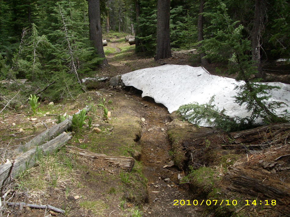
Well, I guess you could say today was “snow day”–lots and lots of it, including plenty of  traverses across STEEP snow on mountainsides!  But yahoo!   We made it up and over Sonora Pass, our last big pass.

Last night the mossies stayed up all night, humming around our net tent.  When I had to get up and go to “the bathroom” at 4:45 am,  they swarmed me and I got lots of bites.  Grrrr!  When it was time to pack up this morning, we had to wear full raingear plus headnets to protect ourselves from the mossie squadrons.   Well, we did expect this, having heard from other thruhiker journals that this is typical Sierras-in-July.

The hiking today began with a nice walk through the forest, then the climbing began.  The higher we went, the more the terrain opened up, and the views were increasingly gorgeous.  Not only that, but once we were up above timberline and out in the breeze–no more mosquitoes!  We began to meet other hikers, and began another day of leapfrogging with Barak and Uri, two guys from Israel. It took a bit of hunting for trail in the snow going up, but there were no steep traverses.  Everything on this side of Sonora Pass is very rounded and sort of mellow.  We took the “shortcut trail” , though, which goes straight up, and OK, that was steep, and I had the ice axe out again.  As usual, Bill just headed right up, and I was slow.  But wow, the views from the top were stupendous! Sierra peaks, all snowy, dominated the horizon to the south, and the dramatic volcanics of the Sonora Pass area were everywhere else.  Many hikers say (and I am inclined to agree) that Sonora Pass is the “best” of all the High Sierra passes.

july13_4snowmnt

But large snowfields were everywhere (in fact, we walked by the place where we camped in 2005, and it was covered with snow).  All the trail signs were buried.  As we started down the far side of the pass, we caught up with Uri and Barak, who were worried and frustrated.  They desperately wanted to take pictures of the spectacular scenery, but weren’t sure if their camera was working.  It seems that on the last big creek crossing (where even Bill had trouble with the current),  Uri was knocked down by the river and though he managed to swim ashore, his camera got soaked.  Mostly he and Barak were worried about the camera memory card, because it had ALL their pics starting all the way back in Campo!  So we did a test.  They took the memory card out of Uri’s camera and we put it in ours and checked to see if it was working.  Hallelujah!   It worked! Uri and Barak practically did a victory dance right there on the trail.  They were able to take pics of Sonora Pass, and everything was OK. 

Leaving a very happy Israeli duo, Bill and I headed on into the snow.  We immediately saw that  the PCT is routed (of course) to go on the shadiest, snowiest slopes. So much of today was snow traversing on (thank God!) nice snow, perfect for walking.  We met lots of people–a bunch of SOBO’s, who had skipped up to Ashland and headed south from there, to give the Sierras more time to melt.  It was fun to see them all, and an amazing sight to see so many hikers, after days of being “just us.”  Since I am slow on snow, a number of other hikers finally caught up with us–Dude & Trouble, and Granite & Terrapin.

We ate lunch hunkered down behind some stunted trees, and  that was our last meal of the day, because we both agreed that we did not want to stop and camp till we were “below snow and above mosquitoes”, as Bill put it.  By 3:15pm, we reached the road at Sonora Pass, and there was Thomas, a trail angel with carrots, water, snacks, offer of a ride to town, AND a big black plastic garbage bag. “Give me your garbage!” he said, and we were very glad to hand it over!

july13_20snowlost

Many hikers go off the trail here and into town, but we pushed on, headed up our last climb of the day.  The snow was not bad, since it was on the south side of the mountain, and the views were great!  So were the wildflowers–blooming in every crack and cranny.  The rocks are no longer “granitic” but “volcanic”, so we knew we were making progress north!  We climbed past the dramatic “Pinnacles”, then a little while later and we were at the top, cheering because it was our last time at 10,000 feet!   While we were standing around taking pictures and cheering, some other hikers came along and asked why we were celebrating so much.  We explained that this was the last time the PCT goes up to 10,000 feet.  “Oh!” they said, and out came the camera phone.  “Tell us about it–we’ll film you!”  So we did a rerun of cheering and celebrating–“Last time at 10,000! (wave all 10 fingers)  Last time at 10,000!”

But from that point, the PCT route down to the Carson River stayed on the NORTH side of the valley.  The south side was snowfree, but we were back to hunting for trail in the snow (slow and frustrating!) until we finally stopped at about 7:30.  We had succeeded in getting below the snow, and there were only a few mosquitoes.  We were very tired and a bit hungry, since we skipped eating supper in order to reach the “no snow zone”.  It was very cold, so we set up the tarp and enjoyed a beautiful alpenglow sunset view after we were snuggled into our sleeping bags.  All the other hikers have passed us, since I am so slow on snow.  But if we can just get back to “regular trail”, I think we will catch up again!  And I am very grateful that the snow at least was nice to us today–no icy stuff and no postholing!

Walk to Rauros:  North of the Field of Celebrant in the Brown Lands

july13_1trailwidejuly13_3viewjuly13_5snowmntjuly13_6snowfieldjuly13_7snowypeaksjuly13_8viewsnowjuly13_9viewsnowjuly13_10dunejuly13_11distantlakejuly13_12snowfieldjuly13_13widetrailjuly13_14distantlakejuly11_15trailnewzealandjuly13_15rockytrailjuly13_16rockysnowjuly13_17snowfieldjuly13_18caradhrasjuly13_19openviewjuly13_20snowlostjuly13_21vistajuly13_22rockyvistajuly13_23bigsnowfieldjuly13_24mountainsjuly13_25rockytrailjuly13_26mountainssnowjuly13_27snowcloudsjuly13_28mountainsjuly13_29snowyjuly13_30snowviewdownjuly13_31bigviewjuly13_32rockyviewjuly13_33viewvalleyjuly13_34montytrailjuly13_35mountainsjuly13_37yesmountainsjuly13_38dunewithsnowjuly13_39mountainsteepjuly13_40valleyviewjuly13_42valleyjuly13_43valleylakejuly13_44mntcloudsjuly13_45mntclouds2july13_46steepmntjuly13_47widetrailjuly13_48snowfieldjuly13_49mountainjuly13_50trailcloudsjuly13_51valleyvistajuly13_52bigvalleyjuly13_53bigvalleyjuly13_54moresnowjuly13_55snowprintjuly13_56snowfieldjuly13_57snowprintjuly13_58snowjuly13_59walkingtrailjuly13_60valleyviewjuly13_61mountaincrestjuly13_62_valleyjuly13_62valleytreesjuly13_63valleytreesjuly13_64hilljuly13_65trailjuly13_66trailforestjuly13_67viewstormyjuly13_68viewhillsjuly13_69snowjuly13_70snowcloudsjuly13_71trailrockyjuly13_72trailhikejuly13_73vistajuly13_74vistamntjuly13_75viewjuly13_76ruggedjuly13_77tarzantrailjuly13_78ruggedrockyjuly13_79vistajuly13_80viewbigjuly13_81viewhikerjuly13_82vistajuly13_83viewvalleyjuly13_84printssnowjuly13_85vistarocksjuly13_86viewjuly13_1viewjuly13_2mountainbilljuly13_3vistasnowmountjuly13_4snowfieldjuly13_5crosssnowjuly13_6snowymntjuly13_7redrocksjuly13_8rockyfieldjuly13_9snowtrailjuly13_10snowtrailjuly13_11snowjuly13_12rockyjuly13_13rockyvistajuly13_14snowmountjuly13_15snowfieldjuly13_16manjuly13_17viewhillsjuly13_18rockgardenjuly13_19vistajuly13_20montyvistajuly13_21rockyvista

Monday, July 12, 2010 Miles Today: 21.9 Total: 1,004.6

Monday, July 12th, 2010

july12_1treeline

If yesterday was “big canyon day”, today was lake, pond, mud and mosquito day!  We had to hike in headnets almost all day, and put on full raingear to protect us from the starving hordes of mossies every time we took a break, but yahoo, we passed the 1,000 mile mark, and we made it out of Yosemite!

Getting up was hard– our clothes were still wet from last night’s late ford, and we hadn’t slept well because the mosquitoes didn’t go to bed last night.  Usually they do, and we can sleep in peace even without a net tent.  Not last night!  And as soon as we started to get up, hungry mosquitoes pounced on us as fast as they could. But the long climb up to Macomb Pass took care of any shivers, the wildflowers were lovely, and we were amused by the fact that PCT’s scenic lakeshore route by Wilma Lake was actually underwater, in the lake. (We had to bushwhack another route).

Again, a comment on Yosemite trails.  We early season hikers hardly ever get to use them!  They are either so muddy and wet that we have to make our own trail, or so rough and rocky that it’s slow going–or even (as this morning) completely underwater!  I think that the folks who plan trail routes ought to come up into the mountains this time of year and take a look at the conditions! 

july12_4meadow

There was a long, viewless uphill-through-forest section of the PCT, enlivened somewhat by the good-size nearby creek that occasionally went into cascades and falls that were quite impressive.  We also started leapfrogging with some other hikers (some of them were slower–we caught up with Uri, Jaybird and Alex–and some were faster–they caught up with us!)  We stopped for lunch in Grace Meadow, and enjoyed the lovely view there. 

Then came a slog up to Dorothy Lake on a rough, steep trail, but hooray!  At the lake, the WIND was blowing.  No mosquitoes! When we finished the walk around the lake and the  final climb to the top of Dorothy Lake Pass  (which is the exit from Yosemite) we were standing in the snow by the almost-buried sign at the Yosemite border, cheering and yelling “Throw the bear cans in the lake!” when Jaybird came along and wondered what was going on.

july12_2rock

“We’re so done with Yosemite!” we told him. Then we hiked happily along the nice, smooth dirt trail… till it disappeared into the snow, and we were back to hunting for the trail.  Sigh. But eventually we located it again and made it all the way down to Walker Meadow, where at last we got to put up the net tent and sleep in peace! (We put up the tarp, too–it was getting cloudy)   The alpenglow on the mountains across the way as we were setting up camp amid swarms of mosquitoes was very beautiful, though.  It feels so good to know we’ve reached the 1,000 mile mark, and there’s only one more big pass to go!

Walk to Rauros:  Trees begin thinning on either side of the river

july12_3meadowjuly12_5treelinejuly12_6streamjuly12_7valleyviewjuly12_8stuntedtreejuly12_1sunriserocksjuly12_2forestjuly12_3forestjuly12_4meadowjuly12_5foresthilljuly12_6viewjuly12_7roadtreesjuly12_9montysnowjuly12_8viewmountjuly12_10mountainjuly12_11trail

Sunday, July 11, 2010 Miles Today: 16.9 Total: 982.7

Sunday, July 11th, 2010

july11_1snowview

Today was “big canyon” day, and it was pretty brutal. The trail and the terrain threw everything they had at us and by the end of the day, we were pretty “wore out”! We had to deal with finding trail in the snow, crossing steep snow, long uphills so steep that I could only plod along, trail so rough and rocky that sometimes we had a hard time figuring out which was the trail and which was just rocks, trail that was one long mudhole, trail that was a creek, and increasingly difficult creek crossings. And there were the mosquitoes– clouds of them.

july11_13clouds

OK, to start, we were up at 5 am, with the idea of “Let’s beat the mossies and try to get big miles!”  But the trail wasted no time in showing who was boss–and it wasn’t us!  Just after we left our campsite, we were into snow that hid the trail and reduced us to wandering around trying to figure out where to go.  When we did locate the right path, that final climb to the top of Benson Pass was so steep that all I could do was plod.  On the other side of the pass, the terrain & trail were so rough and rocky that again, I could not walk fast.  GRRRR!  Frustrating!  

To add to the fun, by our best estimate, besides the repeated multi-thousand foot ascents and descents, at least half the time today the PCT was just one long mudhole that we couldn’t even walk on.  Trying to walk along rough terrain on the EDGE of a trail is tricky!  By noon, we had only done 4.5 miles!  Considering we started at 5:30 am, that’s pretty pathetic! 

But finally we were  down into Kerrick Canyon (it took awhile because of having to climb over snow), and finally we could really HIKE along a nice trail with minimal snow issues.  Kerrick Canyon is a lovely forested valley, and we enjoyed the views as much as the trail.  But finally we came to the ford of Kerrick Creek.   Scaaaary! I had to go behind Bill, holding on to his pack.  It was a much more difficult crossing than Return Creek! 

 Then came another huge, steep climb up (I cheered myself by looking at the lovely wildflowers along the way) and another long downhill to Stubblefield Creek.  Partway down into the canyon, a roaring river basically took over the trail and we stood there wondering how to proceed.  It was not a “normal ford”, but a situation where we were on a steep mountainside and the trail itself had become a roaring cascade.  But we tackled it and got through.  Whew! 

At the canyon bottom, though, we faced our worst ford yet–Stubblefield Creek.  The guidebook described it as “wide and placid”. Wide it was, but not very placid.  It was moving right along and deep (waistdeep on me, as it turned out).  When we were standing on the near bank making plans for where and how to cross, though, it didn’t look TOO bad, so Bill and I crossed side by side, with Bill in the lead.  When we were about 3/4 of the way across, Bill shouted, “I’m losing it, Monty!   Don’t count on me for help!”   Sure enough, the creek was starting to push him backwards.  All I could do was say, “Oh Lord, please help me!” and continue to “move one thing at a time” (trek pole or foot), fighting to stay upright and not be knocked over.  What a relief when we made the other side!  By this time, it was 7 pm, and we were exhausted.  We sort of staggered up from the river, soaking wet, and walked to a nearby lovely grove of trees, saying, “That’s it!  We’ll just camp here!  And wow, what a blessing!  There were lots of nice, dry, flat campsites!                                                 july11_17waterfall

 Too cold, wet and tired to set up the net tent, all we could do was get out of our wet things ASAP  (the mosquitoes were swarming us)  throw on dry sleeping clothes, burrow into our sleeping bags with headnets draped over them, and call it a day!  But hallelujah!   Stubblefield was our last big creek crossing, AND tomorrow, hopefully, we will be OUT of Yosemite with its awful trails.  I am so glad that we did the PCT in 2005, because that’s when I discovered that the minute you leave Yosemite National Park, the trails become very nice.  I am SO looking forward to those trails!

Walk to Rauros:  Bare winter trees on both sides of river

july11_2snowtrailjuly11_3rocksmountjuly11_4viewsunjuly11_5rockyvalleyjuly11_6mountainsjuly11_7trailviewjuly11_8hillhighjuly11_9treesviewjuly11_10mountviewjuly11_11trailviewjuly11_12hillhighjuly11_14treesviewjuly11_15trailnewzealandjuly11_16foresthighjuly11_1forestviewjuly11_2snowfieldjuly11_3rockytrailjuly11_4vistajuly11_5lakevistajuly11_6forestjuly11_7mountainjuly11_8lakeforestjuly11_9rocksjuly11_10viewjuly11_11snowhikerjuly11_12rocksjuly11_13forestjuly11_14creekcrossjuly11_15forestrocks

Saturday, July 10, 2010 Return Creek Miles Today: 24.2 Total: 965.8

Saturday, July 10th, 2010

july10_6bridge

I never thought I’d be able to get up at 5am and start hiking, because I was so exhausted from yesterday, but the realization that “I can get rid of the bear can at Echo Lake!” was a HUGE motivator!  The sky was full of little puffy clouds, moving fast.  “I wonder what kind of weather we’re in for today?”  I wondered.  It wasn’t a cold morning–only 50 degrees, which is “warm” for this altitude!

I love walking the PCT around Tuolemne Meadows, because my family used to camp, fish and walk here for a week every August. As we followed the trail through the meadows, across some more creeks, and over the vast sheets of glistening granite, I enjoyed the views of what I call “the Tuolemne Meadows icons” like Lembert Dome, Cathedral Peak, etc.  The farther we got from Tioga Pass, though, the worse the mosquitoes got, till we had to put on our headnets just to hike in peace.

july10_9mountains

We reached the bridge over the Tuolemne River, where the placid waters start their whitewater plunge steeply down into the Grand Canyon of the Tuolemne.  Several hikers were lounging at the bridge, and as we began the descent into the Canyon, we met quite a few more.  They were all so clean!  I’m afraid at this point on the PCT, our own clothes look pretty grungy, even though we wash them every time we’re at a resupply.  All the hikers were “heading home” from overnight camping at Glen Aulin.

The PCT turned off and began to climb up along Cold Canyon creek.  The trail was actually DRY!  Wowee!  No mud!  We were making good time, but I was dreading the crossing of Return Creek, a notoriously “dangerous” ford up ahead.  Along the way, we caught up with a sweet old guy out backpacking with a TON of photographic equipment.  He was very cheerful about the weight he was carrying.  I was impressed!  We stopped for lunch just before Return Creek.  A little bit more hiking, and we could hear the roar of Return Creek just ahead.  I was praying silently, “Please, Lord, help me get across OK”.  Well, not to worry!  One look at it, and I said, “Bear Creek was a lot worse! I  can cross this, no problem!”  So I crossed Return all by myself, and cheered when I made i to the other side!

 A long uphill climb through slowly increasing patchy snow and several more creek crossings brought us to pretty Miller Lake with a sandy beach. Nice! A bit more up, and we were at the spectacular dropoff of Matterhorn Canyon. To me the Canyon looks like scaled-down Yosemite Valley.  Beautiful!

july10_11traillake

A lot of switchbacks (and snow travel too) and we were at the canyon bottom. It’s a nice long walk along the valley floor, with plenty of time to savor the spectacular views, and plenty of tributary creek crossings. Oh, for just one day of dry shoes, socks and pants!

After eating supper with a lovely view of Matterhorn Creek and the canyon, we tackled the long climb up to Benson Pass.  The PCT follows a very pretty, cascading creek lined with green grass and wildflowers.   The trail tread crisscrosses the creek several times, and we ended up camping just before the last ford of the creek, where the PCT turns for its final climb up to Benson Pass.  There were plenty of mosquitoes around, but we were too tired to do anything but toss down a groundsheet, our sleeping pads and sleeping bags and then collapse.   I wore my hat and mosquito headnet to bed, hoping that would more or less protect me from those “mossies!”   But what a relief to know that Return Creek is behind us!  I know there are more big creek crossings ahead, but Return is the one I dreaded the most.

Walk to Rauros: Bare winter trees on both sides of river

july10_1lakejuly10_2mountainjuly10_3mountainjuly10_4lakejuly10_5crossingjuly10_7trailviewjuly10_8waterfalljuly10_10trailforestjuly10_12viewlakejuly10_13viewtrailjuly10_14viewmountainjuly10_1sunrisejuly10_2sunrisejuly10_4montymeadowjuly10_5lakejuly10_6baretrailjuly10_7roaringwaterjuly10_8trailmeadowjuly10_9creekmonty