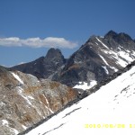
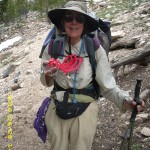
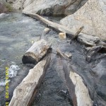
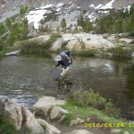
Archive for June, 2010

Wednesday, June 30 Mather Pass Miles today: 11.7 Total: 823.4

Wednesday, June 30th, 2010

30june4snow

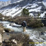
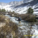
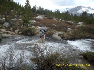
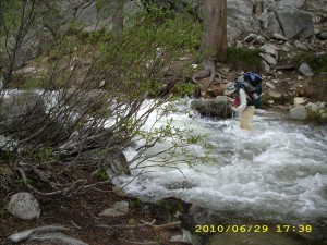
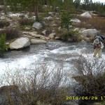
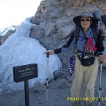
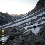
Another tough day!  It took us from 5:30 am till 7:30 pm to do only 11.7 miles!  We were climbing over snow most of the day, which makes for slow going.  This morning, a short walk took us to the South Fork of the Kings River. The ranger note yesterday said, “do not cross here— way too dangerous. Walk upstream to where the trail crosses back over.”  Yup, the river was obviously quite deep and was a  roaring torrent all the  way across.   Bill was still determined to cross it, however.  I begged him not to, but PLEASE to just walk up the near side as the ranger had advised. To my great relief, Bill finally agreed to follow the ranger’s suggestion.

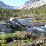
Turned out that the “bushwhack” up along the south side of the Kings was very pleasant and easy and pretty, too. It isn’t steep and has a nice open feel to it, so we could admire the magnificent Sierra scenery.  Not only that, but it was not wet or muddy, and there were no big tributaries to ford.  If we had bullied our way across the river down below and determinedly stuck to the PCT, we would have had several more nasty creek crossings.  We could see those tributaries coming in from where we were on the other side, and commented, “I sure am glad I don’t have to ford THAT!” 

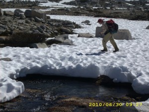
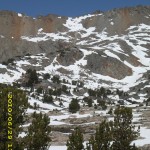
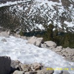
It was a good thing that the first part of the hike up to Mather Pass was not very steep.  Bill is still not feeling well at all.   He still has to stop and rest a lot, and can’t eat much.  He decided to start taking Flagl to see if it would help.  Eventually we reached the PCT again, well up toward the pass, and simultaneously were  back into the snow and playing “Where’s the trail?” The snow turned out to be a great benefit in one way, though–we could cross creeks on snow bridges and not get our feet wet!   I love snow bridges!

In retrospect, though, I should have realized sooner that walking on miles of snow without protecting your lower face from sunburn is really dumb!  I was so absorbed in just dealing with being terrified half the time that I didn’t even notice I was developing a pretty bad sunburn.   Bill has a beard, so there’s no problem for him!


30june6mountainpass

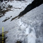
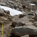
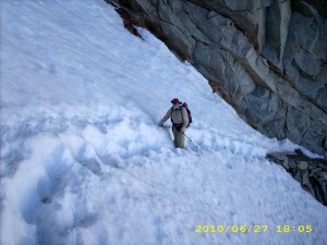
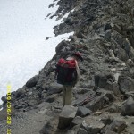
 We reached the foot of the pass (again, made very difficult by so much snow) and found quite a few other folks also heading up, more than we have seen on any of the other passes.  I could not believe that we’d caught up with so many of them after our slow going for the last couple of days.  Going up Mather is the steepest of all the passes, and very scary. Bill whizzed halfway up and sat there chatting with another hiker while I painstakingly “chopped in” every step I took with my faithful ice axe. I felt very bad about being so slow, and felt even worse when I got to the point where I could hear Bill and the other guy laughing–at ME!   “It is painful to watch, isn’t it?”  joked Bill, pointing at me, and the two of them thought it was very funny.  I know that guys like to give each other a bad time (it’s a guy thing, and normally I don’t care), but I was so scared and tired that it really hurt and I had to fight not to cry.  As soon as I got to the “breather spot”,  Bill took off again and I sat there feeling very low. 

Then a wonderful thing happened.   A young couple came happily climbing up the steps I had just chopped, with the wife rejoicing at how easy it had been for her “with these nice steps.”  She mentioned how worried she had been about the steep climb up Mather.   I didn’t pipe up with, “Well, you can thank me–I made those steps”,  but I was so blessed and encouraged!   I picked up my ice axe and tackled the next climb, feeling much more cheery! 

30june12waterview

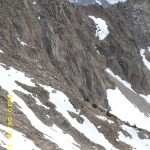
Woo-hoo!  I reached the top at last.  Going down the other side of Mather is not as steep or scary.  It involved a mix of scrambling over snow and rocks.  Bill is always way faster than I am on this type of terrain, even when he is not feeling good.  I have to be especially careful when scrambling on rocks.  I don’t have the world’s best sense of balance, plus the challenges of wearing bifocals (makes it hard to judge distance) and I have rather floppy ankles.  So on rocks, I’m very cautious!  

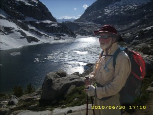
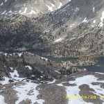
But finally we made it down to Palisade Lakes, which were still semi-frozen.  The ice was breaking up, though,and there were cute little “baby icebergs” floating in the water.  I wish I had a picture of them, but we’d had a very nasty stream crossing just above the lakes that looked dangerous enough that I’d wrapped the camera thoroughly in plastic bags and set it high up in Bill’s pack.  Once we got across (all went OK!), Bill took off and was way ahead of me, so I had no camera available.  Too bad–those really were totally cute little icebergs!

Then it was down the famous “Golden Staircase” with its huge rock steps. I yelped a little at each step down, because my poor knees were already so sore from all the snow and rock scrambling.  I LOVE my trek poles–what a help they are when my knees are tired!  And seeing the green grass and forests in the valley below was also encouraging.  In 2005,  I cried a bit on this stretch out of sheer frustration at being so slow on the huge rock steps and rough trail.   I cried a little bit this time, too, for the same reason.  But those green meadows and trees were getting closer and closer!   I felt like I was “coming in for a landing” on an airplane!

 As soon as we were down in the valley, and back into nice dry forest,  we stopped and camped, completely wiped out.   It was 7:30 pm.  When we were doing our best to clean up before getting into our sleeping bags, Bill and I both discovered that we have a rash on our lower legs.  What could it be?  Sunburn-related?   Just being constantly wet?  At any rate, it does sting a bit.  I also realized, duuuuh! that I had a very bad sunburn on my lower face.   Tomorrow I will wear my black mosquito headnet when we come to snow.  That should help!  

Walk to Lórien: Reach the Guardroom junction in Moria

30june1creek30june2trail30june3trail30june5mountain30june7mountain30june8rockontop30june9rocks30june10creekpass30june11creekpass30june13views30june14treesview30june15trail

Tuesday, June 29 Pinchot Pass Miles today: 11.4 Total: 812.2

Tuesday, June 29th, 2010

29june6trail

Had a solid night’s sleep, which really helped me today. I felt 100% better!  Bill was also feeling perky and was talking about “maybe we can get over both Pinchot and Mather passes today!” (I thought, “I’ll settle for just Pinchot!”)   The mosquitoes came to see us off as we packed up and headed for the “little Golden Gate Bridge” over Woods Creek.  The creek was a roaring torrent of white water–I sure am glad for the bridge!  It’s a suspension bridge that will take one person crossing at a time.  I went first.  The bridge sways every time you take a step, and for me, it’s a bit scary.  But I made it almost all the way across (only about 20 feet left to go) when Bill thought I was done, and bounded on to the bridge.  Yikes!   The whole bridge started bucking and heaving up and down.  I was terrified, but too scared to turn around and yell at Bill to stop.  So I kept going, but man, was I glad to reach solid ground!

But the walk up toward Pinchot Pass along the creek was beautiful, and I soon felt very much consoled by the wildflowers along the trail, and the beauty of Woods Creek as it rushed and roared and cascaded and leaped in foaming whitewater torrents over the boulders in its path.  We also met some JMT  SOUTHbounders  Hooray!  That meant people are starting to make it through the snow and over the passes–there will be footprints to follow!

But suddenly, without warning,  Bill just “bonked.” He stopped hiking, took off his pack, lay flat down on the ground, and said, “I feel awful.” From that point on, he would not eat (“I feel sick”) and for the entire rest of the day, he  could only go a little way before stopping again.  I was worried.  Yesterday during the climb out of Vidette, I had to stop and rest a couple of times because I was so awfully tired, but I didn’t feel sick.  It soon became obvious that we would only make it over Pinchot Pass today, not Mather.

29june7snowpass

Soon the trail completely disappeared under the snow, and we spent at least two hours trying to head in more or less the right direction, based on Bill’s JMT experience.  Pinchot is a tricky pass to locate, and many early season hikers get lost trying to get there.  But Bill was watching for his favorite landmark, a rock formation he calls “Kilroy”, that’s located just to the left of the pass.  He spotted it, and we were headed for it, doing snow traverses and rock scrambles along the way, when we spotted two other hikers headed in the wrong direction.  We shouted and yelled and waved to them, trying to point out the right way to go, but they couldn’t hear us and eventually disappeared from sight.  We never saw them again.

Note from Alexa: Ack that sounds fairly ominous!

29june8creek

By lunchtime we were at the foot of the pass. Bill choked down a few bites, and drank Emer-gen-c with a liberal dose of GSE in it, while he studied the pass and strategized on a way up. Then it was time to put on the Microspikes, take ice axe in hand and climb straight up. This is still “terror time” for me, but I am getting better at it.  Near the top of the pass, amazingly, several switchbacks were snowfree, and we were able to just plain hike instead of climb.  But just short of the very top, it was steep snow again, and I went back to Microspikes and ice axe.  What a relief to finally be standing on top!  It was whoop ‘n holler time for me! 

29june11creek

Bill rested again, and planned a strategy for getting down.  There are several lakes below the north side of the pass (they were mostly frozen over and surrounded by snow) and that made it easier to see where to go.  At first we were able to follow snowfree switchbacks down the pass,  but then the snow took over again, and footprints headed along the snow, roughly following the path of the trail.  We decided to only “sort of” follow them, and shortcut whenever possible.  Our plan worked fine.  The farther down we went, the less snow, and the trail was playing hide ‘n seek, but we always managed to find it again.  We noticed that there was one set of footprints which seemed to be following the same basic strategy we were using, and that did save us a bit of time–at several points, when we were hesitating about which way to go, one of us would spot the footprints and cheer, “Look!  They went thataway!” and off we would go again. 

 When the snow thins, the creek crossings begin, and of course the trail itself (when visible) was a creekbed itself.  The outlet creek of Lake Marjorie was wide and a little deepish, but moving very slowly, so it was an easy crossing.  Whew!  After that came numerous smaller creeks that were rushing and roaring, but only knee deep.  I was able to cross them OK, and I am a lot less scared than I was a couple of days ago.  Practice helps! 

Finally we were happily switchbacking down a snowfree !!! trail into the Kings River Valley, when we came to a sign the rangers had put up.  “Please Read!” it said in large letters.  It warned that the next creek crossing was extremely fastmoving water, and would be much safer to cross on a log 300 yards upstream.  It also said that the next crossing (the Kings River) was very deep and fast and far too dangerous to attempt a crossing.  The rangers recommended that all hikers stay on the near side of the river and follow it up till the trail itelf crosses back over near Mather Pass.  Bill’s reaction was, “Humph!  The rangers are sissies!”

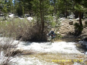
He then took off on a tear down the trail.  I couldn’t keep up with him!  So he arrived at “the next creek crossing”  and was standing there looking at it when I arrived.  It did look nasty–all white water, and yes, moving very fast.  I said, “Wow, we’d better go upstream to the log!”  Bill said, “No way.  This is do-able,”  and in he went.  I thought about going up to the log all by myself, but in the end, I watched Bill very carefully to see where the worst spots were .  I could see that the creek was never more than “just above the knee” deep, but oh man, was it roaring!   Scary!  Once Bill was safely across, I started in, praying like crazy with every step.  Basically what I do is say, “Lord, please guide my foot/trek pole”.  The rule of thumb in these crossings is to move one thing at a time–either one trek pole or one foot. 

About 2/3 of the way across, it started getting really hard for me.  Taller, heavier people have an advantage over us shorter, lighter people on these roaring crossings.  I yelled to Bill for help, and he came back into the creek to help steady me against the current as I finished the crossing.  Whew!  Then he said he was completely exhausted and wanted to camp NOW, even though it was only 6 pm.  I agreed, but asked if we could go just a bit farther on, to get away from the roar of the creek. 

And so we walked for a little while till we found a really nice camping spot between two big logs.  It was clouding over, so we rigged the tarp.  Bill went straight into his sleeping bag, but I did persuade him to drink a cup of Emergen-C with GSE added, and to take an Advil PM to help him sleep, since he said he didn’t sleep well last night, and that was part of his problem.  But he refused to eat anything else, saying “I’m too tired”, and went to sleep.  I was feeling pretty good, so I sat up for awhile eating supper and just enjoying the beauty of the woods.  What a relief to be out of the snow!  And no mosquitoes, either!   When I did go to bed, I took some time catching up on my journal notes.  I’ve only written one sentence a day till now, because I was so tired!

I am concerned about the Kings River crossing tomorrow.  All the hikers I know of always do as the ranger recommended and follow the river far upstream.  But Bill is being very stubborn about river crossings, and he does not feel well.  I decided that if the river looks too scary tomorrow morning, I will not attempt to cross it, but will meet Bill farther up the trail.   I hate doing this, but I am also very worried.

Walk to Lórien: Within Moria and Gollum begins following
29june1trailgreen29june2creek29june3snowcreek29june4mountains29june5snow29june9creek29june10creek

Monday, June 28 Glen Pass Miles today: 17.3 Total: 800.7

Monday, June 28th, 2010

28june1monty

It was a cold, cold  night last night, and I should have taken some Motrin,  I think, before collapsing into my sleeping bag, because every bit of me ached from the effort of getting over Forester.  As a result  I didn’t sleep much even though I was so tired.  But we dragged ourselves up at 5:00 am, anyway, because we have  long way to go before Glen Pass.  The PCT was still playing hide ‘n seek in the snow, so it took us awhile to find our way downhill to Vidette Meadows.  I did think it interesting, though, that the plants up here have not even begun to swell their buds yet, and it’s almost the end of June!  They sure don’t get much “growing time”!

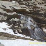
Eventually we were down in the lovely forests of Vidette M., hiking along with the river roaring by.  Of course every side creek coming into the river was roaring, too, so I got lots of practice in creek crossings!  Bill and I now live all day in perpetually wet shoes and socks and lower pant legs.  Anybody who wants to obsess about removing shoes and socks for every stream crossing would take FOREVER to get through so much wet stuff.  We just head right in, shoes and all, whether it’s a creek crossing or just plain “PCT Creek”, where the trail itself becomes a waterway! 

After the nice walk through Vidette valley, we began the killer uphill toward  the Kearsarge Pass trail junction.  It was a beautiful day, and very warm.   Due to the heat, plus lack of sleep, I think,  the climb  just about did me in— I had to stop and rest several times, instead of just chugging on up as I usually would have done.  This was really frustrating to me, because I knew we were “under the gun” timewise to make it over Glen Pass before it “iced up”.

28june9snowice

When we got to the Kearsarge junction, we got a good laugh, because the “junction”, sign and all, was in the middle of a snowmelt lake, surrounded by snowfields!  But there was a sort of trail of footprints to follow as we headed for Glen Pass.  Bill has done this pass in early season several times, and he said the approach and climb are not bad, but going down is pretty scary.  If he thinks something is scary, I figure it will really be tough.  We climbed up and up through the snow, heading for the foot of the pass.  Yesterday, we actually skipped a meal to save time, and we did it again today.

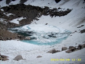
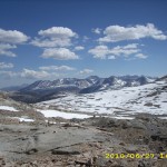
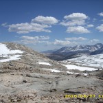
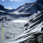
 The climb up Glen  was a combination of “straight up the snow”, “scramble up rocks” and “walk along a bit of visible trail.”    When I came to those blessed bits of trail, I could stop and look around, and wow!  What magnificence!  There were snowy mountains all around, roofed with a spectacular blue Sierra sky.  The lake below the pass was frozen over with the extraordinary light bluegreen color that frozen lakes seem to have.   Finally, long after Bill, I made it to the top of the Pass, where I began to hoot ‘n holler and yell.  (Again, Bill thought I was nuts to do this.  He just figures, “Hey, I made it!  End of story.”) 

Now for going down the other side, the part that even Bill calls “scary”.  For me, it was back to the “controlled terror” of a descent where if you slip, you are basically done for. I had already committed my personal safety to God’s care, and again just concentrated on “the next step.”  Some hikers glissade down from this pass, but Bill considers that suicidal, even if it is fast.  Even he just plain walks down.

28june19lakemountain

 Fortunately, we were blessed with “perfect” snow to walk on, and were able to follow a footprint trail that slowly made its way down diagonally across the steep snow wall.  I didn’t look down, just  concentrated on the next step, and was VERY glad those steps were there!  Further down the mountainside, there was less snow and more rocks.  I wear Microspikes when on snow, and take them off for rocks.  They are VERY easy to take on and off, which is one of the reasons I chose them.  When I’m not wearing them, I simply hang them from the sternum strap of my backpack.  We didn’t even bother trying to “follow the trail”, just headed right on down.

 And so we finally made it to Rae Lakes, where the lakes were not frozen, big fat trout were hanging out right by the shore, and Dragon Mountain  provided a dramatic backdrop. We scrambled across the “log jumble bridge” between the lakes–it was pretty scary (there were a lot more logs in 2005)– but with some help from Bill, I managed to do it.  Then we headed out, still dealing with hunting for trail-in-snow, and tried to hike faster, to make up for all the time I’d lost creeping over the pass.   On the way, we met another helpful ranger who had tips for us about Pinchot Pass and some of the creeks up ahead.  We also passed a large group of backpackers who’d already stopped for the day.  Turned out they were doing a trip which began at one of the Cedar Grove trailheads, went up over Glen Pass, then back down to a different trailhead at Cedar Grove.  They were camped in a meadow that was absolutely loaded with mosquitoes.  I did not envy them, but they seemed to be having fun, mossies or no mossies!

We were determined to camp at Woods Creek,  remembering it as low (no snow!), flat and dry and pretty.  Our memories were correct!  There it was–dry ground, hardly any mosquitoes, and a LOT of campers!  We went off into the woods and found a wonderful spot to cowboy camp on soft pine needles with the roar of the river not far away.  So by around 7:30 pm, we were comfortable in our sleeping bags.  I decided to take some Advil PM because I was so sore and tired from carrying a heavy pack over so many obstacles.  It worked.  I totally zonked out.

Walk to Lórien: Enter the Doors of Moria after being attacked by the Watcher in the Water
28june2snowtrail28june3trail28june4water28june5snowmountains28june6mount28june7mountains28june8snowypass28june10rocks28june11rockssnow28june12pass28june13mountains28june14pass28june15montytrail28june16crossingcreek28june17crossingcreek28june18pondmountain

Sunday, June 27 Forester Pass Miles today: 23.2 Total: 783.5

Sunday, June 27th, 2010

27june10snow

This was a long, tough, amazing day— we made it up and over Forester Pass! After fording Rock Creek (no problem) we made the long uphill/downhill to Crabtree Meadows with deer grazing peacefully in green meadows and Mt. Whitney piercing the sky way up high. I was impressed by the new “trail engineering” –somebody put in rock steps of a decent height for us short-legged people!  And we heard from some other hikers that the snow on the Whitney ascent trail is “not bad.”  That was encouraging to hear as we headed toward Forester Pass.  (The reason we didn’t do a side trip to climb Whitney is that we’ve climbed it several times already!) 
After that came the first of many scary creek crossings, notably Wallace Creek, Wright Creek and Tyndall Creek.  Fortunately for me, they got progressively harder, so by the time we reached Tyndall, I’d had some practice on the other two.  What we did was have  Bill go first while I watched very carefully to see where the worst of the current was.  Then once Bill was across, he yelled back some advice about how to proceed, and I stepped into the cold, roaring current,  leaning into my trek poles, facing the river, and sidestepping across. If I started feeling overwhelmed, I would yell for help and Bill would get back into the creek  to give me a hand. Tyndall Creek was the worst— pretty scary, and thighdeep on me.  But hooray, I made it through all three of them!  And OK, I also prayed every step of the way across.  (Little soapbox here:  praying during scary creek crossings is not a “crutch for cowards”.  It’s a continuation of what I do when I’m just plain ol’ walking the trail, only the topic is different.  I’ve noticed that even hikers who say “There’s no God” have their own ways of coping with scary creek crossings.  Some of them just plain swear their way across!)

27june20snowfield

Bill was talking excidedly about one of his favorite spots up ahead–the Little Bighorn Plateau, which he said has an awesome 360 view of mountains all around.  He did not exaggerate!  Wow!  And best of all, it was lunchtime, so we had an excuse to stop and enjoy the spectacle for awhile.  Bill said, “Let’s not cook this time. If we just eat quickly, we might be able to make it over Forester TODAY, if we hurry.”  So we just ate some crackers and peanut butter before heading on.  As it turned out, that was the last food we got for the rest of the day.

The PCT went on up to Bighorn Plateau, and when we got there, Bill was amazed at the amount of snow.  The few areas that weren’t covered with snow were snowmelt LAKES!   Bill hikes the JMT every year right around this time, and he said he had never seen so much snow at Bighorn before.  It was a bit of a challenge to find and follow the trail.  As we climbed higher, more and more often the trail disappeared under snow. Finding it again took a lot of time, and usually when we did find it, the trail itself had become a creek.

But we persevered, and got to the point where we could see Forester Pass against the sky, but everything was totally covered in snow.  We did our best to figure out where to go, but grrrr!  Up in Oregon on the PCT around Mt. Jefferson, where the trail is often buried in snow for a long time, they have rock cairns with a stick on top to mark where the trail goes, so there is never any doubt.  I would love to have those here in the Sierras!    As we got closer to the foot of Forester Pass, we met Ranger Alison, a very helpful gal  who had just come over Forester herself.  She told us to follow her footprints, and pointed out the best route (“Straight up!”).  We could see two other hikers up ahead, who were already at the foot of the pass.  “And be careful of postholing,” Ranger Alison warned.  “I just went down all the way up to my waist, with BOTH feet trapped.  I had to dig myself out–right over there.”   Sure enough, we could see a big hole in the snow. 

Bill and I were very glad to know there were hikers just ahead of us and a footprint trail to follow, and we were making very good progress, when whooomph!  Down I went, postholed up to my waist, just like the ranger, and both my feet were instantly caught in what felt like solid concrete.  I could not move them at all.  Bill was pretty disgusted with me, because it happened near a rock (the vicinity of a large rock is much more likely to produce postholing) and he said I should have been more careful.  I felt really bad, knowing what a chore it was going to be to get out of the hole.  It was already late in the afternoon.  And sure enough, it took me a good half hour to dig out of the hole.  I am the only one with an ice axe (which was the most helpful tool), so there wasn’t much Bill could do to help.   Man, I was glad I had that ice axe, though!  If I’d had to dig myself out with only our little plastic trowel, that would have been awful.  By the time I extricated myself, my feet were freezing cold.  It was a wonderful moment when I was able to climb out of the hole, put my pack back on, and head for the pass again. 

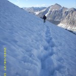
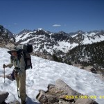
At the foot of the pass, we headed straight up, following the “footprint trail”.   Bill breezed right up, climbing up the snow, using just his trek poles, while I followed much more slowly, chopping secure steps with my ice axe.

Note from Alexa: Hmm perhaps Bill needs the new trail name “Legolas”

27june26snowhike

We were encouraged to hear the whooping and cheering of two hikers who were ahead of us, every time they came to a stretch where the PCT switchbacks were actually visible and they could follow a dirt trail for at least a little way.  We also cheered when we reached those spots!  Finally we could hear a great outburst of hooting, hollering and cheering.  “They must have made it to the top,” we said, and that was a great encouragement, especially to me.  I have to say that for much of the climb up, I was totally terrified.  All I could do was concentrate on “the next step” and not look down. 

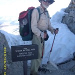
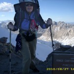
Near the top there was a whole stretch of nice trail, heading for the famous “Chute of Death.” I was very surprised and relieved to find that enough hikers had already crossed it so there was a relatively secure “trail” across the Chute. I was actually able to go first, and walk right across.  Amazing!  A few more short switchbacks, and by 6 pm,  we were yelling and screaming at the top, too.  (Well, to be accurate, I was doing the screaming and yelling.  Bill doesn’t go for such behavior!)   

But a couple of quick pics were all we had time for…  then it was a race to get down before dark, over snow that was rapidly becoming icier.  First comes a long traverse across a steep mountainside.  There were pretty good tracks to follow, but still scary, because if you slip here,  you’ll be a very dead duck at the bottom.  I was very tired and scared, and of course, Bill was soon way out ahead, but I kept plugging along the best I could. 

Bit by bit, we came down off the pass, on various other “steep mountainside traverses.”  The footprint trail which had been very clear now began to “disagree” and footprints headed in various directions.  Every bit of bare ground we came to was soaking wet from melting snow, and every bit of PCT trail we managed to spot was not a dry trail, but a snowmelt “creek.”   By 8 pm, we still had not reached “dry ground” out of the snow, and we were very exhausted.  We’d had nothing to eat, not even a Snickers, since noon.

But hallelujah, shortly after 8:00, we spotted the trail!  And not only that, we were able to follow it down to the first little set of campsites above Vidette Meadows.   These campsites are literally perched on the mountainside near a creek, but oh wonderful, a couple of them had dry snowless spots big enough for our tarp.  The last time we did the PCT, in 2005, this area was warm and sunny and the wildflowers were awesome and a lady was lounging in the sun writing in her journal.  Now, it was 8:30 pm, the sun was down behind Forester Pass, it was very cold, and we were both so tired we could hardly move.  I thought about trying to cook some dinner, but decided that all I wanted to do was crawl into my sleeping bag.   Before I laid my head down, I managed to figure our mileage (23.2 miles–not bad, considering the conditions) and wrote “Up & over Forester” in my journal, before I turned off my headlamp and just crashed.  What a day!  One big pass done!

Walk to Lórien: Attacked by Wargs in a barren country of red stones near the Sirannon

27june1steps27june2trail27june3view27june4greenview27june8view27june7greenpond27june6green27june9trail27june11snow27june13snow27june14mountains27june15mountains27june16snow27june17mountains27june18crossing27june19snow27june21rockssnow27june22mountains27june23mountains27june24mountainhike27june25snowmountains27june27billsnow27june28snowhiking27june30snowmountain27june29montysnow27june31mountain

Saturday, June 26 Miles today: 24.3 Total: 760.3

Saturday, June 26th, 2010

26june4hikers

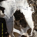
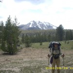
All the dramatic clouds of yesterday evening must have blown away during the night–we woke up to clear skies and a very pleasant morning.   We hoisted our still horribly heavy packs and headed for Diaz Creek— we needed water.  Along the way we got a good laugh out of a “sign” that was written in marker pen on a cow skull by the trail.  But we were so distracted with admiring the scenery and spotting “old friend” landmarks from our day hikes in the Cottonwood Pass area, that we missed the unmarked trail to the creek. Oh well— we decided to ration water and go for Chicken Spring Lake.

It was still quite a few miles to the lake, and the PCT of course wanders all over the place, with lots of uphills.  I am still not back to full strength since my round of giardia/whatever, and that means I did a lot of huffing and puffing on those uphills, and could not hike as fast as usual.  Snow on the trail was never a problem, but we noticed plenty on the mountains around, including a lot of snow cornices.

26june6vista

We reached Cottonwood Pass around noontime, and I was totally wiped out.  A couple of very friendly older guys were there, and they kindly took a picture of Bill and I together.  Then one more mile of climbing took us to Chicken Spring Lake, where both Bill and I just plain collapsed for awhile till I got myself together enough to make us some freezedried beef stew for lunch.  The plants at the lake were just barely starting to show buds, and there were a few snow patches. 

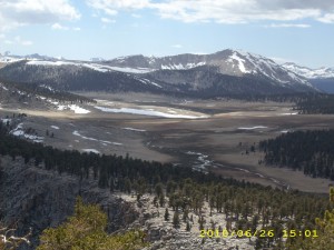
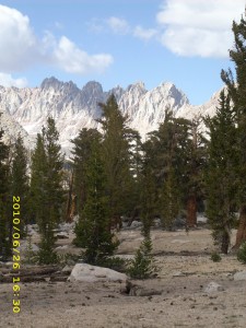
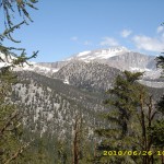
After a good rest, we started off again, saying, “Now we REALLY are going into the HIGH Sierras!”  Sure enough, it wasn’t long till the trail was totally buried under a snow cornice, but we managed to scramble over it without a problem.  The views of course became more and more awesome–high, snowy mountains, meadows far below, big puffy clouds.  The long rest stop for lunch plus having a hot meal had made both Bill and I feel a lot better, so we were really enjoying ourselves.   We marched happily along the miles of downhill toward Rock Creek, and just before we reached it, there was a note tacked to a post, inviting the hikers over to the summer ranger’s house for free food.  Free food?  That is truly a siren call for any hungry thruhiker!

So we followed the faint path off through the woods, across a little creek, and finally came to the totally cute little ranger cabin.  The ranger ( a young woman) was there, with her husband, her little boy and several other friends.  The “free food” turned out to be an almost empty hiker box.  Oh well! I asked if we could see inside the cabin, and the ranger said “Sure!” so I went in and had a look.  It’s very cozy, but I was surprised to see that there was nowhere to sleep.  The ranger explained that they never sleep in the cabin unless it’s raining, but camp outside in a tent.  That seemed odd to me, but I guess they must have their reasons??   Anyway, back we went through the woods to the PCT.

26june7mountains

Back ontrail, and headed for Rock Creek, we met another ranger who said the snow line is at 11,500 feet and rising daily!  That was good news–it means we only have to deal with snow when going over the passes.  But shortly afterwards, came a discouraging development— we met a sad young thruhiker couple who were heading south after turning back at Forester Pass. The wife said Forester was totally terrifying and she just could not make it to the top.  So they were turning back, planning to go to Horseshoe Meadows, where the wife could go to town and wait till her husband had finished doing all the scary high passes.  Then she would rejoin him.  This bad new really worried me.   If an obviously young, strong woman could not make it over Forester, what about me?  All I could do was say, “Well, I will do my best.” (And pray a lot!)

At around 7 pm, we had reached Rock Creek, which had a campsite with bearbox.  There were only a few mosquitoes, so we made a nice comfortable cowboy camp with snowy mountains all around.   Tomorrow….we tackle Forester Pass.

Walk to Lórien: Redhorn pass of Caradhras blocked by snow

26june1trail26june2marker26june3mountains26june5view26june8view