Archive for September, 2010

Sept 21 The adventure continues–on to Seattle!

Tuesday, September 21st, 2010


Sept21_1skagittransitSept21_2hikers  

Last night before we went to sleep, we carefully set the hotel’s digital alarm clock to go off at 5:45 am.  Our plan was to load up, grab some of the free coffee downstairs (which was supposed to be available at 6 am), then head for the  6:35 bus.   When the alarm went off,  we groggily got up, wondering why we were so tired.  Dressed warmly and carrying our packs, we headed downstairs, only to find that the hotel lounge was closed, there was no coffee, and it was VERY dark outside.  Bummer!   Then I had an idea–I looked at my wristwatch and said, “Oh joy–it’s only 3:30 am!  The room clock was wrong!  No wonder we feel so tired!”

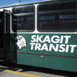
So back to bed we went!   Oh man, did it feel good!   I personally really do feel completely exhausted.  I guess on the trail I was running on “gotta finish!” power.   We got up AGAIN at 6:00,  got the coffee (nice and hot!) and headed out into a slightly cloudy early morning.  It took only a couple of minutes to reach the bus stop, and we  expected the bus to arrive soon.  It didn’t.  No bus, no bus, no bus.  I looked again at the bus schedule–oh bother!  We thought the bus left at 6:35, but last night we misread the sign.  It actually left at 6:25!   So we now had to wait an hour for the next one.  Brrrr!  It was cold.  I started thinking about breakfast….hmmm–there was a grocery store just down the street–maybe they would open soon and I could get something.

I studied the Cascade Mountains to the east, and they were totally shrouded in dark clouds.  It was obvious that during the night it had rained heavily in Sumas, and since it was very cold, I figured  “It must have snowed up there.”  Turned out later that I was right–we heard from other hikers later that it did indeed snow!  Wow, I’m glad we finished when we did!  And I was very glad to see the SUNrise in Sumas–I had not been looking forward to going from bus to bus in the rain!

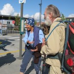
Just then, along came Patrick, an Irish “gentleman of the road.”  We chatted with him for awhile, then I saw the grocery store was open and went over to get us some breakfast.  I figured Patrick might like some, too, and yes indeed–he was very happy to get the big cinnamon roll I brought him.  He insisted on giving us a tomato in return (he’d fished it out of the dumpster in the back of the store).  In view of the fact that he was living on the streets, we suggested he might want to go to the local rescue mission where  there are food, a bed, showers, and help getting a job.   Patrick bristled at the idea–his position was “Rescue mission? No way!”  We urged him to reconsider.  Bill and I have personally helped work with people at rescue missions, and we have seen firsthand the awesome wonder of seeing God transform someone’s life, even when the person seemed too far gone for any help at all. 

Patrick didn’t like this talk about God and missions, so he left, and it wasn’t long till the bus to Bellingham came, with a very friendly, helpful driver and passengers.  As the bus followed its winding rural route through farms and dairies, the folks aboard were giving us advice about getting to Seattle via local buses.  It was a beautiful morning, with sun and clouds, and we enjoyed the ride (which only cost us “senior citizens” a dollar!).   Once we reached Bellingham, we didn’t even have to wait for our next bus–it was right there at the bus plaza, and we hopped aboard after paying another $1 each.  This second bus took us to Mt. Vernon, and from there we had only a short wait till a FREE “connector bus” to Stanwood.  Another 10 minute wait, and we boarded the bus to Smoky Point (which cost us a total of $2.50).  Smoky Point bus stop is by a shopping center, and it was lunchtime, so we found a pizza place and had a good meal. 

After lunch, we went back to the bus stop, and for another total fare of $2.50, we rode another bus to Everett.  Just a 10 minute wait there, and we hopped our final bus of the day which took us to Seattle (the fare for that was $4.50).   If you wonder why I keep mentioning fares, it’s because we couldn’t believe how cheap it was!   The final total fare for our trip from Sumas WA to Seattle was $13.50.  And that’s for TWO of us!  Wow!  And it was kinda fun.  I was so tired that it was very nice to just sit on the bus and watch the scenery go by, and we were really grateful for the friendly, helpful bus drivers.  We never had to wonder, “Now what?”   The bus drivers always told us where to go–in fact one of them even walked us over to the free connector bus at Mt. Vernon.

It was a beautiful, sunny afternoon in Seattle, but a glance to the west told us that the Cascades were still shrouded in dark clouds.  So if we were still on the PCT, we’d still be in the rain (and maybe snow).  It was great to feel the sunshine again!  Some of the bus drivers and passengers we talked to today were telling us that even though it was only September 21, Washington had already received a rainfall total that was equal to the ENTIRE winter’s worth of rain in  a normal year.  They were almost apologetic–several said, “Too bad you weren’t hiking in a normal autumn–you would have had nice weather.”  Well, we made it anyway, and as soon as we got off the last bus, we headed for the Amtrak station to pick up the train tickets Bill reserved online while we were at Snoqualmie Pass. 

Outside the station we met another PCT hiker who’d finished the day before we did.  He was waiting patiently for the next train to Chicago, then from there he’d head home to Minnesota.  After a short chat, we went inside, and while Bill got in the ticket line, I ended up talking to a group of senior citizens who were waiting for a train.  They were fascinated by what we’d just done, especially when they found out how old Bill and I are.  I encouraged them to consider hiking the PCT, too!  And I think that maybe a couple of them might be able to try.

Then Bill and I hiked up 1st Street.  What a change to be back in a city after months of mountains!  We were headed for the Green Tortoise hostel–we knew it was somewhere near the Pike Street Market–and after some hunting around, finally found it.  Yahoo–they had room for us AND tonight the hostel was providing dinner–tacos!   All the other people there were very, very young.  Besides Bill and I, there was only one other couple who were “grayheads.”  After taking a very welcome shower, I spent the time till dinner just lying down.  I still feel totally exhausted.  Bill went off to explore the Market down the street.  We both thoroughly enjoyed the taco dinner and it was fun to rub elbows with people from all over the world (though I’d say the Australians were in the majority). 

We went off to sleep in our very comfortable double bunk.  The hostel was full that night, so we had plenty of company!   We have to be up ‘n at em early tomorrow to catch the Amtrak train to Portland.

Monday, Sept. 20 Manning Park–we made it! 2,663.5 miles!

Monday, September 20th, 2010

Sept20_2pctmarker

It rained off and on all night, and the little bit of trench we made managed to do a good job of keeping  the rainwater from running under the tarp.  I didn’t sleep much–actually that has become “normal” for me, since we have no functioning alarm clock to wake us up in the dark at 5:00 or so. 

It was very cold as we ate up our breakfast granola–I could see my breath under the tarp!  Huddled under the tarp as the rain continued, we packed up our stuff and cheered at the thought, “Who cares if we get wet and cold today?  We’re almost done!”  Once we are all done stowing gear, and have put on our packs and picked up our trek poles, we always pray and give the day to God.  Today we were able to say, “Thankyou, Lord, that we are almost to Canada!  Help us finish well.” 

The PCT was basically headed down toward the Canada border, which was nice–no more big hills to climb!  There was one confusing junction where we temporarily went off on the wrong trail, because the trail SIGN was mounted way up on a tree, and there was a branch hanging down over it so we didn’t see it at first.  It didn’t take long for us to figure out we were no longer on the PCT–when we turned around and went back, we spotted the sign.  Oh well. 

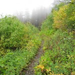
But there were an awful lot of plants hanging over the PCT, and they were soaking wet from the rain.  Pushing through them was like taking a shower with all your clothes on.  Early on, the clouds were very low, so we could see very little, but gradually they lifted (plus we got lower!) and we began to see the mountains up ahead.  Of course that meant we were straining to make out the border!   The trail wandered gradually down, but finally we came to the last 4 switchbacks that take you down to Monument 78.  Once the trail started switchbacking, I was cheering, “Yes!  We are almost there!” 

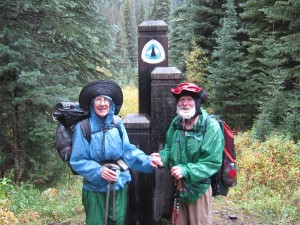
We arrived at the US-Canada border, still  in the rain, and found somebody had camped right at the monument. He/she had managed to squeeze a tent onto the little bit of flat ground available.  “Hi, there!” I sang out, and it turned out to be The Graduate, who was contentedly reading a book, still in the warmth of his sleeping bag!   “Could you take our picture?”  I asked, thinking he could do it easily without even getting up, but it turned out he was waiting for us to show up so that WE could take pictures of  HIM!  So he put on his shoes and we had a mutual photo session.  It turned out The Graduate had not yet signed the register, because he couldn’t figure out how to get at it.  We were happy to show him how, and we all signed it.  

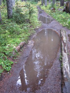
 Then we headed out for Manning Park. The first part of the PCT right after the monument is not a trail. It is an obstacle course. I’d been warned about it by some of the SOBOs, and they were right.  It was so bad that for a joke, I started a mental check list to see if I’d yet met every conceivable trail obstacle.  Let’s see–there was a broken bridge that had me standing there staring and saying to myself, “How in the world am I supposed to get across THIS?” (I did get across, very gingerly!).  There were large holes that I had to negotiate around, plus stretches of trail that were basically a soaking wet mess of tangled plants to get through.  There were rocks to climb over, and most of all, there was mud, mud, mud, while the rain continued to come down.  Fun!  Bill is very good at zipping through all of the above, and he was soon far ahead of me.

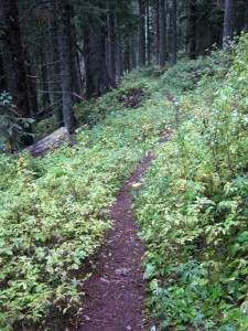
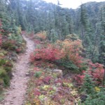
Finally the obstacle course was done.  Hooray!  The PCT went back to being just a nice trail climbing up the side of a mountain canyon.  The fall foliage was gorgeous.  There is one kind of  low-growing bush that turns a brilliant bright yellow color–it looks like sunshine on the ground and a couple of times as I looked up ahead, I’d see it and think for a second, “Look!  A sunpatch!  The sun must be trying to come out!”  But one look at the dense gray sky and continuing rain would give me a reality check–“Oh bother!  It’s that pretty yellow bush again!”  I started calling it “The Sunshine Bush.”

Sept20_5mud


Sept20_6markerbill

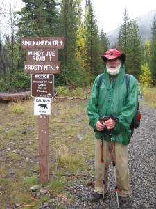
I caught up with Bill at the top of Windy Joe Mountain, where he was waiting for me and exploring the campsites that are located up there.  (His conclusion was, “I’m glad we are not camping here tonight!  Everything is soaking wet and there are no genuinely FLAT places!”), then we started the long roadwalk downhill to Manning Park. I remembered this from 2005, and I’d been looking forward to it, thinking, “Oh, won’t it be nice to stroll down the road, enjoying all the lovely fall colors?” Well, make that hurry along, dodging the evergrowing puddles, in the pouring rain, wet and cold.  The Graduate passed us–he was meeting his parents at the trailhead.  He was rejoicing– “I get to sleep in my own bed tonight!”  I wondered where WE would be sleeping tonight??  Abbotsford, perhaps, as we did in 2005?

Finally we reached TRAIL’s END!  Hooray!  But after a few pictures, we headed off down the road to Manning Park, as rain continued.

Sept20_1trailgreen

When we arrived at Manning Park Lodge,  we found out that we’d just missed the only bus by an hour (it left at 11:00 am), and there wouldn’t be another till tomorrow morning. We couldn’t wait that long, not with our Amtrak booking already set up for the morning of Sept. 22.  So we two cold PCT SUCCESSFUL THRUHIKERS!!!! headed into the restaurant for big bowls of hot soup, a sandwich each, and hot coffee. I was worried about Bill–his hands were freezing cold and he just could not get them warm.  The food was VERY good!  There were a lot of people in the restaurant, and I very politely inquired of each group whether they were headed in the direction of Abbotsford, in hopes of finding a ride.  No luck.  Everybody was either heading east, or already had a carful of  folks. So  I headed out into the parking lot to try for a ride there. It was tough. It was still raining, and it seemed as if everybody was going east, not west. Bill and I even tried going out to the highway to stick out our thumbs and hitchhike, but all the cars just went roaring by.  It was pretty discouraging. 

 So back to the parking lot we went, and I stayed outside looking for more “ride possibilities” while Bill went back inside to phone up our Chevron/Techron credit card company, since the card was refused when we tried to pay for lunch.  (The Capital One card DID work)  While I waited for people to come out of either the lodge or the restaurant, I entertained myself by reading a large informational sign, and that’s when I discovered the “wonderful” fact that there are now GRIZZLIES in this area!  Apparently since the “grizz” are now protected, they have been making a comeback.  Man, I am glad I didn’t know that!  I don’t mind black bears, and have no problem with chasing them away or bossing them around, but grizz!!!  Yikes!

Finally a nice older couple offered us a ride, and we were on our way, with our packs perched on our laps (not too bad–we only had basic gear in them–no bulging food bags!), down, down out of the mountains, while rain continued to pour down.  I thought about the 3 mile walk back to the US border from Abbotsford, and the thought of doing it in the rain was NOT very appealing.

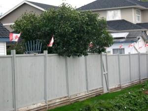
But once we were down in the Fraser River Valley, the rain stopped, the clouds began to break up, and by the time the kind couple dropped us off at the park ‘n ride by the highway, the SUN was SHINING!  Oh man, did it feel good!  It was 4:30 pm, so we had to do the walk along Highway 11 with rush hour commute traffic roaring by.  It took an hour to do the 3 miles, because we had to wait at traffic lights.  One of the houses along the way was bedecked with Canadian flags.


Sept20_7housecanada

Once we arrived at the border station, we had a long wait.  There were hardly any “border guys” on duty, and a lot of folks who wanted to go through. I was worried, because I knew Bill and I were fresh from the trail after days of rain, so we didn’t look very reputable or impressive.  We started talking to another guy who was waiting, too, and that helped pass the time.  When it was finally our turn,  the official guy just looked at our passports and waved us through.  No problem!  Whew!  In 2005, we had to explain ourselves a bit.  Not this time!

We stepped out the door into Sumas, Washington.   We dodged huge puddles (I guess it rained in Sumas, too??) and  lost no time finding a place to stay(right across the street, and only $45 for the two of us–not bad!).  We hung our wet gear up in the bathroom to begin the drying process, and then headed down the street looking for a place to eat.  The only place open was a Mexican restaurant called El Nopal, so that’s where we had dinner, and joked about “this is becoming our PCT tradition–we have to finish up with dinner at a Mexican restaurant!”, because that’s exactly what happened to us in 2005 also!  The food was very good, and then we headed back to the motel for showers, more gear-drying and sorting, plus phoning home to say “We did it!  We are back in the USA!”

Then we were very glad to collapse into a soft, dry, warm bed–our plans for tomorrow include taking several local buses to get to Seattle, and the first bus leaves at 6:35 am.   It almost felt unreal that after so many months, we were finally done,  and pretty much safe, too (other than a few scrapes and bruises).   Thanks be to God!

Sun. Sept. 19 Miles today: 28.9 Actual total: 2,648.6 miles

Sunday, September 19th, 2010

Well, it rained quite heavily all night, but we stayed very comfortable under our tarp, with no problems, thanks to the heathery ground underneath us that soaked up every bit of the rain so that nothing ran along the ground.  It was still raining while we ate breakfast and started our packup, but stopped for a brief while as we climbed back up to the PCT and embarked on our last full hiking day!

The rain continued off and on for the rest of the day, sometimes heavily and sometimes lightly, but what made it bearable was that the clouds had lifted and we could see mountains and views once again.  Yesterday, though it didn’t officially “rain”, we were in clouds and mist all day and couldn’t see anything.  The scenery on this part of the PCT is so gorgeous that  rain or no rain, it was a blessing to be able to see it.   Temperature-wise, it was very cold, and I wore most of my layers all day.   We changed our snack times and meal times a bit–the governing consideration was “Look, it stopped raining for a little while!  Let’s eat now!”   Then we would gobble down a Snickers or whatever before moving on.  But at lunchtime, the rain finally stopped for an hour and oh joy!  We found some rocks to sit on–much better than the very wet and muddy ground.

All the colors of the landscape around us are definitely in “autumn mode”.  Even the grass is turning a golden-yellow.  I didn’t get many pictures of it, though, because of the rain, and I have to admit that my enjoyment of the autumn beauty was lessened by being so cold and having to deal with so much rain.  

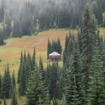
As far as actual hiking went,  the first “landmark” of the day was reaching Hart’s Pass with its cute ranger station house.  I signed the register there, and was surprised to see that even though it was still very early in the morning, two hikers had already signed in.   I also noticed a lot of cars parked in the area, but no people walking around.  Did that mean we’d be meeting lots of folks on the trail?  We were very sad to see that pretty Meadow Campground, which lies just below the PCT, was devastated by a forest fire.  In the rain and cold, nobody was camping there, and it looked very forlorn.

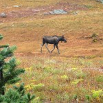
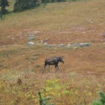
From Hart’s Pass, the PCT takes a big climb up and up till it reaches “cruising altitude” at about 6200 feet, contouring along mountainsides for many miles, and occasionally dropping down or going up a bit to various “passes.”  At Windy Pass, we had a huge thrill–the highlight of the whole day!  We were sitting by the trail taking a Snickers break, when a MOOSE came strolling by in the meadow, not far away.  We both whipped out our cameras and started taking pictures!  Mr. Moose soon spotted us, stopped and stared at us for awhile.  He had a nice set of antlers, so we were a little bit concerned (we’d heard several hiker tales of  bad-tempered moose), but he finally “floated” away, obviously not worried about us.  I was amazed that such a big, heavy critter could move so effortlessly. 

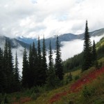
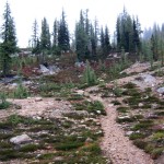
With the clouds high in the sky, even though it was mostly raining all day, we still got awesome views of the huge U-shaped, glacier-carved forested valleys.  Everything in the landscape here seems to be on a “giant” scale.  Fall colors are everywhere.  Every mountainside is painted in yellow and orange–even the dark green forests are embroidered with bright colors.  We met a hiker who FINISHED the PCT yesterday (way to go!) and was hiking back south to get a ride out at Hart’s Pass.  He gave us welcome news of the hikers who have finished in the last few days, and among them were Trash Bucket and Happy Camper!  What a relief!  Now we know they are OK!

We were passed by The Graduate, who is on a tear for the border.  He plans to hike nonstop till he gets there.   Next we met a dad and daughter out backpacking.  The dad is very enthusiastic about the PCT–his son thruhiked successfully two years ago!  It was fun to talk to them, but we didn’t linger too long–it was coooold!  The trail took us to the top of a pass.  The “new” route then goes WAY down into a valley,before climbing  up again to the next pass.  The “old” route just contoured evenly over, but it was pretty much demolished by rockslides, so was abandoned.   Grumping a little bit, we headed down and began the climb back up. The rain at that point decided it was time to do a “cats & dogs” downpour.  Oh fun!   Bill has been having more and more trouble with big uphill climbs, and this was no exception.  I was soon well ahead of him, and planned to wait at the top.  When I got there I was surprised to find that somebody had set up camp (two tents, plus food hung from trees)  but no-one was there.  I waited for a long time, and no Bill.  Brrr!   The wind and rain were freezing, so I decided to hike along a bit farther to get out of the wind, and stop and wait again.   Still no Bill.  I began to get worried.   

As it turned out, he had taken his time climbing up to the pass, and once he got there he messed around for awhile taking pictures, and also trying to walk “back” a bit on the old PCT trail that’s been abandoned.  Meanwhile, whom should I see coming southbound on the PCT but “Balls” and his lovely little daughter (9 or 10 years old).  The last time I saw him was in the Sierras, when we were both glissading down a pass, and he zipped right past me.  Turned out that he had left off thruhiking because of a foot injury, and had only completed the California PCT– but his daughter really wanted to see Monument 78 (so did he!), so he took her on a little backpack adventure.  They’d been to the monument and were returning to their “base camp” at the pass.  Aha–so that explained the two tents!   Bill finally showed up as I was talking to them, and he and I headed on north together.  The afternoon was very cold and getting colder.  

Finding a place to eat some supper was very hard.  The wind was strong and there were few protected spots.  We finally huddled behind some trees and ate as fast as we could.  Brrrrr!   Then we mushed on fast, partly to stay warm, and partly just to get to a campable place before dark.  Those miles after supper included climbing up to the highest point of the PCT in Section L (7,000-plus feet) in rain, with wind so strong I could not use my umbrella.  Bummer!  I really missed the umbrella–it keeps my head and shoulders and the top of my pack dry, plus it breaks the wind so I stay warmer.  But this wind was far too wild and strong–I had to stow the umbrella.

The PCT went up and up into what on a nice day would be a lovely “alpine garden” area, but for us it was in the cloud, freezing cold and windswept.  We reached the top at last and began switchbacking down to near Hopkins Lake.  Side trails led to some campsites, hooray!  But it was still raining and everything was soaking wet, muddy and cold.  We disagreed about where to set up the tarp, but finally went with the spot Bill wanted.   I was sort of bummed because this was our last night on the trail, and I was hoping for a really nice campsite like we had in 2005.  No such luck, this time.   We barely got the tarp up in time before it was dark, as the rain continued.

Today was a tough haul–a challenge to be met, which is a good thing–but not at all fun.  The upside is that we actually got to SEE some scenery at least for awhile. The other thing that helps me to keep going is to “sing” in my head (not out loud–I need all my breath for hiking!) and I am very glad I’ve learned so many gospel songs and hymns.  I pick one with a good “hiking  rhythm” to it, and “sing” all the verses to myself, then pick another one.  A lot of the thruhikers listen to recordings as they hike–I would find that very distracting.   As the rain pattered on the tarp tonight, we had our last evening Bible reading.   Only 14.9 miles to go, and we are DONE!   I am looking forward to being warm, dry and clean, plus resting my very tired feet.

Sat. Sept. 18 Miles today: 26.2 Actual total: 2,621.7 miles

Saturday, September 18th, 2010


Sept19_9meadowhillsSept19_11plantsSept19_2cabinSept19_1baretreestrailSept19_6viewmeadowSept19_4trailtreesSept19_5viewtreesSept19_3trailcloudsSept19_8animalmeadowSept19_7animalmeadowSept19_9meadowhills

We ate breakfast at 5:30 am, but it was still so dark when we finished that we waited a bit before packing up.  It rained off and on all night, and was still raining as we loaded our packs under the protection of the tarp, and we set off hiking in the rain, too.  But after less than an hour, the rain stopped, and did not return.  Hooray!  (Though we were “up in the clouds” all day, and did have to deal with a lot of “fog drip”).

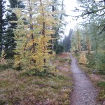
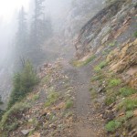
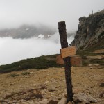
The first project of the day was to finish the climb up to Cutthroat Pass.  The drippy clouds at that point were lifted up high enough that we could see more than just trailside plants.  We could see some mountainsides, and the fall foliage was beautiful.  An added plus was that the trail was wide enough that we were not having to push through soaking wet vegetation,  but just walk happily along–the very wet plants could not touch us.  As we climbed higher and closer to the top of the pass, the terrain became more stark and alpine.  Soon we were actually IN the clouds.  The top of the pass was completely barren (except for a PCT sign), and as we began the descent, the clouds were so thick that we could not see a thing.  The trail switchbacks down, with big dropoffs on one side, which had me really nervous in 2005, but were not a problem this time.  The wind was blowing, and the clouds were moving around, so occasionally we’d get a glimpse of the huge, deep valleys below or of the snow-capped peaks up above.  The PCT heads down to Grant’s Pass, then follows a long, contouring climb up to Methow Pass.

From the top of Methow Pass, we headed down again into the Methow River valley, and it was quite a “down”!  Bill joked, “Are we going back to sea level, do you think?”  The long walk down could have been more enjoyable, but we were in clouds and couldn’t see anything but the forest right by the trail.  There were lots of little rockhop creeks to cross before we finally reached the valley floor.  We stopped for lunch at Willis Camp, by Golden Creek.  When I was rummaging in the food bags, I discovered that a mouse had gotten into the cookies in Bill’s food bag.  We ate them anyway, along with hot (!!yum!!) coffee the Manns had given us, and a backpacker version of tuna casserole (Lipton Side of noodles & sauce, plus a packet of tuna, plus freezedried peas.  Love this stuff!!)  It was very cold down in the valley, but not raining, so while we ate, we hung our very wet tarp between two trees to dry off a bit, and managed to dry the ground cloth a little bit, too.

The long climb out of the valley up to Glacier Pass took most of the afternoon.  Basically it involved a lot of contouring and switchbacking, in and out of avalanche paths and forest.  The “avalanche sections” were very overgrown with floppy wet plants, and the PCT there was rocky and muddy–what a mess!  It’s the sort of situation where you just have to grin and say, “Are we having fun yet?   Wheeeee!”  and keep on walking.  Eventually, as the trail climbed higher, there were no more big floppy plants–just very steep grassy hillsides.  We still couldn’t see anything except for one brief moment when the clouds parted and we could see some views.  The wildflowers along the trail are pretty much just faded and dry, but the fall foliage was very colorful.  The little six inch high huckleberry plants had lots of ripe berries–I ate a few, but it’s hard to bend over that low with a backpack on, while continuing to hike!

We reached Glacier Pass (which had a nice campsite) and mushed on for another hour to the final top of the climb.  From there we watched the trail and map carefully, because there was supposed to be a campsite with water up ahead.  In 2005, we couldn’t find the water, and that was hard, because from that point, there is no more water for 15-20 miles (depending on which guidebook you follow).  Complicating our search was the fact that we were IN the clouds.  It was like being in a dense tule fog back home.   We did locate the campsite, and the serious water search began.  First step is simply to stand still and LISTEN–that’s often the best way to locate a small, hidden water source.  But this time, careful listening didn’t help.  A number of different little paths led downhill from the campsite, so I headed off on one, and Bill on another.  I had no luck, but Bill did.  He found the water, a ways down the hill, coming from a small spring located in a little meadow.   We collected water and sat down to eat some supper, enjoying the fact that we were down out of the wind behind some rocks.  The best part of all was that a totally cute little pika came out of the rocks nearby and sat “meeping” at us.  (I have decided that the best way to describe a pika’s voice is that it “meeps”). 

Then it was back up to the trail, continuing on in a very cold wind and thick clouds. Brrrr!  But we were very glad it was not raining–just cloud mist and no more.  Less than a mile along, we met a SOBO hiker who asked if we’d seen “the campsite with water”.  We assured him that we’d just come from there, and told him how to find the water; he was delighted.  After wishing each other well, we went our separate ways, but now it was MY turn to be worried about finding a campsite.  We could not see more than about 20-30 feet in the thick clouds, and the PCT was endlessly contouring along a very steep hillside in a bitter cold wind.  The map showed a saddle up ahead–hopefully we’d find some flat ground there, and soon, because by 7 pm it starts to get dark.

We reached the saddle and were terribly disappointed.  Not only were there no flat places (it was too narrow), but everything was blackened by a relatively recent forest fire.  All we could do was to keep going, and now I was seriously praying for God’s help in spotting something despite all the clouds.  Finally, just before dark, the mountainside widened out a bit, and I saw a slightly sloping, but still reasonably flat little spot just down from the trail. It was all covered with some sort of dwarf heather stuff, but we put down our ground cloth anyway, and got our tarp up just before it became truly dark.  The wind was rushing and roaring all around us, but the heather made a very soft “mattress”.  At around 9 pm came the pitterpatter of rain on the tarp, but we were snug and warm.  I thought about tomorrow–it will be our last “regular hiking day” of this journey.  “Will the sun come out?” I wondered.  Bill commented that the weather forecasts in Washington state shouldn’t ever say “Chance of rain”–they should just be realistic and say “It WILL rain.”  What they should be saying is “Chance of SUN”, because that really IS chancy!  Well, we will see what tomorrow brings!

Fri. Sept. 17 Miles today: 21.4 Actual total: 2,595.5 miles

Saturday, September 18th, 2010


Sept18_4cloudtrailSept18_7billfogSept18_6viewcloudsSept18_1trailflowersSept18_2trailviewSept18_5trailfoggreenSept18_3trailsign

It sure was nice to be in a warm, comfortable bed last night and listen to the rain pouring down OUTSIDE.  It had turned into just a bit of “drip” when I got up very “late”, at 6:15, to sort food and load the packs before breakfast at 7 am.  It was another awesome Stehekin Valley Ranch meal–eggs & potatoes, tomatoes, biscuits, fruit & yogurt, French toast and plenty of cowboy coffee.  I also made us a great “trail lunch” from the fixings laid out–AND Kerry Courtney (wife of the owner) had even set aside a pound of cheese for me, since I’d asked if I could buy some to supplement our trail food.

Mr. Courtney, the owner of the Ranch, was away campaigning for Congress!  He is one awesome guy, and I told his wife that I sincerely wished I could vote for him instead of the lame candidates we have down in California.  I read his campaign literature and was very impressed.  He said he felt he just could not continue to “hole up” in his little heaven-on-earth in Stehekin Valley and watch his beloved USA “go down the tubes.”   I wish him all success!

At 8:30 am, a bunch of us piled onto the bus to head back to the PCT.  One fellow was a “regular” backpacker, and the rest were dayhikers.  We were very surprised to be the only thruhikers.  Since there were several of “us thruhikers” going into town on the bus yesterday, we figured there would be a whole crowd this morning.  Nope.  It was just us.   At the PCT trailhead, there were some PCT hikers waiting for the bus.  They planned to share some rooms at the motel in town.  We gave them the lowdown on where everything was, and where to get food,  then we shook hands and wished each other well on the last push to Canada.

When you leave the trailhead at the bus stop, you have a choice–either walk the PCT (which, true to form, goes up, up, up and down, down) or you can just walk the dirt road till the PCT comes down to it–much easier and quicker.  We decided, though, to stick with the PCT.   The trail immediately climbs right up a rocky hillside and passes very pretty Coon Lake.   The trailside fall foliage was lovely, and overhead it was cloudy, with an occasional sunbeam momentarily breaking through.  We wore our raingear because the bushes along the trail were dripping wet.   I like the “pattern” of the trail here–it goes up, up, up, then flattens for awhile before heading up again.   So we would huff ‘n puff for a bit, then be able to hike easily and enjoy the views before it was huff ‘n puff time again.  Another great thing was that we could actually SEE where we were going, since it wasn’t raining (yet!) and the mountains are so huge.   I like the feeling that I’m actually making progress!

The PCT basically winds its way up a long forested canyon with very steep sides.  What’s really awesome is that every time you reach a side canyon, you get a glimpse of massive, snowclad mountains up at the head of the side canyon.  There are lots of creek crossings to do–some have bridges, and some are rockhops.  One of the creeks had a suspension bridge, but the trail up to the bridge was so unbelievably rough and rocky that we turned off and just rockhopped across the creek.  We stopped for lunch at one of the bridges, and I took off my wet rainpants and hung them on a rock to dry.  Bill did the same. 

But after lunch, when we were packing up our gear,  I picked up my rainpants and stowed them in my pack, but Bill did not remember to get his pants.  They were gray, and almost perfectly matched the color of the rock they were lying on, so I did not notice them, either, and we took off.  By the time Bill realized he’d forgotten his rainpants, we’d covered a lot of miles, so going back to retrieve them was out of the question.  Major bummer, given the weather (rain immanent) and temperatures (cold).  I was very worried and upset when I realized what had happened. 

We reached the highway near Rainy Pass, and followed the trail as it paralleled the road for quite a ways.  We could hear the cars going by, just out of sight.   The forest was quite a color contrast–very green evergreens with brilliant fall foliage on the deciduous trees.  When we finally reached the highway crossing, there were two backpacker guys who’d just finished a 70 mile hike and were waiting for their wives to come pick them up.  They were very tired!  But they were thrilled to meet two “real thruhikers” and plied us with questions for a little while before we headed on to the trailhead parking area.

In the parking area, a young couple were just taking off their packs and getting ready to stow them in their car.  Unfortunately, they had a dog with them, and he rushed at us, fangs bared, barking fiercely.  We brandished our trek poles and shouted to the couple to get their dog under control.  Their reaction was typical–they became very huffy because we had “threatened their dog!”  Unbelievable!  I will never understand such people!    They finally collared the dog and put him in the car, and left.  We lowered our trek poles and growled to ourselves!   Grrrrr! 

After eating some supper, we put in a couple more miles before looking for a place to camp.  It is getting dark earlier and earlier–our hiking day is a lot shorter than it used to be!  Finding a campsite wasn’t easy, though–the PCT was doing its usual side-of-the-mountain route, and there were no flat places.  Plus, it’s Washington, and there are lots of plants covering the forest floor.  I finally spotted a possibility a bit after Porcupine Creek,  but it looked like rain was immanent, so we did trench the “uphill side” of the tarp.  Then we unpacked, and that’s when Bill discovered he’d left his rainpants far behind, drying on the rock.   He was quite disgusted, and I was very worried and upset.  We are heading into a lot of very exposed,  above-timberline situations, and the forecast was for cold rain all day tomorrow. 

Just as we finished cleaning ourselves up and crawled into our sleeping bags, the rain began.  As I write this, it’s not a heavy rain, just steady.  Maybe it will finish by morning??  At any rate, I am very grateful for a whole day of hiking today with NO rain!   And there are only 3 more days to Manning Park!   But I am very, very worried about Bill, with no rainpants.  I depend heavily on mine, not only in rain, but in any very cold weather.  And that’s what we are heading into.