Archive for the ‘CA Southern – B’ Category

Wednesday, May 5 – Miles Today 7+ – Total Miles 196.2

Wednesday, May 5th, 2010

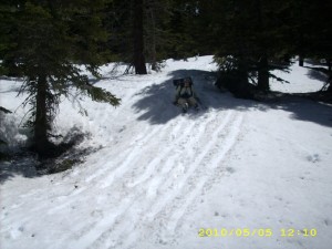
may5_snowtrail4

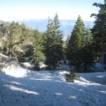
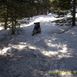
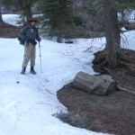
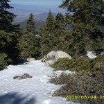
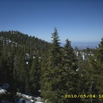
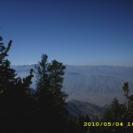
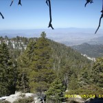
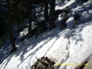
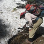
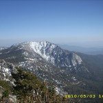
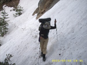
Well, we made it— all the way across the fearsome Fuller Ridge–and we are still in one piece, sort of.  I ache all over from bruises and scrapes and falls.   This morning was a rerun of the last 2 days— plenty of scary traverses and trying to figure out where to go. We got up at 5:45, determined to finish Fuller Ridge, but the snow was so icy and hard that we soon gave up, found a sunpatch and sat down to eat a bar while enjoying an awesome view of Mt. San Jacinto.  The wind was blowing hard, and it was so cold that I finally had to put on my raingear to stay warm.   After awhile we decided that the snow had softened up enough to be reasonably safe, and were on our way.

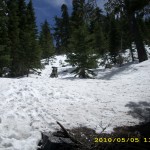
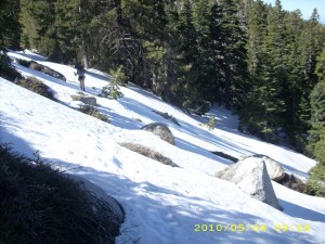
All day long, we faced one steep, snowy hillside after another.  We were trying to follow other people’s tracks, but the tracks soon just headed all over the place.  I guess everyone else who went before us were lost, too!  Even Bill fell a couple of times, and on one of those times, the alcohol fuel bottle and our “medicine bag”  (containing bandaids, Motrin, etc) fell out of the net pocket on his pack.  He was too busy picking himself up and getting underway again to notice, and I was so far behind him that I didn’t even know to look for them. 

We did figure out a couple of things, though.  Bill finally took my suggestion that on scary traverses, if he just “stomped harder” and left a bigger footprint, it would be easier and faster for me.  And boy, did that make a difference!  I did not need to keep chopping steps for myself.  The only “downside” was that Bill’s steps were so far apart that I really had to “streeeeetch” to reach them.   (Later on, at the hostel in Big Bear, I was talking to Not a Chance, and she said she had the exact same problem–her boyfriend Croatian Sensation made nice tracks for her, but the steps were so far apart that she also had trouble reaching them!)    And I figured out that on most all downhills if I just sat down and glissaded with my ice axe as a brake, I could move along quite quickly.   (As I said before, I did pay a price for this!  Bill says maybe my trail name should be Scarbutt.  I vetoed that idea!!) 

We did meet several other hikers in the morning, and in every case, they greeted us with a very anxious, “Have you seen_____?”  Seems there are a lot of  missing thruhikers! 

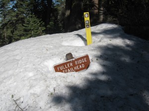
may5_c2_snowburiedsign

At noon we stopped for a hot meal that came all the way from Australia–a sweet ‘n sour freezedried lamb stew, courtesy of our daughter Mercy and her husband Ted, who were in Australia last year.  It was clear, cold and windy.  Again, I put on my raingear just to stay warm while we ate.  The hot food really helped, and we continued the slow process of trying to figure out where to go, picking our way along, when finally Bill said, “Enough! We will just head down.”

So we did— and spotted a dirt road!  Hallelujah!   After consulting our maps and figuring out where we were,  we followed the road back UP the hill (dodging plenty of snowbanks and snowdrifts which were blocking even the road) and headed back  to the PCT. Along the way, another “lost” PCT hiker popped out of the woods— boy was he glad to see us! He was a big, strong, young guy, but when we compared notes, it turned out it had taken him just as long to get across Fuller Ridge as we did.  So I felt a lot better–I had been feeling very discouraged about being slow. 

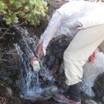
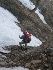
Once we found the PCT again, we all collected some water from a little creek nearby.  The young guy was so tired that he decided to stop for the day and camp.  Bill and I agreed, “We want OUT of the snow!  We are not stopping now!”  We figured that we’d still be hitting snow at least part of the way down to San Gorgonio Pass, and if we waited till morning, that snow would be icy and nasty.  Right now it was soft.  So we said goodbye to our exhausted fellow hiker and began the long walk downhill.  We still had to deal with some snowfields, but nothing bad, and between the snowy traverses we were able to hike on nice stretches of TRAIL!! 

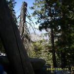
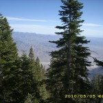
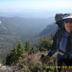
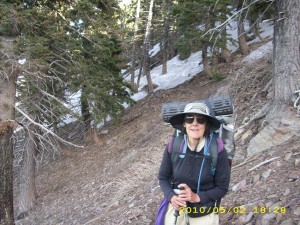
Finally we were completely out of the snow.  What a blessed relief! I ached all over, the wind was howling and it was cold, but wow!  We made it!  And we got in almost two hours of travel on the very long but very scenic switchbacks down to San Gorgonio, before the sun went down.  I spotted a little low hollow surrounded by chaparral, and that’s where we are camped tonight, somewhat protected from the very strong, very cold wind.  What a switch from 2005, when it was horribly HOT here!  We are grateful to God for His help, and I am praying for all our fellow hikers to make it safely through the snowy challenge of Fuller Ridge.

Walk to Rivendell: Nearing edge of Midgewater Marshes

may5_c2_billtrailmay5_c2_snowmay5_c2_snowtrail

may5_c2_viewsnowmay5_snowtrailmay5_snowtrail2

may5_snowtrail6may5_snowtrail8may5_trees

may5_treesvistamay5_vistamay5_vista2


Tuesday, May 4 – Fuller Ridge Miles Today 6.2+ – Total Miles 189.2

Tuesday, May 4th, 2010

may4_snowtrees4

Today was probably the toughest and scariest day I have ever had in my life.  It took us from 6:30 am till 6:30 pm to cover just 6.2 miles of PCT.    It’s a good thing we had a wonderful camp last night and slept very well.  (No wonder!  We were both wasted from battling the snow!)  We waited until 6:00am to get up, to give the snow time to soften. The other hikers camped nearby waved at us from their tents as we went by, and we waved cheerily back, thinking, “Yahoo! Pretty soon we’ll be across Fuller Ridge and down out of the snow!” 

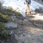
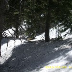
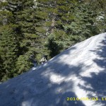
No such luck.  We very soon lost the trail again, and it took a long time before we finally relocated it.  And after that, the rest of the day  turned out to be  agonizingly tough. We hardly saw the trail at all, except for one junction–everything was buried in snow.  We had to contour on hard, icy snow along steep mountainsides.  Crossing these was absolutely terrifying for me, because I knew that if I slipped, it was a long way down.  All I could do was pray and keep putting one foot in front of the other.  My ice axe got quite a workout! 

 I ended up covered with bruises and scrapes from many falls. Sometimes the ice axe “self arrest” worked, and sometimes it didn’t. One time when it didn’t, I (thank God) landed into bushes. The other thing that I ended up doing (since my pants were already torn) was to glissade down steep hillsides, where Bill would bootski or plungestep. (It turned out later that though this was a lot faster, it was also scraping the skin off my rear end.  I was in so much pain from all my bumps and bruises that I didn’t even realize what was happening.  I forgot that snow is actually a lot like sandpaper, and that pioneer women used to scrub pots with it!)

 What made it even worse was that Bill was just bouncing along fearlessly and happily.  He spent probably 80 % of his time today waiting for me as I took a half hour to cross a snowfield he’d done in less than 2 minutes.  This made me feel awful, and it was very discouraging.   As a result of my being slow, we were passed by several hikers, all young, strong, fearless guys.  Their approach to a traverse on steep, icy snow was to slip, slide, laugh and joke all the way across, where I was doing the 1) Chop step with ice axe   2) Plant ice axe firmly on uphill side of the step  3)Step into the freshcut “step”  4) If it feels secure, repeat Steps 1-4.   Several times I tried to be braver and just slip ‘n slide across like Bill and the guys do, but every time I tried that, I slipped and fell.   I only cried once, and only for a minute, after one particularly scary fall.  Other than that, I prayed like crazy for just plain courage to keep going.

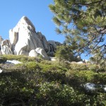
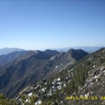
 Other than that, the weather was glorious, the views and scenery awesome.  It really cheered me up whenever I felt particularly bad.  I was VERY grateful for such a beautiful day!  We were so busy battling snow that we never got around to eating breakfast till 10:30 am, and lunch was also very late–2:30 pm.  Eating was a very welcome break from the snow!    And I also realized something else that made me feel better–I am the only woman up here!  Every hiker we have seen is a guy, and a young guy at that.  Bill is the only old guy, and I am the only woman we have seen.  (Found out later that there was one other girl, one day ahead of us, named Not a Chance.  She made it through with her boyfriend Croatian Sensation.  She told me later how hard it had been for her, too.)

 Around 6:00pm, among the rocks and snowdrifts, we found a dry ground campsite and collapsed— but with an awesome view of Mt. San Jacinto!  My arms ache from chopping steps,  my quads ache from constant uphill/downhill, and my rear end, well, it REALLY hurts.  My prayer tonight was something like, “Lord, PLEASE help us get safely off this snow tomorrow!”

Walk to Rivendell: Yes, still in Midgewater Marshes
may4_c2_mountainmay4_c2_snowtrailmay4_c2_vistarocks

may4_snowtreesmay4_snowtreereflectmay4_snowtrees2

may4_snowtrees3may4_snowtrees5may4_snowtrees6

may4_sunsetmay4_sunset2may4_vista

Monday, May 3 – Miles Today 11.1+ – Total Miles 183

Monday, May 3rd, 2010

may3_snow

The wind blew fairly hard all night last night, but we were snug and secure among the boulders of the Desert Divide main ridge.  Knowing that we were in for a VERY tough day, we got up early and prayed for God’s help as we shouldered our packs and started out along the trail.  And what a day…it took us 12 hours of hiking to find and hike only 11 miles of PCT.

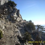
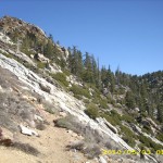
The first section of trail we had to face is literally blasted out of the mountainside.  It is amazing to me that they even managed to get a trail tread through here at all.  Often we were climbing across steep snowfields and I did a lot of chopping steps with my ice axe. Bill just walks straight across, very fast, with his trek poles (he says his theory is “Momentum trumps gravity!”)  then he sits down and waits (as long as 20 minutes) for me to creep across, chopping steps as I go. 

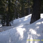
Just as in 2005, eventually we lost the trail entirely in the snowy forest.  In 2005, we were able to head downhill till we were out of the snow,  then contour over and head back uphill to Saddle Junction.  Bill wanted to do that again, but I was very dubious.  As far as I could see, the snow extended far, far down the mountain, not just a little way down as in 2005.  And going DOWNhill on steep icy snow is pretty scary.  But Bill insisted, so down we went.  We kept going and going, still in deep snow everywhere,  till we ran out of water.

OK, we’ve been snow camping, so we knew what to do.  We stopped and melted snow to get water.  Later on, we found a creek under the snow, and chopped away at the ice that covered it till we could get at the water. Another thruhiker came by, also hunting for the PCT, and he was very glad to find water!  Our fellow hiker took off in another direction, while Bill continued to go determinedly downhill.  But there was no end to the snow, and finally even Bill reluctantly concluded, “This is not working.”  So we turned and headed UPhill again.  Noontime came, and I found a rock to sit on to cook lunch, while Bill headed up the hill to a really big rock that was high enough to give him a view of the area.  Yahoo!  He spotted a lot of footprints off to the west that looked like they might be the PCT.   We were eating our lunch when yet another lost thruhiker came along, and when Bill told him about the footprints on the other side of the hill, he was overjoyed.  “Idylwild, here I come!”  he said, and was amazed to find out that we were planning to bypass Idylwild and head straight for Big Bear.

After lunch we also headed “over the hill”, found the footprints, and yes!  It was the PCT.  Before long we were at Saddle Junction.  It was buried in snow, but well-marked.   From there, the trail heads up south-facing slopes, so the snow soon disappeared, the sun was warm, and we joyfully switchbacked up on snowfree trail…for a little while.  Then we were back into snow-covered forest, hunting for “trail indicators” like cut branches or logs.  Every now and then we would find something, but progress was slow, and we were both exhausted.  I was all banged up and scraped from many falls on steep, icy snow.   At 4 pm, we found a bare, flat piece of ground, and Bill suggested we just stop and camp.  But even though I was very tired and discouraged, I could not bear the thought of giving up so early.  And I knew that in the morning the snow would be all hard and icy again, instead of soft.  So I begged to go on, and Bill agreed.  Shortly afterward, we met two other thruhikers, also without a GPS, who were hunting for the trail, too.

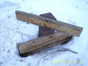
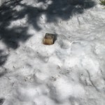
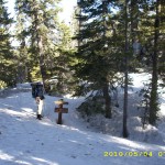
At this point, all I could do was ask God to guide us, and as it turned out, He did.   We were walking along, looking for SOME sign of the PCT, when I spotted just the top of a trail signpost sticking out of the snow!   Hooray!   Now we knew where we were!   We happily followed the direction indicated, and soon were back on almost-snowfree trail, heading along toward Fuller Ridge.   We stopped for water at Strawberry Cienaga, and it was wonderful to be able to drink as much as we wanted, without worrying about where we’d be able to find water up ahead.   While we were sitting there relaxing a bit, along came the other two hikers–they’d also found the trail.  We all plan to camp tonight at Strawberry Campground.

may3_sign

At the campground, there were only a few snow patches, but very little level ground, so I took my ice axe and levelled out a place for Bill and I to set up a cowboy camp.  Then we ate a very late peanut butter and crackers supper and collapsed into our sleeping bags.  We are at 8,030 feet elevation, it’s 39 degrees and the wind is blowing.   Good!   Our shoes are soaked from all the snow–maybe they will dry out a bit.   I am very grateful for being safe (other than some scrapes & bruises) and for finding the PCT again.   It’s going to be more of the same tomorrow, but hopefully by tomorrow night we’ll be across Fuller Ridge and down out of the snow!

Walk to Rivendell: Still in Midgewater Marshes
may3_c2_billtrailglowymay3_c2_snowtrailmay3_c2_snowtrail2

may3_c2_snowtrail3may3_c2_snowtrailsignmay3_c2_vista

may3_c2_waterbillmay3_hill2may3_hills

may3_montyvistamay3_mountainsmay3_steeptrail

may3_trailmay3_vista


Sunday, May 2 – Miles Today 25.2 (+2) – Total Miles 172.9

Sunday, May 2nd, 2010

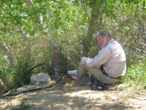
may2_c2_billrestingshade

Today was a long day (5:00am until 8:00pm) of great contrasts (and some danger), but it began with a fabulous surprise. We were up in the dark at 5:00 am, with temperature 39 degrees, and headed off as the PCT continued a constant climb, contouring around hill after hill.  We were starting to get very hungry, and were talking about how it was too cold to stop for breakfast unless we could find a sunpatch, when the PCT turned and headed down into a little valley.  Suddenly we could see the highway, a sunny field, and  what looked like a thruhiker encampment!

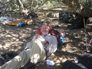
Well, it turned out to be “Doc’s Place Oasis”— Doc was there to greet us with hot coffee and bean and egg burritos. We scarfed them up, PLUS our trail breakfast, and I said out loud, “OK, that does it! This is NOT a thruhike. It is a Hobbit walking party, with food at every road crossing!”   As it turned out, “Doc” really IS a doctor–a podiatrist, in fact, and besides feeding hikers, he was also working on their FEET.  We watched in awe as he worked on one hiker’s horrible blisters, and were grateful that so far, our “carry weight while training for the PCT” plan has worked.  Neither Bill nor I have even a sign of a blister.   Doc also was fixing hikers’ shoes–people who chose to wear cheap, lightweight “roadrunning” shoes are finding that after only 160 miles or so, their shoes are being shredded by the rough, rocky, Southern California PCT.  I am so glad I have TRAIL running shoes with a forefoot plate and other “rock protection.”

It was really hard to leave Doc’s place–we were having so much fun talking to everybody– but we knew that mega-tough trail lay ahead, and maybe even some danger, so we finally dragged ourselves away, crossed the highway, and headed off into the San Jacintos!

may2_montytrees

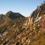
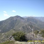
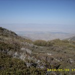
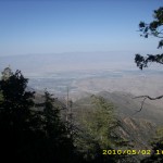
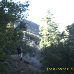
As the PCT goes up and up into the Desert Divide San Jacinto mountains, it goes past awesome rocks and increasingly awesome views. The trail was not bad at first, and it was a nice cool day.  Gradually the climb grew steeper, and then we began to encounter more and more “blowdowns”–fallen trees lying across the trail that we had to either climb over or go around.  When we took our 9:30 am Snickers Break,  “Scout” stopped and joined us.  (He’s a genuine Boy Scout leader!)  What a great guy!   The boys in his troop are lucky kids, but they’ll have to manage without him this summer as he thruhikes the PCT!

Our morning “water plan” was to have Bill make a run down to Cedar Springs, but it took us till after 12 noon to reach the springs trail, so we decided to use up all our remaining water at lunch, then refill everything at the springs.  So after we’d eaten our freezedried lasagna and veges (very good, but very messy), Bill headed down the 1-mile trail to get water, while I did “housekeeping”–washed up all the dishes, and aired our gear.  Scout came along and stopped to chat, and that’s when I found out that he was actually IN the terrible Sierra storm of August 2005, which was really scary for Bill and I, and resulted in the death of three boys.  Scout said that the troop had been following all the rules for what to do in a severe thunderstorm, but it turned out that the rules were not adequate for the situation.  Since then, the Boy Scouts have revised their “severe storm safety” plan. 

Various dayhikers passed by (it was Sunday, and a nice day to hike) before poor Bill finally returned, completely tired out and saying “Never again! That spring is too far down the hill!”  Several tough climbs after that, switchbacking up (and seeing some snow patches!!) we reached  Fobes’ Saddle, where there were thruhikers taking a break and watching the rockclimbers who were “doing their thing” nearby.  Three more killer uphill miles, and we were on  the saddle above Apache Spring, where we stopped for some crackers and peanut butter, then pushed on for what we thought would be 1 more hour of hiking.

may2_snow2

Nope— make that 2 more hours of scaaary!   We’d only been hiking for 15 minutes when we hit our first serious obstacle–the famous  “300 yards of icy snow” on a very steep mountainside, with a “run-out” a hundred feet or so down. Bill tried a few steps out onto it (following the footprints of other hikers), but even he immediately turned back and said, “No way!  We can’t do this–it’s rock-hard-icy!”  So we opted to slip, slide and scramble around below it (scary in itself on a steep mountainside), and a thorny plant tore a big hole in my pants when I slipped and fell.

Note from Alexa: Sounds like the section when Frodo & Sam were in Mordor with those nasty dropoffs and razor thorned plants.

may2_c2_billsnow2

We finally made it around the snowfield and back up to the PCT, vowing, “The next campsite we come to, we will take!”  Well, there weren’t any campsites–just endless steep hillsides and very scary trail that was often just a scratch on the mountainside, with a big dropoff below.  One icy snowpatch after another blocked our way.  Most did have footsteps across them.  Bill would go first, and I followed behind, scared stiff, because a slip would have meant at the least, a serious injury.

The sun went down as we picked our way along, but it was still light enough to see, and we finally made it to the top of the ridge and the cozy campsite where we’d stopped in 2005–only oh bother, it was already occupied by another pair of hikers!  But we knew there were more camping possibilities ahead, and it was just starting to get dark when we found a tiny flat place, squeezed between the boulders, threw down our sleeping bags and collapsed.

It’s a cool, quiet night tonight at elevation 7,200 feet.  I was happily surprised when I figured our mileage –I didn’t think we’d done very well, but 25 miles (plus two more for Bill) is not bad!  I am very grateful to think of the people who are praying for us. Tomorrow we face an even bigger “snow challenge” plus the “fearsome” Fuller Ridge.

Walk to Rivendell: Midgewater Marshes
may2_c2_billrocksmay2_c2_billsnowymay2_c2_billtrail

may2_c2_hikersrestmay2_c2_rocksvistamay2_c2_vista

may2_rocksmay2_snowmay2_sunrise

may2_sunrise2may2_vista2may2_vista3

may2_vista4may2_vista5

Saturday, May 1 – Miles Today 23.4 (+ Half Mile) – Total Miles 147.4
Saturday, May 1st, 2010

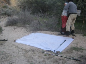
may1_c2_tarp

A nice clear 30 degree morning at elevation 5,000 feet,  but shouldering heavy packs (seven days of food plus full loads of water) was a serious “groaner”. After starting at 5:00 am, by 7:00 we found a cozy sunpatch to stop at for breakfast before  reaching Chihuahua Valley Road.  We were standing at the trailhead parking (several vans were there), when along came hiker Pat, fresh from overnighting at Trail Angel Mike’s place just up the road.  He said there were a lot of hikers still at Mike’s place, sitting around drinking coffee!  

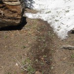
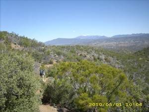
“OK,” I thought, “that does it!  For any hiker who starts for Canada from ADZPCTKO, this is NOT a thru-hike!   It is a Hobbit Walking Party, with food at every road crossing!”    Just up the trail we found out what all the vans were about–  a whole pack of trail gorillas were cutting brush and fixing the trail tread— boy did it need it!  I took a “before” and “after” picture to show the difference.  Thankyou and cheers to all trail gorillas!! 

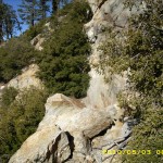
We followed the PCT up to a great viewpoint–there was Mt. San Jacinto up ahead–very exciting!  But after that, we were dealing with “un-gorilla-ed” trail –lots of pushing through bushes, with very rough, rocky tread, and tread that was falling down.  Add in our very heavy packs, and it made for slow progress.   We also talked for awhile with a hiker who asked Bill, “I’ve got a question for you. How’d you ever get a woman to go on this hike with you?” Bill answered by telling him the story of how the Lord brought us together. He encouraged our fellow hiker to consider asking God to reveal Himself in a way that was clear. The hiker’s response was “Nah— I already tried that.” But we are praying for him.

We went down the side trail to Tule Spring to cook dinner, rinse our socks, and air sleeping bags on a warm but breezy day. The rest of the afternoon, the trail was what I call “cozy”–no big broad vistas, just lots of winding out of picturesque little canyons and gullies and rocks, with plenty of wildflowers.

may1_c2_billrest

Later in the afternoon, came a very long climb up along Table Mountain.  With our heavy packs, even Bill became so tired that he decided to stop and rest  before our normal 3:30 Snickers break.  I was glad to rest, too!  Half an hour later, we reached the Hiker Oasis water cache.  A lot of hikers were sort of collapsed around it, and the cache was full of water— we could have saved ourselves a lot of energy carrying heavy water loads. One guy was reading a book on Attila the Hun, so we ended up talking history for awhile.  What was supposed to be a 10 minute break ended up being WAY longer!

Note from Alexa: This is an insider family joke— Bill has been a big fan of Attila since I can remember and I grew up with I think a story about him every week or so. It is part of the reason, when I bought my bows, that I chose hand-crafted Hungarian imported archery recurves in the style the Huns had.

may1_trail

From the cache, it’s another 8 1/2 miles to the highway, but we knew we’d never make it before dark, so we ended up stopping early because we were both so tired, and camped in a sandy wash, with another hiker in his tent a bit “upstream” from us. By tomorrow night, we may be at Apache Peak, where the “snow fun” begins!

Walk to Rivendell: Camp at Chetwood

may1_c2_billtrailmay1_c2_rocksmay1_c2_trail2

may1_c2_trailhikersmay1_c2_vista2may1_c2_water

may1_cactusmay1_cactusmontymay1_gunbarrell

may1_cactusmonty2may1_montyplantmay1_trail

may1_vista