Posts Tagged ‘Echo Lake’

Saturday, July 17, 2010 Miles Today: 24.1 Total: 1,120.1

Saturday, July 17th, 2010

july17_2mntlake

We passed 1,100 miles today! But wow, it was a tough 24 miles! It felt more like 34 miles! For many miles this morning, the PCT was unbelievably rocky and rough.

We had a good night’s sleep in our net tent with the mossies whining around outside, wishing they could get at us!  Once we got underway, it was a lovely morning.   Echo Lake was very peaceful– no motorboats this early, and the water was all silvery in the early morning light.   We passed the “water taxi” sign on a tree, and I will say this–if you ever think your life is boring and you want a thrill, well come to Echo Lake and ride the water taxi!  We saw it in action yesterday, and whoever it is that “drives” the taxi, well,  he drives like Jehu!  Wild! 

Picking our way along the very rocky trail, we finally reached  Lake Aloha with its many islands, in its very High Sierra-looking setting of snowy granite peaks.  There was enough snow by the lake that we lost the PCT for a few minutes.  The day was rapidly becoming very warm, and some folks were already swimming!  They must be tough–that water was snowmelt!  I wondered how bad the snow was going to be up on Dick’s Pass.

Then we made “the big right turn”, where for awhile we headed down to other lakes, notably Heather Lake and Susie Lake.  We took a Snickers break at Susie Lake with its rugged backdrop of Jack’s Peak, and Bill decided to go swimming!  So our 15 minutes turned into more like half an hour.  I tried going into the water myself a little bit, but backed off.  Coooooold!  Off we went again, starting the big climb  to Dick’s Pass. I figured, “Well, pretty soon I’ll probably be getting out my ice axe!”

On the way up, we met the two littlest, cutest “trail dogs” I have ever seen!  Their names were Poky and Toby–two tiny Yorkies.  Their proud owners said that the tiny pair of dogs have done lots of miles, and commented, “You don’t need one of those big slobbery dogs to hike with!”   As we climbed higher, the trail got wetter and muddier.  At one point we met a ranger lady digging diligently with her shovel, trying to divert some of the water off the trail tread.  We kept on chugging, admiring the gnarly, twisted trees–sort of giant bonsais–that manage to survive in the severe conditions up here. 

july17_14montysnow

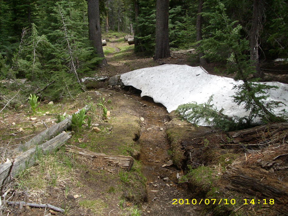
Finally, right about noon, we reached the summit of Dick’s Pass, and what a joke!  As it turned out, the snow on the pass wasn’t bad at all, and all sorts of folks were up there, including a whole troop of Girl Scouts making a snowman and throwing snowballs! The trees on top are so dwarfed that it’s like being in a Christmas tree plantation, so with the snow it was Christmas-y. After a nice break, we headed down the other side, which was totally covered with snow, but so many people had tramped on it that the trail was very easy to follow. Downhill we went, past Dick’s Lake and Middle Velma Lake, then it was back to trail-wandering-through-forest, with lots of mosquitoes.  Actually, the trail wandered so much that at one point, I began to worry whether we were still on the PCT, but a hiker we met confirmed that we were still on course.  Whew! 

july17_17lake

The farther we went, the worse the mossies got.  Both Bill and I were hiking in headnets.  Along came a small group of backpackers, looking rather unhappy and swatting at the mosquitoes.  The lead guy stopped right in front of me.  “Hi!” he said.  “I sure could use a headnet like that right now.  I’ll give you a thousand bucks for yours…no, make that TWO thousand.  Seriously!”   I just laughed and said, “No way, Jose!”   There is NO way I would ever consider hiking in these conditions without my headnet!  The trail continued on through viewless forest for much of the afternoon.  Sometimes it was dry forest (nice!) and sometimes it was a swamp (muddy trail, clouds of mosquitoes!)  At one point, we heard a tree come crashing down in the forest off to our left.  We’ve been around falling trees before, and the moment we hear that first crackle of breaking branches, we instantly freeze and get ready to leap out of the way.  This time, hooray, it was a decent distance away from us.

At our afternoon Snickers break, Bill constructed a wooden “prosthetic” for his trek pole, since the tip had broken off. He now has BOTH trek poles operating with “wooden legs”, which we find rather funny. We made camp tonight near a dirt road above Richardson Lake with hordes of mosquitoes. We were very tired, and groaned at the thought of having to rig the tarp-net tent combo.( The net tent was constructed to HANG under the tarp, not stand up by itself.)   But then Bill said, “Wait, I think I can rig just the net tent.”  And he did it!  It’s a simple rig, very nifty, using two crossed trek poles.

While we were doing this, along came the three Israelis, Noga, Shani and Evan, all in headnets and moving fast!  They camped not far from us.   So we crawled into our sleeping bags and crashed, serenaded by the indignant whining of hordes of mossies.   Only 38 more miles and we’ll be at Donner Lake and Pooh Corner!  I was very happy to see we’d made good mileage today, and I am so glad Bill figured out a way to easily rig the net tent!

Walk to Rauros:  Reach the edge of the eastern part of South Undeep

july17_1mountainjuly17_3creaturejuly17_4lakejuly17_5vistahillsjuly17_6mountainsjuly17_7snowfieldjuly17_8vistajuly18_9meadowtrailjuly17_10montysignjuly17_11viewrockyjuly17_12trailrockyjuly17_13distantvistajuly17_15lakefarbelowjuly17_16snowylakejuly17_12snowtreesjuly17_2darkjuly17_3taxitreejuly17_4distantlakejuly17_5distantlakejuly17_6lakesnowyjuly17_7laketreeviewjuly17_8lakeviewjuly17_9lakejuly17_11lakeviewjuly17_12creekjuly17_14viewcreekjuly17_15hikerjuly17_17hikersdogjuly17_18trailjuly17_19hikertrailjuly17_20snowfieldjuly17_21snowtrailjuly17_22forestjuly17_23bill

Friday, July 16, 2010 Echo Lake Resort Miles Today: 21.9 Total: 1,096

Friday, July 16th, 2010

july16_3snowfield

The birds started singing really early this morning–it was nice to hear them!  The PCT in the Sierras is up so high most of the time that there really aren’t many birds.  It was great to hear that early morning “choir sing”.  Unfortunately, last night, all night, we were subjected to the “other” choir–mosquito whines.  There were plenty of them, and we’d been too tired to set up the net tent, so I got pretty well chewed up, and didn’t get much sleep.  Oh well–“On to Carson Pass!” we said as we hit the trail this morning, thinking it would be an easy cruise to breakfast at the visitor center.

Nope! The trail had other ideas. It had a lot of uphill (puff! pant!) and a number of icy snowfields to cross. Bill chopped steps for me with the ice axe.  I’d been thinking about getting shed of the ice axe at Echo Lake, but seeing so much snow, I started to be concerned about Dick’s Pass up above Tahoe.  “I think I’ll keep the ice axe awhile longer,”  I decided.  Some of the snowfields we encountered this morning were small enough that we could go around them, slipping and sliding on steep scree.  I’d rather slip ‘n slide on scree than on hard, icy snow!  But there was compensation–wildflowers of every color, glowing in the early morning light.  Beautiful!  I tried to take photos of them, but no camera can do justice to such amazing light.

The closer you get to Carson Pass, the better the trail, and the views are wonderful. When we reached the visitor center it was 7:30  am, but the volunteers were already there.  Last time we arrived here, the volunteers practically fell over themselves offering us fresh fruit, etc.  This pair, an older husband & wife, told us that yes, they did have fruit, etc., but we would have to wait till they finished setting up everything at the center.  No problem–we settled down at the picnic table to eat our usual breakfast of granola & freezedried fruit.

Then another set of volunteers arrived.  They took one look at us and said, “PCT thruhikers!!  Howsit going?  Want some fruit?” and before we knew it, the picnic table was laden with peaches, bananas, cherries and sodas.  Yum, yum!  And just then, a bunch of other thruhikers popped out of the woods, so we were all sitting there feasting, and VERY grateful to the Carson Pass volunteers!  Everybody was on a tear to get to Echo Lake.  Trouble & Dude are determined to make it by 2 pm, and all the rest of us are saying, “Oh, whatever!  All we care is that we’ll get there sometime today.”

july16_6mountains

One of the volunteers had mentioned that “When you get to the top of the climb out of here, you’ll get your  first view of Lake Tahoe”.  And yes indeed, there it was–blue, blue Tahoe!  Beautiful! Wildflowers were everywhere, and lots of dayhikers with their very happy dogs.  The trail took us down into what I call “Ponderosa Meadows”, complete with rustic ranch buildings and lots of creek crossings.  One of them was the Truckee River, but I’m not sure which one–there were so many!  There was still snow on all the mountains around us, and when the trail climbed back up again, sure enough, we were dealing with snow once more–nothing very bad, but it did slow me down.  It was a very warm day, and I was glad whenever we got to some shade.  There were big piled-up thunderclouds to the east, and after awhile, we began to hear the sound of thunder, but didn’t see any lightning. 

july16_12rocks

My sore right ankle was feeling much better, which was very encouraging!.  Eventually we began “the big downhill” to Echo Sno-Park. I remembered this from 2005 as horribly rough and rocky– and it still is. For me, that means very slow going. Sigh. But we made it, and did enjoy the views of Lake Tahoe on the way down. Even though the trail is very rocky, it  is very pretty and green.  Finally we were back “on the flat”, walking along near the snow park, and I was just commenting to Bill, “Well, we’re almost to Highway 50, but it’s still a ways to Echo Lake,” when oh no!  I twisted my sore ankle AGAIN on a little rock in the otherwise smooth trail.  It really hurt!  From that point on, I was limping badly and yelping  when the ankle bent even a little bit.  I was really bummed about it.  At the parking lot near the highway, we saw Granite and Terrapin trying to “yogi” a ride from dayhikers.  We told them it was often easier to get a ride down to South Lake Tahoe from Echo Lake Resort, and they said  they might do that if they had no luck at the snow park.  On we went, me limping badly, as the PCT spent quite some time parallelling Highway 50.  Once we’d crossed the highway, it was another 1.5 miles to Echo Lake, and it was obvious that Bill was itching to get there.  So I told him, “Go for it–I’ll get there when I can,” and he soon disappeared into the woods. 

By now it was a very hot afternoon, and I was sweaty, hurting and pretty miserable.  What if the ankle turned out to be serious enough to force me to stop hiking?  Since I was all by myself, I did sniffle a bit and did ask God to please help me be brave and please help the ankle to recover.  By the time I got to Echo Lake, I was more or less a wreck.  I saw Bill–he’d picked up our resupply box–but all I could think was “Cold drinks!”  I mumbled something at Bill about “See you in a minute” and headed straight into the store to buy a pink grapefruit juice and an orange juice.  Then I sort of staggered back outside and collapsed on the picnic bench where a number of hikers were gathered.  I did nothing for awhile but steadily sip the cold juice.  Oh man, did it taste good!!

Finally I felt recovered enough to chat with the other hikers.  Most of them were busy “spiffing” to make themselves presentable enough to hitch rides into town.  All the other hikers are much younger than we are–they were full of vim and vigor, and talking excitedly about the buffets and casinos of South Lake Tahoe.  Bill and I went down there in 2005, and though it was nice to rest in a motel and eat at the buffets, we had agreed it wasn’t worth the bother of getting there and back.  The two Israeli girls, Noga and Shani, hung around for a long time, talking to people.  When they decided to get an ice cream shake, they had a hard time deciding what flavor to choose out of the HUGE menu of possibilities.  They finally went for fresh raspberry, and said it was really good! 

Bill and I got two huge, fantastic sandwiches, and went to sit and eat in the shade at the side of the store.  Leaning on the wall, we ate and discussed what to do next.  The post office was closed, and would not reopen till 11 am tomorrow. We had bear cans to mail home, but Bill did not want to wait around that long. With my very sore ankle, I DID want to wait.  In the end, though, I told Bill I’d talk to the store people and see if there was a way to mail the bear cans today.  It took some doing, but finally I was able to talk to the store manager, who also runs the post office, and she agreed to take the bear cans!  So we loaded the cans with our Microspikes and Yak Trax, and waved them GOODBYE!  Two old ladies were sitting and eating ice cream by the post office window, and I had to explain to them why we were so happy to get rid of those strange black cans!

I made one last try at persuading Bill to camp at Echo Lake (I was thinking about how nice it would be to just camp now and get a good rest before starting early in the morning, but he was very determined to hike on.  So I sat in the shade (it was still hot) sorting food into the food bags.  Then I got one more cold juice drink before we hit the trail again at 6 pm.  I was worried about where on earth we could camp.  There are cabins all along the lake for quite a distance.  But when we started hiking, I was very pleased to discover that my sore ankle felt MUCH better.  I guess the 3+ hours of rest had really helped!  

The walk around Echo Lake is so pretty, and it was especially beautiful in the evening light.  We made it almost all the way past the lake before the sun went down, and at that point, we snuck off the trail into a flat place surrounded by bushes, to set up a stealth camp.  We could hear the boats on the lake and the dogs in the cabins barking, but nobody knew where we were, except the mosquitoes!   We set up the net tent so we could sleep in peace.  I was desperately tired, and the thought of another night with mosquitoes chewing on me was just too much.  Hooray for the net tent!  And there was a beautiful sunset.  I lay in my sleeping bag and listened to the voices of evening hikers going by on the trail, and thought about how great it was that tomorrow, I’ll be able to carry a much lighter pack. 

Walk to Rauros:  High wolds of the Brown Lands, Gollum grows more daring

july16_1sunrisejuly16_2snowjuly16_4snowgreenjuly16_5glowviewjuly16_7treesviewjuly16_8distantmntsjuly16_10hillsvalleyjuly16_9vistajuly16_11snowymountainsjuly16_13rocksjuly16_14switchbacksforestjuly16_15lakejuly16_1flowerstrailjuly16_2flowerstrailjuly16_3flowersjuly16_4snowtrailjuly16_5montyjuly16_6meadowviewjuly16_7meadowjuly16_8snowtrailjuly16_9trailjuly16_10buildingjuly16_11billmontysign

Saturday, July 10, 2010 Return Creek Miles Today: 24.2 Total: 965.8

Saturday, July 10th, 2010

july10_6bridge

I never thought I’d be able to get up at 5am and start hiking, because I was so exhausted from yesterday, but the realization that “I can get rid of the bear can at Echo Lake!” was a HUGE motivator!  The sky was full of little puffy clouds, moving fast.  “I wonder what kind of weather we’re in for today?”  I wondered.  It wasn’t a cold morning–only 50 degrees, which is “warm” for this altitude!

I love walking the PCT around Tuolemne Meadows, because my family used to camp, fish and walk here for a week every August. As we followed the trail through the meadows, across some more creeks, and over the vast sheets of glistening granite, I enjoyed the views of what I call “the Tuolemne Meadows icons” like Lembert Dome, Cathedral Peak, etc.  The farther we got from Tioga Pass, though, the worse the mosquitoes got, till we had to put on our headnets just to hike in peace.

july10_9mountains

We reached the bridge over the Tuolemne River, where the placid waters start their whitewater plunge steeply down into the Grand Canyon of the Tuolemne.  Several hikers were lounging at the bridge, and as we began the descent into the Canyon, we met quite a few more.  They were all so clean!  I’m afraid at this point on the PCT, our own clothes look pretty grungy, even though we wash them every time we’re at a resupply.  All the hikers were “heading home” from overnight camping at Glen Aulin.

The PCT turned off and began to climb up along Cold Canyon creek.  The trail was actually DRY!  Wowee!  No mud!  We were making good time, but I was dreading the crossing of Return Creek, a notoriously “dangerous” ford up ahead.  Along the way, we caught up with a sweet old guy out backpacking with a TON of photographic equipment.  He was very cheerful about the weight he was carrying.  I was impressed!  We stopped for lunch just before Return Creek.  A little bit more hiking, and we could hear the roar of Return Creek just ahead.  I was praying silently, “Please, Lord, help me get across OK”.  Well, not to worry!  One look at it, and I said, “Bear Creek was a lot worse! I  can cross this, no problem!”  So I crossed Return all by myself, and cheered when I made i to the other side!

 A long uphill climb through slowly increasing patchy snow and several more creek crossings brought us to pretty Miller Lake with a sandy beach. Nice! A bit more up, and we were at the spectacular dropoff of Matterhorn Canyon. To me the Canyon looks like scaled-down Yosemite Valley.  Beautiful!

july10_11traillake

A lot of switchbacks (and snow travel too) and we were at the canyon bottom. It’s a nice long walk along the valley floor, with plenty of time to savor the spectacular views, and plenty of tributary creek crossings. Oh, for just one day of dry shoes, socks and pants!

After eating supper with a lovely view of Matterhorn Creek and the canyon, we tackled the long climb up to Benson Pass.  The PCT follows a very pretty, cascading creek lined with green grass and wildflowers.   The trail tread crisscrosses the creek several times, and we ended up camping just before the last ford of the creek, where the PCT turns for its final climb up to Benson Pass.  There were plenty of mosquitoes around, but we were too tired to do anything but toss down a groundsheet, our sleeping pads and sleeping bags and then collapse.   I wore my hat and mosquito headnet to bed, hoping that would more or less protect me from those “mossies!”   But what a relief to know that Return Creek is behind us!  I know there are more big creek crossings ahead, but Return is the one I dreaded the most.

Walk to Rauros: Bare winter trees on both sides of river

july10_1lakejuly10_2mountainjuly10_3mountainjuly10_4lakejuly10_5crossingjuly10_7trailviewjuly10_8waterfalljuly10_10trailforestjuly10_12viewlakejuly10_13viewtrailjuly10_14viewmountainjuly10_1sunrisejuly10_2sunrisejuly10_4montymeadowjuly10_5lakejuly10_6baretrailjuly10_7roaringwaterjuly10_8trailmeadowjuly10_9creekmonty