Archive for April, 2010

Friday, April 30 – Miles Today 14 – Total Miles 124.3

Friday, April 30th, 2010

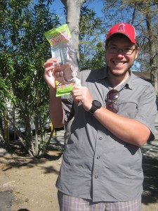
april30_c2_hikerholdingpackage

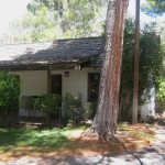
Since we don’t have to check out until noon, we have been very leisurely this morning. We made and drank up all the coffee that came with the room, (plus turning some of it into “redneck mochas” by adding hot chocolate powder.) We also ate some instant oatmeal that we got from the hiker box.  By the way, the rooms here at Warner Springs were built of adobe in the 1800’s!  They are very comfortable, and furnished “ranch style.”   The famous Kit Carson once stayed here! 

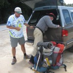
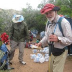
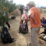
Then we moseyed over to the store, and there were three hikers going through their resupply boxes. One young guy was astounded to find that his mom (who had mailed the box) had added a solid chocolate 1 pound bunny. “This is more than I can possibly eat” he groaned, “here, everybody— have a piece.” So we all broke off pieces of bunny, and stood around eating and talking. “What’s your name?” was asked of each, and someone pointed at the guy with the bunny remnants and said, “Got it! You are Chocolate Bunny!” So we all chimed in, “Chocolate Bunny! Chocolate Bunny!” The poor guy got so embarrassed and pleaded, “No, no! Please don’t name me that!” But it was too late.

Note from Alexa: I have a feeling his mum will become famous for that stunt. This is an excellent example of how people end up with their trail names.

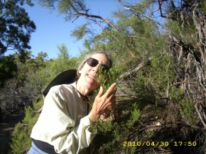
april30_montytree

Our plan for the rest of today was to go on a walkabout to explore all the facilities of this resort (which are considerable) eat some odds and ends for lunch, hang out at the pool with the hikers, have dinner and then head out, back to the PCT. Our packs weigh a ton— 7 days of food (includes a “cushion” for the difficult Desert Divide snow) plus water for 27 miles of hiking. But the weather is beautiful again— clear, cool and best of all, CALM!   The wind has stopped!

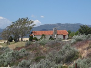
april30_c2_buildingvista

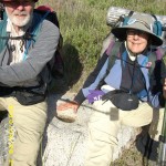
However, after another soak in the hot pool, Bill decided not to leave Warner Springs after dinner as planned, but after lunch. So I ran around taking pictures before we had to go. Many buildings here are from the 1830s, and are really truly adobe and still in use, including the church.   When we went to the mini-mart to grab an ice cream on our way back to the trail, there was Warner Springs Monty, and he offered us a ride  to the PCT in his truck!  Monty plans to start his own 2010 thruhike in a couple of weeks.  Right now he is still troubled by plantar fasciitis in one foot.

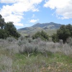
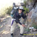
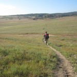
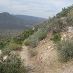
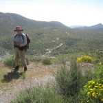
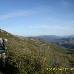
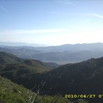
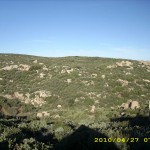
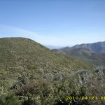
So on a lovely afternoon, we were back on the PCT, enjoying  Southern California at its best— beautiful, dramatic mountains studded with huge boulders, and creeks that go singing and cascading down narrow rocky canyons lined with huge trees, long grass and wildflowers peeking out from under every bush.  The trail itself is very well-maintained,  sandy but firm, and fun to walk on.  The guidebook warned of ticks–hopefully we won’t pick up any!!   And for the benefit of non-Californian hikers, a bright pink sign by the trail pointed out which plants were poison oak.  Several hikers commented that they were very pleased with that information! 

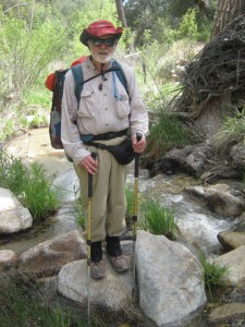
april30_c2_creek

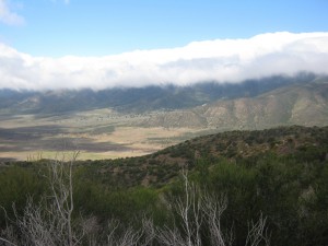
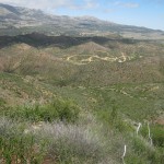
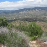
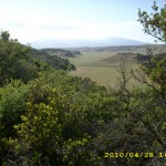
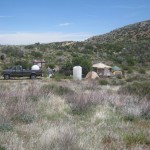
We zigzagged up Agua Caliente Creek, crossing it several times. Then we switchbacked up to rocky, bouldery slopes with stunning views of the Warner Valley and Lake Henshaw.  By 5:00 we’d reached the trail to Lost Valley Springs.   It was a big flat place and a large thruhiker encampment was  busily being set up. We were amazed that people would stop so early, but there they were, setting up tents, cooking dinner, etc.  With all the tents and side trails, we wondered where the PCT went.  One of the hikers grinned wickedly and said, “You should know by now how to tell which one is the PCT— it’s the trail that goes up!” Sure enough, it was!

 We put in several more ‘up’ miles through an area that in 2005 had just been devastated by fire. Much is regrowing— what a difference!  Around 6 pm, we stopped for supper  (cold burritos) at a comfortable, cozy bend in the trail.   It was one of those “perfect trail moments”–good food, not windy, not too hot or cold.  On we went for several more miles after that,  continuing to ooh and aah over the awesome views.  But 7:00 came, and we had a hard time finding a flat, clear, non-charcoaly campsite.  Finally I spotted one down below the trail, with bushes to block the wind.  It was 40 degrees and getting colder, but we happily set up a cowboy camp under clear skies!

This afternoon’s hike was SO “classic Southern California” at its very best.  Days like this on the PCT are pure joy, and no challenge!  We went to sleep very contented.

Walk to Rivendell: Boundary of Cardolan

april30_c2_buildingapril30_c2_carloadingapril30_c2_horses

april30_c2_poolapril30_c2_vistaapril30_montysign

april30_vistaapril30_vista2april30_vista3

Thursday, April 29 – Warner Springs–Miles Today 1.6 – Total Miles 109.6

Thursday, April 29th, 2010

Our “oak duff mattress” under the big oak tree gave us a wonderful night’s sleep. The cows thought so, too— they spent the night bedded down around us, but left at dawn. We slept in untill 6:00am before leisurely making our way along Agua Caliente creek, and then on to Warner Springs. First thing was to get a room, clean up a bit, then to breakfast at the golf course restaurant. There were only four golfers— all the rest were hungry hikers! Main topic of conversation was, “Yikes! The snow!” Everyone is debating what to do about the Desert Divide, three days hike from here.  Bill and I have already decided we are going straight through, no matter what.
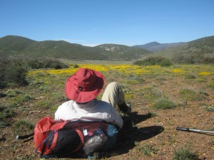
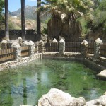
Next agenda item for me was laundry, and I made it just in time to start my load before someone else. It was so cold (60 degrees) that I brought my sleeping bag to sit in on the laundry room floor. While our clothes dried, I had a great time talking to a hiker from New York state who was once a submariner on the Nautilus! Awesome! Then I headed for the hot pool for a good soak. Bill and I feel like we’ve been “jell-oed.” We had time to read, get our box from the post office, plus some goodies from the hiker box, and then spent awhile trying to figure out why/how so many bees were getting into our room. Before we figured it out, one of the rascals stung me! Oh well!

A continual parade of hikers can be seen here— the ones just coming off the trail look tired and grubby— the rest of us clean and relaxed. At the pool, we enjoyed both the hot soak and the conversation— lots of different topics. Hikers have wide-ranging opinions! Before we went for dinner, Bill discovered that the terrific winds yesterday (we learned at Warner Springs that some of those gusts hit 50mph!) had literally blown his mosquito headnet right out of its storage pocket on the side of his pack. So we will order more fabric and have it sent to Agua Dulce at the Saufley’s, where I can sew him another one.

On the bright side, the weather is improving, the flowers here are beautiful (iris, lilacs, roses…) and at dinner we had a chance to talk with a very interesting chap who was at ADZPCTKO and had a book on hiking the Israel National Trail. He let me borrow it for awhile to look at, and it was fascinating. The author warned in the beginning that his friends often tease him about lapsing into Welsh, because after all, the book is in English (the only English guidebook to the trail) and sure enough, Welsh phrases popped up all over the place (always translated, though).

Note from Alexa: Mae hynny’n ardderchog!

The chap we were talking to has hiked all but the south portion of the trail, and after looking at the book, I can see why— it’s rugged desert country when sometimes the “trail” is a ladder down a canyon wall. But talk about geological beauty— wow! So that was a fun read, and Bill also called ahead to Big Bear City’s “PCT hiker rest stop” to tell him we hoped to be there by May 7. Oh, and the guy with the Israel National Trail book also told us he and friends had been up in the Desert Divide / Fuller Ridge just a short time ago, and he thought we would make it through just fine!

Walk to Rivendell: Still The Barrow-Downs (presumably captured by the Wight!)

Wednesday, April 28 – Miles Today 28.1 – Total Miles 108

Wednesday, April 28th, 2010

april28_c2_vista

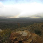
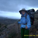
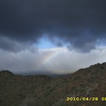
At 3:00 am, Bill and I had to get up and rig the tarp. It had clouded over and a light mist was coming down. At 5:00am we really did get up, break camp, put on our packs… and when we came out of our cozy gully, we were shocked to see RAIN coming down, just across from us on the other side of the valley!  Out came the rain-gear. The wind was fierce, and got worse as the day went on— but it never really rained on us— we were on the “dry side” of the valley, with the cacti and ocotillas, all of which had at least some flowers! Very pretty, but walking a narrow trail with the wind slamming you around and cacti waiting to “bite” your ankles got tricky sometimes!  Now I understand why the San Felipes are such a great cactus garden–they are in a rain shadow zone!  The views were spectacular, especially when some sun broke through and there was a huge rainbow.  Part of the time, we were walking and talking with Colter, who is from Fairbanks, Alaska.

april28_c2_hikersresting3

  Eventually it was warm enough to shed some layers  The PCT is a steady but gentle uphill, with some scary dropoffs right by the edge.  By 11:00am, we’d reached the famous “3rd gate water cache” where a group of thruhikers were hunkered down out of the wind. And what a wind! There were several times when I literally could not make progress against it!  We topped up our water, and hiked on.  The trail continued uphill, switchbacking in and out of every gully.  We kept leapfrogging with the “cache gang”.

The wind grew steadily worse, till several times I literally couldn’t make any headway against it–I felt as if I’d walked into an invisible wall.  Sometimes it blew me right off the trail.  But finally, after a particularly tough struggle with the wind, we rounded a corner where  we could see the Montezuma Valley!  We cheered and continued battling the wind till we finally reached the beautiful big oak trees of Barrel Springs. We headed straight for the springs, ready to fill up on water.  But oh, major bummer!  A sign by the spring warned that the water was no longer safe to drink, thanks to a NEW cistern that had been installed for the purpose of “making the water better.”  The new cistern had not taken MICE into consideration.  Apparently the little guys try to drink from the new setup, then fall in and drown, so the water is no longer safe at all. 

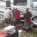
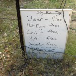
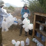
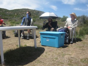
But as it turned out, we were still OK, waterwise, because near the spring was ANOTHER  hiker oasis!  Two retired couples with big ‘ol RV’s had parked in such a way as to create a windfree zone, and they had lots of free food.  We enjoyed hot chocolate, hot dogs, chili, coleslaw, brownies and conversation.  (Beer was also available, but it was just too cold for a cold beer!)  Turned out that these friendly folk live not far away, and had noticed the crowds of hikers passing through in late April/early May.  “Let’s do something for them!” they decided–and we are the beneficiaries!   A steady stream of hikers were arriving, all very happy to get out of the wind and rest and eat! 

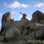
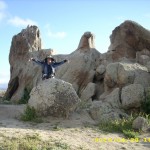
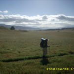
The PCT at this point undergoes a radical change.  No more hills, cacti and chaparral!  Instead it’s gorgeous miles of lovely green valleys, huge wildflowered meadows, and sweeping views.  But the wind was still simply awful.  I was so tired from fighting wind all day that at this point, I was just plodding along, and couldn’t really enjoy the fabulous scenery.  But the famous Eagle Rock was as wonderful as ever!  Bill climbed on TOP of the Eagle this time, so I could take his picture up there! 

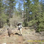
The sun got lower and lower as we walked on and on, still against the wind, looking for some sheltered place to camp.  At last the trail dropped down into a little valley with big oak trees.  Hooray–no wind, AND lots of SOFT oak duff to lie on!  Just as it was getting dark, we quickly laid out a “cowboy camp”  under a venerable oak tree.  I was busy writing notes by headlamp, enjoying the oak duff “mattress”, when a whole  herd of cows came over to watch us for awhile before they made camp, too, all around us!  I have to admit that it was a little spooky when they first arrived.  It was so dark that I could only see the yellow-orange glow of their eyes in the faint light from my headlamp.  But I knew they were cows, not coyotes! 

The cows soon lay down for the night, and as I went to sleep, I could hear their little cow noises, plus the sound of frogs singing in the nearby creek.  The wind which had been roaring in the treetops died down, too, so all was very peaceful.  Life is good!

Walk to Rivendell: The Barrow-Downs

april28_c2_billvistaapril28_c2_flowervistaapril28_c2_glowingvista

april28_c2_glowingvista2april28_c2_hikersrvapril28_c2_largeflatvista

april28_c2_signapril28_c2_vista3april28_c2_vista4

april28_c2_vista5april28_c2_watercache2april28_eaglerock

april28_eaglerockmontyapril28_montybillapril28_montyvista

april28_plantsapril28_stormycloudsapril28_trailclouds

april28_vistasapril28_vistas2april28_vistas4


Tuesday, April 27 – Miles Today 27.2 – Total Miles 79.9

Tuesday, April 27th, 2010

april27_c2_restingvista

During the night last night, the wind began to gust and blow so hard that Bill got up and took down our tarp so it wouldn’t be damaged.  At 4:45am, a very fast-moving, hiking-by-headlamp guy passed us in the dark, and seeing us in our “cowboy camp” near the trail, sang out,  “You guys call yourselves hikers? How come you’re not up yet?” We cracked up laughing and decided he was right, so we hit the trail before sunrise. (Actually, if we had been worried about a hot day ahead, we would also have started hiking around 4 am!) 

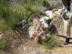
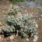
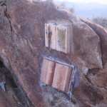
It was a cool and very windy morning, and we were walking on the remains of the old Sunrise Highway.  One section was literally blasted through the rocks, and looks like a gateway.  Turned out that many people have put up memorials there–sort of “gravestones” glued to the rocks.  Since most of the PCT this morning consisted of a narrow strip of  trail along a steep mountainside with a BIG cliff right by the edge,  my “I will not be scared of big dropoffs by the trail” determination got a good workout today— but oh man, the views were awesome! It was a very pleasant day to hike— the only downside was an unbelievably rocky trail almost all day. The wildflowers were very nice— we stopped for our midmorning Snickers break in a lovely valley completely carpeted with yellow flowers.   Along with the flowers, though, we began to encounter more and more cactus plants, including what we call “anklebiters”–little low cacti right by the trail.  We had to watch our step!

april27_c2_coolerresting

By 10 am we were at the top of Chariot Canyon, where we got lost in 2005.  Not this time!  We were REALLY careful to stay ON the PCT, which proceeded to go very steeply down into the canyon, all the way to the bottom,  then did a killer uphill back up the other side.  Bill and I both agreed that our “lost” route was better than this!  The other annoying thing about the PCT as opposed to the “lost” route was that the PCT is unbelievably rocky and rough.  Bill can zip right along a rough trail, but I get really slowed down. Also, in 2005, the wildflowers were unbelievably spectacular, and this time they were nice but not  that remarkable. 

We’d heard a rumor that there was a trail angel at Rodriguez Truck Trail, and sure enough,  and the trail rumor turned out to be right— there was an awesome hiker oasis setup. It was around noon when we arrived, all hot and sweaty, so we headed straight for the free showers and showered with all our clothes on–that way both we AND our clothes got rinsed!   The breeze dried us in no time while we ate our lunch supplemented with cold juice and snacks.   

The  oasis is run by a husband and wife who run a store in Julian.  They had all kinds of snacks, drinks, and hiker gear for sale.  “Oasis Guy” is an avid horseman who told us about riding the length of California on the old “CA Riding and Hiking Trail.”    He told us that the “pre-PCT way” to go from Mexico to Canada was the CA Riding and Hiking trail, then the Oregon Skyline Trail and the Washington Trail.  But once the PCT was put in, the older routes became obsolete and mostly are no longer maintained.  “Not good!” was his comment.  “The old routes were better.”    But all that aside, he was having a blast hanging out with us hikers!  And apparently his hiker oasis has probably saved at least one life already!   A few days ago, when we were camping under a truck trailer at Campo,  “Oasis Guy” says that very late in the day, in bitter cold and rain, when it was almost sunset, he had just lit a lantern at the oasis, when he saw a hiker on the PCT, wearing only a thin shirt and shorts, and obviously in bad shape, walking unsteadily and acting very confused.  Hypothermia!   So Oasis Guy ran out into the rain,  grabbed the hiker, towed him into the tent and started giving him hot drinks and doing everything he could to save the guy’s life.  It worked!  Whew!

Some of these stories were being captured on film, because among “us hikers”  eating lunch together was a husband/wife team of videographers, who were happily shooting footage of us all hanging out.  Bill and I reluctantly  left, after filling up our Platypuses for the hot, dry run to Scissors Crossing, which is about 10 miles away, over very rough and rocky trail.  Bill was worried about having a run-in with an anklebiter cactus (which did happen to him in 2005–ow!!!) so he went ahead of me in order to see the trail better.  Also, the wind was really blowing, which made it hard to walk straight.  I will say this, though–this section of the trail is a sort of “cactus rock garden”, very pretty–as long as you don’t end up with cactus spines in your leg!

april27_montyplant5

We mushed on to Scissors Crossing, where there was quite a crowd!  One of the hikers had a friend who’d made a “pizza run” to Julian, so we got to eat some of a great pizza in addition to our “trail dinner.”   The  big topic for all the hikers was “How much water should I carry for the hike into the San Felipes?   We were all hunkered down out of the absolutely HOWLING wind while we ate and chatted.  After loading up on water, all the others stopped to camp by San Felipe Creek.  But  we went on for another hour, bathed in beautiful “sunset light”, looking at the awesome views across the valley, switchbacking up to a cozy, sandyside gully we spotted in 2005.  We figured it wouldn’t rain tonight, so we made a great camp there, out of the wind.  My feet are very tired, but hooray!  We made over 27 miles!

Walk to Rivendell: Bonfire Glade in Old Forest

april27_brightflowerapril27_brightflower2april27_c2_hikers

april27_c2_plantapril27_c2_resthikersapril27_c2_resting

april27_c2_rocksapril27_c2_rocksglowapril27_c2_tentsrest

april27_c2_trailsteepapril27_c2_trailbrushapril27_c2_trailsteep2

april27_c2_vistarestingapril27_c2_vistayellowflowersapril27_c2_watercache

april27_hilltrailapril27_montybill2april27_montyplant

april27_montyplant2april27_montyplant3april27_montyplant4

april27_montyplant8april27_montytrailapril27_ontrail

april27_vistasapril27_vistas2april27_vistas3

april27_vistas4april27_vistas5

Monday, April 26 – Mt. Laguna–Miles Today 17.4 + 2 – Total Miles – 52.7

Monday, April 26th, 2010

april26_c2_backpack

Last night was not too cold, so we had a number of “visits” from the mosquitoes!  Oh well–we were eager to hit the trail today, and got up before sunrise to begin the steady uphill climb while it was still cool.  It was still very early when we reached Long Canyon Creek, which turned out to be another big thruhiker encampment.  There were tents everywhere, and bleary-eyed folks just starting to get up.  We gave them a cheery wave as we walked on by.  When the sun finally managed to come up over the mountain, we stopped for breakfast by very pretty Long Creek. 

And that was when we discovered to our dismay that it was NOT a good idea when we vacuumsealed the freezedried fruit that we put on our granola.  What was supposed to be tasty strawberry bits had turned into a hard brick that did not want to break apart.  Sigh.  We ended up breaking the brick in half and dunking it into our cupfuls of granola and powdered milk till it softened up enough to eat it. (It still tasted good, though!)

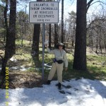
Then we began the serious climb up into the Laguna Mountains.  The trail was often rough and steep, but the views were spectacular, and we were cheering about being able to do the really tough climb early, while it was still cool, till Bill noticed a potential disaster— “Monty, your trek pole tip is gone!” Oh no! That was truly serious–it would be a long time till we would be at a place where we could get another tip.   So we turned around and walked back down, hunting for it.  Bill went a lot faster than I did, because I asked every hiker I met, “Have you seen a trek pole tip lying by the trail?”  Nobody had.  Finally, when I was almost all the way back to Long Creek, along came lovely Noga, a hiker from Israel.  When I asked her about finding a tip, she said, “Yes, I found one back there and picked it up.”  She took off her pack, rummaged a bit, and handed me back my lost tip.  Whew!

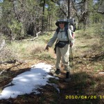
At this point, we had lost a LOT of time, and instead of heading back up in the cool of the morning, it was now very warm.  We chugged along as fast as we could, till we could see PINE trees on the ridges up ahead.  Pretty soon we were out of the chaparral, and into  the high part of the Laguna Mountains, dodging snow patches, and walking through green grass shaded by big pine trees.  We passed a lot of hikers as we went along.  One guy was actually composing a poem out loud as he walked.  

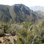
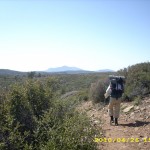
Finally we got to the Burnt Rancheria Campground “hiker faucet”.  It was turned on–hooray!  But the campground itself was closed, all the other faucets were turned off, and the bathrooms were locked.  So any hopes of camping there today were erased, and we decided to push on after stopping at the store.  The PCT travels along near the edge of a big dropoff into the desert below, and the views were awesome!  We strolled along, looking down and speculating about what it would be like to be a Spanish explorer on foot going through there with Anza’s expedition, till we reached the turnoff for the Mt. Laguna store.

april26_c2_hikersresting

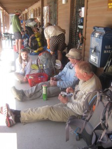
The entire long porch at the store was lined with jolly thruhikers! We got a great lunch, and enjoyed talking to everybody.  A guy sitting by us was eating a pint of ice cream. “It’s a pint at every resupply now,” he joked. “Then farther along, it’ll be a half gallon, and by Stehekin, it’ll be a gallon!”   A “local guy”  who lives at Mt. Laguna came by and said, “You hikers are nuts!  I see you out on the PCT in wind and rain and awful weather.  Now you have a beautiful sunny day, and what do you do? Sit on the porch of the store!!  You guys are crazy!”  Well, actually the reality was “Everybody’s waiting for the post office to open so they can get their resupply box!”

Well, we had no resupply box, so after finishing lunch, we  moseyed over to the Desert View picnic area.  I wanted to rinse out my dusty, sweaty socks and shirt, and I desperately needed a nap.  I have not really slept at night since we left Campo, so I’ve been hiking on “happy power” and now I’m really, truly TIRED.  So I hung my rinsed clothes on a bush, and lay down for a two hour rest. By 2:00pm Bill was anxious to head out, so off we went, following the PCT as it wandered in every direction but north!  But that’s OK–the wanderings took us past one spectacular “big dropoff to the desert” view after another.   We did a lot of oohing and aaahing.

Along the way, we met Cloudbuster, who was very unhappy.  He had stopped at the Mt. Laguna store, leaned his pack and trek poles up against the wall outside, and when he came back, his trek poles were gone.  Somebody had taken them, either accidentally or on purpose.  He asked for our help, described the trek poles, and we promised to watch for them as we went along.  The sun began to drop lower and lower, till by 7:00 we’d reached another thruhiker encampment at the Pioneer Mail picnic area.

We headed for the water faucet to top off our water for the 24 tough, waterless miles tomorrow and behold, at the “Non-potable water–Horses Only”  sign, we found a CACHE of water left by a Christian.  Besides lots of water, there was a ziplok with mini-Bibles in it and a note that said, “Let not your hearts be troubled.”  I left a thankyou note, then we walked on a little way and camped in the chaparral just off the trail.  I prayed for Cloudbuster, that he’d be able to retrieve his trek poles, and thanked God for Noga, who DID retrieve my trek pole TIP!     (Note:  We found out later that Cloudbuster DID get his poles back–he spotted them with the person who’d taken them)

Walk to Rivendell: In woods near Stock-brook

april26_c2_billstandingapril26_c2_hikerapril26_c2_rockytrail

april26_c2_trailreddirtapril26_c2_vistaapril26_firstsnow

april26_montystandingapril26_montystanding2april26_snowsign

april26_walkingapril26_trail