Archive for the ‘Oregon – B’ Category

Sunday, August 15, 2010 Miles Today: 32.8 Total: 1,786.8

Sunday, August 15th, 2010

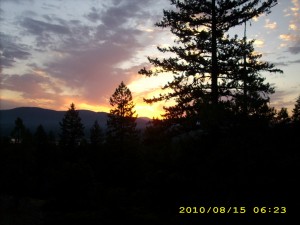
aug15_1sunrise

Well, we had quite a lightning show and thunder concert last night– plus rain! Wow! We haven’t had rain since Campo and the San Felipe hills. There was a gorgeous orange-gold sunrise to admire.  In the morning, all we did was walk through viewless forest, but on very nice trail, “patterned” by the raindrops.  Our footprints left very clear marks!  And of course all the plants along the trail were soaking wet.  Overhead, the sun and the clouds were battling as to which would win out in the sky.  Bits of rain continued to fall.  Oh well–now we KNOW we’re in Oregon! 

 Bill’s math says we have to do 30 miles a day to reach Cascade Locks on time, so we were really chugging along the trail.  After we crossed Dead Indian Road, it was very obvious that the trail had been worked on.  It contoured along very nicely, and was built like a raised bed.  Blue diamonds marked the route for Nordic skiing, and made it very easy for us, too.  There were even blue arrows on the trees to show when the trail took a sudden bend!

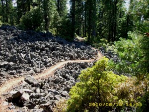
aug15_2trailrocks

Lunchtime was wonderful– we went to the Brown Shelter  (a very cute log cabin) where there is a real old-fashioned hand pump for delicious cold spring water.  We had a fun conversation with a SOBO hiker from Washington state.  He said he wasn’t doing the whole PCT, but wow, he was planning to do all of Oregon, and all of California as far as Walker Pass!   He makes all his own gear and dries all his own trail food.  

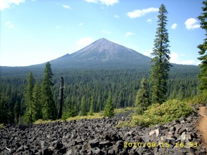
 From there, we soon were on the “lava walk” around Brown Mountain, through miles of lava interspersed with forest. The trail through the lava is very well-done and not hard to walk on.

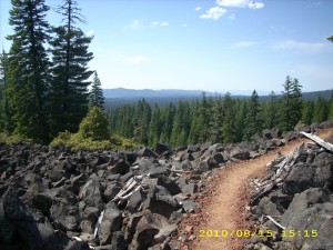
aug15_3trailforest

We started getting views of grey Mt. McLoughlin, and reached the Cascade Canal in time for supper.  The canal water didn’t look drinkable, so we didn’t take any for our platypuses, but it was great for washing our very grubby feet and socks.  Then we put in another six miles, and were well up the shoulder of Mt. McLoughlin before making camp, where the mosquitoes and crickets were both “singing.” I prefer the crickets!

Walk with Aragorn to Minas Tirith:  Reach Isengard, continue on highway

aug15_4hillstrees

Saturday, August 14 Hyatt Lake Resort 2010 Miles Today: 25 Total: 1,754

Saturday, August 14th, 2010

aug14_4trailtrees

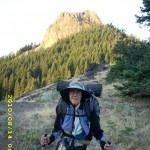
Last night an owl hooted for a very long time. Was he/she lonely? It was a warm morning with clear skies, and we didn’t need our jackets for very long as we followed the windy, twisty, weedy PCT on its way around Pilot Rock. Last night Bill did some math and he is thinking about trying to make it to PCT “trail days” in Cascade Locks at the end of August. That means we have to average at least 30 miles day!  I asked the Lord to put me on His “cruise control” to hike along quickly, but not so fast that my very bony body can’t handle it. I am feeling stronger every day– is it the Nutella?  Or the extra food I’m carrying?
aug14_5treessky

I was hoping to get a good pic of  Mt. Shasta, but it was too hazy.  Mt. McLoughlin to the north is completely gray–no snow on it that I can see.  The biggest concern today was finding water– the sources are getting farther and farther apart.  When we reached what the guidebook called “the fenced in spring”, there was water aplenty, and two section hikers who wanted to talk about BEARS!  I’m sure there are bears here in Oregon, but we are not worried about them.  We took on enough water to see us all the way to Hyatt Lake.

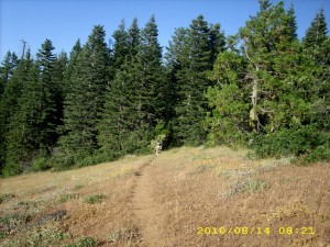
The guidebook writer doesn’t seem to like this section, and says that nobody would bother with it unless they were thruhiking.  What a bunch of rot!  The dayhikers sure don’t think so!  This is very pretty trail–it’s like walking through a park.  Sometimes you’re amid grass and trees, and sometimes you’re walking through a very green-carpeted Oregon forest.  There are great views of Ashland and very blue Emigrant Lake, far below. 

We reached Hwy. 66 well before lunch, which meant we were really moving fast this morning!  There was another place along the way where we could have gotten some water, but when we reached it, there was a note warning that there were dead rats in the water collecting tank.  Yikes!  We were glad we’d taken on full water loads earlier! 

Then it was on to Little Hyatt Reservoir, which was very full and overflowing vigorously.  Lots of very friendly people were hanging around.  But we didn’t linger–we figured on lunch at Hyatt Lake!  It wasn’t long before we were walking across the Lake dam and heading for the fisherman store on the other side.    The resort restaurant was open, but all they had was pizza, beer and ice cream.  I don’t know why, but I was just yearning for anything BUT those items.  We asked the store guy if there was any other restaurant, and he said, “Sure, it’s just a quarter mile down the road.  I’ll take you over there.”  We hopped in his little golf cart thing and he gave us a ride.

Well, that was a pretty long quarter mile!  Way longer, actually!  We were flying along the road (the guy drove like a Jehu!) with tiny little Zoe the dachshund in the front seat, and when we arrived at the other restaurant, the store guy showed us where we could even go take showers!  Back to the restaurant then, for great big sandwiches and glass after glass of lemonade.  Once we were wellstuffed, we walked back to the “Bucks & Does” shower building to wash both ourselves and our socks.  Then we sat around in the sun for awhile to give the socks a bit of drying time.  I managed to yogi a ride for us back to Hyatt Lake proper, we picked up our resupply box and I started loading our food bags.

That’s when I discovered that the little store now has only chips, drinks, ice and bait.  It used to have a lot more, which I’d counted on to finish off our food supplies.  I sent Bill on a run for the hiker box to see what he could find.  He came back with peanut butter.  Well…I guess we’ll be on slightly short rations till the next resupply.  We got ice cream cones at the restaurant and talked to some of the other thruhikers there, before strolling back to the PCT with a very nice young couple who were SOBO’s.

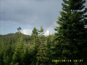
The PCT heads off through the forest, with  glimpses of the lake, but meanwhile, the weather had turned a bit ominous.  This morning’s pretty puffy white clouds had turned into thunderclouds, which started booming and muttering.  During the rest of the afternoon, we were occasionally misted with rain, but that was good, because it was cooler, and we saw a double rainbow.  Rainbows are awesome–every time I see one, I think about God’s promise to Noah, and just in general how God keeps His promises. 

When it was time to make camp, the trail was up fairly high, and the clouds were growing darker.  We figured that if there was a lightning storm, we definitely did NOT want to be up high.  The Boy Scout leader we’d talked to when we were heading up into the Desert Divide back in southern California said that the safest place in a thunderstorm is 1) Not up high   2) Not down at the bottom  3) Not near a tree that has been previously hit by lightning, but 4) On the side of a hill, in the forest.  So we headed down the hillside, into the woods, till we found a small flat place.  We rigged the net tent for the mosquitoes and the tarp for rain, then crawled into our sleeping bags.  The funny thing is, in 2005, it also rained on us by Hyatt Lake! 

Walk with Aragorn to Isengard:  On highway to Isengard
aug14_1montyhillaug14_3viewhills

Friday, August 13, 2010 Miles Today: 28.5 Total: 1,729

Friday, August 13th, 2010

aug13_1viewgreen

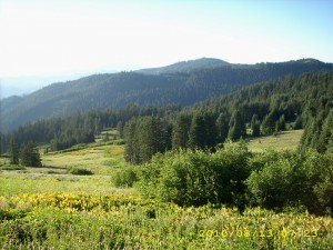
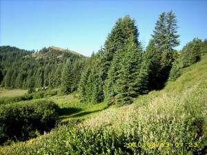
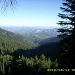
It was actually warm at 5:30am, and it did turn into a very warm day. Oregon scenery is beautiful– both close up (dramatic hills, rocks, trees, flowers) and far off (golden hills, Mt. Shasta and other volcanoes of various sizes.) The trail wanders around, but the wanderings are worth it. 

We had breakfast at Sheep Camp Spring, and were entertained by watching the MANY birds flying around and “doing their thing.”  I think they are attracted by the water and the many wildflowers.  I was amazed at the hummingbirds.  They were drinking from water flowing across the trail by simply hovering over it.  They also came around and hovered by us, as if to say “Hello!”    We also saw several deer in the early morning.  In 2005, we were walking through here in hunting season, and met a lot of frustrated hunters who said, “We haven’t even SEEN a deer.”  Well, there seem to be plenty of deer around this time! 

The PCT goes down to various gaps, then climbs up again, but the climbs aren’t too bad, because the hills here are so rounded.  At about 11am we found a wonderful surprise– a Pepsi cache tucked under a white fir tree, with a “Welcome to Oregon, PCT Hikers” sign.  It was a hot day already, so cold Pepsi was indeed a welcome!

aug13_2greentrees

As we drew near to Grouse Gap, we started meeting a lot of dayhikers who’d come out to enjoy the unbelievable wildflower display in the springs area near the Gap.    Wow!  There were wild delphiniums taller than me!  And there were quite a few improvements to the trail.  In 2005, we were picking our way through a fair amount of mud (among the beautiful flowers), but this time the tread was a sort of “raised bed” of gravel.  Very nice!  The flower display is so gorgeous that no mere photo can really do it justice. 

From the flowers at Grouse Gap, it’s 10 more miles to Callahan’s, and it’s 10 miles of fairly level trail winding along the mountainside, up above a road.  Unfortunately the policy in this area seems to be “Let the forest turn into a trash pile of fallen dead branches, so that if there’s a lightning strike, we’ll have a ferocious forest fire.”  The mess was so bad that I even took a picture of it.  It would be so easy to take good care of a forest so close to a road.  Sigh. 

At one of the side trails down to the road, we met the Israeli girl Shani.  She told us very sadly that she’d be finishing her hike at Callahan’s.  She’s in such pain with foot problems that she decided  to go home.  “Noga will keep going, though,” she told us.  We wished her well and said a final goodbye.  Bummer.  Finally around 4pm we could hear the sound of traffic on Interstate 5, and soon we spotted a carved wooden sign on a tree.  It said, “Callahan’s Lodge” and had an arrow pointing left.  An informal little trail down the hill from there was marked with orange flags.  We followed it to the railroad tracks (which included a tunnel!) and then down a road to the restaurant.

A number of other hikers were already there, and we all sat outside.  We smell!!!  I don’t think any of the nice clean folks inside would want us anywhere close to them! We feasted on a wonderful spaghetti dinner with the Callahan’s perq of “First beer free.”  Turns out that the Lodge has a “thruhiker special”.  For $40 each, you get showers, laundry, all-U-can-eat dinner and breakfast, and camping on the lawn.  It was a tempting thought, and most of the hikers were planning to go for it, but we decided to continue on.  The Callahan’s staff refilled our platypuses for us, and we waddled back to the trail.  I was totally stuffed! 

The PCT goes winding uphill, circumnavigating various rock formations, heading for the spectacular Pilot Rock, which is a landmark for miles around.  It was a very hot afternoon, and I was so full from dinner that I just could not hike fast.   When it was time to find a campsite, we had quite a problem.  There was a fair amount of private property right by the trail, very few flat places, and the ground was extremely rocky and weedy.  We finally located a grassy hollow not far from the PCT, where the ground was not quite as rocky, and there was a beautiful view of the northern mountains in sunset light. 

Walk with Aragorn to Isengard:  Battle of Helm’s Deep. Near Fords of Isen walking through trees of Huorns.

aug13_5greentreesaug13_6vistatrees