Posts Tagged ‘mosquitoes’

Friday, August 20, 2010 Miles Today: 24.6 Total: 1,936.8

Friday, August 20th, 2010

Aug20_3porch

Since we camped last night near the RR tracks, I got to see some trains go by before I went to sleep, and one of them was an Amtrak train— on time, if I remember my Amtrak schedules correctly!  Amazing! I had no idea that Amtrak ran so close to Shelter Cove!  Other trains came by later on, but they were all freight trains.  I enjoyed listening to them–camping near a railroad is great! 

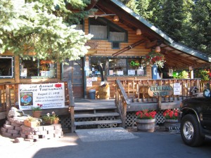
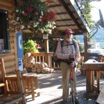
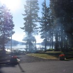
At 5:30, I started writing some journal stuff while still inside my sleeping bag, and at 6:30 we packed up and went to the store for breakfast–burritos, muffins, cheese, coffee and juice.  We ate on the porch of Shelter Cove store with a great view of the lake. Bill is definitely feeling better this morning!  He was able to eat (but nowhere near as much as I did).  I was still eating and organizing our data book papers, guidebook pages, etc. for the PCT coming up, and looking through the resupply box and hiker box to see what I might need to buy at the store, when Bill said he’d go hunt for where the laundry was so we could at least wash our socks. 

If I’d been paying better attention, I would have noticed that he was taking his pack with him, including his food bag.  So when I got to the point of inventory-ing the food bags, Bill’s was gone.  Oh no!  So I went off to hunt for him.  I wandered all over the place amid the cabins at Shelter Cove.  One of the employees there saw me and asked if he could help.  He offered me a ride in his golf cart, and we drove around looking for Bill.  No luck.  It was as if he had totally vanished.  I was very frustrated!  All I could do was go back to the store and make a guess as to what was still left in Bill’s food bag.  Based on that guess, I finished my food “shopping” and was loading up my pack when Bill finally came back.

It turned out that he’d been way off someplace washing HIS socks–he’d forgotten to bring mine!  He was annoyed to find that I was “still not finished” with the resupply, and I was very unhappy about not having clean socks!   Grrrr!  I had to take my socks and wash them in freezing cold water in the bathroom, while Bill waited some more.  It did remind me once again, that if you are thruhiking with someone else, and for some reason you have to split up for awhile, be SURE you are both really clear on who’s doing what and when/where to get back together!  I had been so preoccupied with sorting out the resupply stuff that I didn’t pay attention very well. 

It was still a very chilly morning when we started walking down the road by the lake, headed back to the PCT.  Good thing we are getting out of here today, though! Tomorrow is a big fishing derby, AND the start of the “Where’s Waldo?” footrace on the PCT from here over to Waldo Lake area.  Shelter Cove will be a total zoo, I am sure–glad we don’t have to deal with it!  We met Phooey again as we were doing the roadwalk–he was headed IN to the store, and was amazed to find that we’d beaten him to it.  When we told him we took the alternate, he said, “Oh!  So THAT’s how you made it here so fast!”

Aug20_7forestgreen

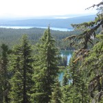
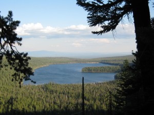
Once you get across the highway and back on the trail, the PCT out of Shelter Cove is very pretty— it goes by a gentle grade up tothe Rosary Lakes and on to some really fine views. The trail junction signs could use some help, though— they are very confusing!  There were also people out putting up signs for the race tomorrow.  We passed the pretty viewpoint where we ate breakfast in 2005–it has a great panorama of all the Rosary Lakes, plus Lake Odell and Crescent Lake.

Aug20_8foresttrail

Then the trail started going up and down, with some pretty big “ups”.  Bill was feeling better, but still not himself yet. He lagged behind all day, and I often stopped to let him catch up, even though I was not hiking as fast as usual.  In spite of the slower speed, though, my klutz factor still kicked in–I stubbed my toe on a root, tripped, and went flying down off the trail.  I landed on nice soft forest stuff, though, not rocks!  Thankyou, Lord!

The woods along the trail here are very pretty, but the mosquitoes swarm you the moment you stop, and at one point, we got to a junction and couldn’t figure it out.  We ended up on a quarter mile long trail that led to a lake!  Oh well, Bill needed more water, and he had to empty out his whole pack to get at his platypus, since he doesn’t stow it in the “hydration sleeve”.  While he was doing that, I walked back to the PCT and using sticks, I made a “PCT” sign and arrow pointing to the correct trail.

Awhile later, I was the one who ran out of water, so Bill waited while I ran down a 1/10 mile side trail to Charlston Lake to fill my platypus.  Turned out there were a lot of people at the lake–it is very pretty, and it’s near a road.  Based on the Where’s Waldo? race signs on trees, I gathered that Charlston Lake is on the race route for tomorrow.  A little while later, we stopped for supper, but Bill had lost his appetite again and ate hardly anything, so I ate it all! 

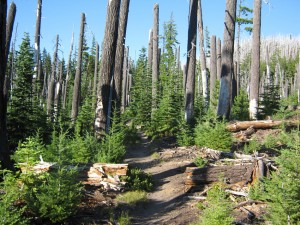
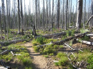
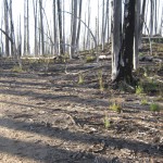
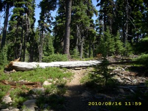
Then we hiked on for a couple more hours, through a forest fire zone that in 2005 was an awful mess to get through. It’s still a fire zone, but this time we didn’t have to climb over blackened trees and search for some sign of the trail.  The tread is now clear and well-maintained.  It was interesting as we walked along, to observe the differing degrees of recovery in the forest, AND the fact that the forest is just barren tree trunks made it so we could SEE two of the Three Sisters up ahead.  Awesome!  We met two guys hiking along with fishing poles, looking for the Lily Lake side trail.  We hadn’t seen it–all we could figure out was that maybe only the PCT tread had been cleared after the fire, and the side trails were still covered with fallen, burned mess.  We hadn’t seen a junction sign for it, either, but back in 2005, all the trail signs were gone–they’d been burned up in the fire–and the PCT route was literally marked with arrows scratched on rocks.  So all we could tell the fisherguys was, “Good luck!”  A short time later, we met their wives?girlfriends? walking along the trail, too.  We felt sorry for them–I don’t think they will be able to find the lake, which is out of sight to the east.

Eventually we made it back into green forest, and stopped to camp near Riffle Lake.  The mosquitoes swarmed us the minute we stopped, so we had to set up camp while wearing our “mossie gear.”  Since the lake was close by, we went over there to wash our very dirty feet and legs–but it was a fast wash!  The mosquitoes pounced the minute we took off shoes and socks!  While we were setting up our net tent, Phooey came by, and also two PCT SOBO’s.  Once the tent was up, we zipped into it and now we are very comfortable listening to the clouds of mossies whining outside.  We have a great view of the lake with the moon shining over it–very pretty!  Once again, I could only pray like crazy that Bill will feel better tomorrow.

Walk with Aragorn to Minas Tirith: In green meadows crossing many streams

Aug20_1interiorAug20_2billporchAug20_4treesclearingAug20_5treesAug20_6pctarrowAug20_9bareforest

Wednesday, August 18, 2010 Miles Today: 33.2 Total: 1,873.8

Wednesday, August 18th, 2010

Aug18_1lakesunrise

It was cold last night after the storm! But clear skies and a bright sunrise made it easy to pack up and walk back to the PCT from our forest camp.  The wind was still blowing a bit, and it was still cold–brrr!—but so great to see blue sky.  After getting one last photo of beautiful Crater Lake, we were back to heading north, down into an “Oregon desert” zone of pumice-y dirt and trees. No other plants grow there.  Many of the trees have strange lumps and swellings on their trunks.

Aug18_7viewmountlake

At the junction with the PCT equestrian trail, we met a sadly limping section hiker who is quitting because of blisters. He said his feet were raw. Bill advised that his shoes are probably too small.  A little while later, we caught up with “Phooey”, who wasn’t even up yet!   And we passed a southbound group of trail workers, all very earnest and wanting very much to be helpful.  They even offered us water!  Wow!  But it still seemed like forever till we reached the highway, since it was basically Oregon desert hiking.  There was more of the same after the highway, too, but that was a good thing–when we stopped for lunch, we could easily spread out all our damp gear for a “garage sale.” 

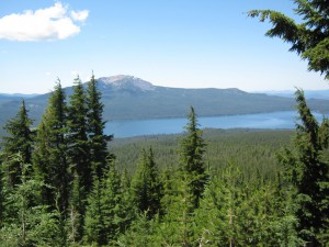
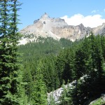
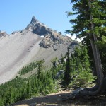
Shortly after that, the views began–stunning vistas of Diamond Lake and the many volcanic peaks in the area.  All the peaks still had snow on them.  We walked on, eager to reach Mt. Thielsen, a trail section we missed in 2005 because of snow.  (That year, we took a lower-elevation route near Diamond Lake.)   Mt. Thielsen did not disappoint us!  Wow!  The PCT climbs right up next to the peak–in fact the trail to the summit takes off right from the PCT, high on a shoulder of Mt. Thielsen.  We spent a lot of time admiring its multi-colored knarly, twisted strata and extremely pointed top.  It does indeed look like “The Lightning Rod of the Cascades.”  From the summit trail junction, we could see two of the Three Sisters, and they looked pretty snowy.  Hmmmm—we will be there soon.  Hope we don’t get lost in the snow there again, as we did in 2005!

Aug18_13distantwater

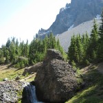
After that, it was down, and down some more to reach cascading Thielsen Creek, the first water in 26 dry miles!   Several other hikers were there, too, and we all were tanking up on the fantastic cold, clear snowmelt water fresh off Mt. Thielsen.  There were lots of nice campsites in the area, but it was far too early to stop for the day, so all of us basically collected water, rested a bit, and then hiked on. 

The PCT took us back into another forest walk on our very tired feet (getting used to new shoes that we got from our box at Mazama) before we once again found ourselves crossing dry meadows, following posts to mark the trail.  At one point (not marked, unfortunately), we went over the highest point of the Oregon/Washington PCT.  All around us were interesting, knarly, multicolored peaks, but none as amazing as Mt. Thielsen.  We stopped for supper near the Maidu/Miller Lake junction, and enjoyed eating with a great view of the lake and boats. 

Three more miles of hiking, and we decided to call it quits for the day.  Our feet were definitely letting us know that they were still getting used to new shoes!  Finding a flat campsite turned out to be impossible, so we had to settle for a sloped one on the mountainside, in the woods,  with our usual buddies, the mosquitoes.  I really enjoyed the hike around Mt. Thielsen today!  Hopefully tomorrow we’ll make it to Shelter Cove.

Walk with Aragorn to Minas Tirith: On Ford of Isen road heading east toward Edoras

Aug18_2forestviewAug18_3forestfloorAug18_4woodAug18_5geardryingAug18_6geardryingAug18_8foresthillAug18_9mountainAug18_10rockyviewAug18_11meadowtreesAug18_12clearing

Monday, August 16, 2010 Miles Today: 32.9 Total: 1,819.7

Monday, August 16th, 2010

aug16_1forest

Well, the crickets sang a great lullaby last night! after a 32 mile day, plus that cricket song, I slept like a log. It was so warm at 5:30 am that we needed no jackets as we began the hike into Sky Lakes Wilderness. The mosquitoes were waiting for us when we came out of our net tent. Last time, we went the lake route– this time we stayed with the PCT. For some time it was just forest and no views. When we stopped for breakfast, we had to eat it under headnets!

Most of the trail this morning was viewless forest, except for some glimpses through the trees of Four Mile Lake.  We turned off to get water at Christi’s Spring, and fended off a horde of mosquitoes to get there.  It was wonderful, cold, delicious Oregon water!  But oh man!  The mosquitoes were terrible!  It’s so pretty at the spring that minus mosquitoes, it would be a wonderful place to just hang out for awhile. 

By lunchtime the forest began to open up and the trail began to climb up, till we were cruising the crest and looking at awesome views of dramatic cliffs, rock formations, etc.  Then the trail seriously took a climb up to 7,300 feet at Devil’s Peak.  The Peak is the highest of several, and they are all in a sort of curved row, with the trail contouring among them.

From up on our lofty perch, there was Klamath Lake to the south, a glorious blue “sea” and to the north, more knarly peaks.  Eventually the peaks blocked our view of Klamath Lake, but we could turn around and see the snowy north side of Mt. McLoughlin.  Amazing how different it was from the dry, gray south side.  The trail was often very rocky. I have noticed that the rocks have their own “music” as you walk over them. Shale goes “clinkety-clinkety.” Pumice goes “crunch, crunch” and regular rocks go “clunk, clunk.”  Just in general, today’s trail was pretty rocky, and it was obvious that at times the trail itself becomes a creek.  Both Bill and I got sore feet, since our shoes are pretty “dead” by now. But feet aside,  I continue to feel stronger and stronger!  Like I said, “Nutella rocks!”  I was able to hike right along and climb all the hills just fine.

Near the high point of the trail today, we met a gang of trail gorillas (some working hard, and some totally slacking).  They were dealing with one of the places where the PCT is basically a scratch across a slippery, slide-y, pumice-y slope.  The crew were positioning large rocks to form a support for the trail tread. As we headed down the north side of Devil’s Peak, well, well, there was snow on the trail again.  (Not bad, though.)   We were headed for a creek down below, because our water supply was low.  As we descended into forest again, the mossies were waiting!  We got the water we needed and took a Snickers break under headnets. 

Much more downhill took us into a barren, blackened, ashy mess of a fire zone. The damaged area was so large that I started being a bit worried about how we’d find a campsite before dark.  But we made it back into green forest near the Stuart Falls trail junction, in time to camp. Enthusiastic mosquitoes were waiting for us, so up went the net tent!  But there was a lovely cricket chorus here, too, so that was compensation!   And we made our 30 miles a day quota, too, even with all the rocks and climbing.

Walk with Aragorn to Minas Tirith:  Pippin uses the Palantir. Turn south.

Sunday, August 15, 2010 Miles Today: 32.8 Total: 1,786.8

Sunday, August 15th, 2010

aug15_1sunrise

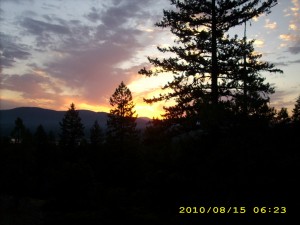
Well, we had quite a lightning show and thunder concert last night– plus rain! Wow! We haven’t had rain since Campo and the San Felipe hills. There was a gorgeous orange-gold sunrise to admire.  In the morning, all we did was walk through viewless forest, but on very nice trail, “patterned” by the raindrops.  Our footprints left very clear marks!  And of course all the plants along the trail were soaking wet.  Overhead, the sun and the clouds were battling as to which would win out in the sky.  Bits of rain continued to fall.  Oh well–now we KNOW we’re in Oregon! 

 Bill’s math says we have to do 30 miles a day to reach Cascade Locks on time, so we were really chugging along the trail.  After we crossed Dead Indian Road, it was very obvious that the trail had been worked on.  It contoured along very nicely, and was built like a raised bed.  Blue diamonds marked the route for Nordic skiing, and made it very easy for us, too.  There were even blue arrows on the trees to show when the trail took a sudden bend!

aug15_2trailrocks

Lunchtime was wonderful– we went to the Brown Shelter  (a very cute log cabin) where there is a real old-fashioned hand pump for delicious cold spring water.  We had a fun conversation with a SOBO hiker from Washington state.  He said he wasn’t doing the whole PCT, but wow, he was planning to do all of Oregon, and all of California as far as Walker Pass!   He makes all his own gear and dries all his own trail food.  

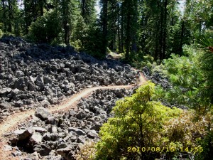
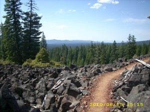
 From there, we soon were on the “lava walk” around Brown Mountain, through miles of lava interspersed with forest. The trail through the lava is very well-done and not hard to walk on.

aug15_3trailforest

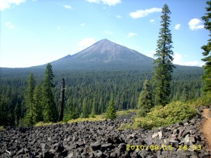
We started getting views of grey Mt. McLoughlin, and reached the Cascade Canal in time for supper.  The canal water didn’t look drinkable, so we didn’t take any for our platypuses, but it was great for washing our very grubby feet and socks.  Then we put in another six miles, and were well up the shoulder of Mt. McLoughlin before making camp, where the mosquitoes and crickets were both “singing.” I prefer the crickets!

Walk with Aragorn to Minas Tirith:  Reach Isengard, continue on highway

aug15_4hillstrees

Thursday, August 12, 2010 Miles Today: 30.3 Total: 1,700.5

Thursday, August 12th, 2010

aug12_1vistatrees

Last night, after lots of good food in Seiad and a long hot climb up the hill, I was so tired that I think I fell asleep as soon as I put my head down! This morning was clear but chilly and very windy. I wore my raingear till breakfast at 7am. (Raingear makes a GREAT windbreaker!)  Just as I remembered from 2005,  the trail was glittering and shimmering in the early morning light.  Lily Pond Lake was covered with lily pads, but no flowers.

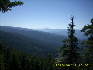
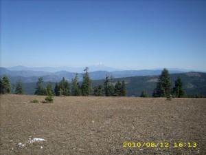
We reached Cook & Green Pass, where a sweet older couple were camped.  Not far from there we also met “Hot Mess” and had a chance to talk a little about really knowing Christ.  We tackled the climb out of the Pass then on to what I call the “rollercoaster hills,” where the PCT makes like a mini-AT, going up and down and up and down. I tried to hike as fast as I could (huff, puff!). Since the hills are often open ground on top of a ridge, the views were great, and now we really truly were SEEING Oregon!  Whenever there was a spring, the hillside would be green grass–elsewhere we were walking across rocky hillsides with rock cairns to mark the location of the PCT.  Wildflowers are getting more scarce, though–summer is starting to “wind down.”

Sometimes the trail went winding around rock formations, and sometimes it would go through a small but dark grove of trees.  We were walking along early in the afternoon when we met another thruhiker stopped by the trail and staring off to the south, looking puzzled.  She had her maps out. 


aug12_4viewrockstrees

 “Hi!” we said.  “Whassup?”  “I can’t figure out where I am,” she sighed.   “What is that big pointed snowy mountain over there?”When I told her ” That’s Mt. Shasta,” she groaned, “Oh no, still Shasta?” ‘Fraid so!

Around 4 pm, we met a whole gang of folks with their horses–a trailclearing crew!  They said they’d been very busy logging out blowdowns.  THANKYOU!  It is so nice to NOT have to climb over a lot of downed tree trunks!  One of the ladies said that her horse has done the entire Washington PCT.  Not bad! 

By 7pm, we reached the Oregon border– a bunch of jolly hikers were there, including Croatian, etc.,  so we got our picture together, signed the register and took off–the mosquitoes were pretty bad. We put in a couple more miles before making camp on a dry ridge.  There was a very pretty golden-colored sunset.  Our first night in Oregon!

Walk with Aragorn to Isengard: Dark clouds from the East begin to overcast the days

aug12_2forestaug12_3foresthills