Friday, August 13, 2010 Miles Today: 28.5 Total: 1,729
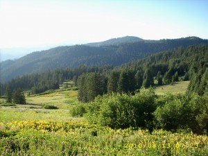
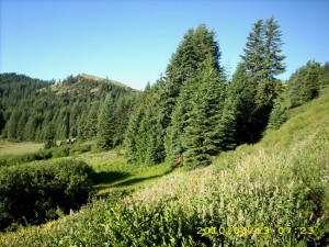
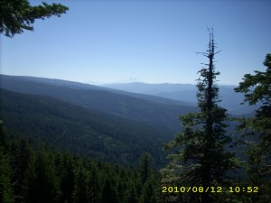
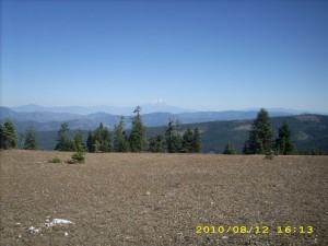
Friday, August 13th, 2010It was actually warm at 5:30am, and it did turn into a very warm day. Oregon scenery is beautiful– both close up (dramatic hills, rocks, trees, flowers) and far off (golden hills, Mt. Shasta and other volcanoes of various sizes.) The trail wanders around, but the wanderings are worth it.
We had breakfast at Sheep Camp Spring, and were entertained by watching the MANY birds flying around and “doing their thing.” I think they are attracted by the water and the many wildflowers. I was amazed at the hummingbirds. They were drinking from water flowing across the trail by simply hovering over it. They also came around and hovered by us, as if to say “Hello!” We also saw several deer in the early morning. In 2005, we were walking through here in hunting season, and met a lot of frustrated hunters who said, “We haven’t even SEEN a deer.” Well, there seem to be plenty of deer around this time!
The PCT goes down to various gaps, then climbs up again, but the climbs aren’t too bad, because the hills here are so rounded. At about 11am we found a wonderful surprise– a Pepsi cache tucked under a white fir tree, with a “Welcome to Oregon, PCT Hikers” sign. It was a hot day already, so cold Pepsi was indeed a welcome!
As we drew near to Grouse Gap, we started meeting a lot of dayhikers who’d come out to enjoy the unbelievable wildflower display in the springs area near the Gap. Wow! There were wild delphiniums taller than me! And there were quite a few improvements to the trail. In 2005, we were picking our way through a fair amount of mud (among the beautiful flowers), but this time the tread was a sort of “raised bed” of gravel. Very nice! The flower display is so gorgeous that no mere photo can really do it justice.
From the flowers at Grouse Gap, it’s 10 more miles to Callahan’s, and it’s 10 miles of fairly level trail winding along the mountainside, up above a road. Unfortunately the policy in this area seems to be “Let the forest turn into a trash pile of fallen dead branches, so that if there’s a lightning strike, we’ll have a ferocious forest fire.” The mess was so bad that I even took a picture of it. It would be so easy to take good care of a forest so close to a road. Sigh.
At one of the side trails down to the road, we met the Israeli girl Shani. She told us very sadly that she’d be finishing her hike at Callahan’s. She’s in such pain with foot problems that she decided to go home. “Noga will keep going, though,” she told us. We wished her well and said a final goodbye. Bummer. Finally around 4pm we could hear the sound of traffic on Interstate 5, and soon we spotted a carved wooden sign on a tree. It said, “Callahan’s Lodge” and had an arrow pointing left. An informal little trail down the hill from there was marked with orange flags. We followed it to the railroad tracks (which included a tunnel!) and then down a road to the restaurant.
A number of other hikers were already there, and we all sat outside. We smell!!! I don’t think any of the nice clean folks inside would want us anywhere close to them! We feasted on a wonderful spaghetti dinner with the Callahan’s perq of “First beer free.” Turns out that the Lodge has a “thruhiker special”. For $40 each, you get showers, laundry, all-U-can-eat dinner and breakfast, and camping on the lawn. It was a tempting thought, and most of the hikers were planning to go for it, but we decided to continue on. The Callahan’s staff refilled our platypuses for us, and we waddled back to the trail. I was totally stuffed!
The PCT goes winding uphill, circumnavigating various rock formations, heading for the spectacular Pilot Rock, which is a landmark for miles around. It was a very hot afternoon, and I was so full from dinner that I just could not hike fast. When it was time to find a campsite, we had quite a problem. There was a fair amount of private property right by the trail, very few flat places, and the ground was extremely rocky and weedy. We finally located a grassy hollow not far from the PCT, where the ground was not quite as rocky, and there was a beautiful view of the northern mountains in sunset light.
Walk with Aragorn to Isengard: Battle of Helm’s Deep. Near Fords of Isen walking through trees of Huorns.

