Posts Tagged ‘Kings River’

Thursday, July 1 Muir Pass Miles today: 14 Total: 837.9

Thursday, July 1st, 2010

1july4viewrock

I summarized today in my journal by writing, “Climbed Muir Pass today. It was like Antarctica.   Miles of snow, rockclimbing and routefinding.”

Well, we headed out at 5:30 am from our nice campsite by Palisade Creek.   Bill and I both slept very well, but we were still tired because it’s just plain been killer hiking for several days, and Bill was still battling some sort of giardiaish bug.  And I have a really bad sunburn from the snow, so I resolved today to wear my black mosquito headnet whenever we are hiking across snowfields! 

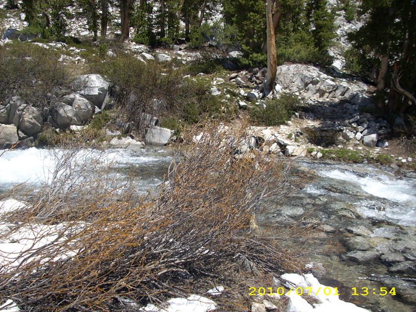
 The day’s hiking began with a long and beautiful climb up alongside the Middle Fork of the Kings River, which roared so loudly we had to shout in order to talk. The trail was constantly either wet, muddy, or crossed by little snowmelt creeks.  But oh, wow, the scenery!  Spectacular cliffs, snowy mountains!   Supremely Sierra!  Big Pete Meadow was actually a lake, the river was so high.  I don’t know how the “I wear Crocs for stream crossings” people ever manage here in the Sierras in early season.  The trail itself was a boggy creek.  But the meadows were so pretty!

1july11snowrocks

 It’s a long, determined climb up to Muir Pass and its accompanying lakes.  By noon, Bill and I were both wiped out and spent most of our lunch break just lying down.  Now I was a bit worried about ME–I was starting to feel sick, giardia-style, and could not face eating anything much.  Neither could Bill.  I did not tell Bill I was feeling sick, because I did not want him to worry.  I just told him I was awfully tired, which was true.

Continuing on, we met a young couple sitting by the trail, debating whether to go on, or not.  Since it was now afternoon, they were worried about postholing problems in the miles of snow just up ahead.  We left them still debating, and pushed on.  Soon the snow became more and more of a factor until by treeline, everything was solid snow and we were back to just guessing where the trail went.  However, there was a pretty good “footprint trail” to follow, which did what I call “island-hopping”, because it went from one big rock to the next instead of just going straight up.  I was very pleased because I felt I was getting better at hiking on snow.  But at the same time, I was concerned because I was feeling increasingly ill. 

When we reached Helen Lake, we found it completely frozen over and shortly after that we came to a point where we had to decide which way to go. Tracks led 2 totally different ways. It was after 6:00pm and getting cold— the snow was starting to “ice up”. Bill and I were totally worn out.  Neither of us had been able to eat much all day.  I thought Bill would know exactly where to go, because he has hiked this pass before so many times, but it turned out that he had no clue.  We got out our maps, looked at landmarks, looked at the two radically different footprint trails, and started out again.  Just after we started out, the snow collapsed under me and I ended up in a MAJOR posthole, with BOTH my feet completely iced in.  I was so tired and and so ill that I did cry for a minute before taking off my pack and digging myself out.  It took about 20 or 30 minutes. 

1july14snowhouse

The delay gave Bill time to make a decision about where to go,  which involved another “straightup” climb up a pretty steep face. I was so tired that I sort of cried again as I set out after him, and sort of “snuffled” my way along for awhile as we started up. The wind was blowing and it was very cold.  The snow was really icing up now, but still do-able.  Bill was quickly far ahead and eventually I couldn’t see him anymore. It was just me ‘n my ice axe and much prayer for strength and courage to “make the top”.   Then I heard a faint shout from Bill.  I couldn’t make out what he was saying (Turned out he was yelling, “The Hut!  The Hut!”)  Finally the snow stopped going up— it rounded off, and to my joy and delight, there was Muir Hut, glowing golden in the evening light.

There was no way to go on–miles of uninterrupted snow lay ahead.  When I stepped inside the Hut, I cheered!   It was warm and cozy!  The sun had been shining on it all day, and the stone had soaked up all that nice heat!  Oh man, it felt wonderful!  We laid out our sleeping bags on the stone ledges inside, then went outside to fire up our little alcohol stove to make some hot beef broth to drink.  Neither of us could face eating anything, but we agreed a hot drink would be wonderful.  I was just in the middle of doing the beef broth, when along came  two young men, brothers hiking together. They told us they did Mather Pass this morning, and here they were at Muir already!   Way to go!  They told us they were on a tear to reach Mammoth in time for 4th of July.  So we all slept in Muir Hut tonight, very comfortable and warm,  with a lovely sunset.  I felt so blessed!

Walk to Lórien: Arrive at Balin’s tomb in Moria and are attacked by Orcs and a Cave Troll

1july1trailgreen1july2trailwater1july3trailview1july5viewmountain1july6flowers1july7viewrocks1july10snow1july9water1july12snowtrail1july13snowtrail

Wednesday, June 30 Mather Pass Miles today: 11.7 Total: 823.4

Wednesday, June 30th, 2010

30june4snow

Another tough day!  It took us from 5:30 am till 7:30 pm to do only 11.7 miles!  We were climbing over snow most of the day, which makes for slow going.  This morning, a short walk took us to the South Fork of the Kings River. The ranger note yesterday said, “do not cross here— way too dangerous. Walk upstream to where the trail crosses back over.”  Yup, the river was obviously quite deep and was a  roaring torrent all the  way across.   Bill was still determined to cross it, however.  I begged him not to, but PLEASE to just walk up the near side as the ranger had advised. To my great relief, Bill finally agreed to follow the ranger’s suggestion.

Turned out that the “bushwhack” up along the south side of the Kings was very pleasant and easy and pretty, too. It isn’t steep and has a nice open feel to it, so we could admire the magnificent Sierra scenery.  Not only that, but it was not wet or muddy, and there were no big tributaries to ford.  If we had bullied our way across the river down below and determinedly stuck to the PCT, we would have had several more nasty creek crossings.  We could see those tributaries coming in from where we were on the other side, and commented, “I sure am glad I don’t have to ford THAT!” 

It was a good thing that the first part of the hike up to Mather Pass was not very steep.  Bill is still not feeling well at all.   He still has to stop and rest a lot, and can’t eat much.  He decided to start taking Flagl to see if it would help.  Eventually we reached the PCT again, well up toward the pass, and simultaneously were  back into the snow and playing “Where’s the trail?” The snow turned out to be a great benefit in one way, though–we could cross creeks on snow bridges and not get our feet wet!   I love snow bridges!

In retrospect, though, I should have realized sooner that walking on miles of snow without protecting your lower face from sunburn is really dumb!  I was so absorbed in just dealing with being terrified half the time that I didn’t even notice I was developing a pretty bad sunburn.   Bill has a beard, so there’s no problem for him!


30june6mountainpass

 We reached the foot of the pass (again, made very difficult by so much snow) and found quite a few other folks also heading up, more than we have seen on any of the other passes.  I could not believe that we’d caught up with so many of them after our slow going for the last couple of days.  Going up Mather is the steepest of all the passes, and very scary. Bill whizzed halfway up and sat there chatting with another hiker while I painstakingly “chopped in” every step I took with my faithful ice axe. I felt very bad about being so slow, and felt even worse when I got to the point where I could hear Bill and the other guy laughing–at ME!   “It is painful to watch, isn’t it?”  joked Bill, pointing at me, and the two of them thought it was very funny.  I know that guys like to give each other a bad time (it’s a guy thing, and normally I don’t care), but I was so scared and tired that it really hurt and I had to fight not to cry.  As soon as I got to the “breather spot”,  Bill took off again and I sat there feeling very low. 

Then a wonderful thing happened.   A young couple came happily climbing up the steps I had just chopped, with the wife rejoicing at how easy it had been for her “with these nice steps.”  She mentioned how worried she had been about the steep climb up Mather.   I didn’t pipe up with, “Well, you can thank me–I made those steps”,  but I was so blessed and encouraged!   I picked up my ice axe and tackled the next climb, feeling much more cheery! 

30june12waterview

Woo-hoo!  I reached the top at last.  Going down the other side of Mather is not as steep or scary.  It involved a mix of scrambling over snow and rocks.  Bill is always way faster than I am on this type of terrain, even when he is not feeling good.  I have to be especially careful when scrambling on rocks.  I don’t have the world’s best sense of balance, plus the challenges of wearing bifocals (makes it hard to judge distance) and I have rather floppy ankles.  So on rocks, I’m very cautious!  

But finally we made it down to Palisade Lakes, which were still semi-frozen.  The ice was breaking up, though,and there were cute little “baby icebergs” floating in the water.  I wish I had a picture of them, but we’d had a very nasty stream crossing just above the lakes that looked dangerous enough that I’d wrapped the camera thoroughly in plastic bags and set it high up in Bill’s pack.  Once we got across (all went OK!), Bill took off and was way ahead of me, so I had no camera available.  Too bad–those really were totally cute little icebergs!

Then it was down the famous “Golden Staircase” with its huge rock steps. I yelped a little at each step down, because my poor knees were already so sore from all the snow and rock scrambling.  I LOVE my trek poles–what a help they are when my knees are tired!  And seeing the green grass and forests in the valley below was also encouraging.  In 2005,  I cried a bit on this stretch out of sheer frustration at being so slow on the huge rock steps and rough trail.   I cried a little bit this time, too, for the same reason.  But those green meadows and trees were getting closer and closer!   I felt like I was “coming in for a landing” on an airplane!

 As soon as we were down in the valley, and back into nice dry forest,  we stopped and camped, completely wiped out.   It was 7:30 pm.  When we were doing our best to clean up before getting into our sleeping bags, Bill and I both discovered that we have a rash on our lower legs.  What could it be?  Sunburn-related?   Just being constantly wet?  At any rate, it does sting a bit.  I also realized, duuuuh! that I had a very bad sunburn on my lower face.   Tomorrow I will wear my black mosquito headnet when we come to snow.  That should help!  

Walk to Lórien: Reach the Guardroom junction in Moria

30june1creek30june2trail30june3trail30june5mountain30june7mountain30june8rockontop30june9rocks30june10creekpass30june11creekpass30june13views30june14treesview30june15trail