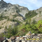
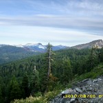
Saturday, August 14 Hyatt Lake Resort 2010 Miles Today: 25 Total: 1,754

August 14th, 2010

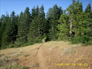
aug14_4trailtrees

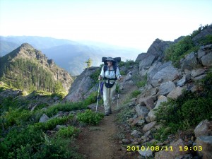
Last night an owl hooted for a very long time. Was he/she lonely? It was a warm morning with clear skies, and we didn’t need our jackets for very long as we followed the windy, twisty, weedy PCT on its way around Pilot Rock. Last night Bill did some math and he is thinking about trying to make it to PCT “trail days” in Cascade Locks at the end of August. That means we have to average at least 30 miles day!  I asked the Lord to put me on His “cruise control” to hike along quickly, but not so fast that my very bony body can’t handle it. I am feeling stronger every day– is it the Nutella?  Or the extra food I’m carrying?

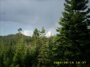
aug14_5treessky

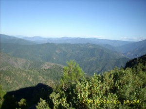
I was hoping to get a good pic of  Mt. Shasta, but it was too hazy.  Mt. McLoughlin to the north is completely gray–no snow on it that I can see.  The biggest concern today was finding water– the sources are getting farther and farther apart.  When we reached what the guidebook called “the fenced in spring”, there was water aplenty, and two section hikers who wanted to talk about BEARS!  I’m sure there are bears here in Oregon, but we are not worried about them.  We took on enough water to see us all the way to Hyatt Lake.

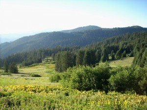
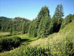
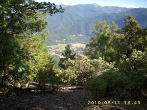
The guidebook writer doesn’t seem to like this section, and says that nobody would bother with it unless they were thruhiking.  What a bunch of rot!  The dayhikers sure don’t think so!  This is very pretty trail–it’s like walking through a park.  Sometimes you’re amid grass and trees, and sometimes you’re walking through a very green-carpeted Oregon forest.  There are great views of Ashland and very blue Emigrant Lake, far below. 

We reached Hwy. 66 well before lunch, which meant we were really moving fast this morning!  There was another place along the way where we could have gotten some water, but when we reached it, there was a note warning that there were dead rats in the water collecting tank.  Yikes!  We were glad we’d taken on full water loads earlier! 

Then it was on to Little Hyatt Reservoir, which was very full and overflowing vigorously.  Lots of very friendly people were hanging around.  But we didn’t linger–we figured on lunch at Hyatt Lake!  It wasn’t long before we were walking across the Lake dam and heading for the fisherman store on the other side.    The resort restaurant was open, but all they had was pizza, beer and ice cream.  I don’t know why, but I was just yearning for anything BUT those items.  We asked the store guy if there was any other restaurant, and he said, “Sure, it’s just a quarter mile down the road.  I’ll take you over there.”  We hopped in his little golf cart thing and he gave us a ride.

Well, that was a pretty long quarter mile!  Way longer, actually!  We were flying along the road (the guy drove like a Jehu!) with tiny little Zoe the dachshund in the front seat, and when we arrived at the other restaurant, the store guy showed us where we could even go take showers!  Back to the restaurant then, for great big sandwiches and glass after glass of lemonade.  Once we were wellstuffed, we walked back to the “Bucks & Does” shower building to wash both ourselves and our socks.  Then we sat around in the sun for awhile to give the socks a bit of drying time.  I managed to yogi a ride for us back to Hyatt Lake proper, we picked up our resupply box and I started loading our food bags.

That’s when I discovered that the little store now has only chips, drinks, ice and bait.  It used to have a lot more, which I’d counted on to finish off our food supplies.  I sent Bill on a run for the hiker box to see what he could find.  He came back with peanut butter.  Well…I guess we’ll be on slightly short rations till the next resupply.  We got ice cream cones at the restaurant and talked to some of the other thruhikers there, before strolling back to the PCT with a very nice young couple who were SOBO’s.

The PCT heads off through the forest, with  glimpses of the lake, but meanwhile, the weather had turned a bit ominous.  This morning’s pretty puffy white clouds had turned into thunderclouds, which started booming and muttering.  During the rest of the afternoon, we were occasionally misted with rain, but that was good, because it was cooler, and we saw a double rainbow.  Rainbows are awesome–every time I see one, I think about God’s promise to Noah, and just in general how God keeps His promises. 

When it was time to make camp, the trail was up fairly high, and the clouds were growing darker.  We figured that if there was a lightning storm, we definitely did NOT want to be up high.  The Boy Scout leader we’d talked to when we were heading up into the Desert Divide back in southern California said that the safest place in a thunderstorm is 1) Not up high   2) Not down at the bottom  3) Not near a tree that has been previously hit by lightning, but 4) On the side of a hill, in the forest.  So we headed down the hillside, into the woods, till we found a small flat place.  We rigged the net tent for the mosquitoes and the tarp for rain, then crawled into our sleeping bags.  The funny thing is, in 2005, it also rained on us by Hyatt Lake! 

Walk with Aragorn to Isengard:  On highway to Isengard

aug14_1montyhillaug14_3viewhills

Friday, August 13, 2010 Miles Today: 28.5 Total: 1,729

August 13th, 2010

aug13_1viewgreen

It was actually warm at 5:30am, and it did turn into a very warm day. Oregon scenery is beautiful– both close up (dramatic hills, rocks, trees, flowers) and far off (golden hills, Mt. Shasta and other volcanoes of various sizes.) The trail wanders around, but the wanderings are worth it. 

We had breakfast at Sheep Camp Spring, and were entertained by watching the MANY birds flying around and “doing their thing.”  I think they are attracted by the water and the many wildflowers.  I was amazed at the hummingbirds.  They were drinking from water flowing across the trail by simply hovering over it.  They also came around and hovered by us, as if to say “Hello!”    We also saw several deer in the early morning.  In 2005, we were walking through here in hunting season, and met a lot of frustrated hunters who said, “We haven’t even SEEN a deer.”  Well, there seem to be plenty of deer around this time! 

The PCT goes down to various gaps, then climbs up again, but the climbs aren’t too bad, because the hills here are so rounded.  At about 11am we found a wonderful surprise– a Pepsi cache tucked under a white fir tree, with a “Welcome to Oregon, PCT Hikers” sign.  It was a hot day already, so cold Pepsi was indeed a welcome!

aug13_2greentrees

As we drew near to Grouse Gap, we started meeting a lot of dayhikers who’d come out to enjoy the unbelievable wildflower display in the springs area near the Gap.    Wow!  There were wild delphiniums taller than me!  And there were quite a few improvements to the trail.  In 2005, we were picking our way through a fair amount of mud (among the beautiful flowers), but this time the tread was a sort of “raised bed” of gravel.  Very nice!  The flower display is so gorgeous that no mere photo can really do it justice. 

From the flowers at Grouse Gap, it’s 10 more miles to Callahan’s, and it’s 10 miles of fairly level trail winding along the mountainside, up above a road.  Unfortunately the policy in this area seems to be “Let the forest turn into a trash pile of fallen dead branches, so that if there’s a lightning strike, we’ll have a ferocious forest fire.”  The mess was so bad that I even took a picture of it.  It would be so easy to take good care of a forest so close to a road.  Sigh. 

At one of the side trails down to the road, we met the Israeli girl Shani.  She told us very sadly that she’d be finishing her hike at Callahan’s.  She’s in such pain with foot problems that she decided  to go home.  “Noga will keep going, though,” she told us.  We wished her well and said a final goodbye.  Bummer.  Finally around 4pm we could hear the sound of traffic on Interstate 5, and soon we spotted a carved wooden sign on a tree.  It said, “Callahan’s Lodge” and had an arrow pointing left.  An informal little trail down the hill from there was marked with orange flags.  We followed it to the railroad tracks (which included a tunnel!) and then down a road to the restaurant.

A number of other hikers were already there, and we all sat outside.  We smell!!!  I don’t think any of the nice clean folks inside would want us anywhere close to them! We feasted on a wonderful spaghetti dinner with the Callahan’s perq of “First beer free.”  Turns out that the Lodge has a “thruhiker special”.  For $40 each, you get showers, laundry, all-U-can-eat dinner and breakfast, and camping on the lawn.  It was a tempting thought, and most of the hikers were planning to go for it, but we decided to continue on.  The Callahan’s staff refilled our platypuses for us, and we waddled back to the trail.  I was totally stuffed! 

The PCT goes winding uphill, circumnavigating various rock formations, heading for the spectacular Pilot Rock, which is a landmark for miles around.  It was a very hot afternoon, and I was so full from dinner that I just could not hike fast.   When it was time to find a campsite, we had quite a problem.  There was a fair amount of private property right by the trail, very few flat places, and the ground was extremely rocky and weedy.  We finally located a grassy hollow not far from the PCT, where the ground was not quite as rocky, and there was a beautiful view of the northern mountains in sunset light. 

Walk with Aragorn to Isengard:  Battle of Helm’s Deep. Near Fords of Isen walking through trees of Huorns.

aug13_5greentreesaug13_6vistatrees

Thursday, August 12, 2010 Miles Today: 30.3 Total: 1,700.5

August 12th, 2010

aug12_1vistatrees

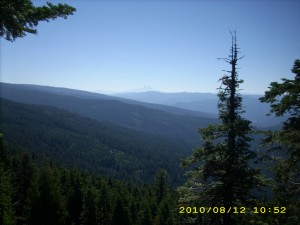
Last night, after lots of good food in Seiad and a long hot climb up the hill, I was so tired that I think I fell asleep as soon as I put my head down! This morning was clear but chilly and very windy. I wore my raingear till breakfast at 7am. (Raingear makes a GREAT windbreaker!)  Just as I remembered from 2005,  the trail was glittering and shimmering in the early morning light.  Lily Pond Lake was covered with lily pads, but no flowers.

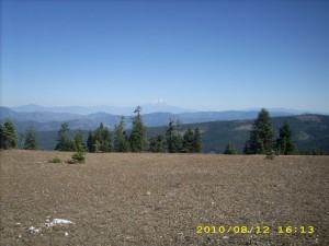
We reached Cook & Green Pass, where a sweet older couple were camped.  Not far from there we also met “Hot Mess” and had a chance to talk a little about really knowing Christ.  We tackled the climb out of the Pass then on to what I call the “rollercoaster hills,” where the PCT makes like a mini-AT, going up and down and up and down. I tried to hike as fast as I could (huff, puff!). Since the hills are often open ground on top of a ridge, the views were great, and now we really truly were SEEING Oregon!  Whenever there was a spring, the hillside would be green grass–elsewhere we were walking across rocky hillsides with rock cairns to mark the location of the PCT.  Wildflowers are getting more scarce, though–summer is starting to “wind down.”

Sometimes the trail went winding around rock formations, and sometimes it would go through a small but dark grove of trees.  We were walking along early in the afternoon when we met another thruhiker stopped by the trail and staring off to the south, looking puzzled.  She had her maps out. 


aug12_4viewrockstrees

 “Hi!” we said.  “Whassup?”  “I can’t figure out where I am,” she sighed.   “What is that big pointed snowy mountain over there?”When I told her ” That’s Mt. Shasta,” she groaned, “Oh no, still Shasta?” ‘Fraid so!

Around 4 pm, we met a whole gang of folks with their horses–a trailclearing crew!  They said they’d been very busy logging out blowdowns.  THANKYOU!  It is so nice to NOT have to climb over a lot of downed tree trunks!  One of the ladies said that her horse has done the entire Washington PCT.  Not bad! 

By 7pm, we reached the Oregon border– a bunch of jolly hikers were there, including Croatian, etc.,  so we got our picture together, signed the register and took off–the mosquitoes were pretty bad. We put in a couple more miles before making camp on a dry ridge.  There was a very pretty golden-colored sunset.  Our first night in Oregon!

Walk with Aragorn to Isengard: Dark clouds from the East begin to overcast the days

aug12_2forestaug12_3foresthills

Wednesday, August 11 Seiad Valley 2010 Miles Today: 20 Total: 1,670.2

August 11th, 2010

aug11_1viewtrees

Down in the Grider Creek canyon, it’s really the deep dark woods–so dark that we waited till 5:30 to get up.  We took off along the trail as soon as it was light enough to see– and it is worth seeing. The canyon walls are high and steep.  Often the creek is running along below cliffs, cascading over the rocks.  The creek water looks so clear and pure–and it sort of sings to itself as it goes rushing along.  Overhanging everything are the huge trees, and the ground is covered with greenery of all sorts.

Eventually we reached the campground and passed a couple of bicycle campers just getting up.  We didn’t have to wonder for long where Croatian, Tangent, etc. were–tracks on the dirt road toward town showed that they were just ahead of us.  Bill stopped to use the restroom at the campground, and I just kept going, figuring he would catch up with me.  But the first person to come along from behind wasn’t Bill–it was Ann.  We walked along and talked a bit.  I told her that we’d managed 30 miles yesterday, and she commented, “I did 40 miles.  That was easy trail.”  Turned out that 30 mile days are commonplace for her.  I can well believe it!  She always walks very intensely, as if she were “on a mission.”  Ann soon took off and disappeared around a bend. 
It was shaping up to be a hot day, so I was walking at a leisurely pace, wondering where Bill was.  When I reached the Klamath River, I stopped to take a picture of it,  when Bill came along, and we decided to stop for a Snickers break.  We discussed the puzzle of why there were so many “No Monument!” signs in front of houses along the way.   What “monument”?  When we reached Hwy 96, it was very busy, so we had to be careful as we walked the road shoulder toward town.  When we reached the Klamath River bridge, I had a brief terrifying moment.  Bill was out ahead of me and by the time I was halfway across the bridge, he was almost all the way across.  Along came a great big truck.  The driver saw Bill, swung out a bit to avoid him, then swung back in and was headed straight AT me!  I flattened myself against the railing, and the truck missed me by a space that was way too small for comfort!  Yikes!
aug11_2viewplants

It was great to reach the Seiad Cafe at last.  Several packs were outside, leaning against the wall, and the place was full of hungry hikers.  Nobody has won the pancake Challenge yet this year–4 out of the 5 pancakes is the record so far.  Bill and I went for huge omelets and potato pancakes, accompanied by fruit shakes.   I asked the folks at the Cafe what all the “No Monument” signs were about.  Turns out that the Feds want to turn the whole valley into a wildlife national monument and get rid of the people.   We were horrified.  I’d like to get on a soapbox and say what I think about it!

aug11_5trailrocks

I picked up our resupply box and went to the hiker tables next to the cafe to sort everything out and load our packs.  The two bicycle guys were there hanging out with their pet KITTEN!  All the hikers were having a great time petting it and playing with it.  Ann was there, and she gave me her leftover Nutella.  I also bought more food at the store.  The distances between resupplies in Oregon are relatively short, so I am pushing up the food weight in an effort to get more calories. 

Then we went next door to the RV park, where they have set up a wonderful “hiker zone” which includes a whole area in the shade, covered with soft hay. Ahh! Comfort! You just role out your Ridgerest and take a nap!   There was also a refrigerator, table & chairs, and a DVD player.  I just plain lay down and collapsed for awhile.  Bill went back to the Cafe for lunch, but I just could not face eating any more–I was still stuffed from breakfast.   All the other hikers were also lying around resting.  They planned to push on at 5 pm, when it was cooler.  But around 2:30, a breeze sprang up, and Bill  & I decided to head out. 

It’s an 11 mile climb out of Seiad Valley, and it was a hot afternoon, but the views were incredible, and the trail itself is quite varied, as it winds in and out of  Lower, then Middle, then Upper Devil’s Peak.  The Klamath River at first looks like a scenic blue river, then as you climb higher and higher, it becomes more like a silver ribbon far below, wandering toward the sea.  We were carrying a ton of water, because in 2005 we hadn’t been able to find the spring that’s located partway up the climb.  This time, the side trail to the spring was well marked, so we took a break there and enjoyed drinking plenty of cold “bug juice” (Crystallite mixed with Emergen-C). 

The trail is constantly climbing and traversing on steep mountainsides, but we were not worried about finding a campsite, since we were up here in 2005, and knew that there was a reasonably flat zone up ahead, on a saddle, not too far from the top of the climb.  Sure enough, by just after 7 pm, we made it, and managed to squeeze in between the bushes with a wonderful view out towards the south.  It’s a clear night, with a nice (though chilly) breeze.  Oregon tomorrow!

Walk with Aragorn to Isengard: In green valley with lots of streams. Huorns are sighted.

aug11_3viewhillsaug11_4viewhills

Tuesday, August 10, 2010 Miles Today: 30.2 Total: 1,650.2

August 10th, 2010

aug10_4darkvistaclouds

We tiptoed around, being as quiet as we could while packing up this morning, so we wouldn’t bother Blue Butterfly.  The sky was full of clouds– all kinds of clouds– all very pretty but a bit worrisome to hikers. “Will it rain? Or will it just make today cooler?” (Turned out in the end that the lovely clouds made a great, comfortable hiking day!)   The sunrise was very red,  and lit up Mt. Shasta, which is now very definitely BEHIND us.  

It didn’t take us long to reach the PCT alternate route, which was developed because the “real” PCT crosses the north face of a mountain, and was snowbound for so much of the year that horses could not get through.   We chose the alternate, and stopped for breakfast near the top of the climb.  Far below us was a little encampment of other thruhikers who were just starting to get up.  All around us were mountains in all sorts of shapes–pyramids, blocks, and just plain “pointy.”  As we descended down a brief north face, we did have the “fun” of getting around a nice big snowfield.   I think that when trail routes are being planned, north sides of things should be avoided as much as possible.  In the Sierras, this was true as well.  South sides of mountains and passes were often clear, while north sides were deep in snow.  It was pretty frustrating to be struggling through snow while looking across at nice plain dirt!

aug10_19mountains

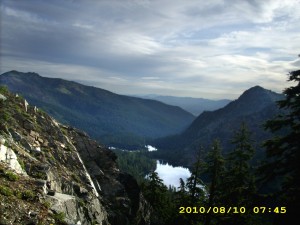
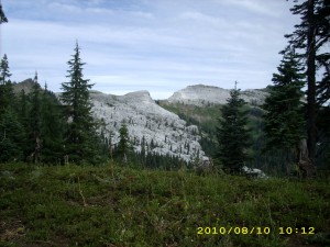
The rest of the morning I felt as if we were wading through wildflowers– they were waist high and gorgeous.  We contoured around the bases of mountains of marble and peered into marble “wells” and caves. The old ranger cabin midway had a brand new, shiny stovepipe. Nice!  The trail contours high above some very pretty lakes, but only comes close to one of them, which is called Paradise Lake.  Up behind it is a dramatic rock formation called King’s Castle.  I understand now why rock climbers like to come here to the Marble Mountains! 

We met some SOBO ladies–the same ladies we’d met hiking SOBO north of Silverwood Lake!  One of them was hiking with her little dog which was carrying its own cute little pack.  Awwwww!  They said they’d met Babysteps and Flashback, who told them “White Beard is coming!”  so they were expecting us.  Turns out that we are becoming a bit of a legend on the PCT this year, a part of the “elite” group of hikers who have not flipped or flopped, but went straight through, AND we are in the “Geezer Three” of the oldest thruhikers on the trail.

The trail makes a pretty steady climb up to around 7,000 feet, so we were very glad to finally reach the long traverse–miles and miles of easy going across green meadows and through forests.  We did have to be careful of our water, though.  Rain that falls here in the Marbles just percolates right into the ground.  There are very few springs or creeks.

Finally came the long down-hill to Grider Creek, and we began to “fly”– it was nice easy trail, very green and shady.  At a road crossing we caught up with Croatian, Not a Chance and Tangent again.  They were busy eating, so we joined them!  I have been eating Nutella by the spoonful every chance I get (hey, it’s 100 calories per tablespoon!) and it is really helping.  I was able to chug right on up the climb this morning, and the downhill to Grider has been actually fun!  Croatian, etc. were determined to camp tonight at the campground, even if it meant hiking by headlamp. 

Bill and I were not so ambitious–we figured on making it to the first bridge across Grider Creek before stopping for the day.  But bummer–there were no flat places by the bridge!  The guidebook said there were campsites at the next bridge, 1.3 miles away, so we pushed on.  Well, the guidebook was wrong.  There were no campsites or flat ground of any kind.  By this time, we were both really tired, and the sun was going down.  So I went into what I call “Hike while looking for a campsite” mode, and it worked!  Up above the trail, to the left, I spotted what might, just maybe, be a little “shelf” of land.  I told Bill to wait while I had a look, and hooray!  There was just enough room for a cowboy camp, on ground covered with soft, cushy leaves!

When I figured out our mileage, I cheered.  We did just a bit over 30 miles!  And here we are with a nice camp in a beautiful forest, with the creek rushing along nearby.  And I am feeling so much better.  Being able to rest in Etna and being blessed by the love and prayers of other believers really was a help…and Nutella rocks!

aug10_28viewforest


Walk with Aragorn to Isengard: Enter meadows crossed with many streams of the Isen

aug10_1hillsaug10_3viewforestskyaug10_5hillgreenaug10_7darkhillsaug10_8hillsaug10_9silhouettetreesaug10_10forestgreenaug10_12viewforestaug10_13forestaug10_15foresthillsaug10_16forestaug10_17forestaug10_21greenhillsaug10_22greenhillsaug10_23greentrailaug10_24greenplantsaug10_25trailgreenaug10_27hillsskyaug10_29hillforestaug10_30viewmountainsaug10_31forestviewaug10_32viewplants