Posts Tagged ‘Sierras’

Wednesday, June 30 Mather Pass Miles today: 11.7 Total: 823.4

Wednesday, June 30th, 2010

30june4snow

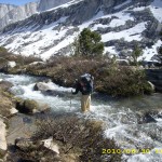
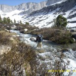
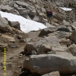
Another tough day!  It took us from 5:30 am till 7:30 pm to do only 11.7 miles!  We were climbing over snow most of the day, which makes for slow going.  This morning, a short walk took us to the South Fork of the Kings River. The ranger note yesterday said, “do not cross here— way too dangerous. Walk upstream to where the trail crosses back over.”  Yup, the river was obviously quite deep and was a  roaring torrent all the  way across.   Bill was still determined to cross it, however.  I begged him not to, but PLEASE to just walk up the near side as the ranger had advised. To my great relief, Bill finally agreed to follow the ranger’s suggestion.

Turned out that the “bushwhack” up along the south side of the Kings was very pleasant and easy and pretty, too. It isn’t steep and has a nice open feel to it, so we could admire the magnificent Sierra scenery.  Not only that, but it was not wet or muddy, and there were no big tributaries to ford.  If we had bullied our way across the river down below and determinedly stuck to the PCT, we would have had several more nasty creek crossings.  We could see those tributaries coming in from where we were on the other side, and commented, “I sure am glad I don’t have to ford THAT!” 

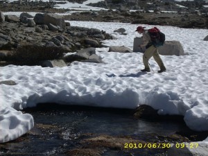
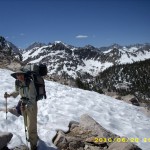
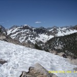
It was a good thing that the first part of the hike up to Mather Pass was not very steep.  Bill is still not feeling well at all.   He still has to stop and rest a lot, and can’t eat much.  He decided to start taking Flagl to see if it would help.  Eventually we reached the PCT again, well up toward the pass, and simultaneously were  back into the snow and playing “Where’s the trail?” The snow turned out to be a great benefit in one way, though–we could cross creeks on snow bridges and not get our feet wet!   I love snow bridges!

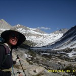
In retrospect, though, I should have realized sooner that walking on miles of snow without protecting your lower face from sunburn is really dumb!  I was so absorbed in just dealing with being terrified half the time that I didn’t even notice I was developing a pretty bad sunburn.   Bill has a beard, so there’s no problem for him!


30june6mountainpass

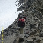
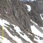
 We reached the foot of the pass (again, made very difficult by so much snow) and found quite a few other folks also heading up, more than we have seen on any of the other passes.  I could not believe that we’d caught up with so many of them after our slow going for the last couple of days.  Going up Mather is the steepest of all the passes, and very scary. Bill whizzed halfway up and sat there chatting with another hiker while I painstakingly “chopped in” every step I took with my faithful ice axe. I felt very bad about being so slow, and felt even worse when I got to the point where I could hear Bill and the other guy laughing–at ME!   “It is painful to watch, isn’t it?”  joked Bill, pointing at me, and the two of them thought it was very funny.  I know that guys like to give each other a bad time (it’s a guy thing, and normally I don’t care), but I was so scared and tired that it really hurt and I had to fight not to cry.  As soon as I got to the “breather spot”,  Bill took off again and I sat there feeling very low. 

Then a wonderful thing happened.   A young couple came happily climbing up the steps I had just chopped, with the wife rejoicing at how easy it had been for her “with these nice steps.”  She mentioned how worried she had been about the steep climb up Mather.   I didn’t pipe up with, “Well, you can thank me–I made those steps”,  but I was so blessed and encouraged!   I picked up my ice axe and tackled the next climb, feeling much more cheery! 

30june12waterview

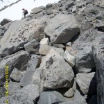
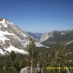
Woo-hoo!  I reached the top at last.  Going down the other side of Mather is not as steep or scary.  It involved a mix of scrambling over snow and rocks.  Bill is always way faster than I am on this type of terrain, even when he is not feeling good.  I have to be especially careful when scrambling on rocks.  I don’t have the world’s best sense of balance, plus the challenges of wearing bifocals (makes it hard to judge distance) and I have rather floppy ankles.  So on rocks, I’m very cautious!  

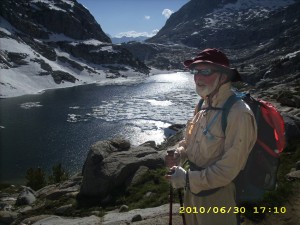
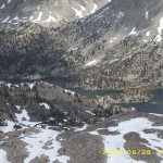
But finally we made it down to Palisade Lakes, which were still semi-frozen.  The ice was breaking up, though,and there were cute little “baby icebergs” floating in the water.  I wish I had a picture of them, but we’d had a very nasty stream crossing just above the lakes that looked dangerous enough that I’d wrapped the camera thoroughly in plastic bags and set it high up in Bill’s pack.  Once we got across (all went OK!), Bill took off and was way ahead of me, so I had no camera available.  Too bad–those really were totally cute little icebergs!

Then it was down the famous “Golden Staircase” with its huge rock steps. I yelped a little at each step down, because my poor knees were already so sore from all the snow and rock scrambling.  I LOVE my trek poles–what a help they are when my knees are tired!  And seeing the green grass and forests in the valley below was also encouraging.  In 2005,  I cried a bit on this stretch out of sheer frustration at being so slow on the huge rock steps and rough trail.   I cried a little bit this time, too, for the same reason.  But those green meadows and trees were getting closer and closer!   I felt like I was “coming in for a landing” on an airplane!

 As soon as we were down in the valley, and back into nice dry forest,  we stopped and camped, completely wiped out.   It was 7:30 pm.  When we were doing our best to clean up before getting into our sleeping bags, Bill and I both discovered that we have a rash on our lower legs.  What could it be?  Sunburn-related?   Just being constantly wet?  At any rate, it does sting a bit.  I also realized, duuuuh! that I had a very bad sunburn on my lower face.   Tomorrow I will wear my black mosquito headnet when we come to snow.  That should help!  

Walk to Lórien: Reach the Guardroom junction in Moria

30june1creek30june2trail30june3trail30june5mountain30june7mountain30june8rockontop30june9rocks30june10creekpass30june11creekpass30june13views30june14treesview30june15trail

Monday, June 28 Glen Pass Miles today: 17.3 Total: 800.7

Monday, June 28th, 2010

28june1monty

It was a cold, cold  night last night, and I should have taken some Motrin,  I think, before collapsing into my sleeping bag, because every bit of me ached from the effort of getting over Forester.  As a result  I didn’t sleep much even though I was so tired.  But we dragged ourselves up at 5:00 am, anyway, because we have  long way to go before Glen Pass.  The PCT was still playing hide ‘n seek in the snow, so it took us awhile to find our way downhill to Vidette Meadows.  I did think it interesting, though, that the plants up here have not even begun to swell their buds yet, and it’s almost the end of June!  They sure don’t get much “growing time”!

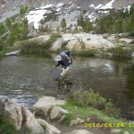
Eventually we were down in the lovely forests of Vidette M., hiking along with the river roaring by.  Of course every side creek coming into the river was roaring, too, so I got lots of practice in creek crossings!  Bill and I now live all day in perpetually wet shoes and socks and lower pant legs.  Anybody who wants to obsess about removing shoes and socks for every stream crossing would take FOREVER to get through so much wet stuff.  We just head right in, shoes and all, whether it’s a creek crossing or just plain “PCT Creek”, where the trail itself becomes a waterway! 

After the nice walk through Vidette valley, we began the killer uphill toward  the Kearsarge Pass trail junction.  It was a beautiful day, and very warm.   Due to the heat, plus lack of sleep, I think,  the climb  just about did me in— I had to stop and rest several times, instead of just chugging on up as I usually would have done.  This was really frustrating to me, because I knew we were “under the gun” timewise to make it over Glen Pass before it “iced up”.

28june9snowice

When we got to the Kearsarge junction, we got a good laugh, because the “junction”, sign and all, was in the middle of a snowmelt lake, surrounded by snowfields!  But there was a sort of trail of footprints to follow as we headed for Glen Pass.  Bill has done this pass in early season several times, and he said the approach and climb are not bad, but going down is pretty scary.  If he thinks something is scary, I figure it will really be tough.  We climbed up and up through the snow, heading for the foot of the pass.  Yesterday, we actually skipped a meal to save time, and we did it again today.

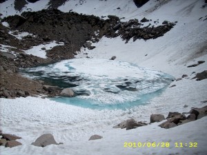
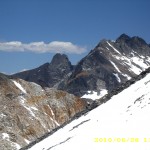
 The climb up Glen  was a combination of “straight up the snow”, “scramble up rocks” and “walk along a bit of visible trail.”    When I came to those blessed bits of trail, I could stop and look around, and wow!  What magnificence!  There were snowy mountains all around, roofed with a spectacular blue Sierra sky.  The lake below the pass was frozen over with the extraordinary light bluegreen color that frozen lakes seem to have.   Finally, long after Bill, I made it to the top of the Pass, where I began to hoot ‘n holler and yell.  (Again, Bill thought I was nuts to do this.  He just figures, “Hey, I made it!  End of story.”) 

Now for going down the other side, the part that even Bill calls “scary”.  For me, it was back to the “controlled terror” of a descent where if you slip, you are basically done for. I had already committed my personal safety to God’s care, and again just concentrated on “the next step.”  Some hikers glissade down from this pass, but Bill considers that suicidal, even if it is fast.  Even he just plain walks down.

28june19lakemountain

 Fortunately, we were blessed with “perfect” snow to walk on, and were able to follow a footprint trail that slowly made its way down diagonally across the steep snow wall.  I didn’t look down, just  concentrated on the next step, and was VERY glad those steps were there!  Further down the mountainside, there was less snow and more rocks.  I wear Microspikes when on snow, and take them off for rocks.  They are VERY easy to take on and off, which is one of the reasons I chose them.  When I’m not wearing them, I simply hang them from the sternum strap of my backpack.  We didn’t even bother trying to “follow the trail”, just headed right on down.

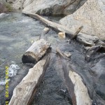
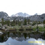
 And so we finally made it to Rae Lakes, where the lakes were not frozen, big fat trout were hanging out right by the shore, and Dragon Mountain  provided a dramatic backdrop. We scrambled across the “log jumble bridge” between the lakes–it was pretty scary (there were a lot more logs in 2005)– but with some help from Bill, I managed to do it.  Then we headed out, still dealing with hunting for trail-in-snow, and tried to hike faster, to make up for all the time I’d lost creeping over the pass.   On the way, we met another helpful ranger who had tips for us about Pinchot Pass and some of the creeks up ahead.  We also passed a large group of backpackers who’d already stopped for the day.  Turned out they were doing a trip which began at one of the Cedar Grove trailheads, went up over Glen Pass, then back down to a different trailhead at Cedar Grove.  They were camped in a meadow that was absolutely loaded with mosquitoes.  I did not envy them, but they seemed to be having fun, mossies or no mossies!

We were determined to camp at Woods Creek,  remembering it as low (no snow!), flat and dry and pretty.  Our memories were correct!  There it was–dry ground, hardly any mosquitoes, and a LOT of campers!  We went off into the woods and found a wonderful spot to cowboy camp on soft pine needles with the roar of the river not far away.  So by around 7:30 pm, we were comfortable in our sleeping bags.  I decided to take some Advil PM because I was so sore and tired from carrying a heavy pack over so many obstacles.  It worked.  I totally zonked out.

Walk to Lórien: Enter the Doors of Moria after being attacked by the Watcher in the Water
28june2snowtrail28june3trail28june4water28june5snowmountains28june6mount28june7mountains28june8snowypass28june10rocks28june11rockssnow28june12pass28june13mountains28june14pass28june15montytrail28june16crossingcreek28june17crossingcreek28june18pondmountain

Friday, June 25 Miles today: 24.3 Total: 736

Friday, June 25th, 2010

25june1viewdark

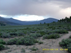
A lot of clouds came in last night and before we’d finished breaking camp at 5:00 am, they started dripping. ( Nothing serious, as it turned out).  A minute’s walk took us to the edge of the Beck Meadow branch of Monache Meadows.  It’s an awesome sight–a vast green meadow with white Sierra peaks on the horizon.  As we entered it, the “bit of drip” from the clouds turned into hail!  I had my umbrella up, so just stepped under a tree to wait and see if the hail would become a problem (it didn’t), but poor Bill had stuffed his raingear way down at the bottom of his pack (he didn’t consider the bit of drippiness to be worth putting on a rainjacket) and it was a major project for him to rummage everything out, find the raingear and put it on, then repack.  By the time he was done, it had pretty much stopped raining!  
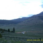
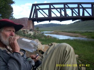
Our first goal was  “breakfast at the swallow bridge!”  so we chugged right along up and down through the woods, till we were out in the meadow again and could see the Kern River down below.  As I expected, when we got to the bridge, there were lots of thruhiker tents!  Camping by the bridge is not a bad idea, because so many swallows means there are NO mosquitoes!  We could eat our breakfast in peace and watch the swallows feeding their babies who were tucked in nests under the bridge.  Most of the other hikers were just starting to get up. 

25june4bridge

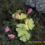
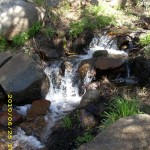
The PCT took us out across sagebrushed meadows (no cows this time–we did see plenty of cows in 2005).  Huge yellow primrose-type flowers were blooming  along the trail.  We headed up Cow Canyon, where we got lost in 2005 because the cow trails and the PCT looked so much alike.  No problem this time–the PCT route was very distinct.  It does crisscross Cow Creek several times, and that was part of what confused us in 2005.   The creek was running well and was very pretty.  But oh, man, it’s a long, long climb, all the way up to 10,500 feet.  Our packs are so heavy that we had to stop and rest more often than usual.

Finally we reached the big downhill to Gomez Meadow.  The mountains here are very rocky and have many dramatic cliff formations  that look sort of like a mini-Yosemite.  We’d planned to get water at Gomez Creek, but oh bummer–it wasn’t a creek, it was a marsh, and the water looked gross.  We sighed and pushed on to Death Canyon Creek, which turned out to be a gorgeous place! Not only is the creek clean, but there’s even a “swimming hole” (well, bathtub size, actually) right near the PCT.  If it were a warm day, we would have jumped right in, clothes and all, but today has been cloudy, windy and chilly.   We settled for taking a nice Snickers break instead, and we took on 3 liters of water each–we were worried about dehydrating at this higher altitude.  I groaned when I put my pack back on and faced the killer climb out of Death Canyon, back up to 10,700 feet.

25june11rocks

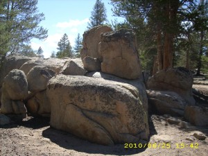
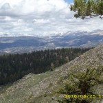
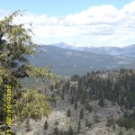
But even though the climb was hard, it was worth the effort!  The rock formations along the trail grow more and more impressive, and the trees look like enormous bonsais with reddish-brown bark.   Views at the top are unbelievable— thousands of feet down to the Owens Valley. We had to hike “overtime”— past 7:00pm— along the steep mountainsides before we could reach a saddle with flat places to camp.

 The mosquitoes were waiting for us, and the clouds looked a bit threatening, so we rigged both tarp and net tent.  It’s a nice quiet forest here, out of the wind, and not too chilly.  It felt great to be inside away from the mosquitoes, but I thought about the snow patches we’d started seeing by the trail and wondered what it would be like in lots of snow.  Tomorrow we also face our first “snowmelt creek” crossing at Rock Creek.  It will be my first High Sierra early season creek crossing, and I am a bit worried about it.  Boy does it feel good to be horizontal!  Bill and I are both totally tired out.

Walk to Lórien: Climbing up base of Redhorn

25june2viewdark25june3bridge25june5flowers25june6trail25june7view25june8view25june9trail25june12trail25june10mountain25june13rocks25june15vista

Thursday, June 24 Miles today: 17.7 Total: 712.7

Thursday, June 24th, 2010

24june2sign

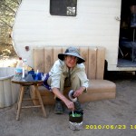
Well, I guess we’ve switched from being “hiker trash” to being “trailer trash” because we really enjoyed our one night in the cute tiny trailer at Tom’s place. Breakfast time saw more hikers coming in and lots of hikers leaving to tackle the Sierras (once they finished their pancakes and coffee!)  The main conversation topics were 1)”What I plan to do when I reach Canada” and 2)Microspikes vs. instep crampons for the Sierra snow.  One of the hikers, named “Jackalope”, has an ice axe he made himself from a wrecked titanium racing bike.  It was very ingenious, and we told him he should have entered it in the “Homemade Gear” contest at the ADZPCTKO. But he’s a very modest guy, so he said no.

After breakfast, Bill started reading a true spy tale by a Brit named Peter Wright.  I took awhile working on the loads in our packs, trying to make the food bag weights equal.  I’ve noticed that with many guy/gal hiking teams, the the guys end up carrying WAY more weight than the girls.  Bill and I don’t do that.  He does carry a little bit more weight than I do, but not much more.  I also worked on solving the puzzle of why for the last couple of days my right shoulder has been sore.  Could be that it’s protesting having to carry more weight in order to give the sore right hip a rest?  Anyway, I rigged a setup that may help.

Then we went to the store to hang out for awhile till the chuckwagon opened, and I ended up helping a couple who had just come in. (They recognized us from reading our blog.)  I hustled the wife in to sign up for laundry so she wouldn’t have to go through what I went through yesterday.   Then we got a big juicy double burger and cheeseburger and lemonade and sat on the porch figuring, “Well, this is it–our last meal before we head out!”  We enjoyed talking to the other couple–they came all the way from Florida to do the PCT!  And they are loving it!

24june5couple After lunch, we headed out for the Kennedy Meadows campground, where the plan was to meet with Miwok and his dad (who were camped there) and visit for awhile before we got back on the trail.  But there was no sign of them anywhere.  We walked through the whole campground, looking for them, and no luck, so we signed the trail register and included a note to let Miwok know we’d tried to find him.  Then we started out. 

I felt very excited and very scared and weirdly enough, very peaceful, all at the same time. All the hikers had been talking about “big snow”, “river crossings”, etc, and I was wondering “Can I do this?”. Bill and I prayed as we began for safety and wisdom all along the trail, and up we went, following the Kern River as it wound its way through banks edged with willows and roses and wildflowers.  It’s really pretty here with the roaring river and the trees, flowers, etc.  We met a very disappointed fisherman, though.  “No luck at all,” he sighed. 

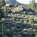
24june6trailUnfortunately, we eventually found ourselves in ANOTHER burn zone with no regrowth.  Bummer.  We stopped for supper after crossing Crag Creek.  The trail was slowly getting more “Sierra-ish”, with rocks and rock formations, and much more rocky on the trail itself.  After another hour, at around 6:30 pm, we were at the edge of Beck Meadow and decided to stop, even though it was early.  We figured that this was a good camping place because it had  lots of trees, flat ground, and a little creek to rinse dirty socks in. Perfect!  And the mossies, though plentiful, were not outrageous.  So we set up the tarp & net tent, washed ourselves and our dirty socks in the creek and nipped into the tent before the mossies could get us!  (I should mention that when I say we “washed”, that does NOT EVER include soap of any kind.  We never take any soap products with us when we backpack, ever.  We don’t want to mess up any mountain lakes or creeks!)

Since it was still relatively early, we were able to enjoy watching the sunset, and spent quite awhile discussing our water plans for the next day.  I generally do this every night once I’m in my sleeping bag.  I look at water sources, how far apart they are, and make calculations as to where to get water and how much water to take.  We do not like carrying extra water if we can avoid it!)  Then it was time to lay our heads down for a lovely quiet evening in the woods.  I wondered sleepily, “When will we hit our first snow?”

Walk to Lórien: Winding up into hills near Redhorn

24june1buildings24june3trees

Wednesday, June 23 Kennedy Meadows Miles today: 1 Total: 702.8

Wednesday, June 23rd, 2010

23june3hikers

We should have rigged the tarp last night, because when we woke up, our sleeping bags and gear were covered with frost, and my drinking tube had frozen. Welcome to the Sierras!  But we were thinking “Hot breakfast!”  and wasted no time heading for Kennedy Meadows.

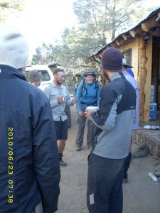
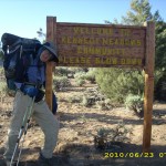
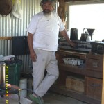
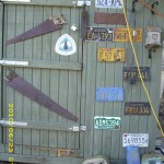
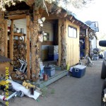
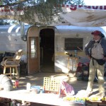
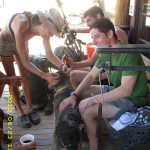
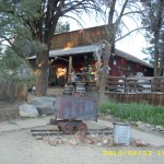
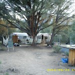
Not far from the store, a hiker hailed us from a motley collection of trailers down below the road. “Ho! How ’bout some coffee?”  We wasted no time on coming down the little embankment to where he was standing.  And that’s how we arrived at Tom’s Place, which is now an important part of the Kennedy Meadows “vortex.”   It turned out that the Kennedy Meadows “chuckwagon” is closed on Wednesdays, but Tom, who lives just down the road with his collection of trailers, has stepped in to fill the gap, and does a great job of feeding the  hungry hikers. And there were hordes of them— all scarfing up Tom’s great coffee, and later, his equally awesome pancakes.

23june8bill

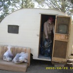
Tom told us we can sleep in one of his trailers tonight, if we want, so we picked out a really cute little one and left our packs there before going to the store to sign up for laundry and showers so we can get clean. I did learn one thing, though.  When it’s primo thruhiker season at Kennedy Meadows (which it is, right now!), you need to get yourself signed up on the laundry list ASAP!  There were already so many names ahead of us that I almost despaired of whether we’d be able to do our laundry today or not.  As it turned out, we did get our turn, late in the afternoon–whew!

It was a warm, breezy day— we planned to just rest and eat as much as we could. Got a good laugh out finding out the origin of the wild rumour somebody was spreading on the trail about a “fearsome river crossing before Kennedy Meadows!”  It seems that what actually happened is that somebody tried to toss his pack across a creek, missed and the pack got all wet. Somehow that morphed into “scary crossing— a guy’s pack got swept away!” Just shows you can’t believe everything you hear!

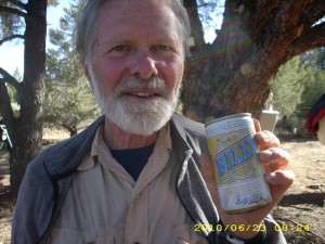
For dinner, we went back to Tom’s Place, where Tom had a big batch of spaghetti waiting.  Oh yes!   And of course there was beer.  We only drink one beer each (unlike many hikers who go for a lot more) and we were highly amused to find one labelled “Bill’s”.  Seriously, that is the brand name!  I also loaded up our packs with all the stuff for the High Sierras.  It involved 9 + days of food, Microspike crampons for me, and my ice axe.  And bear cans!  After I’d stuffed my pack, I almost dreaded even trying to pick it up.  I was sure it would be unbearably heavy.  But to my surprise,  though it was heavy, it wasn’t outrageous.  That was very encouraging!

Of course we also got lots of snacks and ice cream at the Kennedy Meadows store, and lounged around there talking to the “locals”, who are a lot of fun…a bunch of old retired guys who look like they are former prospectors.  Actually, they’re not, but they sure look the part.  All of them were bemoaning the fact that there’s no more Saturday Night Movies allowed at Kennedy Meadows.   Some annoying lawyer type person came and said the movie night was illegal and that if they wanted to continue it, they’d have to pay some astronomical fee.  So no more movies.  Bummer.  The only thing that happens now in the movie amphitheatre is a once a month church service.  Well, that’s a good thing, but the movies were like the social gathering for the whole valley, and everybody (including the hikers) is very sad that they are no more.

There was a lovely sunset,  and some of the hikers started a campfire.  Bill and I decided we’d rather just rest, so we headed for the nice soft bunk in the little trailer.  No frost on us tonight!


Walk to Lórien: Being tracked in Hollin

23june1sign23june2trail23june4inside23june5wall23june6outside23june7outside23june9hikers23june10trailer23june11trailer23june12cabin23june13trailers