Archive for the ‘CA Sierras – H’ Category

Sunday, July 4 Vermilion Valley Resort Miles today: 4.6 Total: 877.2

Sunday, July 4th, 2010

4july4lakeboat

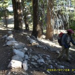
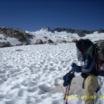
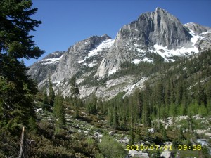
It was very cold last night, but nice and clear, with lots of stars. I should mention how grateful I am for the glorious weather we’ve had in the Sierras so far. Today was no exception— beautiful! We walked down the famous “53 Switchbacks” and I was just plain enjoying myself.  In 2005 I was all worried about missing the ferry to VVR.  This time I said, “Oh, whatever!  If we miss the ferry I’ll just walk on in.”  Bill was planning to walk into VVR anyway, instead of taking the ferry.  I am feeling much better–in fact, I’m hungry, and thinking about all that great food at VVR!  I guess the GSE is working!  And last night I finally figured out the lower leg rash problem we’ve been having.   Duh–it’s “diaper rash”–the result of having constantly wet pant legs rubbing on the skin.   A day at VVR with dry pants and sunshine should be a big help! 

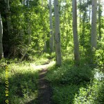
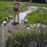
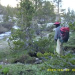
About halfway down the hill, the PCT goes through a lovely aspen forest.  Many of the whitebarked trees have names and dates carved on them.  Some of  the dates go back a LONG way!  But I didn’t spend too long looking at them, because in that damp greenness, the mosquitoes were pretty bad.  We had to ford two creeks, also–ow!  Our rashy legs are pretty sore!  We reached the bridge over Mono Creek, which was a whitewater roar.  I stood looking at it and thinking, “Tomorrow we have to ford that.  Yikes!”  Since the morning was starting to warm up, I stopped to take off a layer of jacket, and got instantly swarmed by the mossies.  I guess that as long as you keep moving here, you’re OK, but if you stop, they get you!

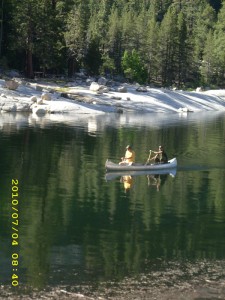
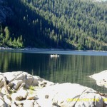
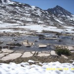
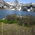
The one & 1/2 mile trail to the ferry seemed longer than it was.  It goes uphill and downhill, and one whole section of it was just plain turned into a swamp.  We had no choice but to slog through the mud.   But finally we reached the ferry turnoff and Bill headed on, following the 4.5 mile trail to VVR.   (He didn’t want to wait 1.5 hours for the ferry). I went to the lakeshore and tried to figure out where the ferry landing was.  Everything looked different from 2005, since the lake level now is much higher.  I saw two fishermen across the way, so I went over to ask them where the ferry came in.

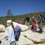
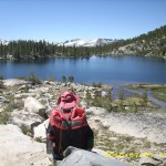
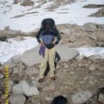
Neither of the guys  knew where the landing was, but one of them looked at me very kindly and asked, “Have you had any breakfast?  Would you like something to eat?”  Wow!  Trail magic!  I guess I looked sort of starving??  It turned out that the guys were basically living on tortillas and meat, so that’s what they gave me–a great big tortilla stuffed with a couple of different kinds of meat. Oh yes!  I thanked them very fervently and went back to where there was a big rock with a lake view,  lay down, using my backpack as a pillow, and slowly ate the wonderful tortilla.  Then I just closed my eyes and rested.  I was so tired!   Little groups of hikers were gathering around me, chatting and talking as they waited for the ferry.  They were all JMT southbounders.  I listened carefully to their discussions of what they’d been through so far, because that’s where Bill and I will be next.  

4july10table

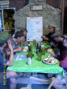
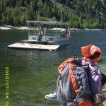
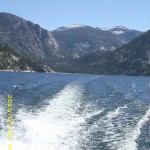
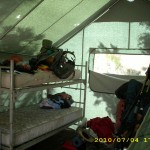
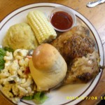
By the time the ferry arrived, there was quite a crowd of JMT’ers, fishermen, and me, the lone PCT hiker.  The VVR dog was also along for the ride.  Apparently he loves going on the ferry, and leaps eagerly aboard whenever the “captain” heads out.   It turned out that  Bill had beat me to VVR.  The first thing we did was to claim two bunks in Tent 4, and leave our packs there.   My appetite is back, and we enjoyed a great breakfast, then chores (showers, laundry, etc).

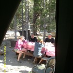
Once Bill and I were clean, we put salve on our very sore legs, and set our wet shoes out in the sun to dry.  So did all the other hikers!  The Tent 4 deck had rows of drying shoes!  There are a couple of picnic tables by the tent, and those tables are like the hiker trash social center.  Hilarious and interesting conversations are the order of the day!   But I was so totally exhausted that I spent every spare minute collapsed on my bunk and listening in on what was said, rather than joining in, as I would have loved to have done.

At around 2 pm,  Bill and I took a “pie break” and each got a huge, delicious slice of pie a la mode from the famous VVR pie menu.  I was feeling a little more rested, so I dived into the hiker barrel to see what I could find, foodwise, to get us to Red’s Meadow.  Bummer–there wasn’t much.  I guess it’s just too early in the season.  So I had to buy some stuff at the store.  I was hoping to find some fruit (even canned would be OK) but no luck, so I asked the clerk, and voila!  More trail magic!  She told me SHE had some fruit, and to come back later and she’d give it to me!  Wow!

 But then, sigh, I was sick again— it seemed like everything I had eaten  just went straight through. I was hungry, though— no nausea. Bother! Just when I thought I was well again. I hated to take any Flagl, because I figured it was more important for Bill to be well.  If we hit nasty stream crossings or snowcovered passes, I really do need his help, and if he were sick because we ran out of Flagl, that would be very bad.  But we counted our Flagls and decided we had enough to share and still make it to Mammoth. I ate the 4th of July BBQ dinner (wonderful!) and we enjoyed the conversation of other hikers.  Ialso reconnected with the kind clerk lady, who gave me canteloupe and grapes!

After that, the other hikers sat up till late around the campfire, laughing and talking and playing guitars,  but we went to bed.  That’s one bummer about being old.  We just don’t have the energy to hike all day and then sit up late.  But it was fun, before I fell asleep, to hear the happy hiker noise!  I am very grateful we’ve made it here safely.  In two days, we’ll be at our resupply in Mammoth!

Walk to Lórien: In meadows near the edge of Lothlórien

4july1treesgreen4july2rockstrees4july3lake4july5lakeboat4july6hikers4july7lakecrossing4july8camping4july9bunks4july11foodplate4july12person

Saturday, July 3 Bear Creek Miles today: 18.2 Total: 872.6

Saturday, July 3rd, 2010

3july3flowers

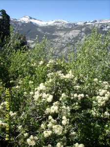
Bill and I both totally zonked last night and slept like logs. “Amazing!” Bill said. “I didn’t even hear the river roaring!” Our long climb up to Selden Pass was enlivened by what I decided to call a “sage hen convention.” We saw several of them on the trail, and heard them drumming in the woods. Bushes in full bloom were hanging over the trail, and smelled very sweet.  Everything was very wet and muddy, though.
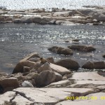
We reached lovely Sally Keyes Lakes, where big fat trout swim within easy reach, and several people were camped.  We were amazed at the trout.  “You could catch them with a net!” I said.  “No need for a pole, hook ‘n bait!” 

3july5logcrossing

Heart Lake (higher up) was frozen over, and we fought our way through snow again, with the trail appearing and disappearing, till we finally reached the top at noon. Getting down was tough— lots of snow and hard to find the way, since the trail stays fairly high up for some time, and there was no reliable trail of footprints.   And I had the added dread of knowing that Bear Creek, one of the most horrendous fords of the High Sierra, was just ahead. But we met a hiker who told us the ranger had put up a rope to help hikers get across.   That gave me a bit of hope, and sure enough, when we reached rushing Bear Creek,  just downstream from the trail crossing, there it was–a nice rope tightly strung across the wide, roaring water, for hikers to hold on to.

Note from Alexa: The great irony of this is that, as you see below, the Walk Middle-earth mileage for this day was using ropes to get across a scary creek crossing in Lórien! Creepy!

3july13rocksmountains

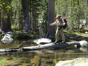
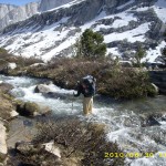
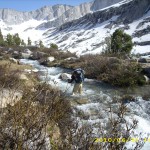
At first Bill said he would just cross with his trek poles, but then he decided to use the rope.  So he went first and I watched.  The water was just below waist deep on him, and obviously, the worst part was on the far side. With my trek poles lashed to the top of my pack, and everything else secured for a nasty crossing, I ventured in.  The water was moving fast, and was waist deep on me.  Using the rope was quite different from using trek poles. With trek poles you are always leaning INTO the current.  With a rope, you need to keep the rope taut so that it can steady you, and that means you are sort of pulling BACK from the current instead of stepping forward and leaning into it.  After all my trek pole crossing practice, this felt sort of counterintuitive, but I managed OK till I got to the far side where I’d noticed even Bill was having difficulty.  It was baaaaaaad!  I yelled for some help, Bill came back into the river to steady me  a bit and I made it. I LOVE ropes!   And I sure am glad Bill is here, too!

 Then we tried to hike on as fast as we could, to be able to reach Vermilion Valley Resort tomorrow. From Bear Creek on, the mosquitoes were just awful–we had to eat our supper under headnets, wearing raingear– and even though we made it almost to the top of Bear Ridge before camping, we still had to rig the net tent. I am feeling better— maybe the GSE is working!  I was actually hungry at suppertime, and could eat with no problems!   VVR, here we come!

Walk to Lórien: Crossing the Silverlode on ropes

3july1trailtrees3july2grass3july4trailgreen3july6lakeview3july8trailrocks3july9montysnow3july10snowrocks3july11signtrees3july12treesmountain3july14rocks

Friday, July 2 Evolution Creek Miles today: 16 Total: 853.9

Friday, July 2nd, 2010

2july3stonehouse

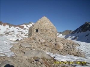
We were all warm and comfortable last night in the Muir Hut, even though the outside temperature dropped to below freezing.  The two brothers left at 4:30am.  It was still very early, and I watched out the little window by my “sleeping ledge” as their tiny headlamps departed into the darkness.  Bill and I waited a little longer, before getting up at 5:15, because we figured that everything would be very hard and icy, plus the light was so dim it was hard to see where the footprint trail went. 

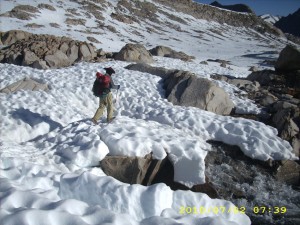
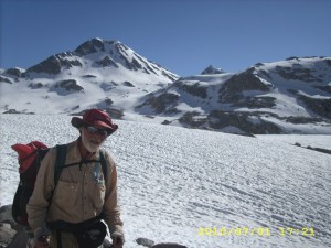
Once we were ready to go, Bill put on Yaktrax and I wore my Microspikes. The whole scene looked like Antarctica, and it was 30 degrees. Brrr!  We were very glad of a well-established “footprint trail” to follow, because the snow here has melted into “suncups”, which makes it like trying to walk on a giant eggcarton with 1-2 foot deep “cups”, all hard and icy. Breaking a trail over suncups is very tough— we were glad it wasn’t us!  And in the shadow of the mountains as we were, the snow was VERY icy indeed. 

2july6eggcups

Down, down, we went, till the trail went around a big bend in the valley and the snow wasn’t quite as all-encompassing.  We began to encounter snowmelt creeks, which we crossed on snow bridges. Eventually we were in the sun again.  Hooray–the snow almost immediately began to soften up.  It is amazing how fast snow changes from hard ‘n icy to soft ‘n fluffy!  Of course I put my black headnet back on. 

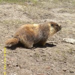
The scenery all around us was breathtaking.  I kept wanting to stop and just drink it in, but Bill as usual was way out ahead and I had to do my best to keep up.  Whoever made the footprint trail was definitely an “islandhopper” who headed for every bit of bare rock he could find.  I am a bit leery of rocks now, after two bad posthole experiences, so I actually tried to steer clear of the rocks.  This meant I had to break my own trail around them, and sometimes that made for slow going.  I got quite a nice little entertainment at one point, though, which I HAD to stop and watch!  It was a marmot, trying to cross a snowmelt creek.  Marmots look a bit rolypoly and not very athletic, but wow, turns out they are really good jumpers, and very agile!   That furry little guy managed to rockhop all the way across the creek without getting wet.  Some of his leaps were absolutely amazing!  I cheered when he made it across!

We were making pretty good progress through all the snow, steadily heading down the hill.  I just kept plugging along, following Bill, till suddenly he stopped.  I caught up with him, and he said, “Something’s not right. That looks like the trail–on the other side of the lake.”  I hadn’t been paying attention much–just following Bill, and now I realized in horror that yes indeed, in all the snow we missed the turnoff to where we were supposed to cross upper Evolution Creek, followed by walking along the OTHER side of the lake.  

Oh no!  Very sadly, we turned around and headed back UP the hill we’d just come down, looking for the trail crossing.  We could not find it.  (Hikers later told us that the crossing, which is a line of huge steppingstones, was completely buried.  No wonder we didn’t see it!)   Finally Bill said, “We have no choice. We’ll just have to ford the creek.”  I was terrified. The “creek” was roaring and very wide.  The place Bill chose to cross looked deep.  Downstream a little way it looked wider and shallower.  I suggested that we should try to cross there, but Bill was adamant.  I tried my best to summon up all my courage and face that crossing, but I just felt like I couldn’t do it, and to Bill’s disgust, I started to cry.  I cried not just because I was so scared, but ironically, because I was so angry with myself for being scared.  I was also angry with myself for not being cheerful and brave!  Oh man!  The result was tears.  I know, I know, it’s totally illogical…and that made me even more angry at myself.

  But Bill put his foot down and said, “Let’s go, we HAVE to get across this thing. ” So I forced myself, sniffles and all, to put my gear into “nasty streamcrossing mode”, then since it looked pretty bad, I did not try to cross by myself, but sidestepped BEHIND Bill, holding on to his pack.  That way, he took the brunt of the roaring, freezing water. Yikes! But we made it, and not only that, but the snow was rapidly less and less, so it wasn’t long before we were hiking on green grass around Evolution Lake. 

Halfway along the lake, we stopped for lunch, very frustrated that it had taken us all morning to cover just 5 miles.  But the sun was warm, the grass was soft & comfortable, and pretty soon we were laughing at the marmots who literally surrounded us on all sides, obviously scheming on how to steal our food.  Bill and I practically had to sit back to back to protect our stuff, since the marmots were coming in from every direction!

Then we switchbacked way down to the Evolution Creek valley and lovely McClure Meadow.  It was gorgeous.  The blue creek wandered along through lush meadows.  Snowcapped mountains were all around.  Quite a few people were camped in the woods there.  A little way before the trail crossed Evolution Creek (another famously fearsome ford), there was another “ranger note” posted by the trail.  It said, “Evolution Creek is chest deep at the official crossing.  I recommend an alternate place upstream–follow the trail of upright sticks to reach the alternate.”  

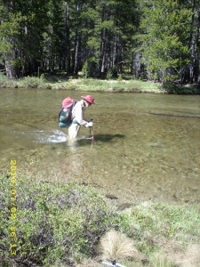
Yikes!  Chest deep sounded nasty.   “Whose chest?”  I wondered.  “Was he six feet tall or five feet tall?”  We lost no time in following the stick trail through the woods, till we were standing on the bank of Evolution Creek.  The creek was pretty wide, but it was obvious that the deepest part was right below where we were standing.   I lowered my trek pole into the water to check the depth.  Thigh deep!   No problem!  And it wasn’t rushing and roaring, just moving along nicely!   Bill and I crossed easily, with no problems.

2july16creekcross

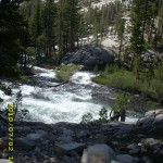
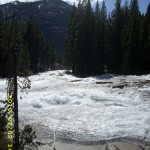
 On we went through the woods, till we were back on the PCT/JMT again.  I found it fascinating how quickly a river can change!   In McClure Meadow,  Evolution Creek just flows peacefully along, but just after the official trail crossing, it begins to plunge down the canyon, and instantly becomes a whitewater foaming ROAR.  Looking at it, you’d never dream that it was easily fordable just upstream.

More switchbacking took us down to the South Fork of the San Joaquin with its nice BRIDGE (I LOVE bridges!) where we stopped and tried to eat some supper.  Neither Bill nor I could eat much.  We both still feel rather sick.  I have been dosing myself with
GSE all day, hoping to cure whatever it is I have.  I tried to tell myself that eating so little and exerting myself so much was bound to create problems, and tried to force myself to eat more, but I just could not do it.  So our supper break was really more of a rest break than anything else!

We pushed on again for another 3 miles or so, before finding a nice place to cowboy camp near the river.  A bit of breeze was blowing, so there were no mosquitoes.  I was very tired, but cheered up when I calculated our mileage.  Despite the slow start in the snow this morning, we still managed to get 16 miles done!  And what a contrast of scene today–starting in Antarctica, and now here, on a warm evening, with green plants and trees everywhere.  The only concern I have left is that I continue to feel so ill and increasingly weak.  On the bright side, we certainly will have no problem of running out of food!   Bill and I have eaten so little that we have plenty left!

Walk to Lórien: At the first leaves of Lothlórien, near the Nimrodel

2july1bricks2july2blockedupstone2july4snowwalking2july5snowwalking2july7montyheadcovered2july8montyrocks2july9snowfield2july10snowmelt2july11creek2july12rockysnow2july13lake2july14critter2july15meadowvalley2july17creek2july18snowview2july19greentrees

Thursday, July 1 Muir Pass Miles today: 14 Total: 837.9

Thursday, July 1st, 2010

1july4viewrock

I summarized today in my journal by writing, “Climbed Muir Pass today. It was like Antarctica.   Miles of snow, rockclimbing and routefinding.”

Well, we headed out at 5:30 am from our nice campsite by Palisade Creek.   Bill and I both slept very well, but we were still tired because it’s just plain been killer hiking for several days, and Bill was still battling some sort of giardiaish bug.  And I have a really bad sunburn from the snow, so I resolved today to wear my black mosquito headnet whenever we are hiking across snowfields! 

 The day’s hiking began with a long and beautiful climb up alongside the Middle Fork of the Kings River, which roared so loudly we had to shout in order to talk. The trail was constantly either wet, muddy, or crossed by little snowmelt creeks.  But oh, wow, the scenery!  Spectacular cliffs, snowy mountains!   Supremely Sierra!  Big Pete Meadow was actually a lake, the river was so high.  I don’t know how the “I wear Crocs for stream crossings” people ever manage here in the Sierras in early season.  The trail itself was a boggy creek.  But the meadows were so pretty!

1july11snowrocks

 It’s a long, determined climb up to Muir Pass and its accompanying lakes.  By noon, Bill and I were both wiped out and spent most of our lunch break just lying down.  Now I was a bit worried about ME–I was starting to feel sick, giardia-style, and could not face eating anything much.  Neither could Bill.  I did not tell Bill I was feeling sick, because I did not want him to worry.  I just told him I was awfully tired, which was true.

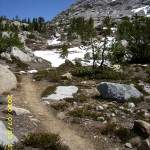
Continuing on, we met a young couple sitting by the trail, debating whether to go on, or not.  Since it was now afternoon, they were worried about postholing problems in the miles of snow just up ahead.  We left them still debating, and pushed on.  Soon the snow became more and more of a factor until by treeline, everything was solid snow and we were back to just guessing where the trail went.  However, there was a pretty good “footprint trail” to follow, which did what I call “island-hopping”, because it went from one big rock to the next instead of just going straight up.  I was very pleased because I felt I was getting better at hiking on snow.  But at the same time, I was concerned because I was feeling increasingly ill. 

When we reached Helen Lake, we found it completely frozen over and shortly after that we came to a point where we had to decide which way to go. Tracks led 2 totally different ways. It was after 6:00pm and getting cold— the snow was starting to “ice up”. Bill and I were totally worn out.  Neither of us had been able to eat much all day.  I thought Bill would know exactly where to go, because he has hiked this pass before so many times, but it turned out that he had no clue.  We got out our maps, looked at landmarks, looked at the two radically different footprint trails, and started out again.  Just after we started out, the snow collapsed under me and I ended up in a MAJOR posthole, with BOTH my feet completely iced in.  I was so tired and and so ill that I did cry for a minute before taking off my pack and digging myself out.  It took about 20 or 30 minutes. 

1july14snowhouse

The delay gave Bill time to make a decision about where to go,  which involved another “straightup” climb up a pretty steep face. I was so tired that I sort of cried again as I set out after him, and sort of “snuffled” my way along for awhile as we started up. The wind was blowing and it was very cold.  The snow was really icing up now, but still do-able.  Bill was quickly far ahead and eventually I couldn’t see him anymore. It was just me ‘n my ice axe and much prayer for strength and courage to “make the top”.   Then I heard a faint shout from Bill.  I couldn’t make out what he was saying (Turned out he was yelling, “The Hut!  The Hut!”)  Finally the snow stopped going up— it rounded off, and to my joy and delight, there was Muir Hut, glowing golden in the evening light.

There was no way to go on–miles of uninterrupted snow lay ahead.  When I stepped inside the Hut, I cheered!   It was warm and cozy!  The sun had been shining on it all day, and the stone had soaked up all that nice heat!  Oh man, it felt wonderful!  We laid out our sleeping bags on the stone ledges inside, then went outside to fire up our little alcohol stove to make some hot beef broth to drink.  Neither of us could face eating anything, but we agreed a hot drink would be wonderful.  I was just in the middle of doing the beef broth, when along came  two young men, brothers hiking together. They told us they did Mather Pass this morning, and here they were at Muir already!   Way to go!  They told us they were on a tear to reach Mammoth in time for 4th of July.  So we all slept in Muir Hut tonight, very comfortable and warm,  with a lovely sunset.  I felt so blessed!

Walk to Lórien: Arrive at Balin’s tomb in Moria and are attacked by Orcs and a Cave Troll

1july1trailgreen1july2trailwater1july3trailview1july5viewmountain1july6flowers1july7viewrocks1july10snow1july9water1july12snowtrail1july13snowtrail

Wednesday, June 30 Mather Pass Miles today: 11.7 Total: 823.4

Wednesday, June 30th, 2010

30june4snow

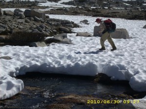
Another tough day!  It took us from 5:30 am till 7:30 pm to do only 11.7 miles!  We were climbing over snow most of the day, which makes for slow going.  This morning, a short walk took us to the South Fork of the Kings River. The ranger note yesterday said, “do not cross here— way too dangerous. Walk upstream to where the trail crosses back over.”  Yup, the river was obviously quite deep and was a  roaring torrent all the  way across.   Bill was still determined to cross it, however.  I begged him not to, but PLEASE to just walk up the near side as the ranger had advised. To my great relief, Bill finally agreed to follow the ranger’s suggestion.

Turned out that the “bushwhack” up along the south side of the Kings was very pleasant and easy and pretty, too. It isn’t steep and has a nice open feel to it, so we could admire the magnificent Sierra scenery.  Not only that, but it was not wet or muddy, and there were no big tributaries to ford.  If we had bullied our way across the river down below and determinedly stuck to the PCT, we would have had several more nasty creek crossings.  We could see those tributaries coming in from where we were on the other side, and commented, “I sure am glad I don’t have to ford THAT!” 

It was a good thing that the first part of the hike up to Mather Pass was not very steep.  Bill is still not feeling well at all.   He still has to stop and rest a lot, and can’t eat much.  He decided to start taking Flagl to see if it would help.  Eventually we reached the PCT again, well up toward the pass, and simultaneously were  back into the snow and playing “Where’s the trail?” The snow turned out to be a great benefit in one way, though–we could cross creeks on snow bridges and not get our feet wet!   I love snow bridges!

In retrospect, though, I should have realized sooner that walking on miles of snow without protecting your lower face from sunburn is really dumb!  I was so absorbed in just dealing with being terrified half the time that I didn’t even notice I was developing a pretty bad sunburn.   Bill has a beard, so there’s no problem for him!


30june6mountainpass

 We reached the foot of the pass (again, made very difficult by so much snow) and found quite a few other folks also heading up, more than we have seen on any of the other passes.  I could not believe that we’d caught up with so many of them after our slow going for the last couple of days.  Going up Mather is the steepest of all the passes, and very scary. Bill whizzed halfway up and sat there chatting with another hiker while I painstakingly “chopped in” every step I took with my faithful ice axe. I felt very bad about being so slow, and felt even worse when I got to the point where I could hear Bill and the other guy laughing–at ME!   “It is painful to watch, isn’t it?”  joked Bill, pointing at me, and the two of them thought it was very funny.  I know that guys like to give each other a bad time (it’s a guy thing, and normally I don’t care), but I was so scared and tired that it really hurt and I had to fight not to cry.  As soon as I got to the “breather spot”,  Bill took off again and I sat there feeling very low. 

Then a wonderful thing happened.   A young couple came happily climbing up the steps I had just chopped, with the wife rejoicing at how easy it had been for her “with these nice steps.”  She mentioned how worried she had been about the steep climb up Mather.   I didn’t pipe up with, “Well, you can thank me–I made those steps”,  but I was so blessed and encouraged!   I picked up my ice axe and tackled the next climb, feeling much more cheery! 

30june12waterview

Woo-hoo!  I reached the top at last.  Going down the other side of Mather is not as steep or scary.  It involved a mix of scrambling over snow and rocks.  Bill is always way faster than I am on this type of terrain, even when he is not feeling good.  I have to be especially careful when scrambling on rocks.  I don’t have the world’s best sense of balance, plus the challenges of wearing bifocals (makes it hard to judge distance) and I have rather floppy ankles.  So on rocks, I’m very cautious!  

But finally we made it down to Palisade Lakes, which were still semi-frozen.  The ice was breaking up, though,and there were cute little “baby icebergs” floating in the water.  I wish I had a picture of them, but we’d had a very nasty stream crossing just above the lakes that looked dangerous enough that I’d wrapped the camera thoroughly in plastic bags and set it high up in Bill’s pack.  Once we got across (all went OK!), Bill took off and was way ahead of me, so I had no camera available.  Too bad–those really were totally cute little icebergs!

Then it was down the famous “Golden Staircase” with its huge rock steps. I yelped a little at each step down, because my poor knees were already so sore from all the snow and rock scrambling.  I LOVE my trek poles–what a help they are when my knees are tired!  And seeing the green grass and forests in the valley below was also encouraging.  In 2005,  I cried a bit on this stretch out of sheer frustration at being so slow on the huge rock steps and rough trail.   I cried a little bit this time, too, for the same reason.  But those green meadows and trees were getting closer and closer!   I felt like I was “coming in for a landing” on an airplane!

 As soon as we were down in the valley, and back into nice dry forest,  we stopped and camped, completely wiped out.   It was 7:30 pm.  When we were doing our best to clean up before getting into our sleeping bags, Bill and I both discovered that we have a rash on our lower legs.  What could it be?  Sunburn-related?   Just being constantly wet?  At any rate, it does sting a bit.  I also realized, duuuuh! that I had a very bad sunburn on my lower face.   Tomorrow I will wear my black mosquito headnet when we come to snow.  That should help!  

Walk to Lórien: Reach the Guardroom junction in Moria

30june1creek30june2trail30june3trail30june5mountain30june7mountain30june8rockontop30june9rocks30june10creekpass30june11creekpass30june13views30june14treesview30june15trail