Archive for June, 2010

Friday, June 25 Miles today: 24.3 Total: 736

Friday, June 25th, 2010

25june1viewdark

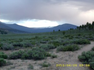
A lot of clouds came in last night and before we’d finished breaking camp at 5:00 am, they started dripping. ( Nothing serious, as it turned out).  A minute’s walk took us to the edge of the Beck Meadow branch of Monache Meadows.  It’s an awesome sight–a vast green meadow with white Sierra peaks on the horizon.  As we entered it, the “bit of drip” from the clouds turned into hail!  I had my umbrella up, so just stepped under a tree to wait and see if the hail would become a problem (it didn’t), but poor Bill had stuffed his raingear way down at the bottom of his pack (he didn’t consider the bit of drippiness to be worth putting on a rainjacket) and it was a major project for him to rummage everything out, find the raingear and put it on, then repack.  By the time he was done, it had pretty much stopped raining!  

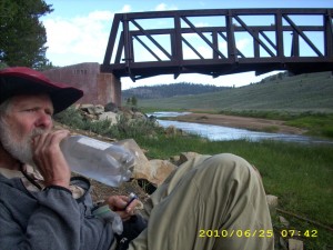
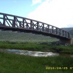
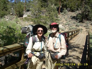
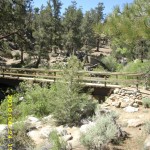
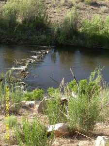
Our first goal was  “breakfast at the swallow bridge!”  so we chugged right along up and down through the woods, till we were out in the meadow again and could see the Kern River down below.  As I expected, when we got to the bridge, there were lots of thruhiker tents!  Camping by the bridge is not a bad idea, because so many swallows means there are NO mosquitoes!  We could eat our breakfast in peace and watch the swallows feeding their babies who were tucked in nests under the bridge.  Most of the other hikers were just starting to get up. 

25june4bridge

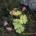
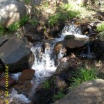
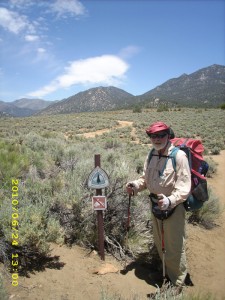
The PCT took us out across sagebrushed meadows (no cows this time–we did see plenty of cows in 2005).  Huge yellow primrose-type flowers were blooming  along the trail.  We headed up Cow Canyon, where we got lost in 2005 because the cow trails and the PCT looked so much alike.  No problem this time–the PCT route was very distinct.  It does crisscross Cow Creek several times, and that was part of what confused us in 2005.   The creek was running well and was very pretty.  But oh, man, it’s a long, long climb, all the way up to 10,500 feet.  Our packs are so heavy that we had to stop and rest more often than usual.

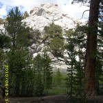
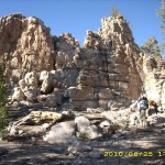
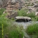
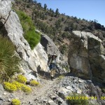
Finally we reached the big downhill to Gomez Meadow.  The mountains here are very rocky and have many dramatic cliff formations  that look sort of like a mini-Yosemite.  We’d planned to get water at Gomez Creek, but oh bummer–it wasn’t a creek, it was a marsh, and the water looked gross.  We sighed and pushed on to Death Canyon Creek, which turned out to be a gorgeous place! Not only is the creek clean, but there’s even a “swimming hole” (well, bathtub size, actually) right near the PCT.  If it were a warm day, we would have jumped right in, clothes and all, but today has been cloudy, windy and chilly.   We settled for taking a nice Snickers break instead, and we took on 3 liters of water each–we were worried about dehydrating at this higher altitude.  I groaned when I put my pack back on and faced the killer climb out of Death Canyon, back up to 10,700 feet.

25june11rocks

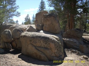
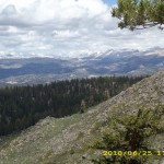
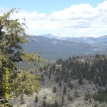
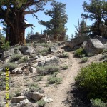
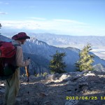
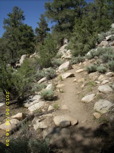
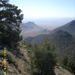
But even though the climb was hard, it was worth the effort!  The rock formations along the trail grow more and more impressive, and the trees look like enormous bonsais with reddish-brown bark.   Views at the top are unbelievable— thousands of feet down to the Owens Valley. We had to hike “overtime”— past 7:00pm— along the steep mountainsides before we could reach a saddle with flat places to camp.

 The mosquitoes were waiting for us, and the clouds looked a bit threatening, so we rigged both tarp and net tent.  It’s a nice quiet forest here, out of the wind, and not too chilly.  It felt great to be inside away from the mosquitoes, but I thought about the snow patches we’d started seeing by the trail and wondered what it would be like in lots of snow.  Tomorrow we also face our first “snowmelt creek” crossing at Rock Creek.  It will be my first High Sierra early season creek crossing, and I am a bit worried about it.  Boy does it feel good to be horizontal!  Bill and I are both totally tired out.

Walk to Lórien: Climbing up base of Redhorn

25june2viewdark25june3bridge25june5flowers25june6trail25june7view25june8view25june9trail25june12trail25june10mountain25june13rocks25june15vista

Thursday, June 24 Miles today: 17.7 Total: 712.7

Thursday, June 24th, 2010

24june2sign

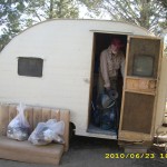
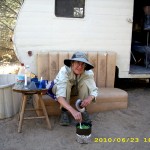
Well, I guess we’ve switched from being “hiker trash” to being “trailer trash” because we really enjoyed our one night in the cute tiny trailer at Tom’s place. Breakfast time saw more hikers coming in and lots of hikers leaving to tackle the Sierras (once they finished their pancakes and coffee!)  The main conversation topics were 1)”What I plan to do when I reach Canada” and 2)Microspikes vs. instep crampons for the Sierra snow.  One of the hikers, named “Jackalope”, has an ice axe he made himself from a wrecked titanium racing bike.  It was very ingenious, and we told him he should have entered it in the “Homemade Gear” contest at the ADZPCTKO. But he’s a very modest guy, so he said no.

After breakfast, Bill started reading a true spy tale by a Brit named Peter Wright.  I took awhile working on the loads in our packs, trying to make the food bag weights equal.  I’ve noticed that with many guy/gal hiking teams, the the guys end up carrying WAY more weight than the girls.  Bill and I don’t do that.  He does carry a little bit more weight than I do, but not much more.  I also worked on solving the puzzle of why for the last couple of days my right shoulder has been sore.  Could be that it’s protesting having to carry more weight in order to give the sore right hip a rest?  Anyway, I rigged a setup that may help.

Then we went to the store to hang out for awhile till the chuckwagon opened, and I ended up helping a couple who had just come in. (They recognized us from reading our blog.)  I hustled the wife in to sign up for laundry so she wouldn’t have to go through what I went through yesterday.   Then we got a big juicy double burger and cheeseburger and lemonade and sat on the porch figuring, “Well, this is it–our last meal before we head out!”  We enjoyed talking to the other couple–they came all the way from Florida to do the PCT!  And they are loving it!

24june5couple After lunch, we headed out for the Kennedy Meadows campground, where the plan was to meet with Miwok and his dad (who were camped there) and visit for awhile before we got back on the trail.  But there was no sign of them anywhere.  We walked through the whole campground, looking for them, and no luck, so we signed the trail register and included a note to let Miwok know we’d tried to find him.  Then we started out. 

I felt very excited and very scared and weirdly enough, very peaceful, all at the same time. All the hikers had been talking about “big snow”, “river crossings”, etc, and I was wondering “Can I do this?”. Bill and I prayed as we began for safety and wisdom all along the trail, and up we went, following the Kern River as it wound its way through banks edged with willows and roses and wildflowers.  It’s really pretty here with the roaring river and the trees, flowers, etc.  We met a very disappointed fisherman, though.  “No luck at all,” he sighed. 

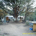
24june6trailUnfortunately, we eventually found ourselves in ANOTHER burn zone with no regrowth.  Bummer.  We stopped for supper after crossing Crag Creek.  The trail was slowly getting more “Sierra-ish”, with rocks and rock formations, and much more rocky on the trail itself.  After another hour, at around 6:30 pm, we were at the edge of Beck Meadow and decided to stop, even though it was early.  We figured that this was a good camping place because it had  lots of trees, flat ground, and a little creek to rinse dirty socks in. Perfect!  And the mossies, though plentiful, were not outrageous.  So we set up the tarp & net tent, washed ourselves and our dirty socks in the creek and nipped into the tent before the mossies could get us!  (I should mention that when I say we “washed”, that does NOT EVER include soap of any kind.  We never take any soap products with us when we backpack, ever.  We don’t want to mess up any mountain lakes or creeks!)

Since it was still relatively early, we were able to enjoy watching the sunset, and spent quite awhile discussing our water plans for the next day.  I generally do this every night once I’m in my sleeping bag.  I look at water sources, how far apart they are, and make calculations as to where to get water and how much water to take.  We do not like carrying extra water if we can avoid it!)  Then it was time to lay our heads down for a lovely quiet evening in the woods.  I wondered sleepily, “When will we hit our first snow?”

Walk to Lórien: Winding up into hills near Redhorn
24june1buildings24june3trees

Wednesday, June 23 Kennedy Meadows Miles today: 1 Total: 702.8

Wednesday, June 23rd, 2010

23june3hikers

We should have rigged the tarp last night, because when we woke up, our sleeping bags and gear were covered with frost, and my drinking tube had frozen. Welcome to the Sierras!  But we were thinking “Hot breakfast!”  and wasted no time heading for Kennedy Meadows.

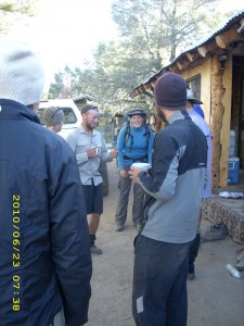
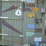
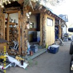
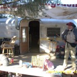
Not far from the store, a hiker hailed us from a motley collection of trailers down below the road. “Ho! How ’bout some coffee?”  We wasted no time on coming down the little embankment to where he was standing.  And that’s how we arrived at Tom’s Place, which is now an important part of the Kennedy Meadows “vortex.”   It turned out that the Kennedy Meadows “chuckwagon” is closed on Wednesdays, but Tom, who lives just down the road with his collection of trailers, has stepped in to fill the gap, and does a great job of feeding the  hungry hikers. And there were hordes of them— all scarfing up Tom’s great coffee, and later, his equally awesome pancakes.

23june8bill

Tom told us we can sleep in one of his trailers tonight, if we want, so we picked out a really cute little one and left our packs there before going to the store to sign up for laundry and showers so we can get clean. I did learn one thing, though.  When it’s primo thruhiker season at Kennedy Meadows (which it is, right now!), you need to get yourself signed up on the laundry list ASAP!  There were already so many names ahead of us that I almost despaired of whether we’d be able to do our laundry today or not.  As it turned out, we did get our turn, late in the afternoon–whew!
It was a warm, breezy day— we planned to just rest and eat as much as we could. Got a good laugh out finding out the origin of the wild rumour somebody was spreading on the trail about a “fearsome river crossing before Kennedy Meadows!”  It seems that what actually happened is that somebody tried to toss his pack across a creek, missed and the pack got all wet. Somehow that morphed into “scary crossing— a guy’s pack got swept away!” Just shows you can’t believe everything you hear!

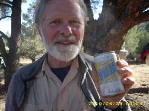
For dinner, we went back to Tom’s Place, where Tom had a big batch of spaghetti waiting.  Oh yes!   And of course there was beer.  We only drink one beer each (unlike many hikers who go for a lot more) and we were highly amused to find one labelled “Bill’s”.  Seriously, that is the brand name!  I also loaded up our packs with all the stuff for the High Sierras.  It involved 9 + days of food, Microspike crampons for me, and my ice axe.  And bear cans!  After I’d stuffed my pack, I almost dreaded even trying to pick it up.  I was sure it would be unbearably heavy.  But to my surprise,  though it was heavy, it wasn’t outrageous.  That was very encouraging!

Of course we also got lots of snacks and ice cream at the Kennedy Meadows store, and lounged around there talking to the “locals”, who are a lot of fun…a bunch of old retired guys who look like they are former prospectors.  Actually, they’re not, but they sure look the part.  All of them were bemoaning the fact that there’s no more Saturday Night Movies allowed at Kennedy Meadows.   Some annoying lawyer type person came and said the movie night was illegal and that if they wanted to continue it, they’d have to pay some astronomical fee.  So no more movies.  Bummer.  The only thing that happens now in the movie amphitheatre is a once a month church service.  Well, that’s a good thing, but the movies were like the social gathering for the whole valley, and everybody (including the hikers) is very sad that they are no more.

There was a lovely sunset,  and some of the hikers started a campfire.  Bill and I decided we’d rather just rest, so we headed for the nice soft bunk in the little trailer.  No frost on us tonight!


Walk to Lórien: Being tracked in Hollin

23june1sign23june2trail23june4inside23june5wall23june6outside23june7outside23june9hikers23june10trailer23june11trailer23june12cabin23june13trailers

Tuesday, June 22 Miles today: 25.2 Total: 701.8

Tuesday, June 22nd, 2010

22june7flowersmonty

I finally actually slept last night, even with the howling wind. I needed it badly! By morning all was calm and we found a great little sunpatch for breakfast in the pinyon pine forest.  All the trees were loaded with little fat green pinecones–looks like a good crop this year!

Pretty soon we were down in the little valley where we camped in 2005 and went through the worst storm I have ever experienced.  No bad weather today!  Then the PCT turns and heads into the Canebrake Creek Valley. There is one house there— 2 stories with an elegant pillared porch like a Southern mansion— out in the middle of the sagebrush. “Long way to the grocery store from there” was Bill’s comment.

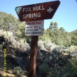
The sign that marked the turnoff for Canebrake Creek campground had a little note pinned to it by a disappointed thruhiker. It said, “I stayed at the campground last night.  There is no water and no camp host. 🙁 ”  We looked at the creek– it had very little water in it.  So we decided to just keep going and get water later.  Up and up we went on  the long, long climb to Trail Summit, with a stop at Fox Mill Spring to take on a full load of water. Some more hikers were there, just leaving. “Are you thruhikers?” they asked.  “Canada, here we come!” we fired back, and we all cheered.  One of them, a Brit, said, “Watch out–the mosquitoes are dreadful at the spring.”   “Well, that comes with the territory,” we said, while we took off our packs.

Fox Mill Spring has a trough for the horses,  but we wanted to get our water straight from the source, so we pushed aside the willows hanging over the spring itself, where the water was coming out of the hillside.  As we’ve been doing, we put six drops of GSE in each bottle, filled it from the spring, then dumped it into our platypuses.  We each took on a total of 3 1/2 liters of water, which is generally the most we ever carry at a time.  As it turned out, it would have been a good idea to get more.

22june8hikers

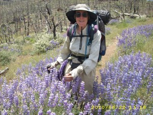
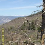
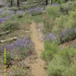
The climb continued, till we were in another burn zone. We were here in 2005 and expected a lot of regrowth by now. Nope— it’s still “just” wildflowers, especially lupines. They were often waist high on me, and the air smelled like perfume as we walked along. Bumblebees were buzzing around us. It was a very warm, humid day, so we were getting pretty sweaty. When we reached Trail Summit, wow!  Filling the horizon were the snowcapped Sierras!  The snow level looked like it was at timberline, which should be do-able for us (I hope–we will soon know!)  Then came miles of downhill going in and out of gullies as the trail wound its way down to Rockhouse Basin.  However, the wildflowers were awesome, and we had free entertainment overhead–military jets “playing” in the sky.

22june12water

At around 3 pm, we reached “the first creek in Rockhouse Basin”, where at last there was some shade–full of hot, sweaty hikers!  They were busy filtering water from the creek.  We looked at it and decided, “No, thanks!”–it was all colors of slime. Even with a filter, we wouldn’t have touched the stuff.  But we did get out a very melted Snickers each, and had fun meeting everybody.  That’s how we  met Miwok, who is originally from Petaluma!  A fellow citizen of  The Egg Capital of the World!  We compared notes with Miwok about where we’d done  training hikes for the PCT.  We generally go to Point Reyes Nat’l Seashore–turned out he generally went to Mt. Tamalpais and the Golden Gate headlands.

The Brit hiker we’d met before turned out to be named “Southy” because he’s from the south of England, and it also seems that he has a thing about mosquitoes–he HATES them! He and the others were also discussing (with great concern) a rumor that “There’s a dangerous stream crossing between here and Kennedy Meadows–a guy lost his pack trying to get across.”  Bill and I told them “No way!  There’s no such thing!  We’ve done this trail before, and there’s nothing but a few small creeks.”  But they were still worried, and were still talking about it as they shouldered packs to head on again.   Bill and I were both feeling very tired from the heat, so we lazed around in the shade for awhile longer.

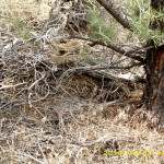
Back on the PCT, we started on the up ‘n down miles as the trail rollercoastered in and out of the big burn zone.  A very noisy little rattlesnake buzzed at us from his spot under a pinyon pine, and he buzzed even louder when Bill stopped and went back to take his picture!  Then we cheered when the trail finally reached the Kern River, which was roaring and rushing nicely and lined with willow bushes and pink wild roses.  The PCT goes winding along above it, through a narrow, rough, rocky canyon.  We were awfully low on water at this point, but decided to keep going and not worry about it.  Late in the afternoon, we passed a beaver pond AND a very wet, happy thruhiker!  He told us he’d gone for a swim in the pond, and was able to watch the 2 beavers at work, building their dam with willow branches. 

We pushed on into the wide, dry, sagebrushy Kennedy Meadows valley, where for some reason, there are no PCT posts to guide you.  We got a bit lost here in 2005, but this time it was a lot easier–there was a clear trail of footprints to follow.  Why, oh why doesn’t the PCTA or somebody mark this stretch of the trail?  At this point, we were seriously looking for water.  The map showed a creek crossing–but it turned out to be dry.  Then the map showed an ORV road going down to the Kern, so we tried following that, and it was no go, either.  Sigh.  We were very tired at this point, and our tails were dragging. 

So we went back to the PCT and just walked along, eyeing the river off to our left, till we spotted a short stretch of riverbank that was clear of willow thickets. We headed straight for it, crosscountry, and when we got there, Bill took off all his clothes and got right into the river for a bath.  I tried to do the same, but the water was freezing cold.  So I ended up doing more of a “splash bath” than a “swimming bath.”  It felt so good, though, to wash off all the sweat and grime of the trail!  We also got some water, and then I found a nice grassy patch to set up camp just before it got dark.

It’s a bright night–the moon is almost full, and animals are making their “night noises” all around us.  Another couple of hikers have camped nearby, and built a campfire, which has a nice “homey/smoky” smell drifting to us on the breeze.  Tomorrow is Kennedy Meadows day, and man, am I ready for it!

Walk to Lórien: Hollin Ridge

22june1viewmountains22june2trees22june3sign22june4trees22june5hills22june6trailflowers22june9trail22june11greentrail

Monday, June 21 Walker Pass Miles today: 26.2 Total: 676.6

Monday, June 21st, 2010

21june2water

Last night was very warm, and it sure was great to be out of the wind!   While I was getting dressed this morning (and it was wonderful to have such a “warm” morning” so that I wasn’t shivering into my clothes!), I was putting on my shoes and wondering what was going to happen with the foot pain that has bothered me for the last two days.  Suddenly, as I stared at my shoes, I had a thought.  I had them laced in what I call “desert style”, meaning very loose around the toes to allow for foot swelling in the heat, and then tight up higher to support my ankles.  “I wonder if I have my shoes laced too tightly?”  was the idea that occurred to me.  So I loosened up the lacing over the arch/ankle zone of my foot.  And voila!  No more pain in my feet today!  I hiked all day on happy feet!  Answered prayer #1. 

As Bill and I hiked along the 1 mile to Walker Pass Campground, we were joking about the thruhikers who “have to” have their “coffee fix” to start the day, and will freeze and shiver early in the morning so they can make that cuppa java.  When we reached the turnoff to the campground, there was a trail angel sign telling PCT hikers which campsite to go to for all sorts of goodies.  Well, it was 6 am, so we figured any trail angel would probably be asleep.  “We’ll just get water and head on” was our plan.  But there was no water!  All the campground faucets were turned off.  Bummer!  It was pretty obvious where the trail angel was–the only campsite that was occupied–so we went there, hoping there might be some water.  The only other option was a yucky spring down the road.

Yes indeedy, there was water (answered prayer # 2) –AND Trail Angel “Oakie Girl” spotted us.  She climbed out of her car (where she’d been sleeping) and insisted on giving us not just water, but BREAKFAST!   At 6 am!  What a feast–cinnamon rolls, scrambled eggs ‘n cheese in tortillas, coffee….wow!   Oakie Girl told us she’s a mountainclimber/peakbagger, not a thruhiker, but she decided that Walker Pass was in great need of a resident trail angel.  She told us that 15 hikers went through yesterday, and she was able to help them with lots of things–food, water, rides to town, etc.  What a great lady!

Then began the big climb out of Walker Pass, and as I walked, sure enough, my right hip began to hurt again.  I thought and thought about what to do, and as I walked along, I tried different things to help it feel better.  What I discovered was that if I pulled UP on the right shoulder strap of my pack, the pain went away.  Hmmm.  I thought about what I might be able to do–a loadlifter strap, maybe?

Meanwhile, we reached the famous “Rock Gate” on the east side of the mountains and began contouring north, with awesome views of the China Lake basin to the east.  Before noon, the trail began to go downhill and we had to cross many rockslides.  Bill  said, “The way I figure it, we should be at the Joshua Tree Spring trail by noon” and he NAILED it!  That’s exactly when we arrived…and were welcomed by 7 other thruhikers, who were eating lunch in the bit of shade available!  We stopped and cooked our dinner and chatted with them all, before they headed on and Bill headed for the spring while I cut off a spare piece of strap and sewed a “loadlifter” onto my right shoulder strap.  I also tied a spare piece of “bear rope” cord to the waistbelt on the right side, and tied the other end up at the shoulder so that the right side of the waistbelt was being pulled up off my hip. It worked! The hip was immediately pain free, and never gave me any more problems all the way to Canada!   Answered prayer #3.

21june8billview

We made another stop for water at Spanish Needle Creek–a bit tricky because it was just a trickle and there were other hikers who also needed to get water.  All of us had to wait our turn!  After that was a long but not hard uphill till we reached the “2nd broad saddle” where we ate supper in 2005.  It was very windy, but there were no ominous clouds as there were five years ago. 

So at sundown, we were looking for someplace  to camp out of the  howling wind— and we had to be specially careful because there was a 2,000 foot dropoff close by and if a bit of gear got loose— it would be gone forever.  Finally located a place behind a tree!  And it was wonderful to NOT have sore feet and sore hip.  Thankyou, Lord!

Walk to Lórien: Near small stream in valley near Rivendell

21june1water21june3sign21june4view21june5trail21june6trail21june7rockytrail