Posts Tagged ‘Mt. Lassen’

Wednesday, July 28 Miles Today: 27.2 Total: 1,362

Wednesday, July 28th, 2010

july28_1treeline

Well, all the hikers (including us) had to scramble at around 2am when a light sprinkle of rain blew through, totally unexpected. Bill simply draped our tarp over the net tent we were already in because of the mosquitoes, and  when we got up at 5 am,  all our stuff was dry. The only problem we had was the darkness–it was hard to see the trail when we tried to start hiking.  So we agreed “Looks like the days are getting shorter again–better bump our get-up time to 5:15.” 

By breakfast time we were at Stover Springs, where a number of hikers had camped. Many were planning to reach Drakesbad by afternoon, shower, swim and have dinner there. We had fun talking to Evan, Swipe and Tradeja while we were eating.  Evan said he was going to try to make it to Drakesbad for lunch.  I remembered what I’d thought about last night, but told myself, “Don’t be silly–it’s 15 more tough miles to Drakesbad (lots of steep hills and rough trail).  No way can I do that many miles on that kind of trail by 12 noon today.”  But then I thought,  “But I can at least try my best to hike fast, and see what happens.”

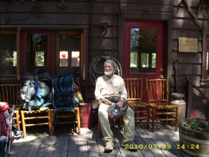
july28_7billbuilding

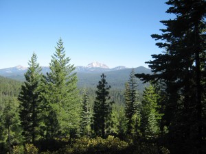
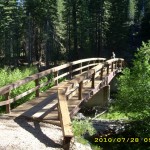
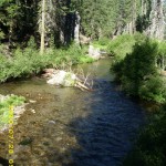
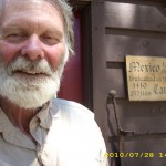
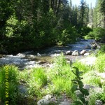
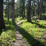
At first, much of the trail was in forest with little to see, but I really enjoyed the glimpses of Mt. Lassen above green meadows. A couple of ridges later, we’d reached the North Fork of the Feather River, where we caught up with several other hikers who were there relaxing. We stopped for a Snickers break, since it’s a very pretty, comfortable spot.  The other guys said they were going to loaf their way to Drakesbad and spend the night there.  We enjoyed the rest, but soon pushed on, and that’s when I said to myself, “Hmmm…if we could reach the park boundary by noon, Bill could “turn on the afterburners” and get to Drakesbad before the end of lunch at 1 pm.  He could get some food for himself and for me.”   

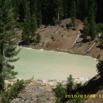
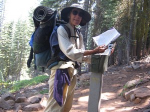
I told Bill about my idea.  He thought it was a bit crazy, but was willing to give it a try, so we both started hiking as fast as we could, and reached Lassen Park boundary by 11:45 am. Bill took off at top speed and was soon out of sight, while I hiked as fast as I could go (huff, puff!) up every hill and RAN on every downhill.  At Boiling Springs Lake, I did stop briefly to talk to a French family, who were already talking to another PCT hiker, Fuzzy Monkey.  The French family were absolutely amazed at the idea of what we were doing; they insisted on taking a picture with Fuzzy Monkey and I. 

Then I started to half-run on down the trail, past the weird blue-y green, steaming lake, and down through the woods towards Drakesbad.  At 1 pm, I was just across from it, on the other side of the meadow, and I trotted and ran as much as I could on the trail through the picnic area and then back up the road towards the resort.  I was absolutely exhausted.  Doing over 18 miles in one morning on rugged terrain was really tough!

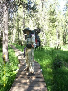
july28_9foresthiker

I raced on, and just after I’d reached the first group of cabins, along came Ed, who runs the place, riding in his golf cart. “Welcome, wanderer!” he cheered, “Would you like some lunch?  Hop in!”  So I got a very welcome ride with him, right to the front door of the dining hall.  I found Bill happily chowing down already, and he said he’d only arrived 10 minutes before I did!  Turned out that it was EMPLOYEE lunch time, and there was plenty of food even after the guests had eaten.  I wasted no time in loading a plate and eating to my heart’s content.  Fuzzy Monkey soon arrived, so all three of us were having a great time.  The Drakesbad folks were awesomely nice to us.  The cost for our all-you-can-eat lunch was only $6.50 each.  Wow! 

 Bill and I totally pigged out and waddled back to the trail at 3 pm.  We took our time for the rest of the day.  Up to the top of Flatiron Ridge we went, then strolled along to Grassy Swale, which was as lovely and green as ever, but the mosquitoes were so bad that we had to put on headnets.  We stopped for a snack at Swan Lake, which was so full that it reached all the way to the trail.  Amazing!  We continued the climb to  Lower Twin Lake, where we planned to stop for water, but we were sad to see that the effect of the 2004 forest fire was still there. Not much has regrown.

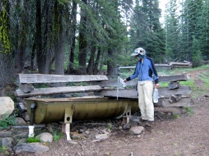
At the lake, we caught up with the Israelis, who’d stopped to cook dinner before putting in a few more miles.  We got our water, then pushed on ourselves, with the plan of getting away from the lake, and hopefully away from the mosquitoes.  No such luck.  The buzzing little biters were everywhere.  So it was “Net tent tonight!”  I have to say again that I’m SO glad Bill figured out how to rig it with just a couple of trek poles, so we don’t have the bother of the tarp.  I crawled into the sleeping bag after taking a Motrin.  My back hip was hurting again today, but it’s probably my own fault–I was RUNNING down hills instead of just walking.  But oh man, it was worth it to get that awesome lunch!  

It’s 15 miles to Old Station, and I started thinking, “Maybe we can make it to the Heitmans by lunch….”, then I slapped myself and said, “Don’t be an idiot!  You don’t need to do 15 miles before noon again!  Take it easy!”  So I’m going to lay my head down and remember to just enjoy the trail tomorrow!  And thankyou, Lord, that we are “home” in Lassen Park!  This is the place where Bill and I actually learned to backpack, many years ago!

Walk with Aragorn to Isengard: Find Pippin’s brooch, enter Rohan

july28_1viewmountainjuly28_2bridgejuly28_3creekforestjuly28_4viewjuly28_5laketreesjuly28_6billbuildingjuly28_8forest

Tuesday, July 27 Miles Today: 29.5 Total: 1,335.8

Tuesday, July 27th, 2010

july27_3trailbare

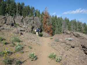
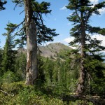
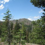
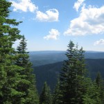
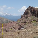
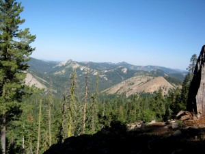
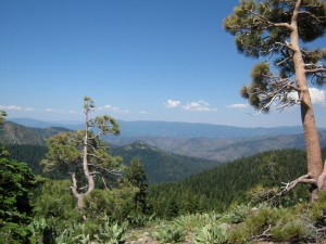
Today’s hike was what I call “The Big Walk Around Ruffa Ranch.” The ranch is down in a valley below(you can see the buildings and the green pastures), and the trail circles it, following crests and ridges. There was no ontrail water for most of the day, but because we were up high, the views were splendiferous– Mt. Lassen, Lake Almanor, even the Sacramento Valley.  We stopped for breakfast at Cold Spring Campground, which does have a wonderful piped spring, and even a bench to sit on.  Several fat, glossy, contented cows were grazing in a meadow nearby.  Once we finished eating, we really loaded up on water, for the 24 waterless miles ahead.  I must say that though water may be scarce in this section, when you DO come to water, it’s wonderful–very cold, very clear and tastes great!

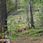
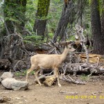
Wildflowers were abundant on the trail this morning– all growing in rock garden style among the lava boulders and formations.  Overhead were pretty clouds.  A few NOBO  hikers passed us this morning, all going as fast as they could so they could hitch into Chester!  We also met several SOBO section hikers. One was a little old whitehaired lady whose trail name was “Noisemaker”; she was carrying an enormous pack.  It made me ache just looking at it!  She must be pretty tough.  We stopped for lunch at a side trail (supposedly there was water a half mile down, but we had enough, so didn’t bother with it).  A very bold deer came out of the woods and came right up to beg from us!  No way would we give it any of our precious food!  It was getting rather annoying, when all of a sudden, another deer came along and chased the beggar deer away! 

july27_1benches

 Then came the big climb of Butt Mountain. When we did this part in 2005, hunting season had started, and the trail hadn’t been brushed in quite a while.  We were pushing through bushes, listening to gunshots in the woods, and hoping and praying most fervently that nobody would think we were deer trying to get away!  This time, the trail was nicely trimmed and a very pleasant walk.  At 3 pm, we reached the post that marks the official HALFWAY POINT of the PCT and stopped to celebrate with bug juice, a Snickers, and signing the trail register!  Yee-hah!  We were amused to see how many hikers had already signed in today.

Then came the long, long, mostly viewless downhill to Highway 36.  By 5 pm, we’d reached Soldier Creek, the first ontrail water since Cold Spring.  We were just about out of water, so it was a welcome sight, and we stopped for supper, plus washing ourselves up a bit in the creek.  We were filthy dirty from dusty trail plus sweat from the heat.  We even rinsed our socks!  Once we were down “on the flat” again, the PCT winds in and out of private property; seemed like every few yards there’d be another sign on a tree that said we were either entering or exiting such-and-so property.  Just before Hwy. 36, there was a sign telling of a hiker cache on the other side of the road. 

When we got there– wow! Hidden behind a huge log was a wonderful hiker cache with cold soda, water, fruit– even bagels!  While we were eating, I noticed that one of the thruhiker gals (last saw her pouring water over herself coming out of Belden) was trying unsuccessfully to hitch a ride into town.  The cars were just flying past her.  Since it was late in the day and we were going to stop and camp soon, anyway,  I went across the road, carrying my Ridgerest, to try to help her out.  (Yogi’s guide to the PCT mentioned that it really helps to write “Pacific Crest Trail Hiker” in large letters on your sleeping pad, to use when trying to hitchhike.  So I’d done that to my Ridgerest.)  Ann, who’d been trying and trying to get a ride, was very discouraged.

july27_10montytrailregister

She was glad of my company, and we hoped that with two of us plus the sign, maybe she’d get a ride…but no luck.   Car after car just roared on by.  I must say I was surprised.  You would think that folks in the Chester area would be clued in to thruhikers by now!  Ann finally decided to just give up and go camp in the woods, so Bill and I did the same.  We walked a bit further on, away from the highway, then found a nice comfortable spot in the trees.   We set up the net tent, because the mosquitoes were pretty bad, and talked about “Drakesbad tomorrow!”  The Drakesbad people had posted an “ad” by the hiker cache, inviting everybody to stop by.   I started having the crazy thought, “Maybe we could get there for lunch!”   We’ll see! 

Walk with Aragorn to Isengard: East Wall of Rohan
july27_2treelinejuly27_4vistabarejuly27_5cloudsjuly27_7treesjuly27_8vistahilljuly27_9vistahillsjuly27_1viewfogjuly27_2viewruggedjuly27_3viewrockyjuly27_4viewthrurocksjuly27_5viewjuly27_6rockyviewjuly27_7rockscirclejuly27_8h2ojuly27_9forestjuly27_10deerforestjuly27_11billforestjuly27_12billforestjuly27_13billlog

Friday, July 23 Miles Today: 25.8 Total: 1,239.8

Friday, July 23rd, 2010

july23_1forest

Last night in the middle of the night, a whole pack of coyotes went by our camp, ‘talking” to each other in their weird coyote voices.  I grabbed my trek poles ready to “whomp on ’em” if needed, but they just loped on by.  Coyotes don’t sound anything like dogs.  They almost sound human.  We were up at 5 am, hoping for lots of miles today.

Down below us to the east, there was huge Gold Lake shimmering in the early morning light.  Beautiful!  But as soon as we began hiking again,  the pain in the back of my right hip next to the spine just got worse and worse, till I was reduced to just limping along as fast as I could, yelping a bit when it hurt too much. To say I was miserable and frustrated would be an understatement. By 10:30 am, every time I put my right foot down, I was gasping from the pain and trying very hard not to cry.  I was kicking myself for not having checked my Motrin supply when we were in Sierra City–I was down to only 5 left, and decided to save those for the long, tough downhill to Belden.  So for now, it was pretty awful for me, painwise.

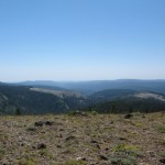
But we reached the wonderful “A Tree” spring with lots of cold, delicious water, and that was a really cheering-up event!  We drank and drank–it was awesome.  But back to hiking we went, and not only was I hurting, but there were snowfields on the trail again.  We actually crossed a little creek on a snow bridge on the north face of Gibraltar Peak!  And there were lots of blowdowns to negotiate, also.  But we cheered again at the top of a climb when at last we spotted the snowy peak of Mt. Lassen on the horizon!  Hooray! 

We also began meeting other hikers, and I tried hard to smile and give them a cheery greeting even though by now every step I took was agonizing, painwise.  Finally I felt like I couldn’t take it anymore, and I literally, out loud, cried out to God,  “PLEASE, please, Father, help me! Either heal my hip or show me what to do!”

july23_2vistaforest

A couple of minutes later, I had an idea.  “Maybe I could buy some Motrin from another hiker….”  I resolved to ask the next hiker who came along, and a few minutes later along came a SOBO guy!  I greeted him with, “Hi!  Hey, I have a little problem.  I’m almost out of Motrin, and I need more.  Could I buy some from you?”  “Sure!” he said, and we both took off our packs.  He rummaged about in his and hauled out his medicine kit.  “I’ve got something better than Motrin,” he said.  “How about Vicodin?”  I was shocked.  Vicodin is a prescription painkiller.  “Oh, I wouldn’t want to take from your prescription,” I said.  “Motrin is fine.”  But he insisted that he could get as much Vicodin as he wanted from his girlfriend who was a nurse, and not only that, but he insisted on giving it to me for free, along with more Motrin!    We told him about all the hiker-friendly amenities at the Red Moose in Sierra City, and he said he’d definitely stop there.  (He was hiking from Belden to Kennedy Meadows).  I took one of the Vicodin and we all headed our separate ways.
july23_5treesview

Within 30 minutes, my hip felt a lot better, and after an hour, I had no pain at all and could hike normally at full speed.  What a joy!  To be able to walk freely and happily along without limping and gasping at every step was a huge blessing.   I know Vicodin is not  a cure for whatever is wrong, but oh man, it feels so good to be able to just HIKE!  I walked along thanking God for His quick help.  I am so grateful!
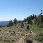
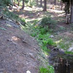
The SOBO guy had also told us about a good water source up ahead.  When we got there,we followed his directions and were able to replenish our water supplies with more cold, delicious water from another spring.  It’s been a very warm day, with a lot of long uphills, so we needed that water!

And so we walked happily along the viewful ridges, and through forests and along Nelson Creek, before finally stopping for the day near the Bear Wallow trail, up above the Grass Valley Reservoir.  I was disappointed that we’d only done 25 miles–it felt like 30 (we are both very tired).  But it’s my fault–I was going so slowly this morning because of the pain in my hip.  I am totally grateful to God for His help–it never even occurred to me to ask another hiker for Motrin (I guess I was in too much pain to be thinking straight).  I am really looking forward to tomorrow!


Walk to Rauros: In ruins of weathered stone near the Emyn Muil

july23_3barevistajuly23_4trailbarejuly23_6trailjuly23_1sunrisejuly23_2viewforestjuly23_3forestjuly23_4viewmountainjuly23_5forestjuly23_6foresttrailjuly23_7foresttrailjuly23_8green