Posts Tagged ‘Mt. Adams’

Thursday, September 2, 2010 Miles Today: 27.1 Actual Total: 2,277.5

Thursday, September 2nd, 2010

A very cold 38 degree morning, but clear skies! It was “walk through the huckleberry bushes day” all day— tall ones, short ones, green ones, turning-red ones and still NO berries! First thing in the morning, we had a couple of river crossings of glacier melt off Mt. Adams. One was an easy rockhop, but the Adams River was trickier and I got one foot wet in the icy water. Ow! The poor foot (which had already been stuck into cold wet socks and shoes earlier in the morning) was not happy!

But at breakfast we found a big glacier-polished rock in full sun with an awesome view of Mt. Adams, and all of me (including the foot) felt much better! Down from Mt. Adams we went, enjoying views of Mt. Rainier as well (a special privilege–Rainier is so often shrouded in clouds).  But we had to keep moving–it was still cold, and in the shade the ground was frozen, with frost still white on the plants and ice crystals in every puddle.  It was so cold that when we reached the famous Lava Spring, we didn’t stop for a drink as we did in 2005–it was just too cold to be drinking icy spring water.  Brrrr!

We finally got to a road, and I admit to fervently hoping there might be a trail angel food cache there, because we are on short rations right now.  In an effort to save on pack weight for this long stretch, I cut our food to a minimum– but then we didn’t make as many miles as we’d planned on.  Now we are definitely running low!  But bummer–no cache!   Oh well.  We hurried through a “lake district” full of pretty little ponds and lakes, but well-populated with mosquitoes, before beginning a long climb up to the top of a ridge where the PCT then circumnavigates a huge valley. Much of this part of the trail involved pushing through knee and thigh-high huckleberry bushes hanging over the trail.  And some of it was down IN the valley, which was very boggy and mosquitoe-y.  We turned on the afterburners to get out of there as fast as we could.

But we still had nice views of Mt. Adams, and across the valley, we could see the mountains of Goat Rocks!  The afternoon turned out very warm (Ahhh! It sure felt good!) and we made it all the way to Walupt Creek and found a nice campsite on a knoll. The wind was picking up and clouds were rolling in, so we set up the tarp carefully.  Looks like it will be another cold night, but Goat Rocks tomorrow!

Walk with Aragorn to Minas Tirith: In a valley near the Anduin and Gilrain rivers

Wednesday, September 1, 2010 Miles Today: 23.9 Actual Total: 2,250.4

Wednesday, September 1st, 2010

It rained all night, but we were warm and cozy under our faithful tarp. Next morning it was still raining in the morning, but warmer, hooray. We did an unheard of thing— ate breakfast in bed!  (The thought of eating a cold, soggy breakfast on the trail was seriously NOT very appealing!)  Then off we went onto the very muddy, puddle-y PCT, pushing through wet huckleberry bushes along the trail. Still no berries, though. I did enjoy looking at the pretty bracken ferns–they are still green, with no sign of fall color yet.

The rain was slowing down a bit when we stopped at a creek to get some water.  Another hiker was there, washing out his oatmeal pot (I guess he didn’t mind eating a cold, soggy trail breakfast??).  We talked with him a bit, and we all agreed that the clouds & rain could go on indefinitely (after all, this IS Washington!), but we were hopeful for some sun when we got closer to Mt. Adams, since right on the other side of the mountain there is warm, dry, eastern Washington.

As we continued on, we passed another PCT hiker, who asked if we were going in to Trout Lake.  He said he was DONE with hiking in the rain.  We said, “No, we hike rain or shine,” and kept on going through the dripping forest all morning till hooray! A ray of sun!

By noon, two wonderful things happened— 1. The best PCT hiker cache I have seen since southern CA (placed by the folks of Trout Lake Abbey) and 2. The sun came out!

Shortly after the cache, we met another hiker who was cooking lunch. Bill had an interesting conversation with him as to whether the “abbey” was Catholic or Buddhist. “I prefer Catholic,” Bill said, “with Buddhists, you get what you deserve. With Catholics, you get what you don’t deserve, because of Jesus. I don’t want to get what I deserve.” “Neither do I!” said the other hiker.

Note from Alexa: Trout Abbey is a Zen meditation centre.

A half hour or so later, we stopped to cook our own lunch, and hung out our stuff to catch some sun–a bit tricky, because even though the sun was out, the trees were still dripping.  But it was so great to be eating a tasty hot lunch while sitting in SUNSHINE.  Since we knew we had a big climb ahead of us up to Mt. Adams, we were glad of a bit of R & R.

On the long uphill, we met a couple of guys on horseback, leading two other horses–they were returning from dropping off trail crew supplies.  And we met several very discouraged, soggy backpackers who were heading down for the trailhead.  Apparently it really poured up on Mt. Adams–they had it pretty tough yesterday.  We could see evidence on the trail itself that yes, no kidding, it really did rain heavily in the last day or so up there.

By later afternoon, we’d reached Mt. Adams, with wonderful alpine scenery, wildflowers galore, green meadows, and snowy white Mt. Adams towering above it all.  At 6:00 pm, even though we hadn’t finished our 25 mile quota, we decided to call it a day when we found a supernice campsite with a view of Mt. Adams.  What a relief to be setting up camp in the sunshine instead of racing to beat the darkness!  We got into our sleeping bags to eat supper, while watching a beautiful gold-orange sunset.  I could seriously get used to this eating in bed routine!  But we are very tired, especially Bill, since he’s still not running at 100% normal, and that was a lot of uphill today! (Worth it, though–so worth it!  This is one of the most beautiful parts of the PCT!)

Walk with Aragorn to Minas Tirith: In Dor-en-Ernil, the lands of Prince Imrahil

Friday, August 27, 2010 Cascade Locks Miles Today: 30.6 Total: 2,155

Friday, August 27th, 2010

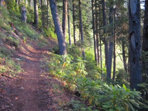
Aug27_1trailforest

Our last day hiking the PCT in Oregon! It was still very dark when we started, so we used our headlamps for a little while.  Clouds were still around us, but slowly cleared back, so we could see pretty well; the deep valleys and steep mountains all around us matched the contours on our maps, so we had a pretty good idea where we were and it was encouraging to chart our progress. The really distant mountains like Adams and St. Helens were hidden in the clouds. Oh well, that’s normal!  We did spot Lost Lake down below.  I have very good memories of going to that lake when I was a kid and we were visiting my aunt & uncle on their dairy farm nearby. 

The PCT really lives up to the “Crest” part of its name throughout this section.  We were way up high pretty much all morning and most of the afternoon.  The result was that we were either IN the clouds or else had clouds just over our heads in the treetops.  At one point this morning, we were hiking in very barren terrain, where the trail junction signs were supported by rock cairns.  The wind was blowing hard, and I can imagine that being up here in a storm would be downright wild.  Many very interesting alpine plants covered the ground.  If I weren’t thruhiking, I’d have sat down to have a good look at them.

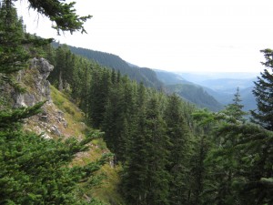
Aug27_4forestvista

By lunchtime we were at Wasco Lake, since we’d  decided to just follow the PCT into Cascade Locks instead of doing the Eagle Creek alternate. NOT A GOOD IDEA! The Eagle Creek trail is a bit scary if you don’t like heights and big dropoffs, and it is almost a mile longer,  but it has one huge benefit— it is all downhill. The PCT has a lot of uphill, some very steep, and it becomes very rocky and rough.

At Wasco Lake, the lake really is very pretty, but it’s very hard to figure out where the PCT goes, since there are trails wandering everywhere and the signage is minimal.  We beat about hunting for the PCT, and wasted a bunch of time, before I finally said, “Phooey on this!  Let’s just walk along Road 670 for a little bit, then bushwhack downhill back to the PCT!”  So that’s what we did.  Then came the long climb up to the Benson Plateau, which is an interesting little world in itself–Oregon Desert again, but this time with the addition of beargrass.  But we were tired, and the climb up to it was not fun.  Glimpses through the trees gave us some idea of how high up were were–very high indeed! 

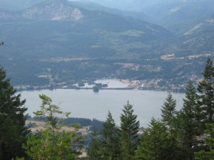
Finally, at last!!! the trail began the long downhill to Cascade Locks.  We left the Oregon Desert behind and were back into pretty evergreens.  The lower we got, the more we saw maple trees and broadleafed plants, including poison oak starting to turn red.  We cheered when we reached what I call “The Big Viewpoint”.  Below us lay the blue Columbia River–across the river was Mt. Adams!   Washington State in sight! 

But then the trail got really cantankerous.  There were lots of switchbacks (no problem), but the trail tread was very rough and rocky.  The rocks underfoot ranged from talus fields where you have to pick your way across very carefully, trying not to twist an ankle, to simply pointed rocks sticking up out of the trail everywhere.    Our feet were very tired, and those rocks really hurt.  We had to slow down quite a bit, which was frustrating when we were so close to the “finish line”!

I took heart, though, when we entered what I call the “maple zone” where we were walking through a forest intertwined with maples and evergreens, with maple predominating.  It is so pretty there!  We started to meet backpackers who were heading out for the weekend, carrying their huge, heavy packs and wearing hiking boots.  They were all so clean!  The only bummer was that there’s a lot of UPhill in the last 4 miles before Cascade Locks.  UPhill–oh man, that’s just WRONG!  All we could do was sigh and trudge along some more. 

But you know what?  The good ol’ method of “just keep putting one foot in front of the other” does work, and finally we did reach the final turn into Cascade Locks  at around 6:30pm.  We headed straight for the Cascade Locks Inn restaurant so we could EAT, and eat we did–steak and baked potatoes.  Feeling much better, we walked on over to Trail Days at Thunder Island.  As part of the PCT Class of 2011, we got to camp there for free, and we wasted no time in rolling out the ground cloth and setting up a quick cowboy camp near the river.  Then we totally crashed.  There was an evening program at Trail Days, and there were trains going by, and other campers talking, but we ignored them all and just went to sleep.  We are tiiiiiired!  And I think we look like wrecks.  But we met the challenge, and it’s hard to believe that we made it all the way through Oregon in only 15 days.  Wow!  Thankyou, Lord!

Aug27_7waterview

Walk with Aragorn to Minas Tirith: Following along the River Ciril

Aug27_2viewwaterAug27_3forestfogAug27_5postAug27_9billsign