Posts Tagged ‘Cabazon’

Friday, May 7 – Mission Creek – Miles Today 21.3 – Total Miles 237

Friday, May 7th, 2010

may7_c2_rocks2

Last night in the middle of the night, a whole pack of coyotes went right by our camp, yipping and crying in their weird coyote voices.  We had our food bags right next to us, and both Bill and I reached out for our trek poles, ready to whomp on coyotes if we needed to.  Not necessary!  The coyotes just went right by us. 

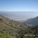
We were up at dawn, eager to get to the Whitewater River to wash our poor filthy socks and have a nice breakfast I’d picked up in Cabazon. We hurried along, passing some spectacular, deep canyons.  I have decided that the “C” in Section C stands for “Canyons”, because you spend all your time walking along the tops of them, going down the sides of them, and trekking along the bottoms of them.   Finally we were close enough to the rim of the Whitewater River canyon to hear the roar of the river below.

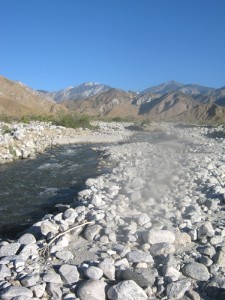
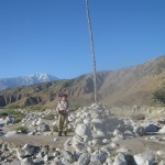
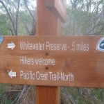
Down we went, anticipating our first “real” river crossing.  We came to the trail junction for the Whitewater Preserve trout farm, which used to be a no-no for hikers.  Well, times sure have changed!  There was a sign INVITING hikers to come over to the Preserve.  We were headed on, but still, it was an improvement over 2005!   The bed of the river is quite wide and rocky.  There was a HUGE pole set up in a cairn of rocks to mark the PCT path.  Soon we were at the river ford, and it looked quite do-able, but tricky enough to warrant some caution.  So we faced the current and sidestepped across, rather than just splashing in. 

Then it was time for a great breakfast of stuff I picked up in Cabazon, and plenty of time to wash our socks, our clothes, and even ourselves.  Wow, did it feel good to be at least “slooshed off”!   We lounged around on the soft sand, eating and talking, with our laundry spread all over the rocks.  It was hard to finally say, “OK, time to hit the trail!”  but we finally pulled ourselves up from the river and began the climb up to the other side of the canyon.

may7_snake5

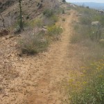
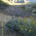
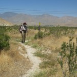
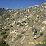
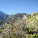
As we had expected, the rest of the day was very tough. At first it was glorious—”knife-edge”  ridgetop walking with awesome views.  And the wildflower gardens along the trail were spectacular.  I was practically skipping along and singing, “This is what it’s all about!   This is why I hike the PCT!” 

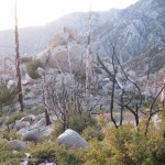
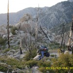
But by midmorning, the trail had dropped down into Mission Creek canyon, and the rest of the day was a relentless climb  back up into the mountains again.  In 2005, it was lovely here— huge shady trees, flowers, lots of butterflies— now it is a burned over wasteland.  Bill and I were horrified at the change.   Instead of a lovely, green, wooded valley, the canyon was a dead, skeletonized forest fire zone.  Very depressing.

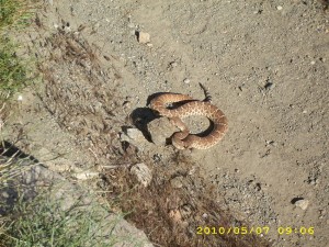
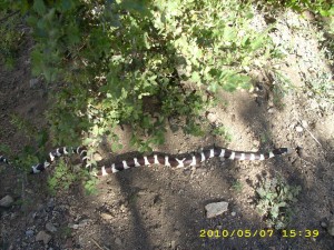
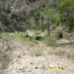
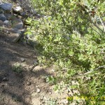
In the entire walk up the canyon, I only saw two butterflies…. and two snakes.  One was a rattler and the other we called the “mystery snake”, since we didn’t know what it was.  The snakes very obligingly posed for pictures–very nice of them!  Bill and I are both still feeling very tired and sore from our adventure across Fuller Ridge, and the relentless uphill with no shade on a very warm day was very wearing.  The PCT in Mission Creek canyon gets all ripped up every winter by flooding, so a lot of our time was taken up just trying to figure out where the trail went.  Basically, you can just follow the canyon, but there are other “side canyons” coming in, so you do have to be careful you are still on the correct route.  

One bonus on a hot day, though–you get to ford the creek over 20 times, so your feet do stay nice and cool!  We were also blessed to find one “green oasis” where we ate lunch.  It was one small tree which had managed to grow back a bit since the fire.  We crawled underneath it to cook and eat some lunch in the SHADE!   A little while after we got underway again, I noticed that the tip of one of my trek poles had come off.  Oh no!  Since we’d basically been just “bushwhacking” up the canyon,through the jumbled mess of rocks and logs,  there was no way I’d ever be able to find it.  But Bill gave me his trek pole tip–he said he didn’t need it, because his poles were basically so thrashed  from Fuller Ridge.

On we went, into a very hot afternoon.  The canyon twists and turns, so at every turn, I’d be looking up at the “new view” up ahead, for a first glimpse of the end of the canyon, with a green forest at the top.  At our 3:30 Snickers break, we sort of collapsed, and it was hard to get up and keep going after our 15 minutes of rest.  By 4:30 pm, I was feeling so wasted that I finally said, “Bill, I’m so tired–do you mind if we stop and rest again for a few minutes?”  I hated to ask, because I knew we needed to make miles, but I was totally wiped out.  Well, it turned out that Bill had been about to say the same thing!  We found a shade patch and collapsed for awhile.   I had to be careful about collapsing, though!  My snow-scraped rear end is really hurting,  and there is nothing I can do for it but try to keep it clean.  When Bill slipped and fell up on Fuller Ridge, he lost our “medicine kit”, so I have no antibiotic ointment, no bandaids, or anything.

may7_2snake1

Finally we dragged ourselves back to our feet, shouldered packs, and kept on going.  Fortunately, the trail at this point was up above the creek, and we weren’t climbing over rocks and logs.  At the last creek crossing, there was a whole encampment of thruhikers.  Everybody looked very tired!  They said they’d stopped because they heard there were no more campsites for many miles as the trail climbed out of the canyon.  They also warned of  fallen trees blocking the trail.  Bill and I wanted very much to get in some more miles, and since it was now a pleasant late afternoon/early evening, we decided to just push on.  After getting some water from the creek,  and figuring out a way to get around the fallen tree mess across the PCT, it took us another hour of hiking before we were out of the forest fire zone, the trail leveled out a bit and we found a beautiful campsite among pine and oak trees. 

The creek nearby was rushing happily along, it was a very pleasant evening, and we were glad to do a final collapse of the day into our sleeping bags!  We did see some snow just before reaching this campsite, and we are concerned about snow problems tomorrow.  It’s 28 more miles till our next resupply, and with a lot of snow on the trail,  I doubt we can make it in one day.  But for now,  it sure is nice to be in such a lovely place for tonight, and good to know that we made it through Mission Creek Canyon without getting lost!

Walk to Rivendell: Weathertop

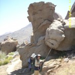
may7_c2_rocksmay7_c2_trailmay7_flowers

may7_lizardmay7_montyflowermay7_trail

may7_trail2may7_trail3

Thursday, May 6 – San Gorgonio Pass – Miles Today 26.5 – Total Miles 215.7

Thursday, May 6th, 2010

may6_trailsign

Wow!  What a day!  Talk about varied!  We had a very chilly, howling-wind camp last night on the side of the San Jacintos.  I ached all over, but consoled myself with the fact that very few thruhikers even attempted Fuller Ridge this year, and some who did, had to be rescued because they were so overwhelmed by the difficulties.   So I guess we are in a fairly exclusive “club”.

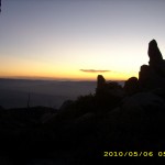
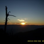
Anyway, by 6:00 am we were on the trail for many more miles of downhill to Snow Creek. The early morning light was beautiful on Mt San Jacinto, and on the huge rocks of the “boulder garden” we were walking through.  I love looking at plants, and it was fun to watch the change in vegetation as we dropped lower and lower–but soon we were making our way through a rather overgrown trail.  (Once we reached Snow Creek, I figured it out that we’d spent about 50% of our time this morning pushing through plants!)  The vigorous plants were actually very pretty–many in bloom–but they really slowed us down.  And my quadriceps were so sore, that every time I had to take a long step down, I would say, “Yelp!” It hurt!

Part of  the way down, we were passed by Smile Train, who told us he’d had to help several ill-equipped hikers who were attempting to cross Fuller Ridge with no ice axe or trek poles or crampons or anything.  Wearing his Microspikes, Smile Train had  chopped steps for them and done whatever he could to assist.  He said that before catching up with the struggling hikers, he’d been just bopping right along.  Soon he took off down the trail–he usually does 30-plus mile days.

We then began to notice some smoke off to our left— found out later it was a brush fire that closed the PCT for a day. Had we been only a few hours later, we would have been stuck up on the Ridge for another 24 hours. Boy, are we glad we did NOT stop and camp early last night.  We appreciate God’s timing and strength!

may6_montywindmills

Coming down, down, down (it is a LONG way!)  we  were also treated to some unique “insect experiences.”  A large swarm of BEES flew over us.  They were very loud and very impressive.  I had not realized how much noise a whole group of bees could make.  And ladybugs were everywhere.  I’m not sure what ladybugs find to eat around here, but they appeared to be thriving!

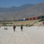
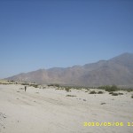
Finally the end was in sight–the faucet at Snow Creek, and the big rock we rested by in 2005.  This time, there was one more addition–a hopeful-looking Smile Train!   Turned out he waited for us because he was hoping we’d hitch into Cabazon with him. He said he’d had a hard time getting rides before, because people were reluctant to pick up a single scruffy-looking guy.  So we agreed, since we were a bit short on food.  After rinsing out our socks (boy, did they need it!) the three of us headed out against the wind in the pass.  It was tough going–soft sand underfoot and a fierce headwind.  At least it wasn’t 115 degrees plus this time–the temperature was only 85 degrees.   While we walked, I told Smile Train about the PCT term, “ride bride.”  He was correct in observing that single guys have a harder time getting a ride than guys with a GIRL.  So it’s not unusual for a PCT hiker to ask a fellow GIRL hiker if she would be his “ride bride.”

In return, Smile Train taught us an Appalachian Trail term:  “Idiot check”, which basically means that every time you are about to head out from a rest break, you carefully check to be SURE you didn’t leave any of your stuff behind.  So the 4 mile walk through blowing sand and wind went quickly and when we reached the shelter of the freeway/railroad underpass, we were all delighted to find a wonderful hiker cache with plenty of sodas and water, snacks and a hiker register.  It felt so good to be out of the wind!  We all ate and drank, signed and read the register, then headed for the nearest freeway onramp headed for Cabazon.

It took about 15 minutes of standing by the onramp holding out my PCT bandana with the words “Hiker to Town” prominantly displayed before a small pickup truck with two guys in it pulled over.  “Where are you you headed?”  they asked and when we told them “Just to Cabazon”, they said, “We can take you, but you’ll all have to lie down flat in the back of the truck so the Highway Patrol can’t see you.”   We all piled in, flattened ourselves like pancakes, and had a crazy 5 mile ride into town!    The guys dropped us off at the first Cabazon exit, and we thanked them VERY gratefully!

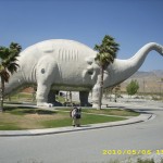
Turned out that the big attraction at this exit was a DINOSAUR park, with lifesize dinos!  Very awesome!   And there was a Burger King, so we all made straight for it and ate and ate and ate.   Next to do was find a place to get some extra trail food and some water.   The nearest ordinary store was on the other side of the freeway, so we went over and got food for our packs.  Water was still a problem, and also how to get back to the trail.  I spotted a little post office and said, “Hey, let’s check there!  Maybe there will be a hiker register and list of trail angels.” 

But the post office had just closed, five minutes before we got there!  We stood in front of it, discussing what to do next, when a man hailed us from across the street.  “Are you PCT hikers?”  Turned out he was a trail angel, who really had missed helping hikers.  Since the PCT was re-routed,  hardly any PCT’ers  go to Cabazon anymore.     He invited us over to his house to get water.  Well, actually, what he did was invite us into what he called his “man cave.”  What an interesting place!   He’s a man of many skills, but his favorite is painting, and his house had several of his paintings, which he framed himself.  The frames alone are works of art.   The house was full of various items relating to his many interests.    “I’m glad my kids are grown and out , so I have the place to myself,” he said.  “And they are a real responsible, hardworking bunch, so I’m not stuck with raising my grandkids like a lot of other guys my age.”

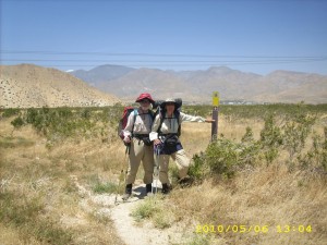
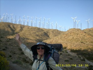
The “Artist Trail Angel” gave us a ride back to the PCT,  and we were off again into the desert, with the windmills singing their thumping, humming song overhead, and the wind blowing.   Smile Train took off –he is very fast–and we began the climb back into the mountains.   It was a wonderful afternoon–the flowers were in full bloom, the wind felt good, and it had only taken 2 hours for our whole “Cabazon adventure.”  The only problem I had was my terribly sore quads and arms and shoulders, and all the desert grit in my poor filthy socks.  The rinse we gave them at Snow Canyon helped a little, but they REALLY need soap and hot water! 

As we were walking along, a guy on a dune buggy came zooming along on a dirt road nearby.  “Welcome to Section C!” he hailed us.  “Y’all headed for Canada?”  “Yes, we sure are!”  we shouted back.  He wished us well and roared off.  Eventually we stopped for a brief snack and tried to shake some of the grit out of our shoes.  Not much luck–there’s still plenty left.

By sundown we were at Teutang Canyon.  It’s a very impressive, deep, dramatic gorge, but we found a nice little side gully and made a comfortable cowboy camp.  The crickets are singing, and it’s a beautiful evening.  I did take some Motrin, though, or I probably won’t get much sleep due to VERY sore muscles!   Battling the snow is a lot different from just plain ol’ hiking!

Walk to Rivendell: Flat country on way to Weather Hills

may6_c2_billrestmay6_c2_billvista2may6_c2_sign

may6_c2_trailvistamay6_c2_trailvista3may6_c2_train

may6_c2_vistamay6_dinomay6_hillside

may6_montyplantmay6_roadmay6_rocks

may6_rocks2may6_sandy2may6_sunrise

may6_sunrise2may6_trailmay6_trail2

may6_trailvistamay6_vista3