Sunday, August 29, 2010 Zero Day Total: 2,155

August 29th, 2010

Aug29_1interiorhiker

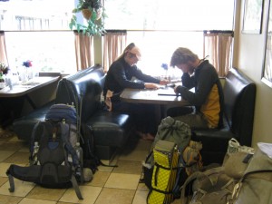
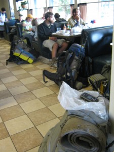
I “slept in” until 6:45am today, but was so hungry that I got up and went to eat at the restaurant, after making coffee and eating yogurt in our room. Bill was still feeling sick and weak, so he did not join me, but stayed in bed. When I got to the restaurant, there were backpacks everywhere and lots of hikers. Fun! I ended up having a lot of different conversations with different folks. Many of them have skipped large portions (all of Oregon, in one case!) of the PCT to be here.

But one of the hiker ladies I talked to who is my age (62) and I were comparing notes on how thin we had become. She knows about “medical stuff” and told me, “You and I aren’t hormone-protected like the younger women. Their bodies fight to hang on to every ounce of fat, but we’re post-menopausal, so we don’t have that anymore. We’re kind of in the same boat as the men now. You notice how thin they are?” And I realized she was right.The guys are all really skinny.  So I guess I’ll just do the best I can. Only 500 miles to go!

Aug29_2interiorhiker

After breakfast, I went back to check on Bill.  He still did not look or feel good, but he still wanted to go to church. I wanted to go, too, and it was only a short walk  to Cascade Locks Community Church. Turns out they have Awana, Good News Club and they are really nice! There was a potluck after the service, which I went to, but Bill did not feel well and went back to bed. He says he is determined to leave tomorrow morning as planned, so once I got back from church, I am loaded up the packs and got everything ready to go.

For dinner I went all by myself (Bill still could not face any food) over to a pizza place that the hikers all seem to like.  The pizza was OK, but I’ve had better ones.  I saved a couple of small pieces for Bill, in case he felt up to eating anything, and when I got back to our room, he did nibble on them.  Poor Bill!  I’ve been running around having fun and eating to my heart’s delight, while he’s been feeling sick and lying in bed.  I am asking God to please help him feel better.  Tomorrow we begin the PCT in Washington!

Walk with Aragorn to Minas Tirith: Following along the River Ciril

Saturday, August 28, 2010 Zero Day Total: 2,155

August 28th, 2010

We stayed in our sleeping bags until 6:30 this morning! No hiking today! Bill was very tired, and I was very hungry, so at 7:00am, we headed out for a wonderful  breakfast at the Inn. We left our packs and stuff at Trail Days, so after breakfast we walked down the main street to check out motels, and ended up where we stayed before— the Columbia Gorge Motel— the only one with a vacancy. Then it was showers, laundry, visiting with my family from Portland, and the rest of the day I spent mending Bill’s very torn-up pants.

Bill himself is not doing well. He looks pale and sick again, his stomach hurts and he’s having “plumbing problems.” He spent most of the day lying down, did not eat much at all, and said he felt very weak. He did take one short walk to look at gear from the Trail Days vendors. 

Trail Days is nowhere near like ADZPCTKO.  No food is available (unless you buy it), and there are more non-thruhikers than there are thruhikers.  We decided that it’s not worth killing yourself to get here!  Oh well.  Taking a couple of zeros here means I can work at  eating all kinds of food, trying to get some fat back on me! I feel strong, but one look in the mirror and I know I need food!

We were in bed way early, and boy, did that mattress feel good.

Walk with Aragorn to Minas Tirith: Following along the River Ciril

Friday, August 27, 2010 Cascade Locks Miles Today: 30.6 Total: 2,155

August 27th, 2010

Aug27_1trailforest

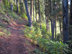
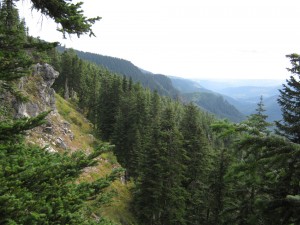
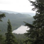
Our last day hiking the PCT in Oregon! It was still very dark when we started, so we used our headlamps for a little while.  Clouds were still around us, but slowly cleared back, so we could see pretty well; the deep valleys and steep mountains all around us matched the contours on our maps, so we had a pretty good idea where we were and it was encouraging to chart our progress. The really distant mountains like Adams and St. Helens were hidden in the clouds. Oh well, that’s normal!  We did spot Lost Lake down below.  I have very good memories of going to that lake when I was a kid and we were visiting my aunt & uncle on their dairy farm nearby. 

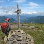
The PCT really lives up to the “Crest” part of its name throughout this section.  We were way up high pretty much all morning and most of the afternoon.  The result was that we were either IN the clouds or else had clouds just over our heads in the treetops.  At one point this morning, we were hiking in very barren terrain, where the trail junction signs were supported by rock cairns.  The wind was blowing hard, and I can imagine that being up here in a storm would be downright wild.  Many very interesting alpine plants covered the ground.  If I weren’t thruhiking, I’d have sat down to have a good look at them.

Aug27_4forestvista

By lunchtime we were at Wasco Lake, since we’d  decided to just follow the PCT into Cascade Locks instead of doing the Eagle Creek alternate. NOT A GOOD IDEA! The Eagle Creek trail is a bit scary if you don’t like heights and big dropoffs, and it is almost a mile longer,  but it has one huge benefit— it is all downhill. The PCT has a lot of uphill, some very steep, and it becomes very rocky and rough.

At Wasco Lake, the lake really is very pretty, but it’s very hard to figure out where the PCT goes, since there are trails wandering everywhere and the signage is minimal.  We beat about hunting for the PCT, and wasted a bunch of time, before I finally said, “Phooey on this!  Let’s just walk along Road 670 for a little bit, then bushwhack downhill back to the PCT!”  So that’s what we did.  Then came the long climb up to the Benson Plateau, which is an interesting little world in itself–Oregon Desert again, but this time with the addition of beargrass.  But we were tired, and the climb up to it was not fun.  Glimpses through the trees gave us some idea of how high up were were–very high indeed! 

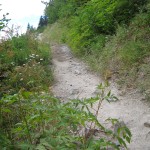
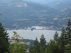
Finally, at last!!! the trail began the long downhill to Cascade Locks.  We left the Oregon Desert behind and were back into pretty evergreens.  The lower we got, the more we saw maple trees and broadleafed plants, including poison oak starting to turn red.  We cheered when we reached what I call “The Big Viewpoint”.  Below us lay the blue Columbia River–across the river was Mt. Adams!   Washington State in sight! 

But then the trail got really cantankerous.  There were lots of switchbacks (no problem), but the trail tread was very rough and rocky.  The rocks underfoot ranged from talus fields where you have to pick your way across very carefully, trying not to twist an ankle, to simply pointed rocks sticking up out of the trail everywhere.    Our feet were very tired, and those rocks really hurt.  We had to slow down quite a bit, which was frustrating when we were so close to the “finish line”!

I took heart, though, when we entered what I call the “maple zone” where we were walking through a forest intertwined with maples and evergreens, with maple predominating.  It is so pretty there!  We started to meet backpackers who were heading out for the weekend, carrying their huge, heavy packs and wearing hiking boots.  They were all so clean!  The only bummer was that there’s a lot of UPhill in the last 4 miles before Cascade Locks.  UPhill–oh man, that’s just WRONG!  All we could do was sigh and trudge along some more. 

But you know what?  The good ol’ method of “just keep putting one foot in front of the other” does work, and finally we did reach the final turn into Cascade Locks  at around 6:30pm.  We headed straight for the Cascade Locks Inn restaurant so we could EAT, and eat we did–steak and baked potatoes.  Feeling much better, we walked on over to Trail Days at Thunder Island.  As part of the PCT Class of 2011, we got to camp there for free, and we wasted no time in rolling out the ground cloth and setting up a quick cowboy camp near the river.  Then we totally crashed.  There was an evening program at Trail Days, and there were trains going by, and other campers talking, but we ignored them all and just went to sleep.  We are tiiiiiired!  And I think we look like wrecks.  But we met the challenge, and it’s hard to believe that we made it all the way through Oregon in only 15 days.  Wow!  Thankyou, Lord!

Aug27_7waterview

Walk with Aragorn to Minas Tirith: Following along the River Ciril

Aug27_2viewwaterAug27_3forestfogAug27_5postAug27_9billsign

Thursday, August 26, 2010 Timberline Lodge Miles Today: 24.3 Total: 2,124.4

August 26th, 2010

Aug26_3mountview

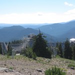
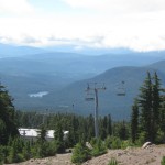
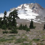
We woke up to a sky much more clear and normal— the smoke seemed to have pretty much blown away, so the fire situation must be better.   Our motto for the morning was “second breakfast at Timberline Lodge!” At Barlow Pass, there was a nice picnic table, so we stopped there for some granola before tackling the big climb up towards Mt. Hood.  The PCT seriously goes up, up, up, till between the trees you start getting glimpses of the deep sandy snowmelt canyons coming off Mt. Hood.  More climbing, and you start to see the ski lifts, and finally you are out of the forest, and out on the sandy shoulders of Mt. Hood itself.
Aug26_6stonebuilding

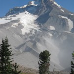
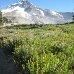
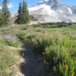
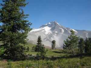
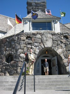
It’s an amazing sight– Mt. Hood  is “right there,” plus wildflowers galore (goldenrod, lupines, paintbrush, many more) and a very strong, cold wind blowing sand and dust in clouds off the sides of the mountain. The wind was strong enough that I was staggering a bit, and it’s like hiking on a sand dune as you slip and slide along the trail. But it wasn’t far to Timberline Lodge, where we headed for the Day Lodge to see about breakfast.  But the cafeteria was CLOSED!  A jolly employee grinned wickedly at us and said, “Oh, but we have some REALLY nice freezedries you might like!” before directing us to the dining room in the main Lodge where they have an all-u-can-eat breakfast buffet.  Oh yes!

We headed for the restrooms at the Day Lodge to clean up and change into “town shirts” before we headed over to the buffet.  To our great relief and delight, at the buffet, there was  Phooey!  We’d been very worried about him–did he make it past the fire?  Well, turned out he was on the shuttle just before ours, so he was OK, and he had asked HIS shuttle driver to wait a bit for US, in case we came along!  So all of us were very glad to see each other.   Awwwwww!  

We then proceeded to eat everything in sight, especially the fresh-squeezed orange juice.  We all could barely walk, we were so full, when we went out into the big lobby to sit on nice, soft, comfortable couches for awhile and just relax.  Along came Dave, who was hiking the Oregon PCT, and we all compared “fire adventure stories.”  Dave and his hiking buddies were behind us, and they’d reached the shoulder of Mt. Jefferson, saw the fire situation, and immediately turned back.  They hiked down to a trailhead, found a ride, and had hitchhiked around the fire zone.

Once we’d sufficiently recovered from breakfast, we got our resupply box and a few more odds ‘n ends, then it was back to the trail again, on a very cold, very windy day.  A film crew with big impressive cameras were setting up their stuff in front of the Lodge, and were having an awful time with the wind.  Some very nastylooking clouds were blowing in along with the wind, and we decided to put everything in “rain prep” mode before seriously starting down the trail.

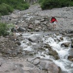
The PCT around Mt. Hood is a real rollercoaster–down into deep snowmelt canyons, then up the other side of them.  At the bottom of every canyon is a snowmelt creek.  The first one was a rockhop for me, and I was glad to make it safely across.  Another hiker who was trying to cross at about the same time I was, well, he was having a tough time, and a friend of him was sort of “coaching” as the timid hiker went from rock to rock.  I normally do NOT like rockhops–to me it’s a lot safer to just wade–but I was enjoying the sensation of DRY shoes and socks, and hoping it could last just a little while longer!

The wildflowers along the trail were gorgeous, and helped to keep my mind off of thinking about the Sandy River crossing up ahead.  In 2005, that was scaaaaary!  but a Boy Scout leader who was there at the time helped me get across on a log.  “How will I make it across this time?” I wondered.  And then it started to rain.  Oh joy!  Now there was rain to add to the snowmelt. 

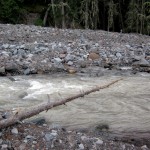
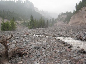
When we got down to the bottom of the long downhill into the Sandy River canyon, I looked at the river and said, “Oh!  This isn’t any worse than those High Sierra rivers!  I can do this!”  Way upstream were what looked like 3 skinny, slippery logs across the river,  Bill said, “I’m crossing on the logs” and headed for them.  “I’ll ford this,” I said, and waded in, facing the current, trek poles braced, just like the High Sierras.  The river was never more than a bit over knee deep, with a nice bottom of small rocks and sand.  I ended up with  clean feet and socks!  Then Bill and I got back together again.  He said the skinny logs were lashed together to make a  little bridge.  Oh well!  The important thing is, we both made it across.

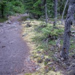
At that point, the “trail” was a series of rock ducks that led us off through the sand and boulders of the canyon floor, till we were back into a sort of Oregon Desert-type forest with one new addition: moss!  Every rock was covered with moss.  The rain continued to fall.
Aug26_15foggycreekview

We were in and out of forest on the way to Ramona Falls, and then made the long steep climb up to Lolo Pass.  Phooey had already stopped to camp, and was trying to build a fire in the misty rain, so he could get warm.  He said he’d gotten rather wet in the rain and needed to dry out and warm up.  We started looking for a campsite, too, and it was not easy.  Finding a place that wasn’t totally covered with underbrush was almost impossible.  But after some beating around up and down the trail near the road, we finally decided on a spot in a grove of trees. 

As we were setting up our tarp, along came Dave, and he asked if it would be OK for him to camp next to us.  Seeing as there was no place else, we said, “Of course” and he began to set up his tent.  “Look at that sunset!” Dave said.  “It’s showing red.  That means the weather should be better tomorrow.”  I sure do hope he is right!   It’s setting up to be a very cold night (I can see my breath!)  but if all goes well, we should make it into Cascade Locks some time tomorrow.  Sure would be nice to hike without rain!

Walk with Aragorn to Minas Tirith: Reach the River Ciril
Aug26_1forestAug26_2mountainAug26_4mountgreenAug26_5mountgreenAug26_7signAug26_8vistaAug26_9forestmountAug26_10mountAug26_11rockscreekAug26_12trailgreenAug26_13flowersAug26_14foresttrailAug26_16crossingcreekAug26_17trail
Wednesday, August 25, 2010 Miles Today: 33.1 Total: 2,100.1

August 25th, 2010

Aug25_2logbridge

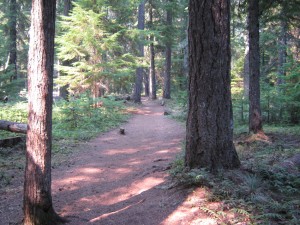
Today was smoke all day, beginning with an orange-red sun early in the morning– and a slightly late start  because I didn’t wake up in time.  As we headed out along the PCT,   beams of light coming through the trees were actually red when they hit the forest floor and tree trunks, so it almost looked as if the forest were on fire. It rapidly turned into a hot day— ninety degrees in the shade. Fortunately, there was plenty of shade! The forest was beautiful, with enough openness that you didn’t feel closed in, and broadleafed trees as well as evergreens.
We spent the morning walking through Warm Springs Indian Reservation. The folks there were busy with some logging.  Several spots along the trail were freshly clearcut, and we could hear the sound of chainsaws in other places.  Yesterday on our long drive around the fire,  we’d had a discussion with Mr. Peterson about forest management, including logging.   He said that believe it or not, there actually is a trend towards logging with horses (just like “in the olden days”), the reason being that horses don’t damage the forest like mechanized equipment does, AND they are cheaper than helicopter logging.  Interesting! 

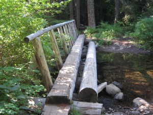
We reached the nice log bridge over the Warm Springs “River” (creek, actually) and stopped to rinse socks and get water.  The light in the forest was incredibly beautiful, because of the smoke haze in the air.  All the trees and rhodies and plants looked as if they had a golden glow to them. 

Aug25_5watersign

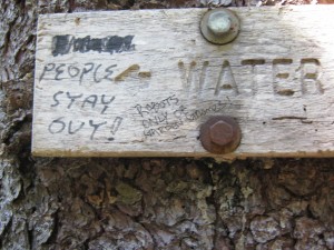
Finally we reached big, blue and very smoky Timothy Lake.  Only a few people were camped  there (instead of the usual summer crowds), and those few were out in the lake swimming, yelling and splashing. Man, would we have liked to join them, but we needed miles, and there were rumours of a hiker cache at Wapinita Pass (True rumours, as it turned out!)  We had planned to stop for water at Little Crater Lake, but changed our minds when we spotted a really nice spring just below the trail.  It had a wooden sign that said, “Water”, but somebody had marker-penned in an indignant request, “People Stay Out!”  The spring does flow into a pretty little pool, and I guess maybe kids were playing in it??  We took a little rest break in the shade at the spring, and enjoyed the COLD, wonderful water!

All afternoon long, I felt as if I were hiking at sunset, which is my favorite time of day to hike!  I loved the golden light and the beautiful forest, but felt bummed that this loveliness was caused by a forest fire.  The trail is easy walking and we decided to aim for eating supper at Wapinitia Pass, just in case there was a cache there.  The PCT went on a long contour along steep mountainsides covered with rhodies, and most of the rocks were covered with moss.  Finally we reached the mountainsides where normally we’d have awesome views of Mt. Hood just up ahead, but (sigh) because of all the smoke, we could barely see Mt. Hood at all.

Aug25_7trailtrees

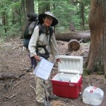
As we approached Wapinitia Pass, there was a great big log with (hooray!) a large cooler next to it.  We cheered and yelled, slung off our packs and looked inside to see what we could find.  Oh yes!  Goodies!   It had apples, soda, beer and candy— great additions to our crackers, peanut butter and dried fruit!   We got very comfortable, sitting on the ground with the log as a backrest, and enjoying the food.  It was hard to get up and go on. 

From there we hiked (the PCT was a Nordic ski trail at this point, well marked!)  till a couple of miles before Barlow Pass and managed to organize a cowboy campsite on a forest floor full of plants and fallen tree branches— not easy!  From what we could see up ahead, it looks like there are no more forest fires between us and Cascade Locks, and the smoke from the fires behind us is slowly lifting and blowing away.  I hope they are getting those fires “knocked down”!    Mt. Hood still has lots of snow on it, which will make the river crossings tomorrow rather “interesting”.   Bill and I agreed on “Second breakfast tomorrow at Timberline Lodge!”

Walk with Aragorn to Minas Tirith: In the land of Lamedon, home of Gondorian sturdy hillmen

Aug25_1lightAug25_3greenmeadowAug25_4gatewayAug25_6viewtreesAug25_8mountainAug25_9montycooler