Friday, July 30, 2010 Miles Today: 16.1 Total: 1,393.8

July 30th, 2010

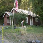
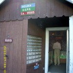
july30_2postoffice

This morning I was up a little after 6 am, hoping Georgi would be, too, because I was hoping she’d let me have some thread to mend my pants.  I tiptoed into the house after saying hi to WS Monty, who was already starting breakfast in the “cookshack.”  Sure enough, Georgi was up and just as chipper and lively as ever. My poor pants were in dire need of another patch! Georgi steered me to her sewing stuff, and soon I was busy mending.  I put a nice big patch on the seat of the pants, where the fabric itself was wearing thin. 

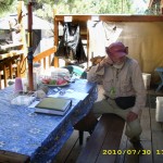
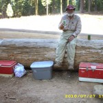
Then I went to hunt up some coffee–it was ready, and Bill had just got up, so we took our nice hot cups and went to sit on a garden bench in the sun. Soon came the breakfast call.   Warner Springs Monty and Goodfoot had made a feast!  There were stacks of fresh blueberry pancakes, and huge skillets of fried potatoes with sausage, veges and eggs, with cheese melted all over the top–plus all the watermelon you could eat.  And did we eat!  It was so much fun to just hang out on a beautiful morning and talk to everybody.  After that, many hikers loaded their packs ready to head out.  The Israelis and I volunteered for KP, and spent the next 45 minutes or so scrubbing pots and pans and cooking tools.

Out of curiosity, I asked the Israelis if they’d ever run into Jews for Jesus.  They said, yes, they had, and very much respected them.  I asked what they thought of the extreme Orthodox folks who actually beat up Jews for Jesus volunteers when they’re out on the streets.  Noga said that she was appalled by that sort of behavior.  It turned out that Noga and the others are all secular Jews–they don’t even believe in God, and are not religious at all–but they respect those who are, and strongly believe in freedom of religion.  “I’m not down on religion,” Noga explained.  “But for me personally, it has no relevance.  I don’t need it, and it would just complicate my life.”  We talked some more, and I encouraged them to consider the possibility that Y’shua (Jesus) really was the promised Messiah.

Then I went back to our tent, loaded our packs, and set them ready to head out to the trail.  I thought we were leaving right away.  Nope.  Bill wanted to contact the Polaroid company to find out about getting the camera fixed.  He got on the Heitman’s computer, figured out how to get to the Polaroid website, and got the product support phone number.

july30_4billsign

I took the phone and dialed the number.  Then I waited on hold forever.  Finally Bill said, “Oh, forget it!  Let’s just send the camera home!”  But just as he said that, voila!  A guy from Polaroid came on the line.  I explained the situation, but he said, “Without a receipt, we will not fix it.”  Well, the receipt was at our house,  and we had no way to dash home and get it!  Finally the Polaroid guy said, “Actually, there is an alternative way to turn the camera on and off.”  He told me what it was, and it WORKED!   Hooray!  Whew!

july30_10rocksbrush

By now it was after 12 noon, and a warm day, but we were very anxious to be on our way. Some other hikers were also ready to head out, so we all piled into Goodfoot’s little pickup truck (me in the cab with Goodfoot, and the three guys in the back with the packs). I dashed into the store to get us some lunch food and a bottle of Motrin for me.  My back hip is slowly improving, but I still need to take some Motrin, and I didn’t want to run out!

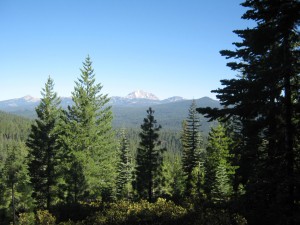
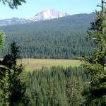
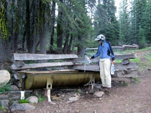
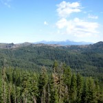
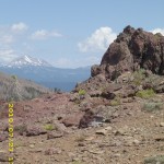
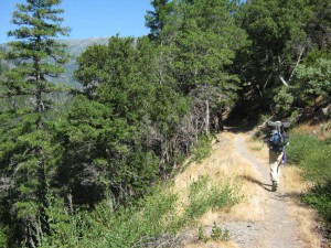
 It didn’t take long to scarf up the lunch, and a bit after 1 pm, on a warm afternoon, we were AT LAST headed back to the trail.  It felt so good to be hiking again, now that we were rested and wellfed.  The miles up to the Hat Creek Rim seemed to just fly by, even though the trail was pretty rough and rocky– soon we were cheering at the sight of Mt. Shasta, all snowy white and grand and impressive.  Mt. Lassen was behind us now, a streaky gray ‘n white.  We’d been told there was a cache near Hwy. 44, and finally we got to it–a collection of gallon water jugs.  We really didn’t need water, but we stopped there for a quart of lemonade and a Snickers.

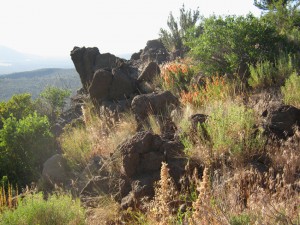
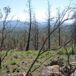
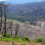
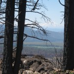
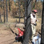
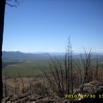
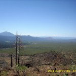
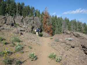
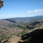
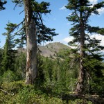
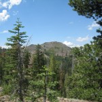
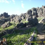
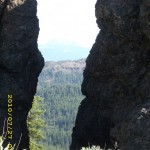
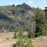
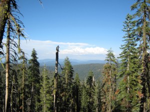
The rest of the afternoon, we were walking the PCT along the Hat Creek Rim. The Rim trail is indeed very rough and rocky and has lots of weed seed stickers waiting to get into your socks, but the awesome views are worth it.  The trail takes you through various “fire zones.”  In the older ones, little trees are starting to grow back.  In the fire zone from last year’s fire, all is barren except for a few tufts of grass and some determined wild morning glories.  In one part of the “new” fire zone, somebody had REPLANTED the trees!!  Way to go!   We cheered for whoever it was.  One of my pet peeves is the idea that after a forest fire, you should “just let nature take its course.”  No way–unless you think it’s “good” to have silt runoff into creeks, and land that stands barren for years.

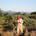
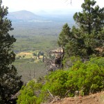
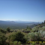
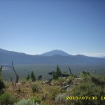
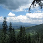
The wildflowers are all done for the year, except the Indian Paintbrush.  We passed many of its little flaming orangered “torches” held high in the brown grass.  There was also one kind of grass whose seedhead breaks apart into individual silvery-gold “stars” that dance and blow around, sparkling along the trail.  Very pretty!  All the dandelions have gone to seed and their round white seedheads looked like glowing white moons.  The trail itself is both very dusty and very rocky.  I was trying to walk fast, but the scenery was so gorgeous that I kept stubbing my toes on the rocks.  Ow!  My poor toes were really hurting!  I’d try to pay more attention to the trail, but the lure of oohing and aahing over views of Mt. Shasta, Mt. Lassen, and the lovely Hat Creek Valley were just too alluring.  So many hikers talk about “The Hat Creek Rim” as if it were some sort of death march.  No way!  It is so beautiful!

At 7:15, we found a nice campsite off the trail behind some bushes, with a great view to the east of low forested hills and pastures.  A number of local creatures decided to comment on our presence–as we set up camp and got into our sleeping bags, there was a continual chorus of animal & bird noises.  It sounded as if they were talking about us!  Some hummingbirds even flew right up to us as if they were checking us out.  There were no mosquitoes–a good thing, because our legs and feet were the dirtiest they’ve ever been, and it took some doing to wash them clean.  Not only that, but because it was so warm today, the water in our bottles was warm, too, and that meant WARM water to wash feet with!  Nice!

We are glad to be back on the trail–by tomorrow we should be at Burney Falls!

Walk with Aragorn to Isengard: Enter the northern downs of Rohan

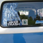
july30_1hikerjuly30_3hikertrashjuly30_5deadtreesjuly30_6vistajuly30_7treesjuly30_8restbilljuly30_11billbrushjuly30_9vistagreenjuly30_1billtablejuly30_2viewplantsjuly30_3vistajuly30_5vistaplantsjuly30_7vistaplantsjuly30_12vistaplants

Thursday, July 29 Old Station Miles today: 15.7 Total so far: 1,377.7

July 29th, 2010

Brrrr!  It was very cold last night.  I checked the thermometer as soon as it was light enough to read it–32 degrees!  We started hiking “all woolied up”–what a switch from the last few days, when it’s been warm at 6 am!

We followed the PCT as it headed into what I call “The Lassen Desert” of pumice and pine trees, but were saddened by the still very serious damage done by the 2004 fire.  Finally we were out of the fire zone and back into green forest with lots of wildflowers along the trail.  I stopped to take a picture of them…and that was the last pic for the whole day–from that time on, the camera refused to open.  I tried replacing the battery, and that didn’t help, either.  So I have no pictures for today.  In 2005, our little camera worked faithfully for the whole hike, except for when the batteries died in the heat at San Gorgonio Pass.  This camera has been a hassle ever since Campo!  Sigh.

Once we reached Badger Flat with its beautiful view of Mt. Lassen, we were on very familiar trail, and happily headed downhill for Old Station, stopping off at the tree plantation to enjoy a rest break & Snickers while lying on deep, soft pine duff.  Ahhh!  We were looking forward to “a rest on the duff” for the last several days!   From the plantation, the PCT goes wandering north, first alongside rushing Hat Creek, then over a couple of lava bluffs, and through a forest with huge trees.  Not too far from the side trail to Old Station, we met 3 nice ladies out horseback riding, and we talked to them for awhile. 

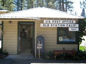
A few more minutes and we were at the Old Station “junction.”  Some thruhikers were sitting around there, debating whether to head up to Hat Creek Rim immediately (which would mean hiking in the heat of the day) or whether to wait and hike up when it was cooler.  Bill and I have a policy of “just hike, don’t worry about the weather.”  If it were us, we would have headed for the Rim.  But in actual fact, WE were headed for the post office at Old Station, so that’s where we went!  At the  PO, we had a temporary scare when the postmistress couldn’t find our box.  Fortunately for us, she had another go at the big pile of hiker boxes, and finally found it–whew! 

Bill was anxious to get to the Heitman’s, and we headed to the store to phone Georgi, but just as we walked up to the store, a car pulled in, and it was friends of Georgi’s who help maintain Cache 22 up on the Rim.  They said Georgi and WS Monty were off shopping in Redding, and offered us a ride if we would just wait while they loaded the car with stuff for the Cache.  So I used that time to get us some great hotdogs for lunch, plus some food to supplement what was in the box.  Georgi’s friends told me that only a few days ago, about 3 hikers per day were coming through, but now it’s more like 10 or 15!  So I guess Bill and I are now part of “The Wave” as it moves north. 

It was a good thing I got those hot dogs, because as it turned out, there’s no lunch available at the Heitmans.  Bill and I piled out of the car and walked about to look at everything.  In 2005, we were the only hikers here.  Now there were hikers everywhere!  We met Shin, much thinner than when we last saw him.  He said that the Sierras just about did him in.  Every hiker we talked to was very tired, and suffering from all sorts of aches and pains.  Many said they were staying for several days, just to rest and recuperate.  A number of tents were set up in the yard for the hikers; Bill and I claimed one, and then I collected all our dirty clothes and started on laundry.  While that was going, I did more repairs on Bill’s pack, and added some padding to my fanny pack.  I  wish there were a way to put more padding on ME!  I am still horribly thin.  Once I got the laundry done, I took my Ridgerest out to a shady spot in the lawn and just plain collapsed for awhile.

WS Monty came by–he cheered when he saw me.  “Hey, Monty!” he said.  “Did you know you’re in the UTube video of the kickoff?”  I didn’t know–that was a fun bit of news!  Monty and his helpers made a fantastic dinner–BBQ hamburgers with all the trimmings, potato salad, regular salad, and lots of watermelon.  It was all-you-can-eat, and believe me, we hikers can EAT!  And what’s really cool is that WS Monty and some others have organized a whole outdoor kitchen so that the Heitmans don’t have to have hikers in the house!  We sat around eating and talking for a long time.  Some of the hikers we’d seen before, and others were new, including a Belgian guy who said his tourist visa for the USA had run out. He had applied for an extension, but was refused.  “I guess I’m an illegal now!” he said.  “But I don’t care–I am going to FINISH this trail, and then I’ll go home from Canada!”    The Israeli girls were listening to him a bit anxiously.  Their visas are also “running low” and they are very worried that they won’t reach Canada before their visas run out.

Meanwhile, Georgi Heitman was running around “mothering” everybody.  She told me how frightening it was last fall when a wildfire almost reached their property.  The green meadow that literally saved their house is very green right now,  and very pretty, but beyond it is fireblackened forest.  She and Dennis had to evacuate, and she told me how hard it was to decide on what to take with them, knowing that when they got back, there might be nothing left.

So tonight, Bill and I are sleeping in a huge carcamping tent that we have named “Pharaoh’s Palace”.  We are clean, wellfed, and comfortable–it’s wonderful!  Tomorrow we will tackle the Hat Creek Rim!

Wednesday, July 28 Miles Today: 27.2 Total: 1,362

July 28th, 2010

july28_1treeline

Well, all the hikers (including us) had to scramble at around 2am when a light sprinkle of rain blew through, totally unexpected. Bill simply draped our tarp over the net tent we were already in because of the mosquitoes, and  when we got up at 5 am,  all our stuff was dry. The only problem we had was the darkness–it was hard to see the trail when we tried to start hiking.  So we agreed “Looks like the days are getting shorter again–better bump our get-up time to 5:15.” 

By breakfast time we were at Stover Springs, where a number of hikers had camped. Many were planning to reach Drakesbad by afternoon, shower, swim and have dinner there. We had fun talking to Evan, Swipe and Tradeja while we were eating.  Evan said he was going to try to make it to Drakesbad for lunch.  I remembered what I’d thought about last night, but told myself, “Don’t be silly–it’s 15 more tough miles to Drakesbad (lots of steep hills and rough trail).  No way can I do that many miles on that kind of trail by 12 noon today.”  But then I thought,  “But I can at least try my best to hike fast, and see what happens.”

july28_7billbuilding

At first, much of the trail was in forest with little to see, but I really enjoyed the glimpses of Mt. Lassen above green meadows. A couple of ridges later, we’d reached the North Fork of the Feather River, where we caught up with several other hikers who were there relaxing. We stopped for a Snickers break, since it’s a very pretty, comfortable spot.  The other guys said they were going to loaf their way to Drakesbad and spend the night there.  We enjoyed the rest, but soon pushed on, and that’s when I said to myself, “Hmmm…if we could reach the park boundary by noon, Bill could “turn on the afterburners” and get to Drakesbad before the end of lunch at 1 pm.  He could get some food for himself and for me.”   

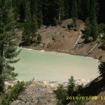
I told Bill about my idea.  He thought it was a bit crazy, but was willing to give it a try, so we both started hiking as fast as we could, and reached Lassen Park boundary by 11:45 am. Bill took off at top speed and was soon out of sight, while I hiked as fast as I could go (huff, puff!) up every hill and RAN on every downhill.  At Boiling Springs Lake, I did stop briefly to talk to a French family, who were already talking to another PCT hiker, Fuzzy Monkey.  The French family were absolutely amazed at the idea of what we were doing; they insisted on taking a picture with Fuzzy Monkey and I. 

Then I started to half-run on down the trail, past the weird blue-y green, steaming lake, and down through the woods towards Drakesbad.  At 1 pm, I was just across from it, on the other side of the meadow, and I trotted and ran as much as I could on the trail through the picnic area and then back up the road towards the resort.  I was absolutely exhausted.  Doing over 18 miles in one morning on rugged terrain was really tough!

july28_9foresthiker

I raced on, and just after I’d reached the first group of cabins, along came Ed, who runs the place, riding in his golf cart. “Welcome, wanderer!” he cheered, “Would you like some lunch?  Hop in!”  So I got a very welcome ride with him, right to the front door of the dining hall.  I found Bill happily chowing down already, and he said he’d only arrived 10 minutes before I did!  Turned out that it was EMPLOYEE lunch time, and there was plenty of food even after the guests had eaten.  I wasted no time in loading a plate and eating to my heart’s content.  Fuzzy Monkey soon arrived, so all three of us were having a great time.  The Drakesbad folks were awesomely nice to us.  The cost for our all-you-can-eat lunch was only $6.50 each.  Wow! 

 Bill and I totally pigged out and waddled back to the trail at 3 pm.  We took our time for the rest of the day.  Up to the top of Flatiron Ridge we went, then strolled along to Grassy Swale, which was as lovely and green as ever, but the mosquitoes were so bad that we had to put on headnets.  We stopped for a snack at Swan Lake, which was so full that it reached all the way to the trail.  Amazing!  We continued the climb to  Lower Twin Lake, where we planned to stop for water, but we were sad to see that the effect of the 2004 forest fire was still there. Not much has regrown.

At the lake, we caught up with the Israelis, who’d stopped to cook dinner before putting in a few more miles.  We got our water, then pushed on ourselves, with the plan of getting away from the lake, and hopefully away from the mosquitoes.  No such luck.  The buzzing little biters were everywhere.  So it was “Net tent tonight!”  I have to say again that I’m SO glad Bill figured out how to rig it with just a couple of trek poles, so we don’t have the bother of the tarp.  I crawled into the sleeping bag after taking a Motrin.  My back hip was hurting again today, but it’s probably my own fault–I was RUNNING down hills instead of just walking.  But oh man, it was worth it to get that awesome lunch!  

It’s 15 miles to Old Station, and I started thinking, “Maybe we can make it to the Heitmans by lunch….”, then I slapped myself and said, “Don’t be an idiot!  You don’t need to do 15 miles before noon again!  Take it easy!”  So I’m going to lay my head down and remember to just enjoy the trail tomorrow!  And thankyou, Lord, that we are “home” in Lassen Park!  This is the place where Bill and I actually learned to backpack, many years ago!

Walk with Aragorn to Isengard: Find Pippin’s brooch, enter Rohan

july28_1viewmountainjuly28_2bridgejuly28_3creekforestjuly28_4viewjuly28_5laketreesjuly28_6billbuildingjuly28_8forest

Tuesday, July 27 Miles Today: 29.5 Total: 1,335.8

July 27th, 2010

july27_3trailbare

Today’s hike was what I call “The Big Walk Around Ruffa Ranch.” The ranch is down in a valley below(you can see the buildings and the green pastures), and the trail circles it, following crests and ridges. There was no ontrail water for most of the day, but because we were up high, the views were splendiferous– Mt. Lassen, Lake Almanor, even the Sacramento Valley.  We stopped for breakfast at Cold Spring Campground, which does have a wonderful piped spring, and even a bench to sit on.  Several fat, glossy, contented cows were grazing in a meadow nearby.  Once we finished eating, we really loaded up on water, for the 24 waterless miles ahead.  I must say that though water may be scarce in this section, when you DO come to water, it’s wonderful–very cold, very clear and tastes great!

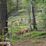
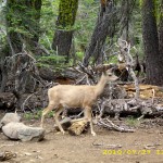
Wildflowers were abundant on the trail this morning– all growing in rock garden style among the lava boulders and formations.  Overhead were pretty clouds.  A few NOBO  hikers passed us this morning, all going as fast as they could so they could hitch into Chester!  We also met several SOBO section hikers. One was a little old whitehaired lady whose trail name was “Noisemaker”; she was carrying an enormous pack.  It made me ache just looking at it!  She must be pretty tough.  We stopped for lunch at a side trail (supposedly there was water a half mile down, but we had enough, so didn’t bother with it).  A very bold deer came out of the woods and came right up to beg from us!  No way would we give it any of our precious food!  It was getting rather annoying, when all of a sudden, another deer came along and chased the beggar deer away! 

july27_1benches

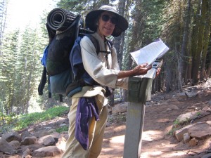
 Then came the big climb of Butt Mountain. When we did this part in 2005, hunting season had started, and the trail hadn’t been brushed in quite a while.  We were pushing through bushes, listening to gunshots in the woods, and hoping and praying most fervently that nobody would think we were deer trying to get away!  This time, the trail was nicely trimmed and a very pleasant walk.  At 3 pm, we reached the post that marks the official HALFWAY POINT of the PCT and stopped to celebrate with bug juice, a Snickers, and signing the trail register!  Yee-hah!  We were amused to see how many hikers had already signed in today.

Then came the long, long, mostly viewless downhill to Highway 36.  By 5 pm, we’d reached Soldier Creek, the first ontrail water since Cold Spring.  We were just about out of water, so it was a welcome sight, and we stopped for supper, plus washing ourselves up a bit in the creek.  We were filthy dirty from dusty trail plus sweat from the heat.  We even rinsed our socks!  Once we were down “on the flat” again, the PCT winds in and out of private property; seemed like every few yards there’d be another sign on a tree that said we were either entering or exiting such-and-so property.  Just before Hwy. 36, there was a sign telling of a hiker cache on the other side of the road. 

When we got there– wow! Hidden behind a huge log was a wonderful hiker cache with cold soda, water, fruit– even bagels!  While we were eating, I noticed that one of the thruhiker gals (last saw her pouring water over herself coming out of Belden) was trying unsuccessfully to hitch a ride into town.  The cars were just flying past her.  Since it was late in the day and we were going to stop and camp soon, anyway,  I went across the road, carrying my Ridgerest, to try to help her out.  (Yogi’s guide to the PCT mentioned that it really helps to write “Pacific Crest Trail Hiker” in large letters on your sleeping pad, to use when trying to hitchhike.  So I’d done that to my Ridgerest.)  Ann, who’d been trying and trying to get a ride, was very discouraged.

july27_10montytrailregister

She was glad of my company, and we hoped that with two of us plus the sign, maybe she’d get a ride…but no luck.   Car after car just roared on by.  I must say I was surprised.  You would think that folks in the Chester area would be clued in to thruhikers by now!  Ann finally decided to just give up and go camp in the woods, so Bill and I did the same.  We walked a bit further on, away from the highway, then found a nice comfortable spot in the trees.   We set up the net tent, because the mosquitoes were pretty bad, and talked about “Drakesbad tomorrow!”  The Drakesbad people had posted an “ad” by the hiker cache, inviting everybody to stop by.   I started having the crazy thought, “Maybe we could get there for lunch!”   We’ll see! 

Walk with Aragorn to Isengard: East Wall of Rohan
july27_2treelinejuly27_4vistabarejuly27_5cloudsjuly27_7treesjuly27_8vistahilljuly27_9vistahillsjuly27_1viewfogjuly27_2viewruggedjuly27_3viewrockyjuly27_4viewthrurocksjuly27_5viewjuly27_6rockyviewjuly27_7rockscirclejuly27_8h2ojuly27_9forestjuly27_10deerforestjuly27_11billforestjuly27_12billforestjuly27_13billlog

Monday, July 26 Miles Today: 17 Total: 1,306.3

July 26th, 2010

july26_1trailforest

Since we had to wait for the Belden post office to open, I “slept in” till 6:30, then got up to see about making coffee for all the hikers.  When I walked into the kitchen, I discovered that the Braatens had left two big platters of watermelon slices and fresh chocolate zucchini muffins. So I snagged a muffin while hunting for coffee supplies.  Everything was there except filters…so I improvised with toilet paper!  It worked fine, and as various sleepy, tousled hikerheads emerged from their various spots, they were very happy to see hot coffee!  But for thruhikers, a muffin, watermelon and coffee are just an appetizer, not a serious breakfast,  so pretty soon we were all making the 0.25 mile trek down the road to the Caribou Restaurant for big HOT breakfasts.  Before we left, though, I washed all the dishes and cleaned up the kitchen, while Bill talked to Mr. Braaten about gold mining. 

Turns out that the Little Haven property does include a gold mine!!!–BUT there are so many government rules now about how you can mine and all the procedures and equipment, that ordinary folks like Mr. & Mrs. B can’t afford to mine on their own property.  And this is the case for many of the small goldminers along the Feather River.  Their operations are all shut down.  Only the “big guys” who can afford the required equipment are allowed to continue.  Mr. B said that a few “little guys” have banded together and are sharing equipment.  Good for them!  But to add insult to injury, now the US Fish & Game department has decided they will no longer plant fish in the Feather River.  The result is that there are very few fish, and those few are wild, wary and hard to catch.  So the Feather River canyon has gone from being a busy, prosperous place (goldmining and fishing) to a place that’s barely surviving, thanks to government regulations.  Grrrrr!

july26_2treeline

Once the kitchen was all cleaned up, Bill and I walked the quarter mile down the road to the Caribou Cafe.  We had the “Hiker Special” breakfast–really good!  The place was filled with other hikers, and what was interesting—nobody ordered coffee; instead we were all having fresh fruit milkshakes!  Awesome!  We walked back and went hunting for Mrs. B so that we could get a ride to the post office.  Turned out she was working on building a retaining wall behind her very thriving vegetable garden (so that’s where the yellow summer squash came from that we ate last night!) 

At the post office, which is basically the enclosed front porch of a house, we were greatly relieved to find our box waiting.  It had everything we needed, so all I had to do was divvy up the food and put it in our food bags.  We wasted no time then in heading back to the trail, still disappointed because we’d hoped for an early start in the cool of the morning. It was 10:30 am before we were able to start, the day was already hot, and it’s a 14 mile long 5,000+ foot climb up out of Belden, at first going up the Chips Creek canyon, then on up into the mountains.  There was no shade for some time, because the canyon had a forest fire a few years ago, and there are no trees left in the fire’s path.

july26_3hillside

The trail at first was in much better shape than 2005–no need to literally fight your way through the bushes while feeling for the trail with your feet!   It was  a hot day (I put up my umbrella for shade to hike under!), but many creeks crossed our path– at one of them a hiker was pouring water over herself!  I didn’t try to hike too fast, because I knew from experience that this is one LOOOOONG climb up.  Chips Creek nearby was very pretty, cascading and roaring down the canyon.  The trail had obviously been worked on, with all blowdowns cleared, and the trail tread very nice.  Finally we came to a sign that said, “This section of the trail was maintained by the California Backcountry Horsemen.”  THANKYOU!! 
But just beyond the sign, oh my! We were once again climbing over and around blowdowns, fording creeks, and even dealing with a bit of snow. Sometimes it was hard to figure out where the trail went.  And some of the creeks were so deeply gullied by snowmelt runoff that it was hard to get across–we had to climb down steep, eroded creekbanks, cross the creek, then climb up the other side.  It was a mess, but we persevered, with a plan of stopping for water at Poison Spring, which is totally misnamed–the water there is wonderful, and it’s actually not too far from the top of the big climb.
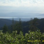
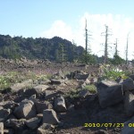
By suppertime, we were up at the top. It’s a rocky ridge with amazing views.  Mt. Lassen to the north was surrounded by impressive thunderclouds, and when we looked south, there were more thunderclouds behind us!  Overhead, the sky was a gorgeous blue.  We were sitting near the trail enjoying our food, when  a number of young guys passed us– they were on a tear to be in Chester tomorrow night!   I’m sure they’ll make it–in fact, Bill and I figure we should be at the Chester road by tomorrow night, too.

Today was kind of tough, with the late start, the heat, the uphills, and then the messed up part of the trail.  The mosquitoes got pretty bad by 6 pm, so when we stopped for the day, we set up the net tent, and now they are whining and humming all around us, trying to get in.  We’re up on another rocky ridge, with a very pretty orange sunset.  One nice thing was, I had NO back hip problem today because it was all uphill.  I took one Motrin when we first started, and didn’t need any more after that.  Tomorrow the trail will go up and down, so we’ll see how I do.  Looking forward to heading into Lassen!

Walk to Rauros: West bank near Amon Hen

july26_1buildingjuly26_2buildingjuly26_3viewhillsjuly26_4greeneryjuly26_5forestjuly26_6forestjuly26_7billview