Monday, May 17 – Mt. Baden-Powell– Miles Today 19.4 – Total Miles 384
Monday, May 17th, 2010
Last night was windy and freezing cold! Brrrr! We broke camp at 5:00am and headed for “adventures on Mt. Baden-Powell.” Because of so much snow on the PCT, we took the “road alternate” that’s only a few steps away, and has awesome views(including Baden-Powell), as opposed to the viewless, forest-surrounded PCT. We met “Wyoming” at the ski lifts, and walked with her the rest of the way to Highway 2. Wyoming stopped there, since she was headed for Wrightwood. We felt very bad leaving her all by herself in the bitter cold, next to a highway with no cars.
Bill and I kept going, with a little bit of concern about whether or not the water would be turned on at Grassy Hollow visitor center. Not to worry! A short way along the PCT from Highway 2, there was a water cache! And not only that, but the trail itself became very pleasant–no more snow wrassles, AND really nice views. The PCT goes through an interesting mix of evergreen, alpine-looking forests and oak woodlands. Finally the trail began dropping down to Vincent Gap, and we were eyeing “Mt. B-P”. From what we could tell, it had a fair amount of snow, but looked do-able.
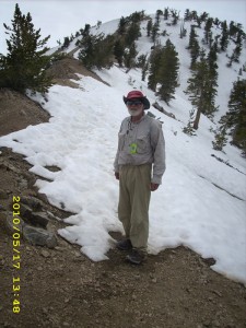
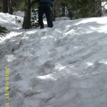
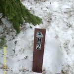
At the Baden-Powell trailhead parking lot, a couple was resting. Turned out they were section-hikers from Eureka, CA, who were headed for Agua Dulce. I took a deep breath and prayed before we began to climb up. At the first the trail was easy going, clear of snow patches. But by the time we reached the “Mile 2” marker, we found it buried in snow with only the top sticking out. Charlie and Shin were there, too, and discussing what to do. The conclusion was, “Forget the trail, let’s just head straight up!” So we all did!
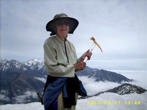
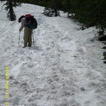
Charlie and Shin were fast, and soon were way ahead, while I did my best. Bill did a wonderful job kicking steps for me— I only needed my ice axe a couple of times— and by 2:00pm we were on top. I was very tired, not so much from the climb, but from the stress of being scared on the steeper parts. We celebrated with a late lunch of crackers and peanut butter while we ate, admired and wondered about the very strange clouds we were seeing above and below us. Some were dramatic,dark and stormy-looking. “Will it rain?” we wondered. The section hiker couple we’d passed earlier caught up with us and soon we all headed out, only able to guess where the PCT headed down the next ridge. Snow covered all north slopes, but the ridgetop was so flat that the snow was easy to walk on.
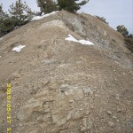
The husband of the other couple was taller and heavier than Bill, and he really worked hard at TRAMPING out footsteps for his wife to follow. Perfect! I was able to use the footsteps, too, though he (and we) tried to stay on bare dirt as much as possible. We all spent the rest of the afternoon in a challenging mix of rock climbing, snow traverses, route-finding (we did see a few short “patches” of trail occasionally) and scrambling over logs and bushes. The rockclimbing bits happened whenever we were faced with a choice of 1) Walk across a steep snowfield vs. 2) Climb over a bunch of rocks. We all chose the rocks! The PCT itself wandered all over the place, which is normal, but oh, man, it sure makes it hard when there’s lots of snow!
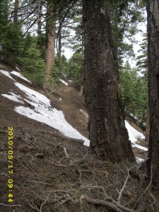
A bit after 6:00pm, we were all climbing up another ridge in a howling cold wind, when I spotted a trail sign in the forest off to the right. Bill went to investigate. Just as he returned, the wind changed to a scream and it began to SNOW! We could hardly even stand up in it. The snow was blowing straight sideways! We and the Eureka couple held a worried conference on what to do. It was getting late, and based on the sign Bill had read, we still had another 3 miles or so to reach Little Jimmy Campground. None of us were even sure how to get there, with the trail buried in snow. In the end, the Eureka folks opted to push on, following the ridge, hoping to reach the campground before dark. Bill and I chose to head down to the highway, which we could actually SEE down below (WAY down!) It took 1 1/2 hours for us to make it–and it was my fault it took so long. Bill’s downhill technique on steep, rough terrain is to just “go for it”, with dirt, twigs and small rocks flying everywhere. Me, well, I am way slower, because I don’t trust my ankles. They have a bad habit of just going “flop” all of a sudden. I definitely didn’t want to sprain an ankle on that mountainside in the freezing wind with a mixture of snow and rain coming down! The hillside was very steep, and we were crossing snow, rocks, scree, and plenty of fallen trees. It took till almost dark before we reached the road, about done in. We’d had no dinner and no snack.
But amazingly and wonderfully, it turned out that we had come down in the absolutely most perfect spot ever–the one place where the mountainside by the road was not a cliff–just very steep. We could still safely sort of half-slide down. And not only that, but we landed in a turnout for the highway that was snow-free, flat, and DRY! The ground was not muddy or puddly. Everywhere else along the highway, there were no turnouts, and there was no way down except over a cliff. The wind was still howling, it was raining with some snowflakes mixed in, and we wasted no time putting up our tarp in “storm rig” before getting under it and burrowing into our sleeping bags. But we were safe! And I was very grateful to God for 1) The great encouragement of meeting up with Charlie, Shin, and the Eureka folks 2) Having such great footprints to follow in the snow 3) Coming down off the mountain in just the right spot!
What a day! Wow!
Walk to Rivendell: High, steep, stony hills with caves.

