Archive for May, 2010

Sunday, May 16 – Miles Today 10.5 PCT 15.4 Detour – Total Miles 364.6

Sunday, May 16th, 2010

may16_fog

Wow, what a day!  Over 26 miles of hiking, and 95% of it uphill, since the trail had to climb from 3,000 feet to 8,000 feet in elevation. 

We were up at 5:45, and took our one leftover trail breakfast down to the Best Western “breakfast room”, which opened at 6:00am. All the thruhikers were there! We scarfed up our trail breakfast, plus everything else Best Western had to offer,  while talking with the other hikers.  The hot topic was the big detour ahead of us— maps were being spread out on tables and opinions of various sorts were “fervently discussed.”   And there was a fair amount of grumping about “The detour is gonna be ugly…yuck, a powerline walk!”

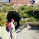
We figured, “Whatever, let’s go!”,  shouldered our packs and headed  back to the PCT, stopping off at Subway to get sandwiches for lunch.  The trail takes you through a dark tunnel under the freeway, then into a very green “jungle zone”, and finally up onto the hillsides where the views begin!  To my great delight, just as we were about to go under the railroad tracks, a train came by! 

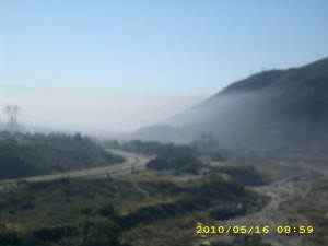
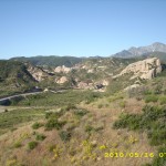
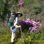
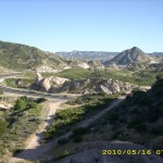
The PCT climbs up and up, with great views of the railroad (did I mention I love railroads??) and also views of the thick smog (or was it smoke? Not sure) of Los Angeles.  It wasn’t long till we came to the officially closed section of the PCT, and turned to follow the detour route, which was a dirt powerline road.  Up and up we went.  The wildflowers were gorgeous.  At the top of the climb we could see a green oasis a little bit below, and that’s where the detour went–to Applewhite Campground.  We got water there and enjoyed talking to one of the park staff about the detour.  He said all the locals think the PCT route is perfectly safe and sending all the hikers on a 15 mile detour is totally dumb.  He also told us he was in the campground on the afternoon when the fire started, and it was very, very scary.  Had the wind been blowing the other way, the whole little Applewhite Valley community would have been trapped.  I am glad the wind went the other way!  I enjoyed the brief stop among green trees and grass and creek!

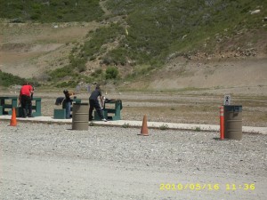
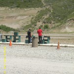
Bill and I hiked on up Lytle Canyon Road, past several cute old wood cabins and houses, till we found ourselves walking up a long, long valley with snowy mountains waiting at the end.  But best of all, just before noon, we reached “The Firing Line,” a big shooting range out in the middle of nowhere.

may16_gunrange2

We bought cold drinks and got permission to watch all the goings on. There were 4 ranges, each different, and all ages of folk, with all sorts of guns, and all levels of shooting ability, from “Wow, he’s good!” to pretty pathetic. Very cool.  (Actually, we could HEAR  “The Firing Line” long before we could SEE it–sounded like a Civil War battle re-enactment.)

Note from Alexa: How uncivilized, they ought to be using longbows


may16_campgroundhikers

A long climb up a rocky road  and then a switchbacking trail took us back to the PCT, which promptly began its usual “scratch across the side of a mountain” pattern.  (I still say we shouldn’t call it the Pacific CREST Trail.  To be accurate, it should be called the Pacific SIDE-OF-THE-MOUNTAIN trail. )  Up ahead on a saddle, we spotted a whole group of people and two parked cars.  “Search and rescue operation?”  was our first thought.  Well, sort of…it turned out to be a search and rescue PRACTICE.  Also in the crowd were a bunch of PCT thruhikers, discussing where to camp tonight.  The final decision was for Guffy Campground. 

Bill and I kept on going, with our usual plan of “We camp at the first flat place we find when the sun starts going down.”   I thought it was maybe another 5 miles or so to Guffy.  The PCT climbed higher and higher.  I was really tired at this point, and pretty soon the group we’d passed back at the saddle caught up with us.  To add to the fun, the PCT soon became an obstacle course of snowdrifts to climb over, while the wind blew stronger and colder.  Finally the snowdrifts became so annoying that we shifted to walking parallel to the trail along a road (we did this in 2005 as well).

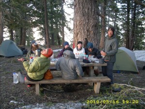
Along the way we caught up again to the group that had passed us.  They’d stopped to wait for a missing member who’d been lagging behind.  All of them were very worried.  We were no help, since we hadn’t seen him either.  A final stiff climb took us to Guffy Campground (turned out it was 8 miles, not 5 as I’d thought).  Snowdrifts were everywhere, the wind was fierce, and it was very cold.  Our first concern was getting water, but we couldn’t find the trail down to the spring till we spotted a guy coming UP it.  Whew!  Bill and another of the young guys headed down to get water while  I hunkered down out of the wind as best I could.  When Bill got back, I cooked dinner in the lee of the bathroom before we hunted around, found a little sheltered  hollow and  prepared for a cold night.  This is the first time we’ve ever had to camp near other hikers, but we were too tired to go on.  It sure is nice to be back in the forest again, though!   Baden-Powell tomorrow!

Walk to Rivendell: Steep lands of the Trollshaws & ancient realm of Arnor

may16_billmay16_billtrailmay16_billtrail2

may16_billtunnelmay16_gunrange1may16_montysignclosed

may16_mountainsmay16_pinkflowersmay16_roadtracks

may16_roadwalkmay16_trainmay16_train2

may16_train3may16_train4may16_treetrail

may16_vista2may16_vista3may16_vistasnowy

Saturday, May 15 – Cajon Pass–Miles Today 0.4 – Total Miles 342.1

Saturday, May 15th, 2010

may15_rocks

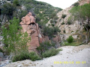
Last night, a sort of tule fog formed on the canyon bottom where we camped, so we woke up to everything soaking wet— sleeping bags, packs, etc. Yuuuck.  But we could afford to be cheery, because we were headed for McD’s and then Best Western. So as soon as it was light, it took only a short but very impressive walk as the PCT twisted and turned its way through a dramatic canyon, before we reached the freeway frontage road, “hung a right” and headed for McD’s.
We ordered the biggest breakfast platters they had and scarfed it all down. Another hiker, Curly, came along, too.  He, like everyone else on the trail this year, was concerned about the big Station Fire detour just ahead.

After breakfast, we strolled down the road and arrived at the  Best Western in Cajon Pass at 7:20am— no problem. The fantastic staff people there gave us a warm welcome.  They quickly got our hiker box, gave us a room, maps of all the fire detours, and even did our laundry for free because one of the coin-up machines was broken down! What a wonderful bunch of people. While the front desk lady was doing our laundry (!!!)  I wrote journal stuff and diligently studied the detour maps. 

 Then we soaked in the hot tub and enjoyed talking to other hikers.  “Chief Daddy” is Scotch and hikes in a sports kilt.  “Chuck Norris”  was a very funny guy who told us, “Hey, did you know that you can be a Triple Crowner?  All you have to do is while you’re here at Cajon Pass, you eat at all three of the restaurants–McD’s, Subway and Del Taco.”  He grinned wickedly.  “Just say ‘I’m a Triple Crowner’–they don’t need to know it’s NOT the AT, PCT and CDT!”

So we started on the “second leg” of our Cajon Pass Triple Crown, and  ate a huge lunch at Subway–a WHOLE footlong EACH!   In the afternoon, I loaded up our food bags so we’d be ready for the PCT again tomorrow, made a “water plan” for the detour, then settled in for a relaxed time of reading the Gideon Bible from the motel drawer (Ezra, Haggai and Zechariah–they go together, Bible history-wise, and have a lot to say about priorities in your life!)

We completed the third leg of our Triple Crown by eating at Del Taco, and when I told the Del Taco guy about the Cajon Pass Triple Crown, he cracked up laughing and told us that he wants to do the PCT someday, too!

 Now it’s hiker bedtime (7:30pm)— time to hit the hay!  It’s been a great day.

Walk to Rivendell: Low hills, fifth day from Weathertop

Friday, May 14 – Silverwood Lake–Miles Today 29.6 – Total Miles 341.7

Friday, May 14th, 2010

may14_trail

The crickets sang us to sleep last night, and they did such a great job of it that I totally zonked out, and didn’t even notice when Bill got up in the middle of the night and took down the tarp.  He told me that it got really windy (which meant the tarp was flapping and noisy) and all the clouds blew away.  To save wear and tear on the tarp, he took it down. 

When we started hiking, we passed several other thruhiker tents.  Strange–almost everybody uses a TENT.  Very few use tarps, and even fewer ever seem to cowboy camp.  I prefer cowboy camping! 

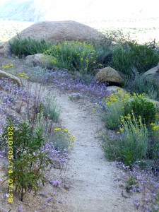
And so we began a walk I decided to name  “Learn to Love the Gullies Day”. We spent most of the morning contouring and climbing in and out of 10 zillion gullies, on our way around the valley to reach the Silverwood Lake dam.  I joked about becoming a “gully connoisseur”, saying things like “Ah, yes, in THIS one the creek is quite exquisite”  or “Observe the rugged rock formations in THIS one!”  The wildflowers continue to be awesome.  I could easily stop every minute and take another picture of all their different colors and arrangements.  Even the GRASSES are beautiful–all different colors and types. Views of the green valley below with snowy mountain backdrop were also very enjoyable.

We were sitting by the trail eating breakfast when the Japanese guy we met last night came by.  His name is Shin, and his trail name is “Turtle.”  Why, I don’t know–he is anything but slow.  He is very nice, and it turned out that his parents own a sporting goods store in Tokyo.  He is testing backpacking gear for them!  We talked a bit and Shin headed out.  After breakfast, we did, too.  Back to the gullies!

To our great surprise and joy, we reached the Silverwood Lake dam by just before 11:00am.  It was a lovely, warm morning and we decided on a goal of  “eat lunch at the picnic area”— on the other side of the lake.

may14_billtrail

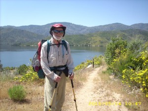
But we’d forgotten it was a long, tough trail to get there–all around the lake and over hill and dale.  I got hungrier and hungrier and hotter and hotter and tireder and tireder.  I was seriously thinking about just saying “Phooey on the picnic area–let’s stop now and go for a swim!”  It took till after 12 noon to get there, and I was so exhausted that I just collapsed under a tree for 20 minutes. We had done 16 miles already! (But the hike around the lake really is wonderful— gorgeous lake views, lots of little pocket beaches.)

may14_billvista

Lunch and plenty to drink revived us both to face the big climb up to the top of Little Horsethief Canyon. The climb was a bit hard, but it rewards you with ever-bigger vistas of rugged mountains and the lake, and waisthigh wildflowers!  Finally we reached the top and began the long contour along the canyon, and that’s where we met two very tired ladies who were doing the PCT as SOBOs from Tehachapi to Lake Morena.  Their tails were really dragging, since by now it was a hot afternoon.  Because of the Sierra snow, their plan was to hike SOBO, then go back to Tehachapi and tackle the Sierras.  Since they do only 13 or 14 miles a day, it’s going to take them awhile!  They anxiously inquired about how much farther it was to Silverwood Lake, where they plan to camp tonight, and cheered at the thought that it was downhill!

A few minutes later,  three BAD bike riders (On the PCT!  For shame, for shame!) cheerily passed us by.  We scolded them in a friendly way, and they just laughed.  Eventually we crossed the canyon and began climbing up to the powerlines where we planned to eat supper.  Along the way, we caught up with another hiker who is being slowed down by his battle with plantar fasciitis.  Bummer!  The wind was blowing, and it was still quite warm, so we found a shady gully to hunker down in while we ate.

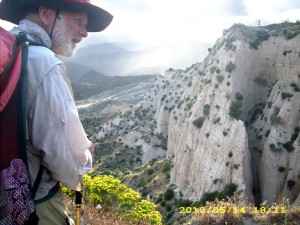
And so in the late afternoon/early evening, we were headed into the spectacular ” Badlands” — awesome, knarly cliffs with big dropoffs!  We had one great view after another in the beautiful evening light!  And I tried very hard to be brave and actually LOOK at the dropoffs instead of just the trail.  I also had fun looking at the trains going by in the distance!

Note from Alexa: Did you see Voyager? Or any Bajoran ships?

Hoping to find a campsite by 7:00, we hurried along all the twists and turns of trail down to Crowder Canyon where we camped in a sandy wash.  While we were setting up our cowboy camp, I looked at the animal tracks in the sand.  Some of them were rather large.  Hmmm!  Coyotes?  The only animals we saw today were lots of horney toads,  several garter snakes,  a bunny and a number of squirrels…no large animals at all.   Oh well–Bill and I were so tired that we just wanted to dive into our sleeping bags.  Instead of crickets, our lullaby tonight is the sound of trains at Cajon Pass.  It’s a good sound–I love it!

Walk to Rivendell: Reached end of valley, fifth day from Weathertop

may14_billsignmay14_campmay14_lake

may14_montyflowersmay14_vista

Thursday, May 13 – Deep Creek–Miles Today 27.5 – Total Miles 312.1

Thursday, May 13th, 2010

may13_montywhitemanz

Clouds moved in overnight, and we woke up to a 30 degree morning with dew all over our sleeping bags.  Bill’s socks he’d hung up to dry on the horse corral railing were all frozen stiff, as was my Platypus drinking tube.  But we knew we had a big hiking day ahead, so at 5 am, we were up ‘n at em.  We scarfed down a “bar” each (Bill likes ProBars; I like Larabars) and passed a number of other hikers who were just starting to get up.

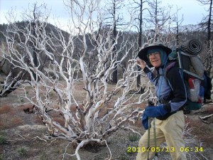
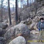
 The first part of the morning, the PCT travels along high above Holcomb Creek, in a burn zone from a fire a couple of years ago.   I felt as if I were at a black and white ball, with graceful  white manzanita and stalwart black tree trunks.  It was actually very beautiful, in a strange sort of way.  We also had fabulous views of snowy mountains far ahead, and desert views to the east. 

may13_creekcrossing2

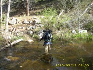
Finally the trail went down  to Holcomb Creek, to a jumbled mess of logs, boulders and riparian greenery.  Little “flags” marked where the trail went, as it crossed the creek a total of 4 times.  But instead of the simple rockhop crossings we did in 2005, we were faced with genuine FORDs.  At each ford, the creek  got deeper— thigh deep on me at the end, with the water really moving, and so cold that after you get out and your legs “un-numb”, you are in pain for a few minutes! Ow!

At the 4th and last ford, we were crossing with another thruhiker, whose friend had already made it to the other side, and was taking pictures of us all.  A great cheer went up from the whole gang of us when somebody yelled, “Last ford!”   Now we were all eager to press on to the famous Deep Creek!

may13_girlblue

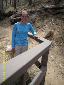
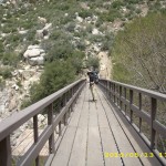
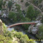
Of course the PCT had to wander all over the place, but then we began meeting dayhikers, so we knew Deep Creek must be close.  A few more switchbacks, and there it was, with a brandnew bridge to replace the wrecked one, AND a lovely trail angel (an injured thru-hiker waiting for her knee to get better.) She gave us an orange and M&Ms, which we promptly ate for lunch!  Meanwhile, down below the bridge, a film crew was at work on a production about the Creek, and there was a whole contingent of PCT hikers lounging on the beach.

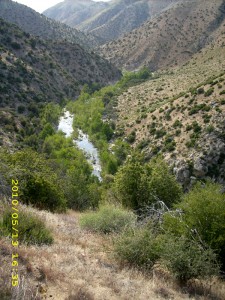
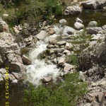
 The entire rest of the day we followed the PCT through the many twists and turns of beautiful, beautiful Deep Creek canyon, with its spectacular rock formations, rushing cascades, and deep green pools.  All along the trail, the wildflowers were gorgeous.  They were mostly desert-type flowers, not large, but there were LOTS of them. 

For “height-challenged” people like me, the trail is often scary (big dropoffs; a couple of years ago, thruhiker No Way Ray died here in a fall off the edge of the trail) so there were stretches where I just tried to stay focused on the trail and ignored the dropoff right next to it.  But finding water was no problem–there were lots of side creeks.  We stopped at one of them for lunch and were entertained by the spectacle of HUGE black buzzing flies doing aerobatics nearby.

We passed the famous Deep Creek hot springs, where there were a number of people running around in their birthday suits.  We’ve heard that the hot pool is really nice, but in view of the ah…other activities…we opted not to stop.  At 5 pm we stopped at a lovely side canyon to cook dinner and were soon joined by two other hikers.  One guy is from Japan.  He’s very nice, but doesn’t say much.  He had noodles for dinner.  The other guy had mac ‘n cheese.  We had stuffing mix with freezedried beef and veges.  All of us agreed that we were determined to “finish” the canyon before making camp, even thogh there were still miles of canyon left to travel. 

By the time we reached the end of the canyon, the sun was low in the sky.  The PCT has to drop down quite a ways before it crosses the spillway of the big earth dam.  We hurried down the many switchbacks, across the dam and spillway, then into the wide, gravelly/sandy creekbed.  In 2005, Deep Creek was quite wide, but very shallow–an easy wade.  This time it was also pretty wide, but much deeper (thigh deep on me) and moving right along.  We walked along the shore a bit before deciding where to cross.  

Then we lost no time scouting out a campsite!  The sun had gone down and though it was still a pleasant evening, we were very tired.  Near our creek crossing, we spotted a grove of sycamore trees,  and set up camp underneath them.  Clouds were gathering, so we rigged the tarp just in case, and then collapsed.  Man, are we tired!  But it’s such a lovely evening, the crickets are singing, and tomorrow we’ll be at Silverwood Lake!   

may13_vista4

Walk to Rivendell: In valley, fourth day from Weathertop

may13_300markmay13_bridgeplankmay13_bridgesilverchair2

may13_bridgeviewsilverchairmay13_creekmay13_creek3

may13_creek2may13_creekbedmarkermay13_creekcrossing3

may13_rockytrailmay13_rockyvistamay13_sweepingvalley

may13_trailmay13_trail2may13_yuckwater

Wednesday, May 12 – Miles Today 27.7 – Total Miles 284.6

Wednesday, May 12th, 2010

may12_vista2

We got up at 5:00 am and enjoyed a “breakfast by firelight” in our room at Nature’s Inn.  We let Ed, the owner, know that we were starting back to the PCT and that we would be praying for him, then headed out on a cold (frost on roofs; could see your breath), clear, NO wind morning! What a relief not to be battling a cold wind all day!

We were just in time to catch the Erwin Lake bus, and enjoyed a fascinating “tour” of the many little neighborhoods in the area as the bus followed a very convoluted route! The friendly bus driver took us as close as he could to the PCT (he said he’s done this for many hikers!), then 2 miles of walking past Erwin Lake, up the hill and we were “home” again on the trail. We both feel 100% better than we did 3 days ago!

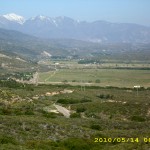
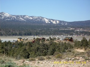
The first miles were quintessential “west” with sagebrush, ranches and horse tracks, but most amazing of all was that if you turn your head right, you’re looking at desert below, but turn left and you’re looking at snowy mountains, forests and lakes. What a contrast! I find it hard to believe that some thruhikers grump about southern California scenery being “boring and ugly”.  No way!

Note from Alexa: Sounds like Peter Jackson’s opinion of the Rohan landscape.

may12_billvista

The PCT was basically fairly easy going, except for a lot of fallen trees to negotiate and snow to get across— fortunately the snow was not as scary, but I am still slower at it than Bill. We also enjoyed the stunning views of Big Bear Lake, and views of several large open-pit gold mines. The mines are much more extensive than they were in 2005!  We ate lunch at Doble Trail Camp, and found that a new “outhouse” had been installed.  It’s basically a pit toilet with a gated fence around it, completely open to the sky…which is fine on a nice day like today, but in the rain, well, not so nice. 

may12_vista5burn

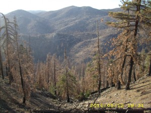
We met only a few thruhikers on the trail today. We heard at Nature’s Inn yesterday that there were plans for a BIG “hiker BBQ” at the hostel today.  Maybe that’s where everybody went??  I’m glad they had such a nice day for it, after all the wind and cold we’ve been having.  At 6:00 pm, we got to a sign that said it was 3.75 miles to Little Bear Springs Trail Camp.  A number of hikers had stopped to camp nearby.  Bill and I stood by the sign and discussed what to do. We had a choice between “camp now” or push on.  Could we do almost 4 miles before dark?   We chose “go on” and hiked as fast as we could through what turned out to be a forest fire zone of blackened trees and ashy ground. 

Just after the sun went down, we made it to the “camp”  (which fortunately had escaped the fire) and ended up laying out our sleeping bags IN a brand new horse corral, the only flat spot we could find!  Since the corral was new, there were no “meadow muffins” to deal with. We were tired, after doing almost 30 miles, and it was very nice to lie down and listen to Holcomb Creek rushing along not far away.  It is wonderful to be back on the trail!

Walk to Rivendell: Second day from Weathertop

may12_billburnedmay12_marshlandsmay12_trail

may12_vista1may12_vista3may12_vista4burn