Archive for May, 2010

Friday, May 21 – Zero at Hiker Heaven

Friday, May 21st, 2010

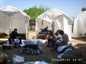
may21_hikerheaventents

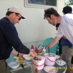
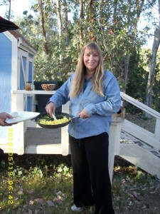
We got up early today, and along with Charlie, we made a breakfast feast for all the hikers– 2 kinds of pancakes, plus bacon, sausage and ham, with plenty of strawberries, bananas, butter and syrup and lingonberry jam to put on them.  All the hungry hikers were well-fed by the time we got done!

Then I found the official “hiker sewing basket” and basically spent the whole rest of the day sewing lots of projects, from fairly extensive repairs on Bill’s pack (and another hiker’s pack) to new construction of items Bill had lost. plus mending other hikers’ clothes.   I would have used Donna Saufley’s sewing machine, but unfortunately it was broken.  So all my sewing was done by hand, which is slow, but on the bright side, a hand-backstitched seam is actually much stronger than a machine-sewed seam.  It was a rather chilly day, though sunny, so I sat in the sun with my sewing, and it wasn’t long before various hopeful-looking hikers were stopping by with their stuff, asking, “Do you think you could fix this?”   That suited me just fine!  I love a sewing challenge. 

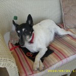
 To add to my fun, one of the Saufley dogs decided he wanted to “help” me and insisted on jumping up and lying on my lap.  Sometimes he lay down on top of the sewing.  I would have been tempted to say, “Doggone it, dog!  Go away!”  but he was just too cute to grump at. By the end of the day,  I’d done extensive repairs and replacements on two packs, made a new “medicine bag” for Bill and I (Bill lost the original when he fell on Fuller Ridge), a new headnet and sungloves for Bill (they were literally blown out of his pack sidepockets by the wind in the San Felipes), and lots of clothes-mending.

Meanwhile,  Bill went to REI and got new trek poles to replace the ones he broke on Fuller Ridge.   In 2005, a whole gang of us hikers all piled into “Big Red”, the Saufley’s van, but those days are over.  Somebody crashed “Big Red” and the insurance company said “No more hikers driving!”   So now, a whole crew of volunteers drives hikers to REI.

may21_bananasplitbill

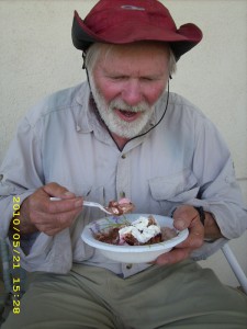
In the afternoon, the section-hiker couple (the Coxes) we met on Baden-Powell came in, all done with their hike, and  carrying  the makings of banana splits! All the hikers instantly were there from all the tents all over the yard!  Amazing how fast the word of “Food!” travels here!  I sat and ate my banana split with Mrs. Cox, and she told me about their adventures getting to Little Jimmy Campground.  She showed me pictures of it on her camera, and said that after we’d headed for the road and they kept on going, she figured out a new technique for crossing steep snow traverses.  “I hold on to the back of my husband’s pack,” she said.  “That way I’m not so scared.”  She was very cheery and talkative–very different from when we’d met on top of Baden-Powell, where she was rather quiet and a bit grim.  “I was scared,” she told me.  “I guess I wasn’t as friendly as normal.”  “Me, too” I said. 

 Later on, volunteer JJ gave us a ride to town and Bill talked to him some more (they’d had other conversations) about knowing God in a real way, not just as religion, and that the key issue was “who is the boss of my life— me, or God?” Bill got out our little Gideon New Testament and showed JJ the verses Romans 10:9-10 and Revelation 3:20.   JJ  said, “OK, I get this!  I’ve always believed in God, but I’ve been running my own life and calling all the shots.  I need to quit that and let God be the Boss.”  So  he prayed with Bill to let God know what he’d decided. It was awesome!

Then JJ headed back to the Saufleys to help the hikers, and we headed for pizza.  The pizza place had only been open for a week, and it was very good.  We managed to eat almost a whole large pizza!  Then we decided to take a “little walk” to find the church we remembered seeing “somewhere down the road” in 2005.    Well, make that a 45 minute walk–we DID find the church, but then it was 45 minutes walk back PLUS the walk back to the Saufleys, and the sun had gone down before we were back at Hiker Heaven.  We found Donna Saufley and asked if we could stay for one more day so we could go to church  on Sunday, and she said, “Sure!”  We were glad of that, because the new Hiker Heaven rule is, “You may stay here for two neros and a zero, then you have to move on.” 

So we are back in our cots in the big white tent, looking forward to one more nice zero day.  And I’m done with sewing, so I can really make it a zero instead of a work day!  And I am so glad for JJ, too! 

Walk to Rivendell: In Rivendell!

may21_bananasplitmay21_hikerheavendog

Thursday, May 20 –Agua Dulce–Miles Today 14.2 – Total Miles 454.4

Thursday, May 20th, 2010

may20_sunrisetrail

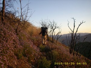
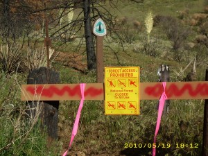
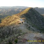
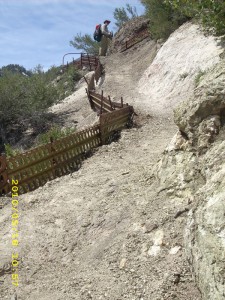
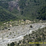
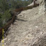
For awhile this morning, we were still in the “burn zone” and following the PCT as it alternated between slipping and sliding across mountainsides (sometimes the trail had just totally fallen away), or pushed through thick weeds. But the early morning light was very pretty, and  finally we were out of the “burn” into just nice, normal trail. When we reached the PCT trailhead parking lot, we discovered a sign that said the PCT was closed, and a barricade to make sure that the message was clear!  Oh well!
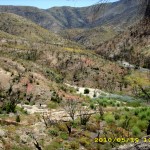
 By 8:00am we were at the KOA in Soledad Canyon, where we cleaned up and ate breakfast.  I had been hoping that somebody in the campground would spot us and offer some hot coffee (that has often happened for hikers in the past) but nobody was even stirring.  After enjoying our granola, we headed back to the trail, which promptly entered what I think would best be described as a “jungle.”  It was hard to figure out which way to go.  At one point, when we were hesitating, along came a Czech guy coming BACK from what had looked like it was the PCT, but wasn’t.  Good thing we met him!  We were saved from going that way, too.  Finally we noticed a few pink flags, figured “Maybe that’s the PCT??” and followed them.  Hooray!  We found the official PCT railroad crossing, and from then on, the trail was easy to follow.
may20_rockformation

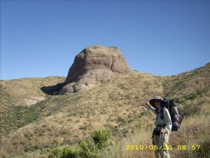
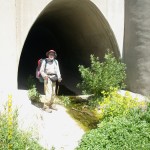
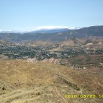
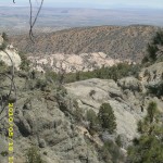
The PCT takes off from there and wanders all over (I think the idea is to give us a chance to admire the rock formations?) but we finally reached the ridgetop where we could see Agua Dulce and the freeway.  We cheered, even though we still had quite a way to go before we got there.  The trail headed down a pretty little creek canyon, then turned left and contoured for a long way, paralleling a creek below the highway, as the day grew steadily hotter.  We reached the dark tunnel under the freeway (it was so dark in the middle of it that I could not see, and was feeling my way with my trek poles).  At the far end of the tunnel, resting in the shade, was a very hot, very tired Czech guy.  “I kept thinking it was only another 15 minutes to the Saufley’s” he groaned.  He was not pleased to hear that there were considerably more than 15 minutes of hiking left!

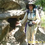
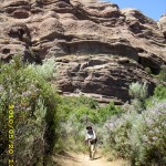
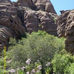
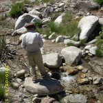
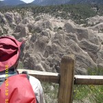
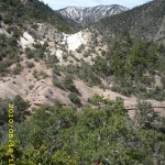
But now we were headed into Vasquez Rocks, which were as awesome as ever. It is so obvious that they were laid down and shaped by massive amounts of water, very quickly. There are lots of caves, too, and what I liked was that there were signs to identify many of the plants.  Little creeks were everywhere, swarming with tadpoles.  I kept slowing down to look at things, which Bill found frustrating–he was on a tear for Agua Dulce! 

We stopped for a hot lunch in the shade of a huge pepper tree, and while we were eating, along came a lady on a gorgeous dapplegrey horse, who asked “Are you headed for the Saufleys? At 4:30 I will give a ride to Walmart for any hiker who wants one.”  That sounded good, and we hurried into town and headed for Hiker Heaven.  Last time, someone spotted us and gave us a ride, but this time we had to walk the whole way.  So we arrived all tired out and hot and very grubby.

may20_hikerheaven

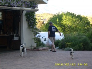
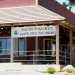
We were greeted by “JJ” (one of Donna Saufley’s volunteers) and the SIX dogs.  JJ said that Donna had quit her regular job in order to help her husband Jim in his business, so she has no more free time to help the hikers.  Being a great organizer, though, she recruited a whole gang of volunteers to take her place!  So the Hiker Heaven “system” still works, and soon we were showered, had our clothes in the laundry, and raided the refrigerator for ice cream!

At 4:30, the “horse lady” came as she’d promised, and soon we were on our way to Walmart.  Turned out that the dapple gray horse we’d seen her riding was being trained for “eventing”.  Also in the car with us was her daughter, who was headed for a gymnastics class.  So while the daughter was at her class, we had 1 1/2 hours to “do” Walmart.  I got all the food we needed for ourselves, plus plenty to share with other hikers.  Once we returned to Hiker Heaven, we ate up all the leftovers in our packs, plus a large salad.  A steady stream of hikers were coming in.  Turned out that everybody had reached Agua Dulce by a different route!   Some of them cheated, though.  They just said, “Oh phooey on the detour!  I hate roadwalking!” and had hitch-hiked to the Saufleys!

We went to bed early, very tired, while many of the younger hikers sat up late talking around the campfire in the yard.  We are sleeping on folding cots in one of the big white tents.  It’s turned into a chilly night, but oh, is it good to be here!

Walk to Rivendell: On path lined with white stones which began at the Ford, with first views of Rivendell.

may20_aguadulcemay20_aguadulce2may20_brego

may20_brego2may20_mcdsmay20_montyrock

may20_trailmay20_trail2may20_tunnel

may20_vista

Wednesday, May 19 – Miles Today PCT 4 Detour 25 – Total Miles 440.2

Wednesday, May 19th, 2010

may19_drgayipresume

Today began with one of the other hikers announcing, “Ladies and Gentlemen, rise and shine! It’s 5:45am and the bus leaves at 6:30!” (We’d all promised Dr. Gay we’d be ready to go at 6:30). But at 6:15, here she came with a huge skillet of hot scrambled eggs “My hens are laying so much, we can’t keep up with them— eat, eat!” she said!  So we lost no time taking care of those eggs, along with some salsa and tapenade.  What a breakfast! 

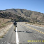
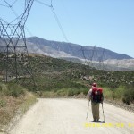
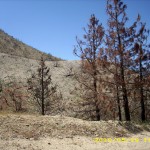
Dr. Gay dropped us and Transient off at the “trail” (the rest of the hikers got dropped off in town) and soon we were roadwalking into the burn zone of the huge “Station Fire” that had closed the PCT. It was sad. In many places, the fire was so intense that it turned even the dirt into ash.  The morning grew hotter and hotter.  We took our midmorning Snickers break in the shade of a tree, and just after that, a sign warned us to stay on the road.

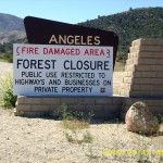
may19_closed

Eventually we reached Aliso Creek road. Hooray, not much longer and we’d reach the powerline road that would take us back to the PCT. But a dayhiker we met warned us that just yesterday, the USFS rescinded its permission to use that route. “But it’s not posted as closed” he reassured us. Yikes! We hiked on as fast as we could, and sure enough, there were no “closed” signs. “Quick, let’s get on it before any rangers can stop us!” we cheered.

may19_burnvista

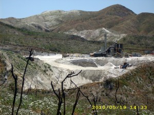
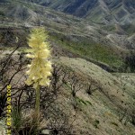
As it turned out, that “closed route” was a busy road to a mine as well as the powerlines— dirtbikes passed us, and mining trucks. Eventually we reached the mine and after that things were a lot quieter— no more traffic.  We were very saddened, though, by the destructiveness of the fire.  It must have been incredibly hot–in many places, even the DIRT was scorched and ashed.  Only a few plants were starting to grow.  It was a very hot afternoon, and the final tough climb to the summit just about did me in.  I  actually had to stop and lie down under one of the few trees that had survived the fire before I could continue on.  But finally we made it to the North Fork ranger station, which was on the edge of the fire zone.  We’d already been warned that there was no water available there, since there was no electricity for pumps. 

But surprise, surprise, there were three PCT hikers at North Fork!  They were also exhausted by the heat and the climb, so had decided to stop and camp.  We only spoke with them briefly, then headed on, back to the PCT— but what a sad sight. The trail was a mess from the fire, sometimes sliding down the hill, sometimes so overgrown with “post-fire type” weeds that it was hard to follow.  We found out later that it was a good thing we’d left North Fork quickly.  Apparently just after we disappeared down the trail, the ranger came boiling out of his office (he’d spotted us talking to the other 3) with a plan of chewing us out for hiking on a closed trail.  Glad we missed him!

Our goal was to camp at Mattox Creek, but the going was so tough that we didn’t make it.  At 8:00 pm, we spotted a little sandy gully that was ash and cinder-free and decided to camp there.  It was a very comfortable camp!  Bats danced overhead as it grew dark (eating mosquitoes, I think–there were plenty of those!).  Bill and I wiped the sweat and dirt off ourselves as best we could with our limited water supply before getting into our sleeping bags.  The sand was a very comfortable mattress, and we were really tired, but  figured “Tomorrow we’ll be in Agua Dulce!”

Walk to Rivendell: Road bending down, camped near small stream with newcomer Glorfindel.

may19_bigvistamay19_crittermay19_doggy

may19_forestclosedsignmay19_ranchbkfastmay19_roadwalk

may19_wildflowersmay19_roadwalkingmay19_vistawithflower

may19_rockycreekmay19_steepmay19_sunsetvista

may19_vistamay19_vista2may19_vista3

Tuesday, May 18 – Miles Today PCT 2 Detour 21 – Total Miles 386.1

Tuesday, May 18th, 2010

may18_trailfalling

Neither of us had any sleep — the wind howled all night, and even with “all our layers on” inside our sleeping bags, it was hard to stay warm. By morning, all our stuff was wet and we headed out very early, hoping to warm up by hiking fast. It didn’t take long to reach the PCT at Islip Saddle, where there was a whole congregation of hikers.  We stopped for breakfast and talked to Charlie and Shin about their adventures on Baden-Powell.  Everyone was tired, and not looking forward to the “big Detour”  ahead, which began right there at Islip Saddle.  We got out the eight pages of maps for the 50 miles of what looked like a lot of roadwalking. 

But  the first leg wasn’t a roadwalk.  It was a lovely, cloud-misty hike down the canyon.  If we turned to look back, we could see snowy peaks towering above  us, and if we looked ahead, we could see sunshine in the valley below.  The trail eventually took us to a crude “dam” of rocks which we had to pick our way across to reach the South Fork Campground, where a lot of orange-clothed CDC crews were hard at work cleaning up the messes left by winter storms.

may18_sign

We crossed the river again and headed into Devil’s Punchbowl park. We were here in 2005 also, and wow! The trails and signs are much improved!  We soon discovered why–there was another group of CDC prisoners hard at work as trail gorillas.  I made a point of thanking each of them as we passed by,  hoping it would encourage them that doing good things is more rewarding than doing bad stuff.  The rock formations in the park are mind-blowing— all colors and sorts, bent, twisted and sculpted, the result of several earthquake faults intersecting in the area.  We started meeting a lot of “daisies”–mostly Japanese tourists.  When we reached the park visitor center area, it was swarming with school kids, so we retreated back up the trail and found a quiet spot to eat lunch and “hold a garage sale” to dry our gear.

Then began the many miles of roadwalking through the desert, passing Joshua trees, houses and more rock formations, and leaving the snowy mountains far behind.  We also passed Transient, who was sitting by the road nursing a  sore knee.  We were very concerned about him–what a major bummer it would be to have to end a PCT thruhike so soon!   By 5:30pm we’d reached the turnoff to the town of Little Rock, where we planned to get more water and eat dinner.

may18_horsies2

It took almost 2 miles of walking before we strolled into Ana’s Cafe, and when we came in, a lady who was also there eating took one look at us and said, “Are you guys hiking the PCT?” “Yes!” “How would you like to stay at my ranch tonight? I’ve got 4 other hikers who are coming, too.” That was a no-brainer! So we ended up with Dr. Gay (she is a veterinary doctor) and got showers, plus camping on her lawn! Her sister hiked the PCT, it turns out, and Gay was overjoyed to be able to help hikers.  It turned out her “first hiker of the day” had been Transient!  He looked much happier and more relaxed than he had when we saw him on the side of the road.

Dr. Gay’s place is full of animals, and it was a lovely warm evening. I walked around a bit to look at all the horses, etc., then we set up our tarp on the grass and enjoyed the feeling of being clean and safe.  Wow, what a difference from last night!

Walk to Rivendell: Camped in saddle of ridge on rocky ground with a gnarled pine tree.

may18_creekmay18_fencemay18_horsies

may18_roadwalkmay18_trailmay18_trail2

may18_trail3may18_vistamay18_vista3

Monday, May 17 – Mt. Baden-Powell– Miles Today 19.4 – Total Miles 384

Monday, May 17th, 2010

may17_billsnow

Last night was windy and freezing cold!  Brrrr!  We broke camp at 5:00am and headed for “adventures on Mt. Baden-Powell.”  Because of so much snow on the PCT, we took the “road alternate” that’s only a few steps away, and has awesome views(including Baden-Powell), as opposed to the viewless, forest-surrounded PCT.  We met “Wyoming” at the ski lifts, and walked with her the rest of the way to Highway 2.  Wyoming stopped there, since she was headed for Wrightwood.  We felt very bad leaving her all by herself in the bitter cold, next to a highway with no cars. 

Bill and I kept going, with a little bit of concern about whether or not the water would be turned on at Grassy Hollow visitor center.  Not to worry!  A short way along the PCT from Highway 2, there was a water cache!  And not only that, but the trail itself became very pleasant–no more snow wrassles, AND really nice views.  The PCT goes through an interesting mix of evergreen, alpine-looking forests and oak woodlands.  Finally the trail began dropping down to Vincent Gap, and we were eyeing “Mt. B-P”.  From what we could tell, it had a fair amount of snow, but looked do-able. 

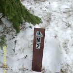
At the Baden-Powell trailhead parking lot,  a couple was resting.  Turned out they were section-hikers from Eureka, CA, who were headed for Agua Dulce.  I took a deep breath and prayed before we began to climb up. At the first the trail was easy going, clear of snow patches.  But by the time we reached the “Mile 2” marker, we found it buried in snow with only the top sticking out. Charlie and Shin were there, too, and discussing what to do.  The conclusion was, “Forget the trail, let’s just head straight up!”  So we all did!

may17_montysnowaxe

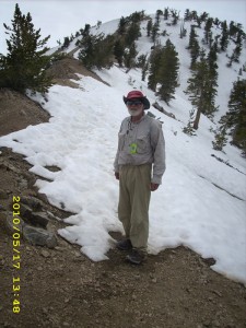
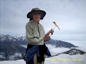
Charlie and Shin were fast, and soon were way ahead, while I did my best.  Bill did a wonderful job kicking steps for me— I only needed my ice axe a couple of times— and by 2:00pm we were on top. I was very tired, not so much from the climb, but from the stress of being scared on the steeper parts.  We celebrated with a late lunch of crackers and peanut butter while we ate, admired and wondered about the very strange clouds we were seeing above and below us. Some were dramatic,dark and stormy-looking.   “Will it rain?” we wondered.  The section hiker couple we’d passed earlier caught up with us and soon we all headed out, only able to guess where the PCT headed down the next ridge. Snow covered all north slopes, but the ridgetop was so flat that the snow was easy to walk on.

may17_snowpatch

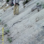
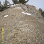
The husband of the other couple was taller and heavier than Bill, and he really worked hard at TRAMPING out footsteps for his wife to follow.  Perfect!  I was able to use the footsteps, too, though he (and we) tried to stay on bare dirt as much as possible.  We all spent the rest of the afternoon in a challenging mix of rock climbing, snow traverses, route-finding (we did see a few short “patches” of trail occasionally) and scrambling over logs and bushes.  The rockclimbing bits happened whenever we were faced with a choice of  1) Walk across a steep snowfield  vs. 2) Climb over a bunch of rocks.  We all chose the rocks!  The PCT itself wandered all over the place, which is normal, but oh, man, it sure makes it hard when there’s lots of snow! 

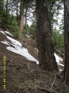
 A bit after 6:00pm, we were all climbing up another ridge  in a howling cold wind, when I spotted a trail sign in the forest off to the right.  Bill went to investigate. Just as he returned, the wind changed to a scream and it began to SNOW!  We could hardly even stand up in it.  The snow was blowing straight sideways!  We and the Eureka couple held a worried conference on what to do.  It was getting late, and based on the sign Bill had read, we still had another 3 miles or so to reach Little Jimmy Campground.  None of us were even sure how to get there, with the trail buried in snow.  In the end, the Eureka folks opted to push on, following the ridge, hoping to reach the campground before dark.  Bill and I chose to head down to the highway, which we could actually SEE down below (WAY down!)  It took 1 1/2 hours for us to make it–and it was my fault it took so long.  Bill’s downhill technique on steep, rough terrain is to just “go for it”, with dirt, twigs and small rocks flying everywhere.  Me, well, I am way slower, because I don’t trust my ankles.  They have a bad habit of just going “flop” all of a sudden.  I definitely didn’t want to sprain an ankle on that mountainside in the freezing wind with a mixture of snow and rain coming down!  The hillside was very steep, and we were crossing snow, rocks, scree, and plenty of fallen trees. It took till almost dark before we reached the road, about done in.  We’d had no dinner and no snack. 

But amazingly and wonderfully, it turned out that we had come down in the absolutely most perfect spot ever–the one place where the mountainside by the road was not a cliff–just very steep.  We could still safely sort of half-slide down.  And not only that, but we landed in a turnout for the highway that was snow-free, flat, and DRY!  The ground was not muddy or puddly. Everywhere else along the highway, there were no turnouts, and there was no way down except over a cliff.  The wind was still howling, it was raining with some snowflakes mixed in, and we wasted no time putting up our tarp in “storm rig” before getting under it and burrowing into our sleeping bags.   But we were safe!   And I was very grateful to God for 1) The great encouragement of meeting up with Charlie, Shin, and the Eureka folks  2) Having such great footprints to follow in the snow   3) Coming down off the mountain in just the right spot!

What a day!  Wow!

Walk to Rivendell: High, steep, stony hills with caves.

may17_equipmentmay17_foggymay17_highaboveclouds

may17_highaboveclouds3may17_narniamay17_rocky

may17_snowcoveredmay17_snowcovered2may17_snowsign

may17_stormyweathermay17_sunrisebluemay17_trail

may17_vistabigtime