Sat. Sept. 18 Miles today: 26.2 Actual total: 2,621.7 miles

September 18th, 2010


Sept19_9meadowhillsSept19_11plantsSept19_2cabinSept19_1baretreestrailSept19_6viewmeadowSept19_4trailtreesSept19_5viewtreesSept19_3trailcloudsSept19_8animalmeadowSept19_7animalmeadowSept19_9meadowhills

We ate breakfast at 5:30 am, but it was still so dark when we finished that we waited a bit before packing up.  It rained off and on all night, and was still raining as we loaded our packs under the protection of the tarp, and we set off hiking in the rain, too.  But after less than an hour, the rain stopped, and did not return.  Hooray!  (Though we were “up in the clouds” all day, and did have to deal with a lot of “fog drip”).

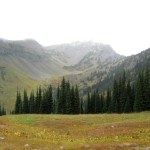
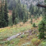
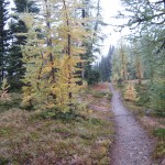
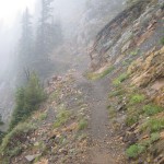
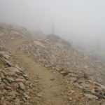
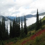
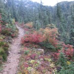
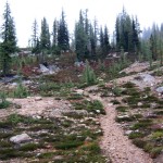
The first project of the day was to finish the climb up to Cutthroat Pass.  The drippy clouds at that point were lifted up high enough that we could see more than just trailside plants.  We could see some mountainsides, and the fall foliage was beautiful.  An added plus was that the trail was wide enough that we were not having to push through soaking wet vegetation,  but just walk happily along–the very wet plants could not touch us.  As we climbed higher and closer to the top of the pass, the terrain became more stark and alpine.  Soon we were actually IN the clouds.  The top of the pass was completely barren (except for a PCT sign), and as we began the descent, the clouds were so thick that we could not see a thing.  The trail switchbacks down, with big dropoffs on one side, which had me really nervous in 2005, but were not a problem this time.  The wind was blowing, and the clouds were moving around, so occasionally we’d get a glimpse of the huge, deep valleys below or of the snow-capped peaks up above.  The PCT heads down to Grant’s Pass, then follows a long, contouring climb up to Methow Pass.

From the top of Methow Pass, we headed down again into the Methow River valley, and it was quite a “down”!  Bill joked, “Are we going back to sea level, do you think?”  The long walk down could have been more enjoyable, but we were in clouds and couldn’t see anything but the forest right by the trail.  There were lots of little rockhop creeks to cross before we finally reached the valley floor.  We stopped for lunch at Willis Camp, by Golden Creek.  When I was rummaging in the food bags, I discovered that a mouse had gotten into the cookies in Bill’s food bag.  We ate them anyway, along with hot (!!yum!!) coffee the Manns had given us, and a backpacker version of tuna casserole (Lipton Side of noodles & sauce, plus a packet of tuna, plus freezedried peas.  Love this stuff!!)  It was very cold down in the valley, but not raining, so while we ate, we hung our very wet tarp between two trees to dry off a bit, and managed to dry the ground cloth a little bit, too.

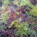
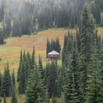
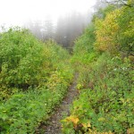
The long climb out of the valley up to Glacier Pass took most of the afternoon.  Basically it involved a lot of contouring and switchbacking, in and out of avalanche paths and forest.  The “avalanche sections” were very overgrown with floppy wet plants, and the PCT there was rocky and muddy–what a mess!  It’s the sort of situation where you just have to grin and say, “Are we having fun yet?   Wheeeee!”  and keep on walking.  Eventually, as the trail climbed higher, there were no more big floppy plants–just very steep grassy hillsides.  We still couldn’t see anything except for one brief moment when the clouds parted and we could see some views.  The wildflowers along the trail are pretty much just faded and dry, but the fall foliage was very colorful.  The little six inch high huckleberry plants had lots of ripe berries–I ate a few, but it’s hard to bend over that low with a backpack on, while continuing to hike!

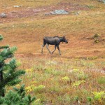
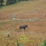
We reached Glacier Pass (which had a nice campsite) and mushed on for another hour to the final top of the climb.  From there we watched the trail and map carefully, because there was supposed to be a campsite with water up ahead.  In 2005, we couldn’t find the water, and that was hard, because from that point, there is no more water for 15-20 miles (depending on which guidebook you follow).  Complicating our search was the fact that we were IN the clouds.  It was like being in a dense tule fog back home.   We did locate the campsite, and the serious water search began.  First step is simply to stand still and LISTEN–that’s often the best way to locate a small, hidden water source.  But this time, careful listening didn’t help.  A number of different little paths led downhill from the campsite, so I headed off on one, and Bill on another.  I had no luck, but Bill did.  He found the water, a ways down the hill, coming from a small spring located in a little meadow.   We collected water and sat down to eat some supper, enjoying the fact that we were down out of the wind behind some rocks.  The best part of all was that a totally cute little pika came out of the rocks nearby and sat “meeping” at us.  (I have decided that the best way to describe a pika’s voice is that it “meeps”). 

Then it was back up to the trail, continuing on in a very cold wind and thick clouds. Brrrr!  But we were very glad it was not raining–just cloud mist and no more.  Less than a mile along, we met a SOBO hiker who asked if we’d seen “the campsite with water”.  We assured him that we’d just come from there, and told him how to find the water; he was delighted.  After wishing each other well, we went our separate ways, but now it was MY turn to be worried about finding a campsite.  We could not see more than about 20-30 feet in the thick clouds, and the PCT was endlessly contouring along a very steep hillside in a bitter cold wind.  The map showed a saddle up ahead–hopefully we’d find some flat ground there, and soon, because by 7 pm it starts to get dark.

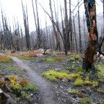
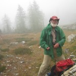
We reached the saddle and were terribly disappointed.  Not only were there no flat places (it was too narrow), but everything was blackened by a relatively recent forest fire.  All we could do was to keep going, and now I was seriously praying for God’s help in spotting something despite all the clouds.  Finally, just before dark, the mountainside widened out a bit, and I saw a slightly sloping, but still reasonably flat little spot just down from the trail. It was all covered with some sort of dwarf heather stuff, but we put down our ground cloth anyway, and got our tarp up just before it became truly dark.  The wind was rushing and roaring all around us, but the heather made a very soft “mattress”.  At around 9 pm came the pitterpatter of rain on the tarp, but we were snug and warm.  I thought about tomorrow–it will be our last “regular hiking day” of this journey.  “Will the sun come out?” I wondered.  Bill commented that the weather forecasts in Washington state shouldn’t ever say “Chance of rain”–they should just be realistic and say “It WILL rain.”  What they should be saying is “Chance of SUN”, because that really IS chancy!  Well, we will see what tomorrow brings!

Fri. Sept. 17 Miles today: 21.4 Actual total: 2,595.5 miles

September 18th, 2010


Sept18_4cloudtrailSept18_7billfogSept18_6viewcloudsSept18_1trailflowersSept18_2trailviewSept18_5trailfoggreenSept18_3trailsign

It sure was nice to be in a warm, comfortable bed last night and listen to the rain pouring down OUTSIDE.  It had turned into just a bit of “drip” when I got up very “late”, at 6:15, to sort food and load the packs before breakfast at 7 am.  It was another awesome Stehekin Valley Ranch meal–eggs & potatoes, tomatoes, biscuits, fruit & yogurt, French toast and plenty of cowboy coffee.  I also made us a great “trail lunch” from the fixings laid out–AND Kerry Courtney (wife of the owner) had even set aside a pound of cheese for me, since I’d asked if I could buy some to supplement our trail food.

Mr. Courtney, the owner of the Ranch, was away campaigning for Congress!  He is one awesome guy, and I told his wife that I sincerely wished I could vote for him instead of the lame candidates we have down in California.  I read his campaign literature and was very impressed.  He said he felt he just could not continue to “hole up” in his little heaven-on-earth in Stehekin Valley and watch his beloved USA “go down the tubes.”   I wish him all success!

At 8:30 am, a bunch of us piled onto the bus to head back to the PCT.  One fellow was a “regular” backpacker, and the rest were dayhikers.  We were very surprised to be the only thruhikers.  Since there were several of “us thruhikers” going into town on the bus yesterday, we figured there would be a whole crowd this morning.  Nope.  It was just us.   At the PCT trailhead, there were some PCT hikers waiting for the bus.  They planned to share some rooms at the motel in town.  We gave them the lowdown on where everything was, and where to get food,  then we shook hands and wished each other well on the last push to Canada.

When you leave the trailhead at the bus stop, you have a choice–either walk the PCT (which, true to form, goes up, up, up and down, down) or you can just walk the dirt road till the PCT comes down to it–much easier and quicker.  We decided, though, to stick with the PCT.   The trail immediately climbs right up a rocky hillside and passes very pretty Coon Lake.   The trailside fall foliage was lovely, and overhead it was cloudy, with an occasional sunbeam momentarily breaking through.  We wore our raingear because the bushes along the trail were dripping wet.   I like the “pattern” of the trail here–it goes up, up, up, then flattens for awhile before heading up again.   So we would huff ‘n puff for a bit, then be able to hike easily and enjoy the views before it was huff ‘n puff time again.  Another great thing was that we could actually SEE where we were going, since it wasn’t raining (yet!) and the mountains are so huge.   I like the feeling that I’m actually making progress!

The PCT basically winds its way up a long forested canyon with very steep sides.  What’s really awesome is that every time you reach a side canyon, you get a glimpse of massive, snowclad mountains up at the head of the side canyon.  There are lots of creek crossings to do–some have bridges, and some are rockhops.  One of the creeks had a suspension bridge, but the trail up to the bridge was so unbelievably rough and rocky that we turned off and just rockhopped across the creek.  We stopped for lunch at one of the bridges, and I took off my wet rainpants and hung them on a rock to dry.  Bill did the same. 

But after lunch, when we were packing up our gear,  I picked up my rainpants and stowed them in my pack, but Bill did not remember to get his pants.  They were gray, and almost perfectly matched the color of the rock they were lying on, so I did not notice them, either, and we took off.  By the time Bill realized he’d forgotten his rainpants, we’d covered a lot of miles, so going back to retrieve them was out of the question.  Major bummer, given the weather (rain immanent) and temperatures (cold).  I was very worried and upset when I realized what had happened. 

We reached the highway near Rainy Pass, and followed the trail as it paralleled the road for quite a ways.  We could hear the cars going by, just out of sight.   The forest was quite a color contrast–very green evergreens with brilliant fall foliage on the deciduous trees.  When we finally reached the highway crossing, there were two backpacker guys who’d just finished a 70 mile hike and were waiting for their wives to come pick them up.  They were very tired!  But they were thrilled to meet two “real thruhikers” and plied us with questions for a little while before we headed on to the trailhead parking area.

In the parking area, a young couple were just taking off their packs and getting ready to stow them in their car.  Unfortunately, they had a dog with them, and he rushed at us, fangs bared, barking fiercely.  We brandished our trek poles and shouted to the couple to get their dog under control.  Their reaction was typical–they became very huffy because we had “threatened their dog!”  Unbelievable!  I will never understand such people!    They finally collared the dog and put him in the car, and left.  We lowered our trek poles and growled to ourselves!   Grrrrr! 

After eating some supper, we put in a couple more miles before looking for a place to camp.  It is getting dark earlier and earlier–our hiking day is a lot shorter than it used to be!  Finding a campsite wasn’t easy, though–the PCT was doing its usual side-of-the-mountain route, and there were no flat places.  Plus, it’s Washington, and there are lots of plants covering the forest floor.  I finally spotted a possibility a bit after Porcupine Creek,  but it looked like rain was immanent, so we did trench the “uphill side” of the tarp.  Then we unpacked, and that’s when Bill discovered he’d left his rainpants far behind, drying on the rock.   He was quite disgusted, and I was very worried and upset.  We are heading into a lot of very exposed,  above-timberline situations, and the forecast was for cold rain all day tomorrow. 

Just as we finished cleaning ourselves up and crawled into our sleeping bags, the rain began.  As I write this, it’s not a heavy rain, just steady.  Maybe it will finish by morning??  At any rate, I am very grateful for a whole day of hiking today with NO rain!   And there are only 3 more days to Manning Park!   But I am very, very worried about Bill, with no rainpants.  I depend heavily on mine, not only in rain, but in any very cold weather.  And that’s what we are heading into.

Thurs. Sept. 16 Miles today: 9.3 Actual total: 2,574.1 miles

September 17th, 2010

Last night the rain died down and turned into “tree drip”, but it was a very wet world this morning.  I was so tired from the big day yesterday that I “overslept” till 5:30 am, which meant we had to eat a very hurried breakfast and pack up as fast as we could.  When I reached over to get Bill’s food bag, which contained the breakfast granola, there was a mouse in it!  The mouse whisked away and I looked for damage–only a small hole chewed in the food bag, but no damage to the food, as far as I could tell.

Bill was still very determined to catch the bus to Stehekin, but I had my doubts.  We had 9.3 miles to go, and less than 3 hours to do it in.  Normally, that wouldn’t be a problem, as long as we kept up a good pace,  but the trail had been so rough and overgrown that it made for  slow going, and I remembered from 2005 that there were some tricky parts up ahead, with lots of rocks, roots, creek crossings, etc.   As we started out, Bill kept urging me to go faster ( a strange situation, because for the last several days, it’s been me out in front, and slowing down for him) but I hesitated because lately every time I hike fast, I end up falling.   So I kept up a good pace, but not fast enough for Bill!   He  finally gave up on me and said, “See you at the Ranch–I’m going to Stehekin!”   He was soon out of sight.

What a relief it was to NOT have to be on a tear along the trail!  I deliberately slowed down and began to relax and enjoy myself.   And there was plenty to enjoy! Mushrooms of all sorts almost “lit up” the ground in the forest.  Every day there have been more of them, and this morning, the display was awesome!  I saw great big huge mushrooms and tiny, fragile little ones.  The PCT alternates between forest and open areas as it travels down the South Fork Agnes Creek canyon.  In the forests, the trail was very nice, and the mushrooms were beautiful, but the open areas were another story!  To get through one of those, I was pushing my way through wet bushes.  Sigh. 

At one of the creek crossings,  I was amazed to find Bill waiting for me on the other side.  He had crossed on a log that was rather steep and slippery, and was concerned that I wouldn’t be able to manage it without help.  Actually, crossing on a steep slippery log was not something I would try even with help!  I just forded the creek–but I was very touched that Bill had stopped there.  And I was worried that this would mean he’d never make it to the bus on time.  He took off again, and I followed him.

As you get farther down toward Stehekin, things do start to dry out.  The trail sort of rollercoasters its way, with more down than up, and an occasional sunbeam managed to break through the clouds.  That was encouraging!  And the trail itself became quite nice and smooth, so I decided to start hiking faster.  Not a good idea!  Again, I didn’t see a little loop of root lurking on the edge of the trail–my toe caught in it, and I was instantly flying, right off the trail and down the hill.   And again, due to my pack and the grace and mercy of God, I landed on my back on some nice soft plants, unhurt.  I just lay there a minute to make sure I was all right, and thanked God for His protection.  After a bit of a struggle to get back on my feet, I climbed back up to the trail, and said to myself, “That does it!  I am NOT going to try to hike fast!  I guess I am too worn down to do it safely anymore.”  And it was true.  I felt very tired, and even my brain felt exhausted.  It’s been a long way since Mexico!

So after that I just walked along quickly, but without “pushing for speed” and finally reached the spectacular Agnes Creek gorge and the amazing bridges that take the PCT over the roaring river (not sure why they call it a “creek”!).   Bill was waiting by the road.  He had not been able to make it to the bus in time, so we strolled over to the bus stop and sat down to eat some Snickers and nuts and other odds ‘n ends from our packs before starting down the road to Stehekin Valley Ranch.   Up ahead were thick gray clouds, lying low.  Bill commented that it must be fog from the lake, but the closer we got, the more we realized “That’s not fog–it’s SMOKE!”

And smoke it was–the USFS people were doing a controlled burn in the forests along the road.   We walked right through the whole thing.  There was very little actual flame–mostly it was a lot of smoldering.  The Forest Service people had looooong canvas hoses snaking down to the river, where pumps kept the firefighters supplied with water.   And they were just strolling casually around spraying a bit of water here and there–no rush, no fuss.  ( They had closed one trail, however.)   I loved watching them with their hoses and special tools,  and kept stopping to look and take pictures.  I had never seen such a sight before!  Poor Bill finally said, “Enough is enough!  Let’s go–we need to get to town!”

Just beyond the blackened, smoky forest lay the bright green pastures of Stehekin Valley Ranch.   We lucked out and got the last available cabin for tonight, and the always-wonderful staff said it didn’t matter that it was still well before lunchtime–we were welcome to start eating anytime!   So we tucked in to chili,  huge sandwiches and cookies, all washed down with cowboy coffee.  We unpacked our gear and spread it on chairs to dry, and I got the laundry ready for a trip to town.  Normally I would have just done it at the Ranch, but the weather looked like rain, and at the Ranch, there is no clothes dryer–just a lot of clotheslines.  (Not to mention the air was very smoky, and we would have ended up with “smoked clothes”). 

On the way to town, of course we stopped at the Bakery and I got one of their huge cinnamon rolls, which Bill and I shared.  There were a couple of other thruhikers on the bus, too, and we had fun talking about our adventures.   Once in town, I did the usual town chores of laundry and shopping and picking up our food box.  The shopping part was disappointing–there wasn’t much I could use at the store, not even peanut butter!   I decided to get some of what we needed from the Ranch when we got back.   And at the Post Office, it was fun to talk to the very friendly postmistress.  But while I was there, I also saw something that worried me.  There was a whole pile of PCT hiker boxes waiting to be picked up, and the top one was for Happy Camper and Trash Bucket.   We thought they were ahead of us.   Had we somehow beat them to town?   That seemed very unlikely.   I stopped to pray for them, concerned that something might have happened.  (We found out later that they were just on a tear to finish.  I guess they decided they didn’t need all the stuff they’d mailed to themselves).  I also went through the hiker box and found a bunch of bandaids (hooray–Bill’s leg needed them!) and a bit of useable food.  The PO lady said that her only problem with the hiker box is that the Stehekin kids know about it, and after school some of them come in and go through the box looking for goodies–till she spots them and chases them out!

Once I got the laundry done, we still had 2 hours till the next bus, so we went to the little park by Lake Chelan and I spent the time mending Bill’s badly torn pants, now that they were clean and not still all bloody!  Bill simply lay down on the grass and took a nap.   There was not a breath of wind, and the lake was like a pond–very lovely with the mountains all around.  It was fun to watch the various watercraft and the seaplanes.   Overhead, the sky was very cloudy, but the air temperature was pleasant.   The little store had posted a printout of the weather report for the next several days, and it was not good.  “Rain, rain, rain” was basically what it said.    I thought to myself, “Boy, we are really going to need ‘rain grace’ and patience to finish this hike!”  I am still feeling very tired, and wished I could join Bill in napping on the grass.

Back at the Ranch, we totally pigged out at their fantastic dinner spread.  There was BBQ salmon and lots of side dishes, plus SIX different kinds of pie!  Wow!  We waddled back to our cabin, took showers and I doctored Bill’s gashed leg.  The swelling has completely gone away, and I don’t think it will bleed anymore.  Last night it did, and got blood all over Bill’s silk longjohns that he sleeps in on cold nights.   I bandaged him up, and then we went to bed.  Just after I turned out the lights, it started to POUR rain–oh, what a lovely sound, when heard from INSIDE a cabin, UNDER a roof!  Back to the PCT tomorrow!

Wed. Sept. 15 Miles today: 26.7 Actual total: 2,564.7

September 16th, 2010

An “interesting” start for the day today–I misread my watch in the early morning darkness and thought it said 5:30 am when in actual fact it was only 4:30 am!  We sat up, ate our breakfast, and started packing up under the tarp, wondering “Why is it still so dark?”  We could tell that it was cloudy, but that didn’t account for the blackness.   Then I took another look at my watch and said, “Oh no–it’s WAY early!  No wonder it’s dark!”  So we draped our sleeping bags over us and lay down for another 20 minutes, till the light was better.  As a result, we got an early start on our hike today, which was good, because I had labelled today as “Scary Day,” due to the upcoming crossing of the “unfordable Suiattle River.”

The sunrise was gorgeous as we hiked along the PCT–all colors, and beautiful cloud formations.  We were still surrounded by snowy peaks, and the trail continued to climb gently through a very alpine area before it finally launched into another10 kazillion switchbacks down into the valley below.  Partway down is Dolly Vista camp (and yes, the vistas ARE awesome!) where we met another thruhiker just packing up.  He said he was so thrilled with the beauty of the view and the sunrise that he just sat and watched the sky instead of “hitting the trail” as soon as he woke up.  Then he said, “I may be wrong, but I really think the PCT yesterday was at least 2 or 3 miles longer than the guidebook says, with all those long new switchbacks.  What do you guys think?”   Well, we fervently agreed!

Then we continued down the switchbacks.  Marmot holes were everywhere, sometimes located one right above the other in a hillside, and even right next to the PCT–but there were no marmots in sight anywhere.  Were they all still asleep?  Did they start hibernating already?

Once we got down into the forest, the “fun” began.  The trail was constantly being blockaded by blowdowns of HUMUNGEOUS trees.  Their trunk diameters were enormous.  When I stood next to one of these fallen giants, lying on its side, it was taller than I am.And often when one fell, it took a bunch of other trees down with it, so we were being faced by some really complex obstacle courses.  Sometimes we detoured way out around the blowdown mess, fervently hoping we’d be able to relocate the PCT on the other side.  At one point, I really thought we HAD lost the trail and was trying to figure out what to do.  Sometimes we climbed over the huge fallen monsters.  Sometimes we sort of squiggled through them.  On one in particular, Bill was busy looking for a way to climb over, while I wandered off a bit to the side and discovered a way to squeeze UNDER.   Later on, we met another hiker who said he actually used a rope to climb over that tree, only to discover after all his efforts, that he could have squeezed under it farther “up the line.”  His comment was, “GRRRRRR!”   I was also kind of “grrring” because the bottoms of my pant legs are so beat up after 2,500 miles, that they were catching in everything and getting torn up even worse.  My solution finally was to tuck them into my socks. 

But aside from the blowdowns, the forest was lovely.  It looked like sort of rainforest to me.  The trees were huge, the plants were lush and green, and the creeks were pretty.  We had a couple of creek crossings–Bill logwalked, and I forded.   If I tried to logwalk, it would take too long. 

Eventually we reached a much more open, drier forest and the trail headed straight for the notorious Suiattle River.   We’d been told to follow the rock ducks to where a log provided a safe crossing of the “unfordable” river.  Sure enough,  when we got to the bottom of the valley, there was a vast, wide “moonscape” that was the bed of the river when it’s in full raging torrent.  It was all sand and boulders.  Footprints and ducks led off to the right, upstream, but we could see glimpses of the river.  I thought to myself, “That doesn’t look any worse than some of the Sierra rivers we had to ford.”  and thought about suggesting that we just go for it and ford the Suiattle.  But I decided maybe it would be better to use the log, since everyone seemed so emphatic about that being the ONLY safe way across.

We slogged along through the sand and rocks for quite a ways before the “trail” turned toward the river, and there was The Log, which other hikers had described as “substantial.”  My first reaction was, “Substantial, hah!  That’s one skinny log!  I thought it was going to be a big moose of a thing, like those blowdowns we got through earlier.”   And I would agree that the Suiattle AT THAT POINT was definitely unfordable.  It was roaring and obviously deep, because it was in a narrow place (which is why the log fit all the way across). 

Bill crossed first, just walking carefully, and was soon on the other side.  There was no way I was going to walk that log!  So I got down and crawled across,  making sure of each move so that I would not slip.  Fortunately, the log still had its bark on, so that gave a good secure, non-slippery surface to hold on to.   It was still very scary for me.  I just kept moving along, praying as I went that I would choose the right spots to hold on to and that I would be OK.  And the only problem I had (sigh) was that out in the very middle, where the current below is at its worst, there was the root part of another tree that had caught against The Log I was crossing on.  One of the roots caught my trek poles which were lashed to my pack  and I had to sort of sit down and disentangle the root from my poles before moving on.   To say I was glad to reach the other side would be a huge understatement!    This kind of thing scares me tremendously, and I told God I was VERY grateful for His help, courage-wise!  Bill also gave me a hug, and that helped, too!

Then we followed a sometimes confusing “path” of hiker footprints and occasional rock ducks, back downstream to the PCT.  This side of the river wasn’t just sand and rocks–it also included a lot of logs, so that made the going a bit trickier.  The PCT headed uphill for our last big climb–to the top of Suiattle Pass.  Partway up, at the corner of a switchback, we stopped to cook some lunch, and another hiker caught up with us.  Crossing the Suiattle was the topic of conversation, of course!  We all agreed that it would probably have been easier to just ford the river down where the PCT “officially” crosses, since the river is wider there and no worse than the Sierra rivers.

The trail up to the pass was all in forest at first, with no views, but there was very pretty fall foliage along the trail.  Finally we got up high enough to see mountain views–but we also got a good view of the sky, and sighed when we saw that it had really clouded over.  This morning had been a mix of sun and clouds, but now it looked like the clouds had won, and were planning to rain.  At the top of the pass, we cheered, “Stehekin, here we come!” and began charging down the switchbacks.  The trail was very nice dirt, not all rough and rocky.

However, that nice dirt trail at one point had a little loop of root lurking, and I caught my left toe in it.  I was hiking very fast, and before I realized what had happened, I was flying through the air, off the trail, just barely missing a stump.  I landed on my back, and my pack took the brunt of the fall, so I was not hurt at all.  I was lying there thinking, “Thankyou, Lord–I’m OK!” and Bill, back up on the trail, looked down and said, “Wow, you did a great mid-air turn there, to land on your back!”  Well,  it wasn’t me that organized that mid-air turn.  I think it was just physics–my pack was heavy enough to pull me around.  And hey, I also give God some credit, too.  That could have been a really bad fall, especially if I hit the stump.  I agree with Joe Anderson at Casa de Luna–there is no such thing as “luck”–it was at least to some degree, God at work. 

Bill gave me a hand up from where I’d landed, and I looked myself over–all fine, except for mud all over my pant leg.  I now look very disreputable–one pant leg all torn up from climbing over blowdowns and the other all covered with mud.  

But a short time later, it was Bill’s turn to look disreputable, only in a much more serious way.  We had turned off the PCT to follow the  South Fork Agnes Creek Trail down toward Stehekin.  We took this trail in 2005 and liked it then, because it just simply and steadily heads downhill all the way, whereas if you stick with the PCT, you have a goodly climb first, then the downhill.  We’d gone a good distance on the Agnes Creek trail when we reached a very simple, steppingstone crossing of a creek.  I was ahead, and went happily across, then headed on along the trail, when I heard a yelp and cry from Bill.  I screeched to a halt and hurried back to the creek, to find Bill all bloody-legged and sort of tangled up on the rocks.  It turned out that he had slipped on one of the steppingstones and fell–not into the creek, but into more rocks.  He had badly gashed his shin and had blood everywhere, running down his leg and dripping on the rocks.  It looked bad enough that for a moment I was afraid he might have broken his leg.   But he managed to get to his feet and hobble the rest of the way across the creek, where we assessed the damage. Whew!  It was a nasty gash and a lot of scraping, but didn’t look like a hike-ending injury.  But it was pretty messy.  Bill had blood all over his pants, socks and shoe.  I cleaned up the gash and we put a large bandaid on it.   Then to add to the “fun”, as we were working on Bill’s leg, the clouds that had been threatening to rain decided “It’s rain time!” and there we were trying to fix Bill’s leg while the rain came down.  So we had to scramble to put on rain gear and get our packs into “rain mode”.

Finally all was done, and Bill began to cautiously walk again to see how his leg felt.  He said he could manage to hike OK, so we marched on through the rain, pushing through very wet bushes overhanging the trail. At times the bushes were so thick we could hardly see the trail.   Previous to this section, the trail had actually been very well-maintained, including bush-trimming.  Oh well.

We stopped for supper under a tree where the ground was still dry and decided to push on for as long as we dared, in hopes of minimizing the mileage into Stehekin tomorrow.   Bill wanted to make the 9:00 bus; I figured we’d never make that, but could at least walk into Stehekin Valley Ranch by lunchtime.    The rain continued off and on as we hurried along.  We reached Hemlock Camp, where the PCT and Agnes Creek trail rejoin and pushed on till 7 pm, when it was starting to get dark–we did succeed in reaching the next of the camps.  A light rain was falling as we set up the tarp and got ready for bed, which included me carefully cleaning and bandaging Bill’s very nasty cuts and scrapes.  His leg was a mess, but I think it will be OK, aside from probably a bit of scarring.  I am sure I will have a permanent scar on my knee from when I fell, weeks ago.  It still has not really healed, though it doesn’t hurt and shows no sign of infection.

We are at a much lower elevation here than we have been for several days, and it is noticeably warmer.  Agnes Creek is roaring close by.  I was VERY glad to finally crawl into the sleeping bag and listen to the rain pattering on the tarp.  This has been quite a day!

Tues. Sept. 14 Miles today: 21.6+? Actual total: 2,538 miles

September 14th, 2010

The “21.6 miles” we OFFICIALLY did does not reflect our actual mileage.  The newly constructed PCT trail we covered today was at least 3 miles (if not more) longer than what the guidebook says.  All the hikers we met today were grumping about it.   The new trail is very nice, but it is also way longer than the original PCT.   The new part is between Fire Creek Pass and Milk Creek.

We knew the trail today would be tough–the guidebook described long “killer uphills”, many creek crossings where bridges had been washed out and were (mostly) now rebuilt, etc.  So we got up very early, ate in the dark, broke camp while it was still pretty dark, and got ontrail when it was still a bit hard to see. 

And down, down, down we went into very dim,damp, green, mossy forest.  Mushrooms were popping up everywhere, in all colors and sizes, from tiny little white mushrooms to huge big ones, and there was a fair amount of what I call “land coral” , a very colorful fungi that looks like coral on a tropical reef.   The forest also did indeed contain many creeks, as the guidebook said.  Some had very nice new bridges, and there were some where we had to stand on the creekbank and figure out how to get across.   The first bridge we came to was a new one but we could see the tangled wreck of the old bridge just upstream.  At another of the new bridges, there were huge log jumbles lying upstream and downstream.  I guess before the bridge went in, each hiker could pick their favorite log to cross on?? Another bridge had its “back broken” so that it sagged down in the middle, but it was still usable, and we crossed with care.

On this whole stretch of the PCT, as you circle Glacier Peak, either you are in deep, dark forest with the mushrooms, or you are out in a boulder field, or you are negotiating a creek crossing.  The boulder fields were particularly impressive–they testify to the terrifying power of avalanches and floods coming down off of Glacier Peak.

The “big climb of the day” was up to Fire Creek Pass.  I wasted probably a mile of hiking at least, because I was not sure we were on the PCT after we crossed Pumice Creek, because I wasn’t sure it WAS actually Pumice Creek!   So after we’d hiked a little while, I got worried and turned back all the way to the creek, looking to see if we’d missed a turnoff and were on the wrong trail.  Nope.  We were on the PCT all the time.  Whew.  So back we went again.  The climb up to Fire Creek Pass was amazing, view-wise, once we got out of the forest and creek crossings.  It was such a relief to be back in open air with rugged snowy peaks in every direction.   For added fun, there was even a military jet, sort of messing around overhead–fun to watch and cheer!  The trail took us up close and personal with Glacier Peak itself–wow!  It is impressive and well-named, with huge glaciers on all sides. 

From the top of Fire Creek Pass, there are jagged snowy mountains all the way to the horizon, in every direction.  We joked about, “Can we see Canada yet?”  and took several pictures before starting on the many switchbacks heading down.  We passed magnificent Mica Lake, which is an extraordinary blue color (I’m guessing it must be very deep?) and even has a beautiful white sand beach.  Bill said it looked like the South Pacific!

As we got down deeper into the valley below, heading for Milk Creek, we encountered a lot of “trail under construction.”  We went happily down what was obviously NEW trail, and every now and then we could see some of the “old” switchbacks.   The new trail had very LOOOOONG, gentle switchbacks, which made us joke again, “This must be the PCT!  It goes UP in order to go DOWN!”   Some parts of the trail were “old” trail, and fairly narrow.  We were zipping right along–maybe too zippy, because Bill fell off the trail.  It was one of those things where he stepped on the outer edge and it gave way under his foot.  The mountainside was almost straight down and very muddy & slippery, so he started to slide and could not stop.  It was scary.  But finally a bush brought him to a halt and he was able with considerable effort to climb back up.   He said, “Man, I thought I was going all the way down to the next switchback!” 

It seemed like it took forever to reach the bridge over Milk Creek.  Not long after the bridge was a sign that said if you were going NORTH on the PCT, to keep on switchbacking DOWN till you reached the Milk Creek trail, and THEN the trail would start back up the other side of the canyon.

I looked at our maps and said, “This is weird!  According to the map, the PCT goes right down to Milk Creek and then right on up the other side.  But we have been going WAY far away from what the map shows.  I guess it’s the new route–they did say the new bridge was in a totally different place.  No kidding!” 

It took us 2 hours to climb the 10 kazillion switchbacks up and out of the canyon.  Bill has been having more and more trouble with big climbs,  and I was worried because it was obvious there would be no flat places to camp till we got to the top.  So I took off and headed right on up with the idea of finding a campsite, so that when Bill got there, we wouldn’t be hunting desperately for something with the sun going down.   Sure enough, I found a really nice spot, and Bill finally arrived at 7:00, which gave us just enough daylight to get settled before dark.   Whew!  I had been getting worried.

When I calculated our “mileage” I was incredulous.  Twenty-one miles?  Impossible! We must have done more than that!  I knew we had been moving right along, and really going fast on the long downhills.   The only thing I could conclude was that the new trail must have been several MILES longer than the old PCT.  I did factor in that there were parts of the trail today which were very muddy (made for slower going) and though a good amount of  “brushing” had been done, there were still sections where we were pushing through plants and climbing over blowdowns (trees) and rolldowns (big rocks & boulders).  And I’d wasted some time dithering by Pumice Creek.   But still–we MUST have done more miles than just 21!

Our opinion so far of the official PCT vs the detour is that the detour is much easier, hiking-wise.  The official PCT is rather tough and strenous.  Scenery-wise, the detour is very pretty, but the official PCT is spectacular.   So our conclusion as to which one to take, well, I would say “It depends.”   If you are in a hurry to reach Canada, take the detour–it’s quicker and easier.  If you feel up to a tough, but magnificent hike, take the official PCT.