A view of the blue
April 8th, 2016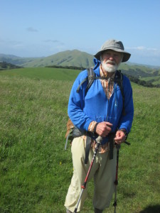 Yesterday was our weekly “big hike” day, when we load up our packs and head out for the whole day. We do shorter hikes on two other days, but Thursdays we try to replicate “the real deal” and hike all day.
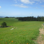
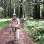
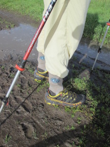
We went for one of our favorite hilly hikes out at Point Reyes National Seashore, where there are plenty of great killer hills to climb, with the bonus of awesome chances to get a “view of the blue”–the Pacific Ocean far below. It was windy and cloudy when we left the trailhead parking area at Bear Valley and headed right up the first climb–2 miles to the top of Mt. Wittenberg. I was carrying my new Z-packs pack, which I modified quite a bit by adding more net pockets to the sides. I love net pockets. I can stow all kinds of stuff and find it easily without having to open the main pack.
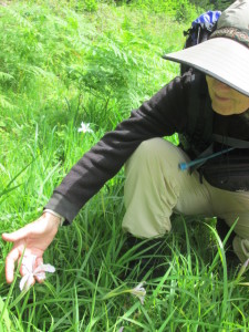 At the top, bummer. No view of the blue–just cloudy, gray and brrrr, cold wind. We couldn’t even see the ocean at all. Oh well–we headed on through Sky Camp and then waaaay down to the road, followed by a rollercoaster contour for 3 miles or so along the hillsides. But then, wow! There WAS a “view of the blue” only it wasn’t the ocean. It was whole hillsides covered with the blue flowers of ceanothus (wild CA lilac) in full bloom. I stopped in my tracks to take it all in. The trail was dusted with tiny blue petals and the air was sweet with the perfume of the flowers. So I did get a view of the blue after all–not waves on the ocean, but waves of flowers on the hills. Works for me!
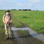
 After climbing Point Reyes Hill and down the other side, then up and along Mt. Vision, we stopped for lunch in wind so strong and cold that we ended up having to hunker down while we ate instead of sitting up on a bare spot to enjoy the view. The clouds did lift enough for us to see the ocean–the line of white at the beach was pretty sizeable, which meant that there were some big waves coming in.
We returned the same way we came, and got home tired and happy. My new Zpacks pack worked just fine, and it is a lot lighter than my good old tried ‘n true small aluminum external frame pack. Now for more CDT logistics–there’s still food to measure and bag up!