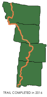
Monday, September 19 Home!

September 23rd, 2016

SUMMARY:  Avis is the only car rental company that does not charge a dropoff fee for one-way rentals, so that’s where our friend took us this morning at the Portland Airport.  We ended up with a new gray Kia, and as Bill put it, “flogged that poor horse” as fast as we dared, all the way back to Petaluma.  It’s a very familiar route along Interstate 5, and made us feel as if we really were headed home.

Back in California at last, the rice harvest was underway in the Sacramento Valley, and it was hot!  97 degrees!  What a change from the cold in northern Montana!

But once we were back near San Francisco Bay, it cooled down, and what a joy to come back into Petaluma and see our house again, looking OK.  Inside, I expected to see spider webs and dust bunnies everywhere, but no–everything was fine.  But we had no time to waste–we needed to return the Kia to Avis at the Santa Rosa Airport.

So we started up one of our other cars, and drove in the sunset light, then the dark, till we finally located Avis (not easy) and turned in the Kia.   By the time we got home again, it was after 10:00 pm.  Tired doesn’t even come near describing how we felt, but we stopped off to pick up some artisan bread, cheese and fruit for a late supper, California style.

Home.  We are finally home.  The CDT is almost like a dream–but we still have lots of scratches, bruises and sore muscles to prove that we really did do it.    And thank you, thank you, Father God, for walking with us all the way!

DETAILS:  Our friend John gave us a ride to the Avis car rental at the Portland Airport.  Good thing he is a Portlander–he knew a way to avoid the commute traffic!  Avis is the only car rental company that does not charge a horrendous fee for one-way rentals.  Good for them!  We ended up with a cute gray KIA “Sportage”, and we left the airport at around 8:30 am with one goal:  Make it to the Santa Rosa, CA airport BEFORE 9:30 pm!  That meant we really had to push it.  Fixit drove as fast as he dared.  “I’m really flogging this poor horse”, he said.

It was cloudy and chilly, even foggy, through most of the Willamette Valley.  We could not see the Cascades at all, and could not even see the Coast Range, not even Mary’s Peak, which is a sizeable mountain west of Corvallis.  We cheered when we saw several new hazelnut orchards along I-5–that means more nuts to make Nutella, which we ate gobs of on the trail!  The tall, beautiful oak and maple trees had just a hint of fall color, unlike the full-on brilliance of fall foliage in Montana.

By 11:00 we were starving hungry and made a pit stop at Subway for sandwiches, before pushing on.  As we got into the Siskiyou mountains of southern Oregon, the clouds began to lift, and by the time we reached the CA border, the sun was out and the sky was blue.  All the rivers we crossed–the Umpqua, the Klamath, the Sacramento–seemed to be running well, with plenty of water.  And best of all, the forests were GREEN–no beetle kill!  No miles and miles of gray, dead trees, like we saw in Colorado, Wyoming and even Montana.

Down from the mountains, then into the Sacramento Valley, where there were many new orchards, mostly of nuts–almonds, pistachios and walnuts, plus new vineyards.  The rice harvest was underway, and the rice paddies were a beautiful shade of gold and green.  The sunflower fields were already harvested, and so was the corn.  I love looking at all the different crops and watching what’s happening on the farms.  It was HOT, though–97 degrees.  What a change from the chill of northern Montana!

Finally we were able to head west on I-80, and we cheered again when we spotted the blue of San Francisco Bay, and soon we were back in Sonoma County with its vineyards and farms, then finally on our own street, and into our own driveway.  My first thought was, “Whew, the garden survived!”  But we had no time to waste.  We tossed our packs into the house, took a deep breath, prayed, and….our own car, which had been just sitting all summer, started right up!  Whew!  The sun was going down, and we still had quite a way to go before we would be at the Santa Rosa Airport.   Fixit drove off in the KIA, with me following, and before long, we were driving in the dark, heading north.

When we reached the airport, we had an awful time trying to figure out where to go, where to turn in the KIA.  It was almost 9:00 pm, and nobody was around in the rental car parking areas.  Finally we figured it out, got the KIA squared away, and FINALLY we were REALLY headed HOME.  It was 10:00 pm by the time we were back in Petaluma, but we stopped off to grab food for a California supper–artisan bread, cheese, fruit.  We scarfed it up and collapsed into our own bed.  What’s weird is that our whole CDT summer just seemed like a dream.  Did we really do it?  Well, the proof was we were bone-thin, full of scratches and bruises, and very tired.  Yes, we DID it!

Thank you, Lord!  It was great!

Sunday, September 18 Along the Columbia River

September 23rd, 2016

SUMMARY:  Yesterday when we got back to East Glacier (thanks to Terry, who gave us a ride!),  the first thing we did (besides eat!) was find out if there was room for us on the Amtrak train.  Yes!  They had room!   By the time the train left East Glacier, there was a bitter cold wind blowing hard, and the rain was falling.   You could not even see the mountains.  We were so glad we made the decision to “run” for the border on the road instead of hike the trail.

During the night last night, our Amtrak train split in half, and our half headed directly to Portland, Oregon, on a route I have never seen before–following the Columbia River on the Washington side.  At first it looked a lot like the desert we hiked through on the CDT, before Rawlins, Wyoming, except for the great blue river.  I was sort of glued to the window, looking at everything, including the very gray clouds, and so glad to be done–no more worries about weather on the trail.  But we are still concerned for the hikers we know who are still out there in Glacier Park and we prayed that God would take care of them as He has us.

Finally we got to the “green part” of the Columbia River gorge, with the waterfalls and magnificent trees and lots of fishermen out on the river in their little boats, and it wasn’t long before we were pulling in to Union Station in downtown Portland.   A short ride on the “Max” and we were at our friend’s house, warm, dry and very well-fed.

Tomorrow we will drive HOME!

DETAILS:  Last night I was walking through the observation car on the train, and met Stop N Go.  I hung out to talk to him a bit.  He said, “When I finished the PCT, I was feeling great and thinking ‘If I had time, I’d turn around right now and do it all again, southbound.’  But now I’m done with the CDT, I’m totally DONE.  I just want to go home.  It’s been really hard.”  That’s exactly how Fixit and I have been feeling.  Our reaction to doing the PCT was, “That was awesome!  Let’s do it again!”  The CDT….I’m with Stop N Go.  All I want to do is go home.  I’m done.

During the night last night, our Amtrak train split in two, with the front end going to Seattle, and our “back” end going to Portland.  Oh bummer, the dining car was part of the train going to Seattle!  We had been really looking forward to a nice big breakfast in the dining car.  So we ended up with coffee and a muffin from the snack bar car.  We were so hungry–I felt like I could have eaten a lot more.

When it was finally light enough to see, we found ourselves in eastern Washington, traveling along next to the Columbia River.  Wow, was it different from the OR/WA I’m used to seeing, which is the Willamette Valley and coastal mountains (and of course, the PCT up in the Cascades!)  I was glued to the window looking at everything.  There were miles of  grassland, with not a tree in sight.  It sort of reminded me of southern Wyoming.  But the river was a gorgeous blue, and what a contrast to the golden-colored grass!  Overhead, the clouds were thick and gray, with no views of the mountains.

We ended up talking to two ladies who were sitting right across from us, and it turned out that they were Christians, too.  Since it’s Sunday, it was especially good to meet some other people who know Jesus, too.

Finally the train entered the Columbia Gorge that we’re familiar with.  The shores were lined with huge trees, there were boats and fishermen, and grand cliffs with waterfalls coming down.  Often I’m driving a car along here, so can’t really look at the views–it was nice to be on the train, and able to see everything.  We passed the Bridge of the Gods, which is part of the PCT (I don’t like heights, so crossing that bridge on foot, with its mesh roadway where you can see waaaaaay down to the river below, was scary for me.  I just looked straight ahead and was very happy to reach the other side!)

Finally the train also crossed the river, and came in to Union Station, Portland.  When we all got off the train (it was the end of the line) I looked for Stop N Go, wanting to say goodbye, but I never did spot him.  Bummer.  He was also headed back for the San Francisco Bay Area, as are we.  The Union Station is really awesome–a huge, big, oldfashioned railroad station right by downtown Portland.  We shouldered our packs and walked over to the Max (Portland’s light rail system), passing a lot of homeless people camped out in doorways.  Welcome back to “civilization” and big city life!  And what a contrast to the folks we met in Montana!  Those Montana people are hardy, self-reliant and hardworking.  You don’t see them lying around in doorways.

But oh, hooray, there were FLOWERS!  Oregon is a wonderful place for flowers, and Portland is called “The City of Roses”.  Unlike Montana, where as the locals put it, “We have 9 months of winter and 3 months of company”, and there are hardly any flowers at all, in downtown Portland, there were flowerbeds in full bloom.  I wanted to keep stopping to look at them and feast my eyes on them, but we did have to get to the Max, because our friend was waiting for  us at one of the Max stations.  It was still gray and cloudy and even a bit drippy, but we did not care.

Our friend John was waiting for us at a suburban Max station, and we went with him for church, then took him and his wife out for lunch.  Fixit spent the afternoon first organizing a rental car for tomorrow, then resting and talking to our friend, and I sat in a very comfortable chair listening to a recording of a poem based on the book of Job in the Bible.  Then we had an awesome dinner (thank you, John and Davilyn!) where we just ate and ate and ate.

Tonight we get to sleep on a bed, and tomorrow, we go HOME!

Saturday, September 17 Canada, eh!

September 23rd, 2016

SUMMARY:  The wind howled all night, and this morning the clouds were moving in fast, looking nastier by the hour.  Before 7 am, we were on the road, headed for Canada, walking against a stiff headwind.  Finally the road dropped down enough to be out of the wind, whew!   And at 9:05, we walked up to the US side of the border.  It was no problem then walking over to the Canadian side for pictures and some cheering!  (Getting back across was harder, though–the USA border officials gave us a bit of a bad time)

The long hike is DONE.  Worth it?  Absolutely.  We got to see God’s loving care firsthand almost every day on this hike, in ways only He could manage, ways we never even dreamed were possible.

Two songs were running through my head as we hiked in the early morning wind and clouds–one a Christian song and the other a sea chantey.  I did change the words a bit….

“Bless the Lord, oh my soul” was a song that I sang to myself on the very first day of our hike, as we were on our way to the CDT beginning at Crazy Cook monument, New Mexico.

“The sun comes up, it’s a new day dawning–it’s time to sing Your song again.   Whatever may pass, and whatever lies before me, Let me be singing when the evening comes, “Bless the Lord, oh my soul, oh my soul, He loves and cares for me, Sing like never before, oh my soul,  My Father walks with me.”

And then there is the sea chantey, “Home, Dearie, Home.”   Here’s my version to celebrate reaching Canada:  “Oh it’s home, dearie, home, My tops’ls are hoisted, and I’m bound to sea.  The birch and the larch and the bonny aspen tree are all turning gold in this north country, and it’s home, dearie, home.”

DETAILS:   The wind howled and blew all night, but it wasn’t too cold, and clouds started to fill the sky.  We ate our last CDT “trail” breakfast in the tent while it was still dark (yum, it was good!) and headed back to the Parkway for the final walk to Chief Mountain border station.  We were walking as fast as we could, hoping to be there when the station opened at 9:00 am.

But the wind seemed determined to give us a hard time.  We were walking straight into a very strong headwind that slowed us down.  All around us the aspens were a glorious gold color, and in the sky, the increasingly menacing clouds glowed red.  We looked at those clouds and said to each other, “Wow, it’s a good thing we’re almost done!”   We kept fighting the wind and kept walking, till finally the road dropped down a bit and we were more protected.  Whew, what a relief!

We reached the National Park border and cheered–kept on walking, peering hopefully around every bend for our first sight of the Border station.  Finally, there it was!  We walked past the line of cars waiting to enter Canada, and asked the guard if we could walk over to the big “International Peace Park” sign where the American and Canadian flags fly side by side, and take a few pictures to celebrate our CDT finish line,  then come back.  He said, “Sure!  Just let me have a look at your passports first.”  A quick glance, and he handed them back.  “Congratulations!”

So we walked over to the sign to get some pictures.  I took pictures of Bill with the Canadian flag, and he was starting to take some pictures of me, when a car pulled up and a lady hopped out.  “Would you like me to take of picture of you two, together?” she asked.  Oh yes!  I was so grateful to her for stopping.

Then we walked back past the Canadian border guard.  We could see Terry, the guy we’d met at the St. Mary’s restaurant, waiting for us.  At that point, we could have simply walked back on the left side of the road, then cut over to where Terry was.  But we thought, “We don’t want the US border guards to think we’re trying to sneak in.  We’d better go through on the right side.”  Big mistake!   We politely crossed over the road (still on the Canada side of the border) and walked up to the US border station, just as we had walked up to the Canadian one.  But to our complete astonishment, one of the border people (a lady) started yelling at us very fiercely and acted rather threatening.  We were amazed.  What on earth had we done?  Well, we finally deciphered what all her yelling was about.  Apparently, if you WALK in, there is a special pathway you are supposed to follow, and we weren’t on it.  OK, what pathway?  We had seen no sign or indication of it.  So as politely as I could, I said, “We are so sorry.  We didn’t know.  Where would you like us to go?”  She pointed to an orange cone back down the road a bit and said, “Go there, and wait until I tell you that you may come in!”

So we dutifully turned and walked back to the orange cone and stood there waiting.  Terry, who was on the US side of the border, was watching all this, equally amazed.  Finally the fierce lady gestured to us that we could come across the border.  She checked our passports and snarled at us some more and finally let us go.   Terry hurried up to us and said, “Whoa!  That was bad!”

We hopped into Terry’s car, and headed back towards his place, stopping off for a second breakfast along the way, and then Terry took us to his place in St. Mary’s, where we were able to do laundry and take showers and have a snack and watch some of the amazing videos and photos that Terry has done.  He likes to hang out with the grizzlies and make videos of them!  He said “If you meet a grizz, just sit down on a log or a rock or something and TALK to it.”  He said that’s what the Native Americans do.   Outside, it was beginning to rain, and clouds covered the mountains.

Then Terry gave us a ride back to East Glacier.  Fixit and I were amazed as the car sped along.  We were thinking, “Did we really walk all this way in just the last couple of days??”  But for me it was a bit of a tough ride because I was in the back seat, the road was very winding, and I haven’t ridden in a car all summer.  So I was battling car sickness the whole way.  Fortunately, Terry kept stopping to take pictures.  “You guys are really lucky!” he said.  “The aspens are at their peak.”  Every time he stopped to take pictures, I would get out and walk around in the cold wind and rain drips, trying to breathe deeply to calm my poor stomach down.  (I heard later from Stop N Go that when he got his ride back from the border, he also got horribly carsick!)

On the drive, Terry told us about his adventures in wildlife photography, and also about how the Native Americans live around here.  He is a friend to many of them and has learned a lot about how they think and see things.  Turns out that he makes a living as a swimming pool expert, particularly in the area of pool chemistry.  He said you CAN have a clean pool without using all the horrible chemicals (like chlorine, etc.).   Terry is a man of many interests and talents, he has no “home base”, really, but is constantly travelling, staying in one place for a little while before moving on.  Actually, he was planning to “move on” tomorrow, so we were really blessed to meet him when we did.

Back at last in East Glacier, we gratefully thanked Terry.  He headed back to St. Mary’s, and Fixit wanted to head for some lunch, but I still felt so carsick that I could not yet face eating anything.  So we went and got our “CDT Finish Celebration” T-shirts.  Fixit got a specifically CDT shirt, while I got one of a hiker out in a remote mountain area that said, “Not all who wander are lost.”  Yeah.  No kidding!

Finally I felt well enough to face eating a late lunch, and then we went to the Amtrak station to get our train tickets for Portland.  We needed to wait a couple of hours, so we used that time to go through our packs and get rid of anything we didn’t need anymore.  And the train station itself is actually sort of a museum, with a lot of very interesting exhibits about the history of East Glacier, the Park, and the train.

Meanwhile outside, it was getting colder and colder.  The wind was gusting, and the rain really started to come down.  The clouds were low–we could not see the Glacier Park mountains at all.  Fixit and I looked at that and said, “Thank you, Lord, that we are not up there!  Please take care of our friends who ARE up there!”   Just before the train was due, Stop N Go came tearing in, and he was able to get a ticket, too.  Whew!

We shivered through the cold and rain on the platform, and it felt so good to sit down and be able to just look out a window at the gray skies and pouring rain.  The train pulled out of the station, and it was “Goodbye, Glacier, we’re homeward bound!”  I stayed glued to the train window until it was too dark to see anymore, and then we went and got dinner at the dining car before curling up on our seats to catch a bit of sleep as the train headed for Portland.

Again, words cannot express how grateful we are to God for all He has done for us.  Every step of the way, He has been with us.  If you are reading this and you do not yet know Him, reconsider.  He loves you, He can change your life, and He has made the way to come to Him, by letting go of “me do” and trusting in what Jesus did FOR you.


Friday, September 16 Roadwalking Through the Aspens

September 23rd, 2016

SUMMARY:  Well, we roadwalked through aspen forests all day and we are camped in the aspens tonight, with the wind roaring all around us.  (We are down in a little hollow place, so we’re not being blown away!).  We were hiking on Highway 89 most of the day, enjoying more great views of the mountains.  By 11:00 am, we’d reached the town of St. Mary.  When we stopped at a café for lunch, as soon as we walked in, the waitress recognized we were CDT hikers and gave us a warm welcome.  That’s when a guy sitting at one of the tables said, “CDT hikers?  C’mon over here and sit with me.  I want to hear all about your hike!”  So we did, and it turned out he really wanted to have a chance to be a “trail angel” and do something nice for the hikers.

He said we could stay in a cabin owned by a friend of his (located about 8 miles from the border) and that he’d give us a ride back to East Glacier tomorrow.  Wow!!!

Well, we hiked as fast as we could, but did not reach the cabin, because we got stopped by the Border Patrol for awhile (did we really look “suspicious”?) and then we were almost to the cabin when a guy in a pickup truck stopped to warn us of a nasty moose in the road, just ahead.  So we turned off (it was starting to get dark, anyway) and found our nice spot among the aspens.  A great “last campsite”!

DETAILS:  As soon as there was enough daylight, we were back to walking along Hwy 89.  The views continue to be awesome–what a contrast between the steep, castle-like Glacier mountains to our left and the rolling plains to our right!  We were counting down the miles, using the green mile markers along the road, and finally realized, “Hey, we can be in St. Mary’s for lunch!”

For most of today, we were walking in aspen forests, but they are different from the aspens of Colorado.  Back there, the aspens were very tall, but here they are much shorter, and right now they are turning all shades of yellow and gold.  The weather is distinctly cooler today than yesterday; the wind is definitely picking up and a bit gusty at times.  We walked steadily along, and we did make it to St. Mary’s by noon.  The town is located inbetween two very long lakes.  The first cafe we got to had a sign, “Closed for the season.”  Then there was a grocery store, so I went in and asked where we could go to get lunch.  They said, “Johnson’s is open–they’re a quarter mile down the road.”  So off we went again, only to discover that Johnson’s access road was a quarter mile, all right, but then it’s quite a climb up to the top.  Meanwhile, right across the street was a Mexican place that said “Open”, but when we went to it, turned out that only the cook had showed up, and no server, so no luck there, either.  We did have fun hanging out for a short bit (hoping the server would show up; he/she never did) and talking to some locals.

Finally we gave up and climbed the hill to Johnson’s.  It turned out to be WONDERFUL!  Not only was the food really good (and plenty of it–no skimpy plates) but the waitress immediately recognized us as being CDT hikers.  Not only did she give us a warm welcome, but a guy and gal (brother and sister as it turned out) called out, “CDT hikers?  Come on over here and sit with us!”  They were eager to hear about our hike, and the guy was especially excited, because he’s always wanted a chance to be a “trail angel”.  So he offered us a place to stay tonight, at a friend’s cabin on the Chief Mountain Road, only 8 miles from the border.  Getting there before dark would be a challenge, but the thought of a cabin was really encouraging.

He also offered to meet us at the border tomorrow and give us a ride back to East Glacier!  Wow!  No worries about hitching!  He described the location of the cabin–his directions were a bit vague, but sounded do-able, and he promised he would mark the driveway so we’d be able to spot it easily.

So we walked on to the intersection of Hwy 89 with a road headed for the border, and stopped there to get some ice cream, Gatorade, peaches, and something for breakfast.  Clouds were building, and so was the wind–at times it made walking just a bit of a challenge.  We cheered when we reached the beginning of our final “leg” to Canada–the Chief Mountain Parkway.  We did a few miles before stopping to eat supper, and while we were eating, along came the guy from the cafe, on his way to mark the driveway of his friend’s cabin.  He told us it was about 6 miles away.  It was almost 6:00 at that point, but we figured if we pushed a bit, we could get there, no problem.

So even though our feet were very tired (roadwalking is hard on feet), we really tried our best.  There were hardly any cars at all on the Parkway, because the border station was closing for the night.  We could see Chief Mountain up ahead–wow!  What a huge, dramatic rock!  It’s very massive, and stands alone.  We were looking at it and saying, “Canada!  Almost there!”

But then, alas–along came a Border Patrol guy.  He stopped and got out of his vehicle and said to us, “Are you aware that you are very close to the Canada border?”  We said, “Yes!  That’s where we are headed!  We’re CDT hikers!”  He looked very dubious and suspicious.  “I need to see your ID,” he said.  “Passports, preferably.”  Well, my passport card was right in my fannypack, so I just unzipped it, pulled out the card and showed him, while he looked at it carefully.  But poor Fixit had all his important papers at the BOTTOM of his pack.  He undid the pack and began pulling everything out.  To my amazement, the Border Patrol guy quickly put a hand on his gun!  Did he think Fixit was going to pull out a weapon and attack him?  I thought we looked pretty harmless–two old, tired hikers.

Fixit finally got everything out of his pack and found his passport card.  The Patrol guy looked it over, studied us, asked a bunch more questions and finally said, “OK.  I guess you’re good.”  I even showed him my CDT bandana, which has a map of the trail, including BOTH official CDT Canada border locations.  I pointed to the Chief Mountain crossing and told him, “This is the trail we’ve been doing all summer, and that (Chief Mtn) is where we’re headed.”

We were glad the Patrol guy was trying so hard to do a good job, and thought how we ourselves would never want to have to do what he was doing, but it had been a fair amount of delay, and the sun was really getting low.  So after he left, even though we were horribly tired, we tried our best to “turn on the afterburners” and hike as fast as we could.  At 7:30 we reached a driveway that seemed to match the description the guy from the restaurant had given us, but it was not marked.  The wind was howling and roaring–was it possible that his marker had been blown away?   We looked and we hesitated.  We tried walking up the driveway a bit, and there was no sign at all of a cabin.

So back to the Parkway we went, and continued on.  By now, the sun was down.  “Let’s go to the next driveway,” we said.  “That might be THE driveway or it might not, but in any case, that’s as far as we will go.”   But we hadn’t gone far when along came a pickup truck.  He stopped and said, “There’s a really big, really nasty moose in the road just around the bend up ahead.  If I were you, I wouldn’t mess with him.  You guys better not go any farther.”   Fixit and I did NOT like the sound of that!  Moose really can be seriously nasty.  So we turned around and went back to the driveway we had just come from.

Now the challenge was finding someplace to camp.  The light was fading fast, and the wind was roaring.  We needed something sheltered.  Hooray for the aspens!  We found a little spot down in a hollow, protected from the wind, set up our tent, and collapsed.  It’s hard to believe we are ALMOST done!   We are so grateful to the Lord for all He has done for us and with us!

Thursday, September 15 On to Canada!

September 23rd, 2016

SUMMARY: We had a great all-U-can-eat breakfast at the Glacier Park Lodge and shared a table with Hotshot and Freebird, who are both superkind and wonderful young people.  We told them of our plan to just roadwalk to the Canada end of the CDT.  It will save us a lot of time, and bad weather is due in a couple of days.  Also, no hassles with getting campsite permits.  They thought we were being very sensible!

Then it was off to the post office to send home our trail food box, since now we don’t need it.  Turned out the PO had already sent it home–they only hold a box for 15 days.  Whew!   What could have been a serious problem (no box) ended up being “no problema.”

By 11:15, we were walking out of East Glacier, and did 19 miles by 7 pm.  There were gorgeous views all along the way–the road had lots of pullouts for cars to stop and look, too.  The Glacier Park mountains are just magnificent–huge and steep, with deep valleys, and snow still clinging to them from the last storm.  The fall foliage is more beautiful every day.

We camped tonight in a meadow off the highway.

DETAILS:   It was cold last night, but not as cold as up in the Bobs.  Our campsite behind the motel was fine–far enough away from the road that cars going by didn’t bother us at all.  We “slept in” till 6:30ish, then brave Fixit went across the street to where there are showers, and even though his only “towel” is a bandana, he took a shower anyway.  Brrrrr!   If it’s this cold, I need a real towel!  So I didn’t join him.

Then we walked over to the Glacier Park Lodge–we had heard glowing tales of their great AYCE buffet breakfast, and we were not disappointed!  We ended up sharing a table with Hotshot and Freebird, who are supernice.  They met on the CDT, and I think they rather like each other!  They are both hardworking, kind young people, and we wish them well.  All of us ate several platefuls of food.  I’m not sure the buffet people make any money off of thruhikers.

Then we went over to the post office to tell them to send our resupply box home, only to discover that they already did!  They are one of those post offices that goes “by the book”: they will only hold a box for 14 days, and on Day 15, they send it home.  Other P.O.’s on the trail are much more understanding, and will hold a box for a long time.  Another CDT hiker, who is planning to hike the trail through Glacier, also came in to get his box, and was told the same thing.  So now he is faced with finding a town source of food for 5 days of hiking.  Bummer for him, but no problema for us.  We are so glad we had decided to finish by roadwalking, or right now it would be really stressful.  Not only would we need to organize permits, but find 5 days worth of food.  Argh.

All I had to do was get enough food for our “first leg”, which is 32 miles to the village of St. Mary’s.  And we stopped by the Amtrak station to find out about getting tickets for the train ride home.  Looks like that will be “no problema” either.  Whew!  Thank you, Lord!

Then we went back to our “camp” and went through our packs, eliminating everything we don’t need anymore, reloaded, and were on our way by 11:15 am.  Hotshot and Freebird spotted us as we set out, and cheered for us!  That was very heartening!  According to the latest weather reports, looks like we will have 2 days of clear weather, then it’s rain & snow.   So even though we are roadwalking, we will still be racing the storm.

As we explained to Hotshot and Freebird, we have 3 reasons for choosing a roadwalk instead of the trail.  1) To save TIME–we really need to be home, so we can get the Awana Club up ‘n running.  2) The weather report is not good   3) The hassle of getting permits.

So we headed UP Highway 49, out of East Glacier.  It’s 12 miles of  narrow and windy road, and we had to jump over to the shoulder when cars came by.  Then it was Highway 89, which was broader and had a better shoulder to walk on.

Both highways had spectacular views, and plenty of pullouts where cars could stop, too, and admire the scenery.  To the west, the view was Glacier NP, with its dramatic steep mountains and valleys, still decorated with snow from the last storm.  There were lakes, too.  To the east, were rolling, brown, relatively flat high prairies. What a contrast!  And everywhere, we saw golden aspen trees and the red autumn leaves of huckleberries.  It was beautiful.

Meanwhile, as we walked along, there were clouds building up into a “thunderstorm configuration” and starting to rumble.  We could see rain falling, off to the east, and best of all, a RAINBOW.  I looked at that rainbow and remembered the rainbow we saw in Phoenix AZ back in April, on the day we started walking to the bus station to go to Lordsburg and the start of the CDT.  And I remembered God’s promise to me when I was in such despair in the snow before Pagosa Springs.  He said, “You WILL make it to Canada, and I will be with you.”  In the Bible, the rainbow is God’s sign that He would keep His promise that there would never be another Flood, but when I see a rainbow, I remember a song our daughter made up when she was only 3 years old:  “Rainbow, rainbow in the sky, shining, shining way up high–Rainbow, rainbow, I see you–you say God’s promise is true.”  So I was hiking along the highway, singing that to myself and rejoicing that we were almost to Canada, and God had taken care of us every step of the way.

I also learned something else in that long roadwalk–how to pass hikers when you are driving in a car.  If you see hikers on the road shoulder, and you have a clear view of the road up ahead, and can safely do it, move over to the other lane as you go by the hikers, and DON’T SLOW DOWN!  When cars slow way down to pass us, it just prolongs the agony of the moment.  It’s far better to move way over (if you can do so safely) and whiz past quickly.

We managed 7 miles more before 7:00 pm.  At that point, we found a dirt road off to the side that did NOT have a “No Trespassing” sign and walked up it till we were away from the highway and camped in a meadow on nice, soft grass.  That’s going to be very nice to sleep on, but the downside of meadows is the dew/frost at night.  We’ll see.  And we only have only a bit over 40 more miles to go.

Thursday, September 14 2 Cures for Mud: Ice & Sun

September 14th, 2016

SUMMARY:  “The Bobs” (Bob Marshall Wilderness) which we just finished today are notorious for having very muddy trails. No kidding! But today, our last day on trail in “The Bobs”, showed us two cures for mud in the trail.

The first one we discovered this morning: ice! If the path is frozen solid, you can walk on it (rough and bumpy, that’s true, but walkable). Since it stayed very cold for some time, the ice was a help in the morning.

By afternoon, we were on a CDT alternate trail along the Two Medicine River, in a wide, sunny valley, and there we found Mud Cure #2—sun! The mud here will dry quickly if it gets enough sun.

So by 2:00pm we were at the highway, and by 5:00pm we were in East Glacier. But there was no “room at the inn”—not even at the hostel. Once again, we are camped behind a motel. Oh well, we got to hang out with Shepherd and share “I survived the snow” horror stories.

DETAILS:  It was another freezing cold morning–everything outside of the tent was frozen, but everything inside was OK.  Last night I put my wet socks (wet from river fords) under my Ridgerest.  They were still wet, and cold, and oh fun, I got to put them on, but at least they weren’t frozen.  The same for my wet shoes–I had put them in a plastic bag, inside the tent;  good thing I did!  I usually put them outside, but today everything outside was literally frozen stiff.  That included the socks I had hung out to “dry” and also my gaiters!

Shortly after we started hiking, we came to a big meadow, and it was all white with frost.  The sky was completely clear–hooray!  No worries about a snowstorm!  We hurried along to reach Badger Ranger Station, where we would reconnect with the CDT.  We have decided that the route we just finished should be renamed “The Hiker Carwash” instead of “The Little Badger River”.

But one thing we had to face A LOT today was mud on the trail.  “The Bobs” are notorious among CDT hikers for being muddy.  No kidding.  But today we discovered that there are two cures for mud:  Ice and Sun.  As we walked along the CDT this morning, wearing all our layers and gloves and trying to stay warm, we found we could walk right on top of the mud and keep our shoes clean because the mud was FROZEN.  It was a little bit tough to walk on–very hard and very uneven–but a lot better than slipping and sliding and getting superdirty.

After awhile, we turned off the CDT again to take the Ley alternate route down to Hwy. 2.  This alternate, which turned out to be very pretty and pleasant, follows the Two Medicine River along a nice wide, sunny valley.  And that turned out to be the second “mud cure”:  SUN!  The mud here in the Bobs dries very quickly if it gets enough sun.  We still had to walk around a zillion big puddles in the middle of the trail, and sometimes walk the edges to avoid a long stretch of mud in the middle, but because of the sun, there was always DRY mud to walk on.

All around us, the higher mountains are white with snow, some more than others.  Our goal today is very simple:  “Let’s try to get down to the highway and out of the snow!”  The snowy mountains are very pretty to look at, especially with the golden aspen trees, but we are very glad we are not up there!

The Two Medicine River route involves multiple shallow, easy fords, and the cold water felt so good on our very tired feet!  All the aspen trees are turning gold and yellow–it’s like the sunshine has come down to live among them.  Just looking at them makes you feel nice and warm!  Once the morning frost wore off, it turned into a very pleasant day, with a little breeze.  We stopped for lunch by the river, and really savored our time–“Last meal on the trail” before we start roadwalking.

We were actually surprised to find that by 2:00 we were at the highway.  Wow!  We might be able to make it into East Glacier today!  So we turned and headed for town, and I was delighted to discover that for much of the way, the railroad tracks are right next to the highway, and they are busy railroad tracks!   Train after train went by, and I had a blast watching them.  We also were looking at the rugged mountains of Glacier National Park.  It’s like the whole park just rises up out of the country around it–sort of like a giant castle, with steep ramparts.  There was snow lacing in and out on all the peaks.  What a backdrop it made for the trains!   I started thinking about how in a few days, we will get on an Amtrak train to head home, and we will be able to see those mountains for one last time.

At around 4:00, we came to a little restaurant and stopped for a bowl of chili before heading the rest of the way into East Glacier.  Again we were surprised–by 5:00, we were THERE!  Our last “trail town.”  But just as it was at Grand Lake, every place to stay was full, even the hostel.  I did see Elusive (busy eating dinner) and was glad to see he was OK.  But alas, so much for any hope of a bed or showers.  But one of the motels let us camp out back, so we set up our little tent.  Actually, it was a nice spot, among some trees, so we could sort of pretend we were still on the trail.

Then we went in search of dinner, and spotted Shepherd at one of the restaurants.  We joined him and we all shared our stories of adventures in the snow.  Shepherd showed us a picture he took of himself during the worst of it–his beard all full of ice, and deep snow all around.  Whew!  But the restaurant is obviously not used to feeding hikers who are almost done with the CDT.  After eating an entire dinner, we were still hungry, so we headed over to Brownies (the hostel) for a cinnamon roll and coffee, before we headed back to our “camp” and sleeping bags.  Wow, it feels good to be horizontal!

The weather report is for another storm arriving in 3 days, which confirmed our decision to leave tomorrow and head for Canada by road.  It’s 60 miles–if we move right along, we should be able to finish before the storm hits.  Checking the map, we could see there are a couple of little villages/towns along the way, so rather than carry a bunch of food, we will just buy food as we go along.  The other CDT hikers we talked to are planning to take the trail, and will have to spend tomorrow organizing their permits and their resupply, etc, so that will mean they only get a couple of days of good weather, then 3 days of rugged hiking in a snowstorm.  And if they decide to wait here in East Glacier till the weather clears, the trails might be so snowed in that they can’t make it.  We are determined to finish.  So tomorrow it’s “Canada, here we come!”

Wednesday, September 13 Hiker Carwash & Muddy Feet

September 13th, 2016

SUMMARY:  Brrr it was cold for us Californios this morning! (25 degrees). It was hard getting out of a warm sleeping bag. But we were hoping to put a dent in the miles before we reach the highway to East Glacier. The trail climbed slowly higher, with snow getting deeper, up to Badger Pass. All that fresh snow was beautiful, sparkling in the sunshine once the clouds went away, but by mid-day, the trail was turning into slush and mud, impossible to avoid.

Worst of all, on one section, horses had gone through and all the mess they made had frozen solid, making hiking there a nightmare. Finally Fixit and I turned off the CDT onto a shorter alternate with a nice but very overgrown trail, where the wet plants made for miles of “hiker carwash”. Oh well, it was still very pretty following the Little Badger River. We’ve got a great campsite tonight, “cow-approved” and it’s cold!

DETAILS:  Brrrr, it was cold last night!  The condensation that formed inside our tent had turned to ice, so as we were getting up, every time we bumped into a tent wall, we were showered with little flakes of ice.  My shoes were partly frozen (had to bang on them a bit before I could get my foot in), and the wet socks and gaiters I’d laid out to dry were frozen solid.  All that made getting up and getting packed up into a bit more of a challenge!

The temperature was 25 degrees when we started hiking, and the sky was covered with solemn, solid gray clouds.  Fixit and I were wearing all our layers, just trying to stay warm.  The trail was still down in the Strawberry Creek Valley for awhile (though slowly climbing), and the snow which fell last night was all over the plants, but not a problem on the pathway.

But of course, the higher we went, the more the snow, until finally even the trail was buried.  I was glad once again to see footprints, and in some cases, even what I call “trailbreaking” ahead of us.  Finally the sun came out, and the fresh snow was sparkling everywhere.  We entered a burn zone, where there were no tree branches to help minimize the snow, and at that point, the trail became VERY buried.  Hooray for whoever was ahead of us; he just plowed on through, which made it a lot easier for us!

At the top of Badger Pass, I held a “mini-celebration”–we officially began to hike our LAST Bear Survey Map.  We had decided, in view of the fact that it’s mid-September, and we’ve already been snowed on several times, that our wisest course of action will be to roadwalk from East Glacier to the border.  So this Bear map will be our last trail map.  I asked Fixit to take my picture at the top of the pass, holding the map (and surrounded by snow).  I thought I was smiling when he took the picture, but looking at it afterwards, I thought “Oh dear, I look awfully grim.”  I guess I was just too tired for a proper smile.  Oh well.

So now we were on a “run for the road” and took off from the summit very eagerly.  But oh no!  Only a short distance along, and we got into a total mess.  We weren’t lost–the trail itself became a horrendous lumpy, icy horror.  Apparently yesterday, during or just after the snow fell, a large group of horseback riders had come in from a side trail.  The horses had left many deep tracks in the slush, and during the night it had frozen solid.  So we were faced with a surface of solid ice that was almost impossible to walk on because of all the holes.  And we could not go along the edge of the trail, because it was a “raised bed” trail, and there were no sides to walk on.  So Fixit and I gingerly slipped and slid and did our best.  After only 15 minutes of this, I was exhausted and fervently hoped things would improve.  (Afterwards, talking to other hikers, we found that everybody had a really rough time on “the horse trail in the ice”!)

But what else could we do–we had no choice but to keep going, and we did.  And hooray, finally at Beaver Lake, the horses kept going straight ahead, while the CDT headed off to the side.  Whew!  Now the only problem was that because the sun was out, the ice and snow were melting, and the trail had turned into a sort of slushy brown pudding, with very few ways to avoid getting mud all over our shoes.   Once again, oh well.  Suck it up!

At lunchtime, we found a sunny, somewhat dry spot to stop and eat.  Elusive stopped by for a few minutes.  He and Fixit are the two oldest CDT hikers this year, and we really enjoy talking to him.  We just wish he wouldn’t blow off the realization that God really loves him and cares about his situation.  He’s very much a “can-do” guy, but there are limits to “can-do” and its variant “me do”.   And neither can-do or me do can fix what a friend of ours calls “the howling wilderness of our inner self” where only God’s peace and forgiveness and holiness can change the whole terrain.

Awhile after lunch, we reached the turnoff onto a Ley alternate trail that provides an easier and shorter route to Marias Pass.  We left the slush and snow behind, and found ourselves instead in what’s called a “hiker carwash”–lots of wet bushes and plants hanging over the trail, which we had to push our way through.  We stopped and put on our raingear, and I got to yell, “Hey bear!  Hikers coming through!” almost continually as we shoved our way along.

Finally we were down in the Little Badger River valley, and stopped for dinner in a very comfortable, soft grassy sunpatch by the river.  It felt so good to be warm again, and there was a beautiful view.  We looked back at the snowy mountaintops and thought, “We were just up there!”  All around us were aspen trees, turning yellow and gold.  Beautiful!

A little while later, we reached and crossed the Badger River, then our alternate route turned and headed back toward the CDT.  We found a nice campsite up above the trail which was cow-approved (had to kick an awful lot of dry cow pies away before we could set up our tent).  We find that the cows are not stupid about where they choose to hang out, and we just have to do some cleanup before we can set up.  We were under a nice grove of trees (always a good thing), and the ground was flat.

But there was a sort of bit of sadness, too, knowing that this is it–our very last campsite on TRAIL.  Tomorrow morning we will be back on the CDT, and then by sometime in the afternoon, we’ll be at the highway.  We figure on roadwalking to East Glacier, then send our resupply box home (we won’t need it), and head for Canada.  So the end is in sight.  I am glad, but I am sad.  The thought of going home soon is so wonderful, but the trail is so beautiful.  I will just try to savor every moment that is left.


September 12 Hiking In the Snow

September 12th, 2016

SUMMARY:  When we looked out of the big white tent this morning, there was snow all over, but the trail was clearly visible, so we wasted no time in heading up several miles to Switchback Pass. The snow grew deeper and finally completely covered the trail—we were glad to have footprints to follow. At the top, the wind was fierce and cold—everything was buried in snow and the wind was already making cornices!  If it weren’t so freezing cold, it would have been interesting to watch the process.

The trail immediately took us down by a lake and another “Chinese Wall”—beautiful with fresh snow. Finally we were below snow level, the sun came out, and for a few brief minutes, it was a bit warm! We had several river fords to do—none even knee-deep, but it did leave us with soaking wet shoes and socks. Now we are back on the “official” CDT, but camped a bit early because it started snowing again.

DETAILS:  We were very comfortable inside our tent, inside the big white tent!  The sound of rain gradually died away during the night, because the rain had turned to snow!  Outside the white tent, there was snow all over everything, and on the inside, there was (sigh) condensation, because it was so cold.

But we could easily see the trail (snow sticks to plants better than it does on hardpacked trail), so off we went, up the many switchbacks toward….Switchback Pass.  The higher we went, though, the more snow there was, and soon even the trail was full of snow–BUT there were footprints!  Somebody was ahead of us–Elusive, maybe?  And that’s who it was.  We caught up with him awhile later, and he told us of his adventure last night, building a “hut” of branches to shelter his tent from the fast-falling snow.  He is way tougher and braver than I am.  He took off again, and was soon ahead of us.

All of us were bundled up with everything warm we had, because of the bitter cold.  We looked like arctic explorers.  (Later on, Shepherd showed us a picture he took of himself at Switchback Pass–he had ice on his beard, and he REALLY looked like one of those intrepid guys such as Shackleton or Peary or Amundsen!)  But thank God, it was not actually snowing when we were approaching the Pass–just a howling, fierce, bitter cold wind.

The snow grew deeper, and it would have been impossible to follow the trail, except that there were now TWO sets of footprints.  One was Elusive, the other a sectionhiker. And then, oh no!  They were joined by the footprints of a BEAR!  Well, actually, a small bear, and it only followed them for a quarter mile or so before turning off.

At the top of the Pass, it was pretty tough.  The wind was freezing cold, and there was so much soft new snow that it was already making a cornice!  According to the map, there should be a 3-way trail intersection at the Pass, but we could only see the trail we came up (lots of footprints!) and a trail heading down (2 footprints) and no 3rd trail was visible at all.  I was a bit worried, but all I could do was 1) Figure God is with us no matter what and 2) Elusive and the sectionhiker are trying to go the same way we are; hopefully they are right??

So we continued to follow the footprints (with me privately thanking God for the fact that there were two strong hikers right ahead of us and we weren’t just all by ourselves in a trackless snow world).  And it really was beautiful, with fresh, white snow all over everything.  We passed a lovely lake, and came to ANOTHER “Chinese Wall”; the snow was clinging to the face of it and making what almost looked like a white lace covering on the cliff.  Beautiful!

Based on the footprints we were following, it looked like the sectionhiker was the one “breaking trail”, with Elusive behind him and us next.  Wow, I was glad for that sectionhiker!  He had the tough work, that made it way easier for the rest of us.  We did not stop until 2:00 pm, when there was less snow, and we could actually find a bit of bare ground to sit on.  And sit, we did!  Wow, we were tired!   I got out the little Ezbit stove and cooked a potful of hot lunch.  We were even able to hang our damp (condensation) tent and sleeping bags on nearby trees in the sun, to dry out.

While we were eating, Elusive came by, and stopped for a little while.  We had noticed there were only one set of footprints, and wondered where he was.  From talking to him, we found out that he had been through some really seriously hard times in his own life, and was hiking, biking and adventuring to help himself work through it.  We felt so bad for him when he told us his story.  Fixit shared with him about the difference it makes when you really have a real relationship with God.  “Christ died for your sins,” he told Elusive.  “And offers you forgiveness.  He rose from the dead and offers to come into your life and change the attitude of your heart to become the kind of person God can live with forever.  Does that sound like a good offer?”

Elusive said basically, “Yes, but…….” and though he was somewhat interested, he would take a pass on it.  So we let it go, and figured,  “We’ll pray for him, and trust God for another opportunity to say more.”

Elusive headed off again, we washed up the eating things, packed up and followed him.  The trail continued on down, completely out of the snow, to Gooseberry Park ranger cabin.  It was a very warm (almost hot, actually) sunny afternoon.  It seemed unreal that only this morning we were “in the arctic”.  Around the cabin there were very pretty aspen trees, turning bright yellow.

Then at last, we were back on the official CDT, which began to go UP again, along Strawberry Creek.  After awhile, we began once again to see snow patches on the ground, then more and more snow.  The trail was still fine, so we were hopeful, and walked right along.  Then, oh no, it began to snow again!  Falling snow is so pretty, but when you are a lightweight gear thruhiker, it’s a worrisome sight.  We stopped, we checked our maps, and saw that just as yesterday, the trail was going up high and staying up there.  Again, it was a bit early to stop, but we did not want to mess with another snowstorm.  There was no place to camp at all where we were, so once again, we turned around and headed back down the trail till we saw a spot under some trees, where the ground was bare and the trees would help keep off the falling snow.  It was only a bit after 6:00, and we normally keep going till 7:00, but again, we wanted to be safe.  Even with 2 shorter days in a row, we have enough food to last us till Marias Pass and the highway.  We figure it will take 2 days to get there.

Tonight it’s very cold, and the rain/snow has stopped for now.  Looks like we will be hiking in more snow tomorrow!

Sunday, September 11 God Takes Good Care of Us

September 11th, 2016

SUMMARY:  The weather report for today was for “very cold, with rain and snow” but the morning was actually warmer than it has been lately. Clouds were moving in though, and at our morning snack break, we did get snowed on for about a minute. Then the sun was back, for several very pleasant hours.

I was really enjoying the fall colors, the many pretty mushrooms, and beautiful moss by the trail. Then back came the clouds and rain and cold. By our afternoon snack break, we’d reached an important junction (I should mention we’d turned off the CDT to do a shorter route) and wow! A ranger cabin!

So we sat on the porch out of the rain to enjoy our snack, then onto the new trail we went, climbing up into the mountains. We passed a (hunter?) camp with a big white canvas tent. Nice! Then the trail really began to climb and the rain turned to snow. Whoa!  No way did we want a rerun of what happened before!  We turned around and went back to the big white tent; no one was there– and that’s where we are camped tonight, with me saying, “God, thank you for taking such good care of us AGAIN!!”

DETAILS:  It actually wasn’t too awfully cold this morning, and hooray, everything (tent, gear, etc.) was dry.  One of the downsides of tent camping on a really cold night is the condensation that builds up inside the tent.  Not last night!  As we packed up, there were a few clouds, and more coming in.  We eyed them suspiciously–the weather report for today was “Rain and snow.”  But at that point, everything still looked good, weatherwise.

We started hiking, eager to reach Spotted Bear Pass and the beginning of the Ley alternate route.  As we walked along, I was thinking and praying about several things: 1)Please NO snow when we need to camp and 2) A good campsite if the weather turns nasty.  At our midmorning snack break, we were sitting by the trail (it was contouring along a mountainside), when it started to rain, just a little bit–and promptly turned to SNOW!  But only for about 2 minutes, then it stopped, and the sun came out again!  We breathed a sigh of relief, put on our packs and kept going.

I have to say that the CDT here is very pretty–there are very big mountains with deep valleys, the trees are just beginning to show some fall color, and along the trail are all kinds of fall mushrooms, fungi and lichens.  The mushrooms especially are so pretty, and the moss is amazing.  The trail itself was muddy in a few places, but basically very nice.

Finally we reached the turnoff for the alternate route, and wow!  I need not have worried about missing it–Elusive had kept his promise and made a nice big sign out of sticks, that read “SB ALT” with an arrow pointing to the left.  The “alt” trail was obviously well-used, only a bit overgrown in places, so we were able to hike right along.

At lunch time, we found a pretty spot to stop; the sun was shining and it was warm and pleasant.  It was actually very relaxing break, and I began to think that maybe the weather forecast was wrong.  But once we started hiking again, suddenly the blue sky disappeared and the rain began.  Oh well.  Rain we can deal with.  But in the back of my mind I was thinking “What about snow?”

Just in time for our mid-afternoon snack break, we reached the junction for another trail that would lead us back to the CDT, and there was a cute ranger cabin, with a PORCH!  A dry place to sit and eat and rest out of the rain!  I told God how grateful I was for helping us get here at just the right time.

The new trail headed back up again, though not steeply, and it did involve several shallow creek fords.  Oh fun–cold, wet feet!  The rain continued, though it was not a heavy rain.  At a bit after 4:30 or so, we passed what appeared to be a hunter camp–a big white canvas tent, with a tarp that provided a sheltered area in front of it.  We said, “Wow, nice!” and continued on our way.  The trail had changed to switchbacks up the mountainside, and we kept going till 5:00, going up and up, when suddenly the rain changed to SNOW.  Oh no!  According to the map, we had 3 1/2 more miles of climbing to do, and then after that, the trail would stay “up high”.  If there was snow down here, no telling how bad it would be farther up.  We decided it would be foolish to go on.

So we looked around for a place to camp (two hours early, but given the conditions, we felt it would be for the best), and there was nothing.  We were on a mountainside with lots of fallen stuff and no flat places.  “Why don’t we go back to the white tent?” I suggested.  “I know that means going backwards, but we know it would be a good camping place.”  Fixit agreed, and we turned around and headed back down.

Along the way, we met Elusive coming up.  He had also looked at the white tent.  We told him we were going to stop early and camp there, and he hesitated.  We urged him to come with us–there was plenty of room–but finally he said, “No, I’ll go on.”  (We found out later that he had quite the adventure camping that night–because it was snowing fairly heavily, he actually built himself a little “tent” of branches, etc. and set up his own tent under that, so he was somewhat protected from the falling snow.  Wow, what a guy!)

We reached the white tent and went inside, out of the rain.  Brrrr, it was cold, though!  The hunters (or whoever it was) had a stove inside the tent and folding cots, etc. but we did not touch any of their stuff, and instead set up our own tent INSIDE the white tent.  The ground was pretty lumpy (bunch grass) but we managed, and crawled into our sleeping bags, listening to the rain falling on the roof of the white tent.  I thought back to this morning, when I was asking God for a good, safe place to camp, and all I could say was “Lord, this is WAY above ‘n beyond!  Thank you so much!  You sure do take good care of us!”


Saturday, September 10 Muddy Trail & the Chinese Wall

September 10th, 2016

SUMMARY:  We were very excited about seeing the famous “Chinese Wall” cliffs today, and hurried along the best we could with “6-day heavy” packs. We are also learning to deal with the frequently muddy trail here—hikers end up walking on the edges of the trail because horses have turned the middle into a mudhole.

It’s quite a climb getting up to the Chinese Wall, but hooray, we are back in green, vibrant forest instead of walking through miles of dead trees. Finally—the Wall. Wow! Just amazing and impressive. It’s mostly grey, but it’s a layered grey. The trail goes pretty close to the base of it, but stays back a bit for safety—you don’t want a big cliff rock falling on you! We are camped near the Wall tonight. Tomorrow we head for an alternate route that is shorter than the official CDT.

DETAILS:  We packed up quickly in a chilly morning, eager to see the Chinese Wall today.  Oh man, our packs feel heavy, with 6 days of food.  At first, the CDT was a multi-lane trail going along the wide Sun River valley, and right from the start it was also a MUD challenge!  I guess it rains a lot here, plus there are horses, and the result is that we hikers often end up walking precariously along the edges of the trail.

We saw several other hikers today, including Elusive, Shepherd, Freebird and Hotshot.  Elusive, Shepherd, and ourselves are planning to do the “Spotted Bear” alternate to the CDT, to save 13-14 miles.  I hope it turns out to be a good alternate, not another one where we end up lost!  Freebird and Hotshot were a bit concerned about weather.  According to the report they heard, another storm is coming in, with “wind, rain and snow.”  All the more reason to take the shortcut!

While we were eating lunch, along came a local couple returning from a backpack trip, accompanied by their super-personality-plus little half-blind chihuahua dog, “Chula”.  When they stopped to talk to us, Chula started rolling around on the ground, trying to take off his tiny sweater that they had put on him this morning, to keep him warm.  Both the husband and wife were carrying guns (in hip holsters) and the wife had a “bear bell”–an old pot with spoons attached to it that jangles and bangs with every step she takes.  We talked about the bears, and they told us, “All our ranger friends here–they all just sleep with their food.  Hanging it is too much of a pain.”   Yeah–and most of the time there is no PLACE to hang it, anyway.

We headed off into the afternoon, on the big climb up to the Chinese Wall.  The trail was still muddy, but the compensation is that the forest and meadows are green and beautiful!  When we stopped for a snack break, we found a nice soft grass patch, and were sort of half sitting, half lying there, eating our Snickers, when along came Shepherd.  We are still amazed that we are keeping up with him at all.  We asked his opinion about the weather report.  He said what he heard was “very cold, with a 20% chance of rain.”  Since it was a clear, sunny day, we hope his report is the right one!  We definitely don’t want another go-round with snow!

Finally, very late afternoon, we got our first glimpse of the famous Wall.  Wow, is it awesome!  It’s very high and goes on for miles.  The rocks of the Wall are layered, various shades of gray, and it is very obvious that the whole thing was all uplifted at the same time.  I tried and tried to get pictures of it, but big problem–the sun was low in the sky, BEHIND the Wall, so any time I aimed the camera at the Wall, the sun glare made it impossible to get a picture.  And if I aimed the camera more sideways, the cliffs were already in such shadow that they didn’t show up well.  I guess the best time to get here would be in the morning, so the sun would light up the Wall and picture taking would work.  Oh well.

The CDT trail turns and follows the Wall for a long way, and we hiked along oohing and ahhing.  It’s very obvious that the strata in the cliff are from the Flood, and the uplift probably happened towards the end of the Flood, when as the Bible mentions (Psalm 104), the mountains “rose up”.  It reminded us of the east side of the Sierras back home in California, where you get the same huge cliffs that all uplifted at the same time (only there, it’s granitic rock with lava stuff down at the foot).

There was a strong, cold wind blowing, so at suppertime, we found a little hollow to get down into–it was just big enough for Fixit and I and our packs, and we had a great view of the Wall.  As we were there eating, along came Elusive.  “Looks like you found a nice spot!” he said, and headed on.  So did we, and kept going till 7:00, when we found a nice campsite.  We are a little bit worried about the weather.  It looks OK right now, but things can change really fast up here.  Elusive, who is ahead of us now, promised me to make a really clear “turn here” sign tomorrow, so when we get to the place where we are supposed to go onto the alternate route, we will know where to turn.  I am praying for decent weather, too!