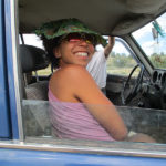
Wednesday, June 1 Thunder Rumblings
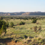
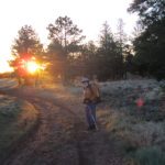
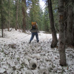
June 1st, 2016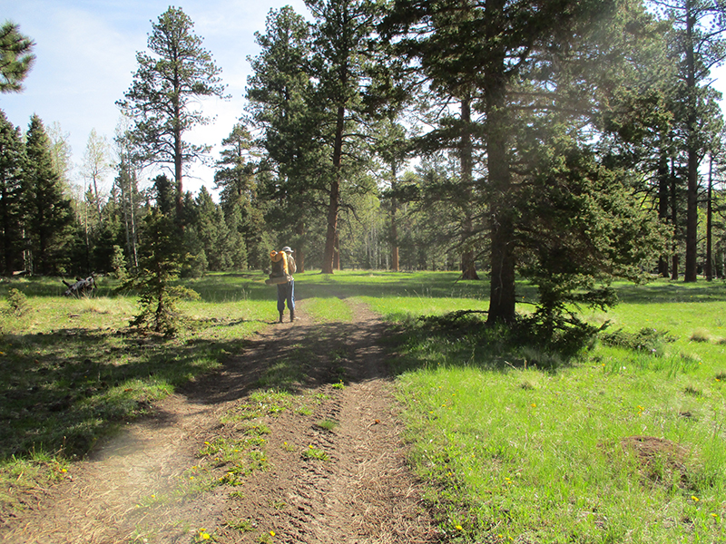 SUMMARY: The sky had only a few clouds in the early morning, but that did not last long. Big, dark gray ones came rolling in, and basically for the rest of the day, our hiking was accompanied by thunder, occasional sprinkles of rain, one downpour of hail, and some lightning that got kind of close. But in spite of it all, at 9:30 am we came to a river ford and at last we knew exactly where we were. But it means we did very few actual trail miles yesterday, so we will run out of food a day before we reach Cumbres Pass, if we don’t ration. But the scenery today was gorgeous, the sun came out as we were setting up camp, and we will see what tomorrow brings!
DETAILS: Last night I was in my sleeping bag, studying the maps, and concluded “I still don’t really know where we are. All I know is I think we are on the CDT, maybe….?”
In the morning, Fixit made the decision to use up the last of our cell phone battery to consult Guthook in hopes of locating where we were. No luck. On our phone (which is rather old), what we do is look at the shape and pattern of the “trail” as shown on the phone, then try to find that same shape/pattern on the map. But no luck. We could not make any sense out of any of it.
Fixit’s response was “Let’s sit down and really study the maps and try to figure this out.” My response was, “We have only two days of food left. That’s not enough to spend a lot of time hunting for the trail. At this point, all we can do is find a road that will take us to a town–then we can get more food AND we will know where we are.” To further complicate the situation, Fixit was also convinced that we had been going the wrong way, and needed to go back. It took a lot of persuading for me to show him that if we went back, we would actually be going back to Ghost Ranch, which is not what we wanted to do! Finally, after some debate, we decided to keep on walking along the road we were on.
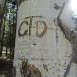
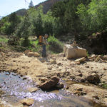
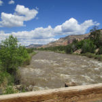
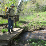
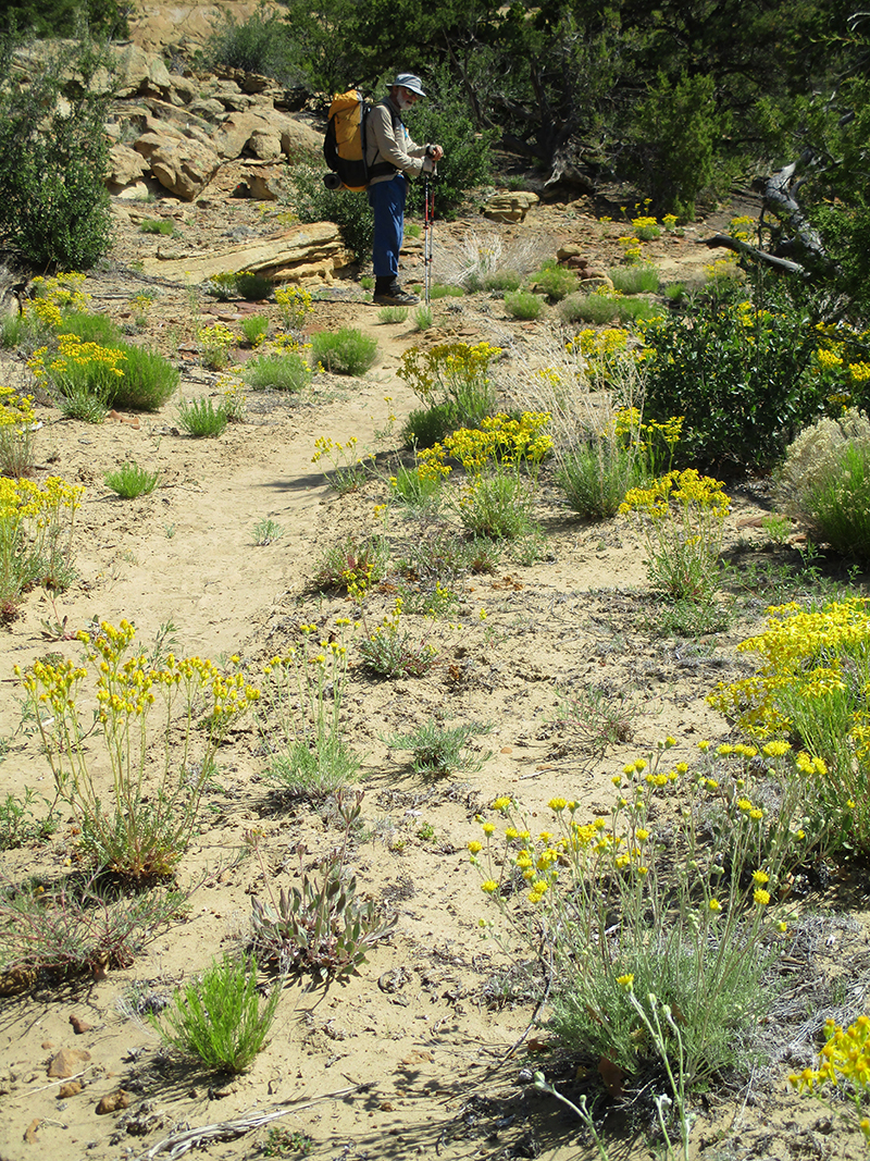
And then, HOORAY! We spotted a CDT emblem! And then another…and another. And then, oh joy! We reached a river crossing with some distinct features, and I FOUND US on the map! There was a log bridge over the river, but it was way too tilted to one side to be of any use. Fixit went off into the forest to look for a lever he could use to straighten the log, while I scouted for a ford. According to the map, there was a place where the river was only thigh deep, and yes, that was true! So I started across, very carefully. The current was strong but not scary strong. The problem was that the bottom of the river was full of smooth, rounded rocks covered with algae. Very slippery! And BRRR the water was cold–it was fresh snowmelt. But I made it, and sat down on the other side rejoicing to know where we were. I studied the maps and figured out that yesterday we only did a few real CDT miles. Ouch. That puts us way behind. We will come into Chama “running on fumes” foodwise.
Eventually Fixit came back–no luck finding a sufficient lever. He really did want to fix that log, so he was a bit disappointed. He does not like it when he can’t FIX something! He made it across the river, too, and since it was 9:30 am “Snickers break” time, we sat in the sun and relaxed for a few minutes. I felt like a huge weight was lifted off us, now that we knew where we were.
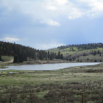
When we shouldered our packs and headed out, dark gray clouds were rolling in, and by lunchtime, thunder was rumbling. But we marched happily along, so glad to be on trail again, till we reached Hopewell Lake, with its campground and picnic area. It was raining at that point (with thunder) and we lost the trail again. It took about an hour of beating around before we finally were able to find it. Sadly, there were some posters up about a missing antler hunter. Apparently he went out with some friends recently to hunt for elk antlers, and at the end of the day, he never came back. Doesn’t sound good.
But now we were back on trail, and after that, things went well. We were just beginning a roadwalk section when we met a ranger who told us how to locate the trail up ahead where it made a right turn. As we hiked along the road, off to the left we could see two guys busy working with a Bobcat on building TRAIL so that future CDT hikers don’t have to walk the road. They saw us and waved and cheered!
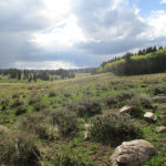
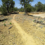
We found out later that several of our fellow CDT hikers, when they reached this road, simply hitch hiked to Chama, because like us, they had been “lost” so much that they didn’t have much food left. But we decided to go for it anyway. Once we got to the trail turnoff, we were back to dealing with mud and marsh and snowmelt, with the additional difficulty of having a thunderstorm right over us, spitting lightning. Our policy on this kind of situation is to keep going and pray, “Lord, You know where we are….send the lightning someplace else, and keep it from making trouble.” At one point, it began to hail, and we ducked under a tree to wait it out. The temperature was dropping, and the rest of the afternoon it was very cold, with lightning and thunder continuing.
At 7:00 pm, we stopped to camp at a spot where obviously someone else must have recently camped, because the grasses were flattened. And as we set up our tent, the sun came out! The storm went away and of course that meant a glorious sunset. I studied our maps and told Fixit, “Well, we have 48 miles to go, and one day of food. This will be interesting! But at least we’re on the trail! And the scenery today was gorgeous!” Fixit agreed, and we burrowed into our sleeping bags for a cold night.
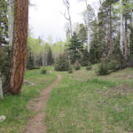
 SUMMARY: Well, we spent about 8 hours today either very lost or else not knowing where we were. Everything was beautiful and we were enjoying the spring greenery, till we ended up losing the trail, and after that–argh!–we were dealing with trying to find a route through snowy forest and marshy meadows. Finally we found a road that occasionally had CDT “stickers” on posts, and just started following it, not knowing where we were till 6:30 pm. We are sore from the obstacle course we’ve been doing, but grateful that at last we do sort of know where we are. Did lots of praying today!
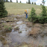
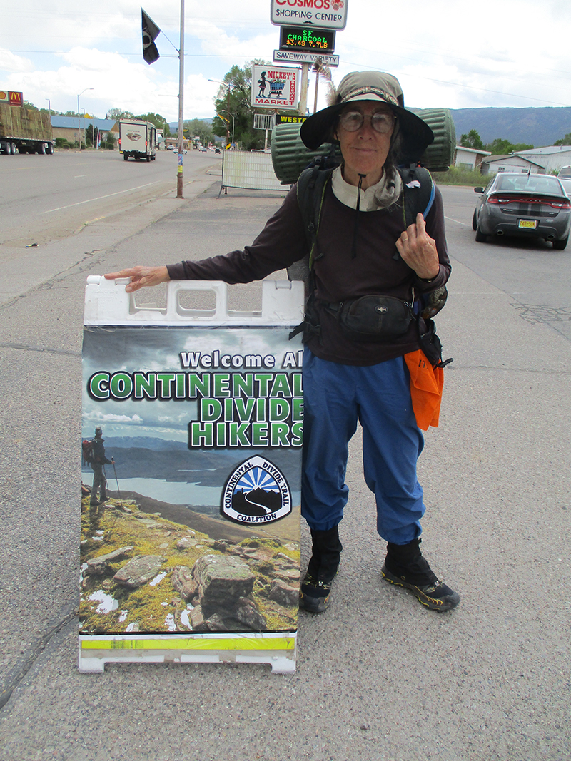
 DETAILS: We had our packs sitting by the door, ready to roll before breakfast–our last chance to eat lots of good food and talk to people. We had fun talking to Yeti and her husband (don’t remember his trail name, unfortunately). All the hikers are talking about one topic: SNOW. Many are planning to simply go home for a couple of weeks once they reach Chama. Others say they will flip up to Wyoming and come back to Colorado later. Yeti offered to help us do the “flip” if we want to, but we told her, “No, we’ll just keep walking north and do the best we can.”
 DETAILS: This morning we stepped out into a cool, fresh morning and stood there taking in the sweeping views across the Abique valley. The breeze was rustling in the cottonwood trees and birds were singing their morning songs. No hiking today–time for a Sabbath rest.
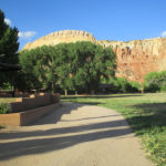

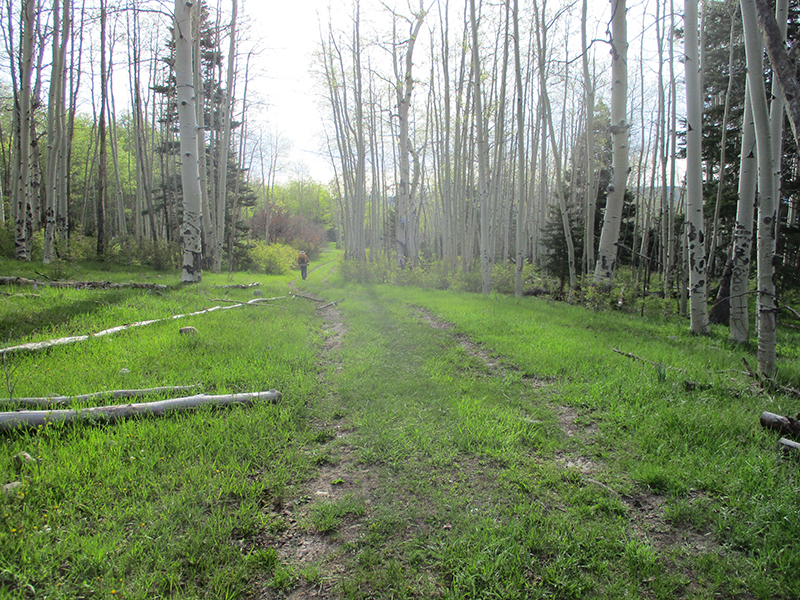
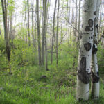
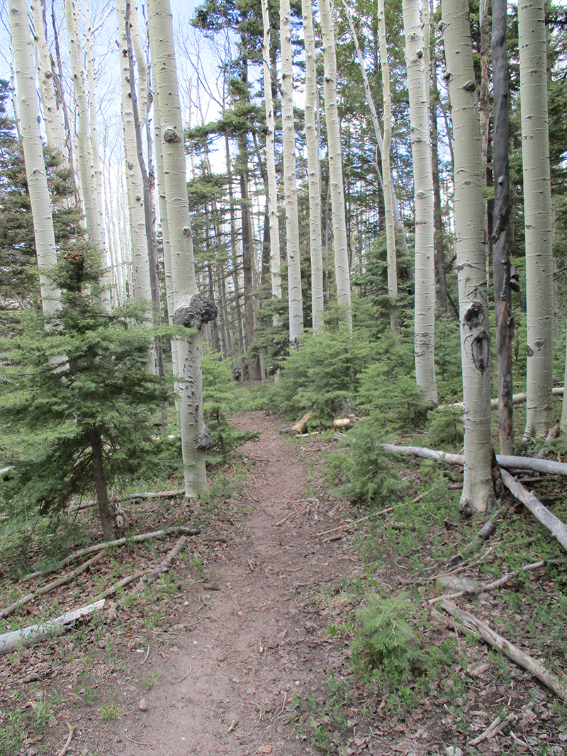
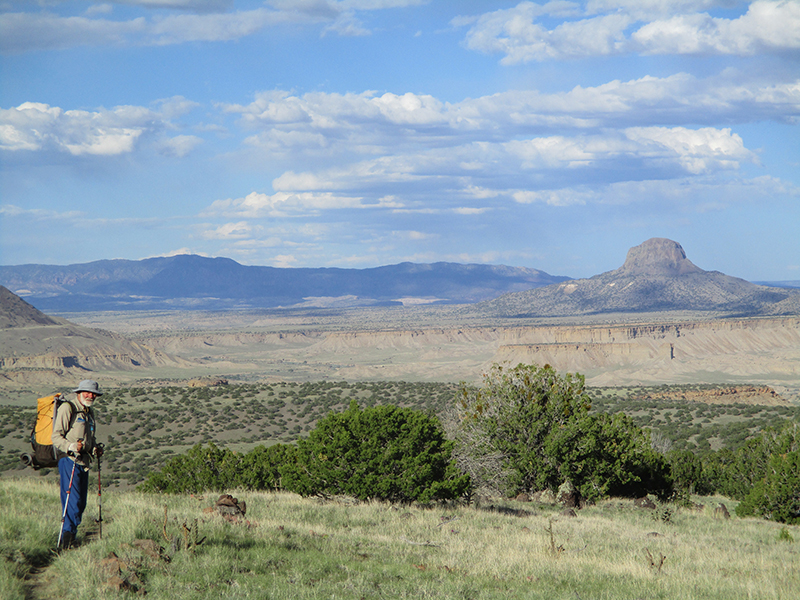
 SUMMARY: The day began with a long switchbacking downhill through spring-green forest to Ojitos Creek. At that point, for some way, it was a creek walk with multiple crossings, just like the Gila River, but very cute and no wet feet! Then out through a spectacular mesa-rimmed valley to a long walk by the rushing, roaring Chama River. Groups of kayakers were riding it, though! We finally reached Ghost Ranch and immediately felt the peace of this place. Lots of hikers are here, and we are all being made very welcome.
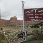
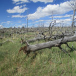
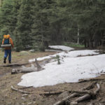
 SUMMARY: It snowed last night–just a dusting, but it was really pretty along the trail this morning–even the old snowdrifts looked pristine and white. But every meadow we crossed had turned into a swamp of freezing cold snowmelt water. Moosh, goosh. Not fun. Then in the forest, it was crunch, crunch, whooompf as we walked on snow and sometimes postholed. A very long (most of the day) downhill through changing forest suddenly ended with a killer climb up a colorful sandstone mountain. Huff & puff! But we made the top, ate some food and now we are cowboy camped despite some clouds that look a bit iffy. We are tired. But what a varied day!
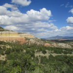
 DETAILS: The first thing that hit us this morning was “We’re HUNGRY!” The Del Prado restaurant doesn’t open till 8:00, so we went across the street to McD’s and got something to start with. Then I took the cell phone and tried to call our daughter Joy–at first I could not get a signal, but finally found that if I went outside I could get service. Joy is doing as OK as can be expected under such grievous circumstances. She was able to be with her husband when he died–it was very sudden and very fast–less than 5 minutes. Apparently the cancer broke into a major blood vessel and before anything could be done, he was gone. Joy says no funeral & fuss are planned–that Craig, her husband, hated to be the center of attention, ever, and the last thing he would want would be a funeral. “So Mom, don’t drop your hike and come all the way out here,” she said. “I’d rather just be with the kids and have things quiet. I’ll be OK, don’t worry about us.” I shed some tears after hanging up the phone. This is really hard.
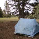
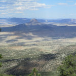
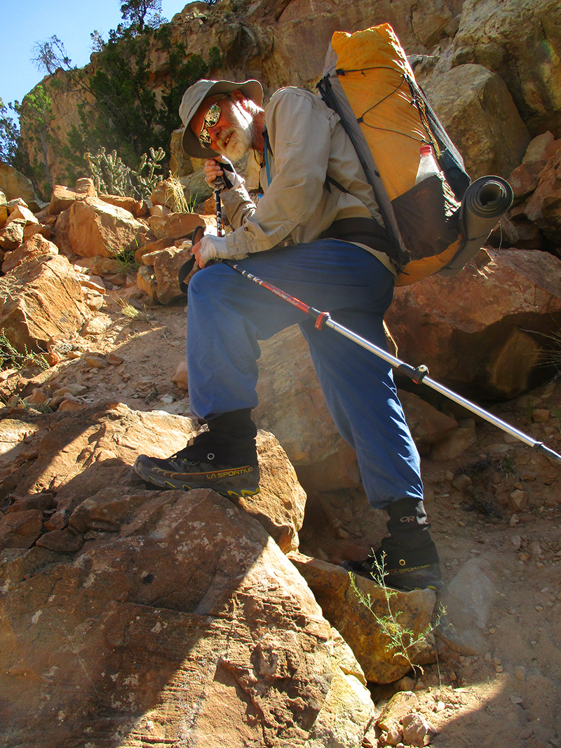
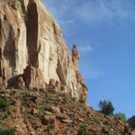
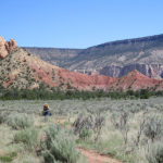
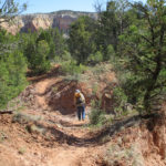
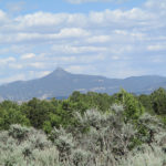
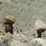
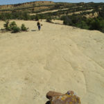
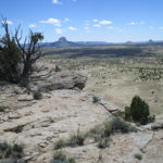
 We tried to call her, but there is no cell phone service out here, not even on the high points. We did get lots of practice today in climbing mesas—those huge flat-topped mountains that are everywhere here in northern New Mexico. Whoever figured out and built the trail was amazing! For me, there still were some scary parts–like skinny steps chiselled into the rock right next to a big drop-off. But once you are “up top”, it’s quite a scene–acres of hard sandstone, spectacular views and wildflowers. We reached Cuba late in the day, with just enough time to eat a bit of dinner and then collapse.
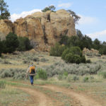
 2) That we were headed for the water cache 5 miles away. We got to the roadcrossing where the cache was supposed to be, and could find no sign of it, so we flagged down a passing car and got water. But Slapshot had found the cache AND a note inside for US to “Call your daughter Mercy ASAP.” So as we went cruising by the cache, not planning to stop because we’d gotten water already, he flagged us down–“Hey, Fixit and 3rd Monty–there’s a note for you!” Without him, we would never have seen the note. It was bad news. Our other daughter’s husband has suddenly died. Oh no! The rest of the day I was hiking all choked up.

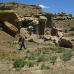

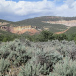
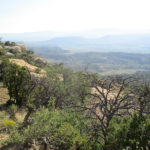
 SUMMARY: Back to walking the very rutted Road 293 this morning. Fixit said, “I had no idea the CDT involved so much roadwalking. Not good!” But by 11:00 am we had reached Los Indios Spring, where we got lots of great water, and after that we were back on TRAIL. The only problem was the scenery. It was pretty–meadows and pine trees–but all the same. I felt like I was caught in a “film loop”–the kind some churches use as background for the words of the songs. But finally at 4:30 pm, the trail plunged over the edge of the mesa and began a 2,000 foot descent to a dramatic vallley below with canyons, rocky outcrops, and more. Beautiful!