Altitude
Saturday, April 16th, 2016Fixit and I were looking at the Postholer chart of snow levels in Colorado–appears it was a more or less average year up there on the Divide. And it isn’t just the snow that concerns us a bit (like “should we mail ourselves some snowshoes??”) We were also thinking about the ALTITUDE. Being 76 and 68 years old means that like it or not, we DO have to think about altitude and how it will affect us.
When we did the PCT in 2005 and 2010, we happily hiked over Forester Pass and all the other high passes with nothing more than extra huffing and puffing. The altitude was not a problem. Then for the next 2 years, we climbed Whitney every year and Fixit did the whole John Muir Trail, again with nothing worse than huff ‘n puff.
But in 2013, all that changed. We were doing our annual “climb Whitney/do the JMT”. As usual, we parked our car at Horseshoe Meadows, hiked up to Cottonwood Pass, camped along the way, and the next day reached our “base camp” on the next “level” down from Guitar Lake. (The reason we use that location for base camp is that it’s outside the “no poop zone” where you are required to carry a wag bag. If you camp at Guitar Lake, you’d better not be digging catholes, or you are BAD!!) At dinnertime that night (no cook, of course–we don’t like bears visiting at night) we found we just were not hungry. Strange. Even stranger, all during that night, though I was lying down, I found my heart was pounding as if I’d just climbed a steep hill. It was weird and I worried a bit about “what is happening to me?”
Next morning, dark and early at 5:00 am, we got up to eat breakfast and start the Whitney climb. To our surprise, neither of us could face eating anything. I managed to force myself to eat a bit, but had to choke it down. We packed up camp, left our packs hidden in a group of stunted trees, and began heading up. Fixit of course was soon far ahead of me. The higher I went, the sicker I felt. Pretty soon I thought I was going to “lose my cookies” and had to stop and sit by the trail, fighting against the nausea. I knew then what was going on. “Altitude sickness! This totally sucks!” But I did not have a headache or any really scary symptoms so I was determined to push on, and I did, all the way to the top, but way more slowly due to having to stop every now and then from feeling so nauseous. I met Fixit as he came down, and he was looking a bit green, too, but determined to begin his journey to Yosemite Valley on the JMT. At the top of Whitney, I felt so sick that all I could do was sign the register, look around a bit, and head down.
On the hike back to our car, though I slowly felt a bit better, I still basically couldn’t eat. But when I reached Cottonwood Pass and the turn down to Horseshoe Meadows, the magic began. As I went down, down the switchbacks, I felt better and better. When I reached the flatlands of the Meadows, the nausea was totally gone and I was hungry! What a wonderful feeling! And at the trailhead, TRAIL MAGIC!! A group of PCT thruhikers were there–they had just come from a zero in Lone Pine and were having a little picnic before heading back up to the PCT. I yelled, “Hey, hikertrash! How’s it going?” and ended up having a beer and sharing trail tales with them.
So….the CDT in Colorado spends a lot of time at altitude. Serious altitude. Fixit and I are wondering how it’s going to work out. We have solved our Mt. Whitney altitude problem by taking 3 extra days of just resting at around 11,000 plus feet, drinking lots of water and eating lots of carbs before continuing on. But on the CDT, what will we do? Our tentative plan at this point is to hang out at Cumbres Pass for at least a couple of days. That’s up pretty high, and we’d have the fun of watching trains go by. I am a total sucker for trains–love them! On the PCT, I was in heaven at Cajon Pass, with all the trains! Anyway, we will see how we feel. I’ve learned my own “early warning system” for altitude sickness–heart pounding even when I’m resting, and not feeling hungry when I should be hungry.
Hopefully all will be OK, and if we really start feeling altitude sickness, the cure is so easy–just head downhill!
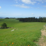
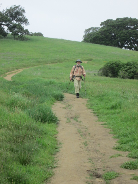
 We spent the day yesterday hiking the Bolinas Ridge Trail in Point Reyes National Seashore. It’s our next-to-last big training hike before we head out for the CDT, and we figured it had at least some CDT features: cows, mud, big hills, wind and wildflowers.
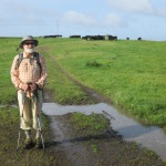
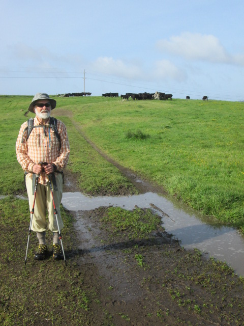
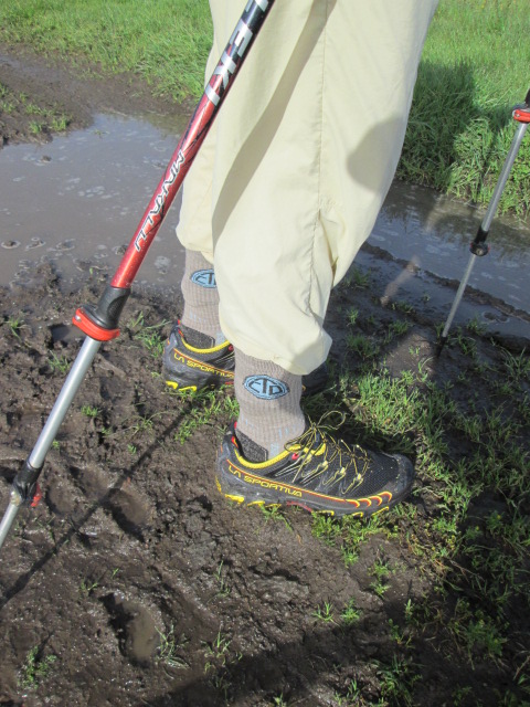 Mud…the Bolinas Ridge has a number of mudhole stretches, but yesterday they weren’t too bad. We stopped and looked at one of the biggest puddles and joked, “So that’s what the water looks like on the CDT? Oh, fun!” But we are seriously thinking about how to deal with CDT water. It’s going to be Aqua Mira, but we may need to strain things first. We are deciding what to bring for that.
 Wind–from what I hear, the CDT can be very windy. OK–we had plenty of that yesterday, too–cold, cold wind that was enough to make us stagger a bit. We were joking about it, “OK, on the scale of PCT winds–would this be Tehachapi Pass level (the worst), or Sonora Pass approach (2nd worst) or Cajon Pass approach (3rd worst) or San Gorgonio Pass (4th worst)?” We finally decided on Sonora Pass, since the wind there was so COLD, just like the one we were in. Brrrrr!
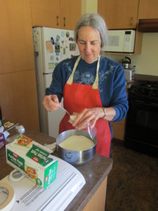 Thruhikers come in lots of kinds! There are those who prep everything, those who prep some things, and those who wing it. The preppers (like me) want to get EVERY last little thing ready ahead of time, pack it in boxes and have the boxes mailed to them along the trail so they can just open the box, put the stuff in their pack and go.
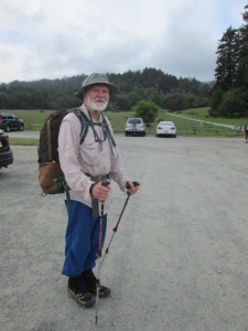 The reason I like being a prepper is that when I get into town, I want to just kick back and relax. I do NOT like shopping, and I do not trust in what I might find in some little fisherman store along the trail. I do believe that as hikers, we represent the CDT or PCT or whatever trail we are on, and we should make local people glad rather than annoyed, that we came to their little town. So we make a point of eating in local restaurants and I do buy a lunch and some snacks for the trail before we leave.
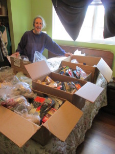 It is tedious to do all the collating, but at the same time it is fun to think about the day when we will actually walk into the towns where the various boxes are going. And the many bags and boxes of stuff that have been sitting in our living room are gradually going away and the contents being put into their shipping boxes in the garage. I will be glad when it is all done!
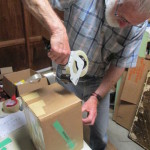
 Back in 2005, when we were total newbies at thruhiking, we thought that the most important thing to work on when training for a long hike was to do MILES–lots of miles. At that point in time, we thought it was a big deal to do 15 miles in a day. So we did our best to do hikes that were at least…gasp…12 to 15 miles long. Sometimes we even pushed to 20 miles. I will never forget one late afternoon when we’d been hiking all day in Sugarloaf State Park near Sonoma, and we were totally wasted because of all the hills, even though we were only carrying lunch and water in a daypack. We were collapsed under a tree to rest, but still determined to get in a couple more miles, and I naively said, “The PCT couldn’t possibly be THIS tough.” Boy, was I in for a shock. It was WAY tougher. Especially on feet. Fixit had endless problems with his feet all the way from Mexico to Canada that year. But we kept going anyway–it took us 5 months, and the first snows had arrived by the time we finished in October.
 In 2010, we said, “Now we know better!” and trained with WEIGHT, carrying our PACKS. Turns out that mileage, though helpful, is not as important as weight. That approach plus custom orthotics worked great–I for one was able to hike the whole PCT without any blisters or foot pain at all (except for the lava walking north of the Sisters in Oregon–owwww!) The other aspect of training we learned was to hike on HILLS as much as possible. And rough trail is good, too.
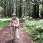
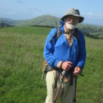
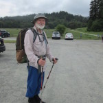
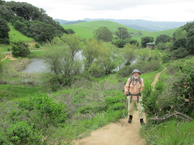 We live in the North Bay area of San Francisco Bay, and that means we have awesome choices for hiking. This is a hikers’ paradise–our favorite trails are in Point Reyes National Seashore, Annadel State Park, Austin Creek Redwoods State Park and Lake Sonoma. All of them have lots of big hills and plenty of rough trail. That’s where we go when we are doing an all day hike. On short days, we take a couple of hours to hike at Helen Putnam Regional Park, west of Petaluma, where there are big hills and some rough/muddy trail. A couple of weeks ago, I was training in Helen Putnam Park, and met 4 forest firefighters who were wearing all their protective clothing, and carrying a bunch of gear. They looked at me with my pack and said, “Looks like you’re training for something!” I said, “Yup! The Continental Divide Trail–New Mexico to Montana. Looks like you’re training, too!” They said they were, and headed for what’s locally known as “The Face”, a very steep bald hillside. I had just finished climbing The Face twice, and was aiming at another hill, but I looked back to see how they were doing. Plod, plod–all that firefighter stuff is heavy! And it was a slightly ominous reminder of fire season–in 2010 we had to go around 10 miles of the PCT in Oregon because of a forest fire. It reminded me to pray for the guys and gals who willingly go out to face the danger of firefighting so that the rest of us can be safe.
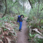
 Yesterday was our weekly “big hike” day, when we load up our packs and head out for the whole day. We do shorter hikes on two other days, but Thursdays we try to replicate “the real deal” and hike all day.
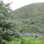
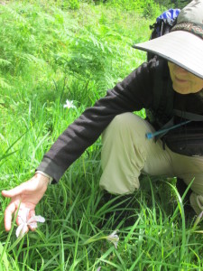 At the top, bummer. No view of the blue–just cloudy, gray and brrrr, cold wind. We couldn’t even see the ocean at all. Oh well–we headed on through Sky Camp and then waaaay down to the road, followed by a rollercoaster contour for 3 miles or so along the hillsides. But then, wow! There WAS a “view of the blue” only it wasn’t the ocean. It was whole hillsides covered with the blue flowers of ceanothus (wild CA lilac) in full bloom. I stopped in my tracks to take it all in. The trail was dusted with tiny blue petals and the air was sweet with the perfume of the flowers. So I did get a view of the blue after all–not waves on the ocean, but waves of flowers on the hills. Works for me!
 After climbing Point Reyes Hill and down the other side, then up and along Mt. Vision, we stopped for lunch in wind so strong and cold that we ended up having to hunker down while we ate instead of sitting up on a bare spot to enjoy the view. The clouds did lift enough for us to see the ocean–the line of white at the beach was pretty sizeable, which meant that there were some big waves coming in.