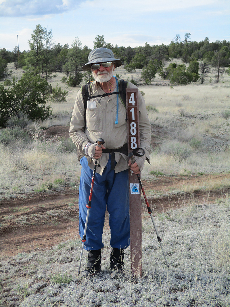
Monday, May 23 Done With Roadwalking!
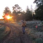
Monday, May 23rd, 2016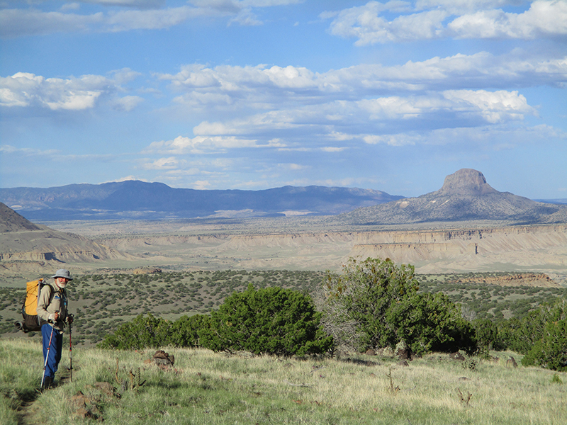 SUMMARY: Back to walking the very rutted Road 293 this morning. Fixit said, “I had no idea the CDT involved so much roadwalking. Not good!” But by 11:00 am we had reached Los Indios Spring, where we got lots of great water, and after that we were back on TRAIL. The only problem was the scenery. It was pretty–meadows and pine trees–but all the same. I felt like I was caught in a “film loop”–the kind some churches use as background for the words of the songs. But finally at 4:30 pm, the trail plunged over the edge of the mesa and began a 2,000 foot descent to a dramatic vallley below with canyons, rocky outcrops, and more. Beautiful!
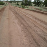
DETAILS: We packed up quickly at first light, eager to be done with the very rough & rutted Road 293, and even more eager to reach the famous Los Indios Spring, to replenish our water. The reason the road was so hard to walk on was obvious–somebody drove a truck on it when it was raining and the road (being New Mexico) was one big mudhole. Now the mud has dried hard as a rock, and it was so messed up that a lot of the time we walked the sides rather than the road itself. Fixit said, “I had no idea the CDT involved so much roadwalking. Not good!”
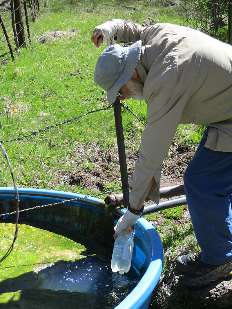
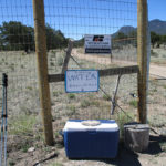
The scenery was what I call “top of the mesa”–fairly flat prairie with a few trees. The only critters we saw were birds–crows and chickadees. Our breakfast stop was brief–brrrr, it was cold, and we were rationing our water. But by 11:00 am we had reached the turnoff to the spring. And look! SIGNS, telling where to go! The spring itself is down in a steep, rocky canyon, so we did our usual routine–Fixit emptied his pack, took all our water bottles and went down to the water. When he got back, he said he had to fix the spring pipe a bit (he is not Fixit for nothing), but he had lots of water. We both immediately drank a whole liter of “bug juice” (Emergen-C plus electrolytes) made from COLD spring water. So good!
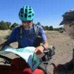
On the way back to the CDT, we met some hikers headed for the Spring–HoB (stands for Hike or Bike), Flying Squirrel, and Early Girl. We have not seen any other CDT hikers for so long that it was pretty exciting to see them.
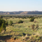
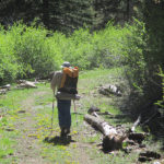
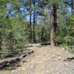
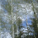
Since the Spring is at the end of the road, now we were off the ruts and back on TRAIL. But the scenery, though very pleasant, stayed the same. Basically you walk through a pretty, grassy meadow surrounded by pinon pines, then into the pines for a little bit, then back into another meadow. Over and over again. No views, just the constant repetition. I felt like I was caught in a “video loop” like some churches use when they are projecting songs onto a big screen and want to have a pretty but unvarying background to the words. The only thing that did change (which I enjoyed very much) was the light. Depending on the time of day, it was really varied. I hiked along looking at it and thinking about “how would I draw/paint this?”
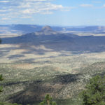
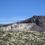
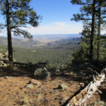
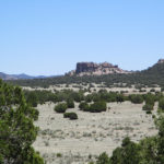
Finally we started getting a few breaks in the trees, and could catch glimpses of a whole ‘nother world down below and around the mesa we were on–a world of dramatic mountains and deep canyons. Then at 4:30 pm, we came to the EDGE. Literally. The trail plunged over the edge of a precipice and headed steeply down almost 2,000 feet to the valley far below. And what a valley! “Awesome” does not even begin to describe it. Immense rock formations were standing here and there, all colored by late afternoon light and some shadowed by clouds. It was classic New Mexico. Even Fixit was impressed. “Wow!” he said. “This sure looks ‘western’!” We took our time heading down, partly to soak up the view and partly because the trail was so steep and rocky. Halfway down we stopped and ate dinner at a spot where we could see the whole valley. Wow.
Once we were finally really down to the bottom, we found it was very windy, and finally at 7:00, when it was time to camp, we had to hunt around for some trees, in order to hunker down out of the wind. We found a good spot, but the cows liked it too, so we both had to spend some time clearing out a lot of old dry cow pies before setting up camp. Now we are very comfortable, and listening to the wind roaring in the branches. Tomorrow we get to walk across this awesome valley!
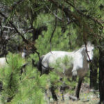
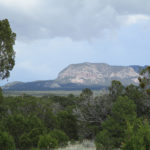
 SUMMARY: We spent about 2/3 of today wandering in the woods on the CDT, meeting hikers out for the day with their dogs, plus horseback riders, and even some WILD horses that were busy eating all the green grass from recent rains. Wildflowers are out–including iris and lots of dandelions! We got wonderful water from the Ojo Piedra Spring. By afternoon we were back to walking across the prairie and had great views of Mt. Taylor (with a bit of snow on the north side) as well as other distant hills and valleys. The wind was blowing fiercely–we had to hunker behind bushes when we wanted to stop. We’re back in the woods tonight, cowboy camping!
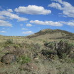
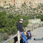
 DETAILS: We decided to do the “run for your life dash” across the RR/freeway overpass first thing, early this morning, so by 6:00 am we were tucking our last bits of gear into the packs and getting ready to start. We felt much better than when we first got here–now we are well rested, clean and relaxed.
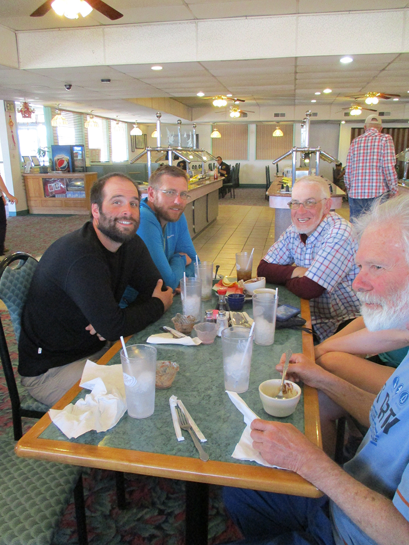 SUMMARY: We had a great zero day today, and when we went for lunch to the Chinese buffet we joined a tableful of other thruhikers. Of course they asked, “When did you start?” and when we told them “April 30”, they rolled their eyes and said, “What did you do–RUN here??” Well, we didn’t run, but we did keep walking a lot. So what did our zero look like? Sleep in, eat big breakfast, do laundry, pick up resupply box, lunch at the buffet, do the mending, load food bags, take a nap, finish the journal, eat dinner, go to bed.
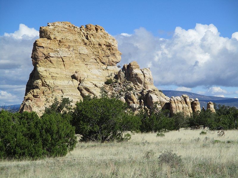 SUMMARY: We woke up to a thick ground fog that made everything (including us and our gear) soaking wet and fringed with ice. But oh, it was beautiful! We packed up and walked out into what looked like a misty watercolor painting. Gradually the fog cleared, and we went through “The Narrows” where menacing black lava reaches the foot of dramatic sandstone cliffs, including the famous “Ventana Arch.” Many hikers do a trail that goes across the lava, but we skipped that (lava – very sore feet) and roadwalked into Grants, continually amazed at the rock formations. We had some trail magic, too, from a tourist family and from a ranger, and reached the Grants Motel 6, ate dinner and collapsed. Zero tomorrow!
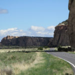
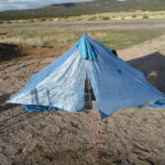
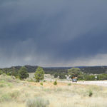
 SUMMARY: We sure are grateful for our nice pine-needly campsite last night. It rained and rained, so all the ground around us became a sea of mud…except where we were. We spent all morning slipping and sliding along a very muddy road, with rain so cold that it actually snowed on us for awhile. But by lunch time, the sun began peeking through, and we reached “El Malpais” lava fields, which meant walking a paved road. Goodbye, mud! But yikes! Ahead of us lay some of the blackest clouds I have ever seen, with thunder rumbling. But as we walked along, the blackness gradually disappeared and tonight our little blue tent is perched by Hwy 117 on a nice gravel area out of the mud (which is everywhere!)
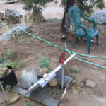
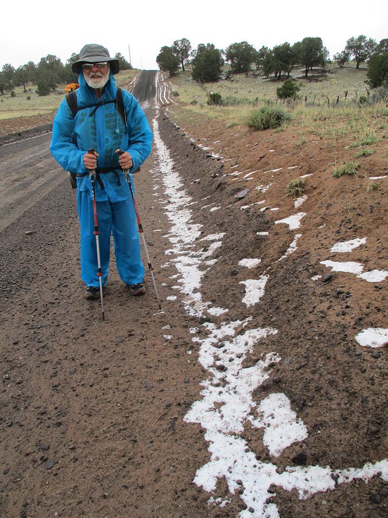 SUMMARY: The weather was brewing for nasty right from early morning–dark clouds were moving in. But we had a wonderful breakfast at the Pie-O-Neer Cafe and when we returned to the Toaster House, the wood stove was crackling and purring, hikers and bikers were organizing their stuff, and all was cozy and cheerful. Once we were ready, we headed back to the Pie-O-Neer for lunch, and there were so blessed to meet a wonderful Christian family and have a great time with them. Manuel, the dad, prayed for us, and as it turned out, we sure needed that–we ended up walking in steady rain most of the afternoon, with thunder and lightning nearby. Then we found ourselves in SNOW, on top of MUD. Tonight our tent is tucked under a tree, while the rain continues.
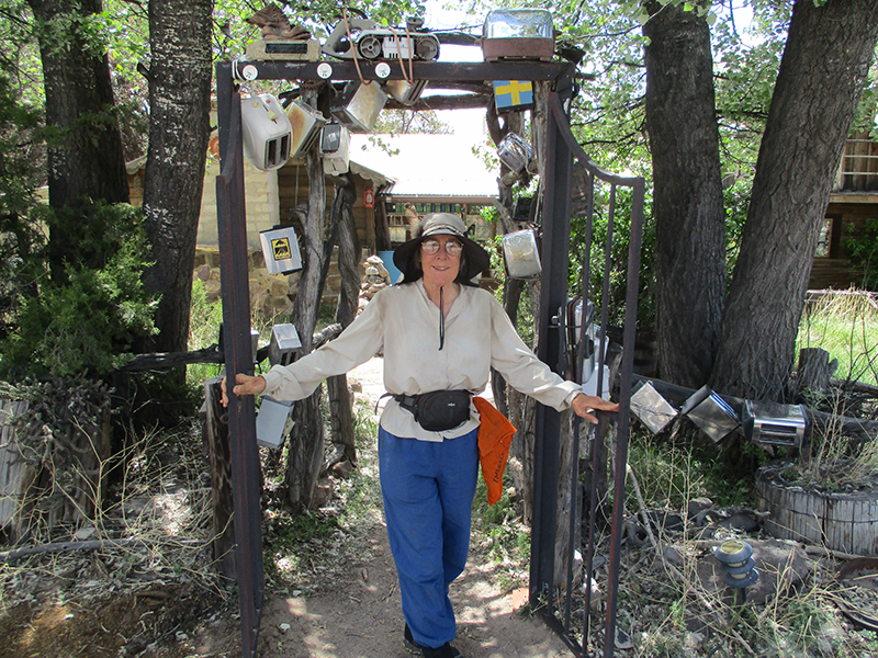 DETAILS: We were up ‘n at’em early on a cold morning, thinking, “Get to Hwy 60, go to Pie Town!” We still had no idea where we actually were, but took every dirt road that went north or nor’east. Hours went by–no sign of the highway. Our water was running low. Then a gift from God–“Talus”, a bikerider, came pedalling along and told us, “Only 9 1/2 miles, and you’ll be in Pie Town, and by the way, there’s a water cache in 3 miles.” Wow! Tired, sore feet, too bad–we turned on the afterburners and made it in by 2 pm, dumped our packs at the “Toaster House” hostel, and got a good meal, showers, laundry and lots of hang-out time with other hikers, and locals, too, sharing trail tales.
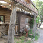
 SUMMARY: One thing about the CDT–to get from Point A to Point B, you often have several choices of which way to go, and those choices can overlap. Today we began on the “Ley Red Route” from Hwy 12 to Pie Town, but finished the day on a different route–the “Bear Survey”. This change was accidental–the two routes came together for awhile, and we went with “Bear” even though we didn’t mean to. This happened way up high on Mangas Mountain, with fantastic views for miles around, and lots of trees (aspens, too!) and wildflowers. Tonight we are cowboy camping down at the base of Chavez Canyon. Pie Town tomorrow!!
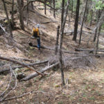
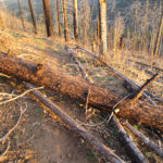
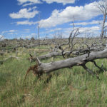
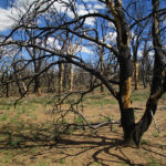
 SUMMARY: We had a glorious time this morning, hiking high up on the Divide, with awesome views in all directions. For a time it was a forest fire zone, which meant a lot of climbing over fallen trees; that’s normal. But around 11:00, with no warning, the really nice trail (well-marked with CDT signs) simply vanished. We were low on water and not sure exactly where we were, because the battery ran out on the cell phone. So we spent the whole rest of the day bushwhacking. It was very tough and we were severely rationing our water. Long story short, we finally popped out of the woods, spotted a big house, got water from their garden hose (nobody was home) and found our way back to the CDT by 6:30 pm. Now it’s raining, but we got into our tent in time to stay dry.