Archive for the ‘New Mexico’ Category

Thursday, June 2 Moments of Joy

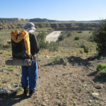
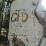
Thursday, June 2nd, 2016

june-2-8
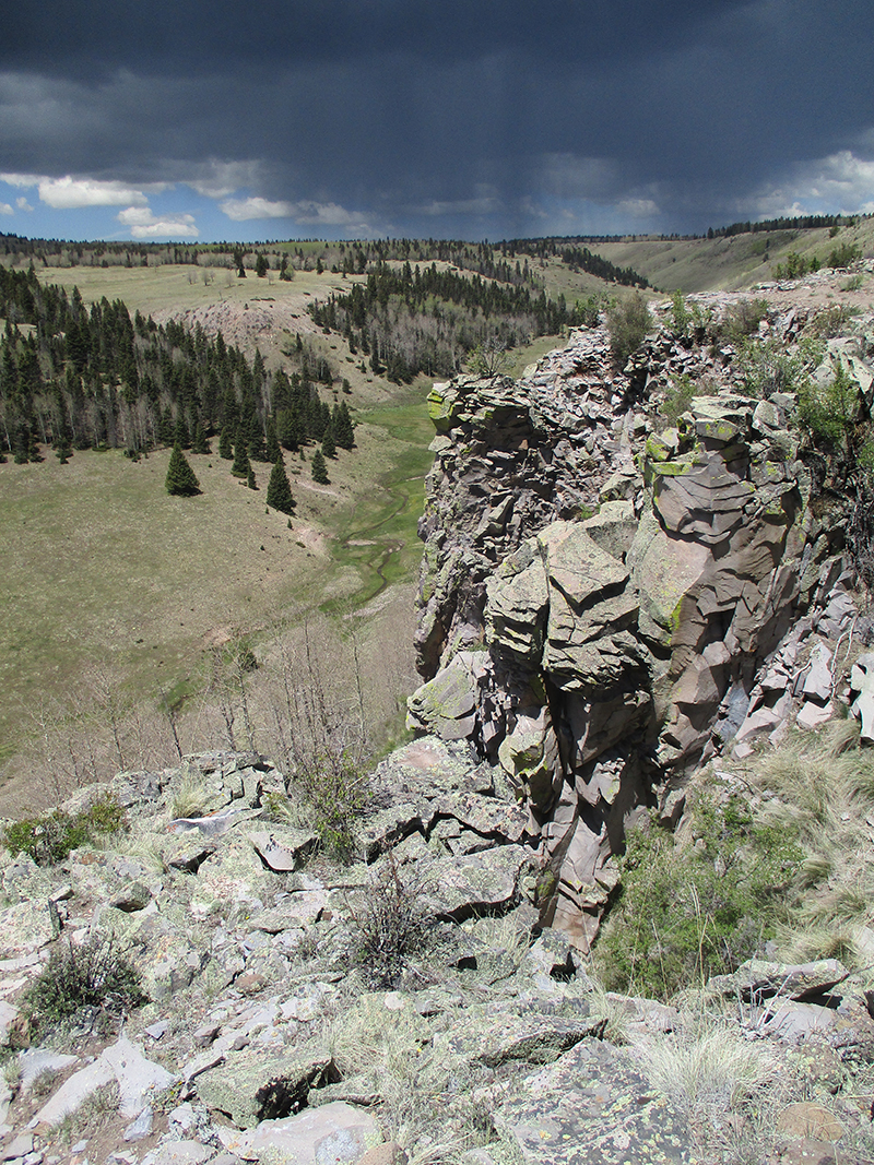
SUMMARY:  Several times every day (and today was no exception) we lose the trail and don’t know where to go.  Some of those “lost” moments last 5 minutes, others last an hour or more.  But there is always the moment of joy when we sot a CDT emblem on a tree or post!  What a massive relief!  Today we were “lost” and hunting for the trail at least 4 times, one of them at 5 pm in a dark snowy forest.  But we always found the trail in the end and had the joyful moment of “Look!  A CDT sticker!”  Today there were magnificent meadows, green forests, scary cliff walks, lakes and quite a lot of snow.  We are camped way up on the Divide tonight, at 10,800′ elevation.  We feel like we are on top of the world, plus there is awesome alpine scenery!

DETAILS: Well, if we hadn’t got so “lost” on Tuesday, we might have been heading into Chama today.  Oh well.  Today we managed to get lost again FIVE times, the worst situation being at 5:00 pm when we were in a forest full of snow and the trail disappeared.

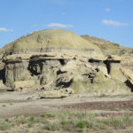
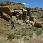
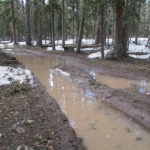
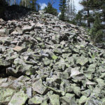
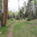
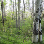
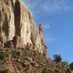
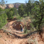
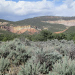
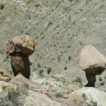
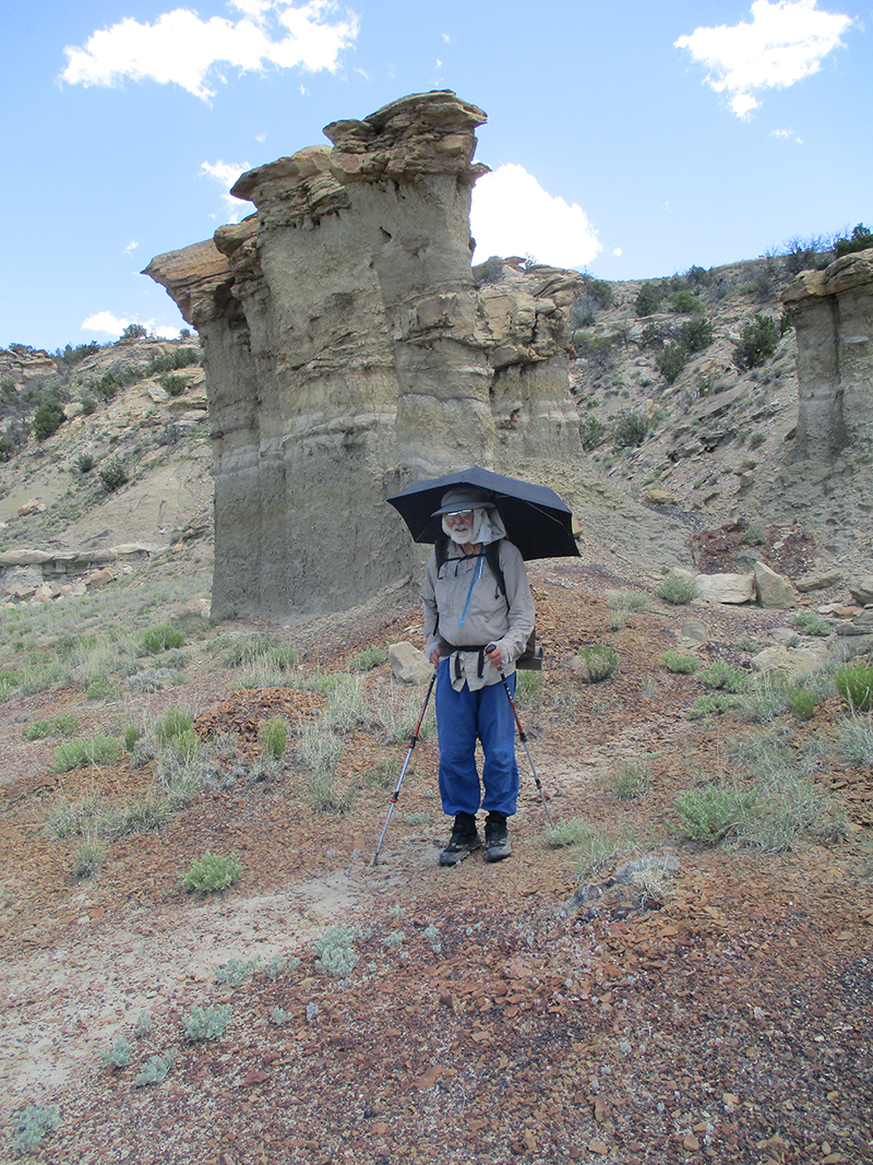
This morning, we headed out along Trail 41, which had a lot of snowbanks next to the trail that were melting fast and turning the trail tread into a muddy mess.  We tried to go around the messes as best we could.  But aside from that, it was a very spectacular area, scenery-wise.  There were huge, dramatic rocky outcroppings and cliffs and areas where the trail edged around rock fields.  Some of the rocks in those rock fields were HUGE.  We stopped and looked at them and marveled, “How did that huge rock ever get over here?”  I can see why the trailbuilders opted to go around and not through the rock fields!

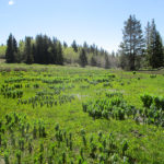
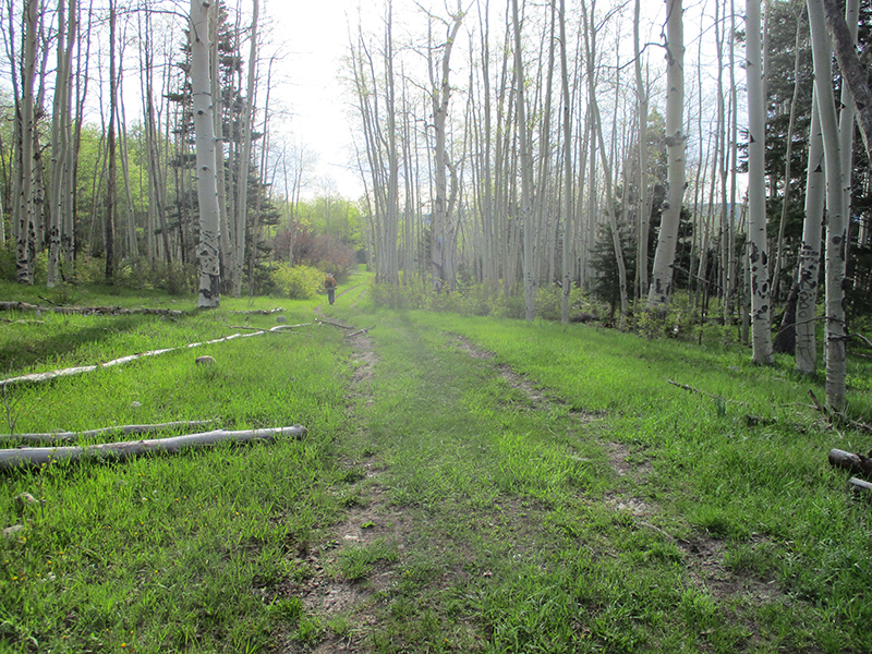
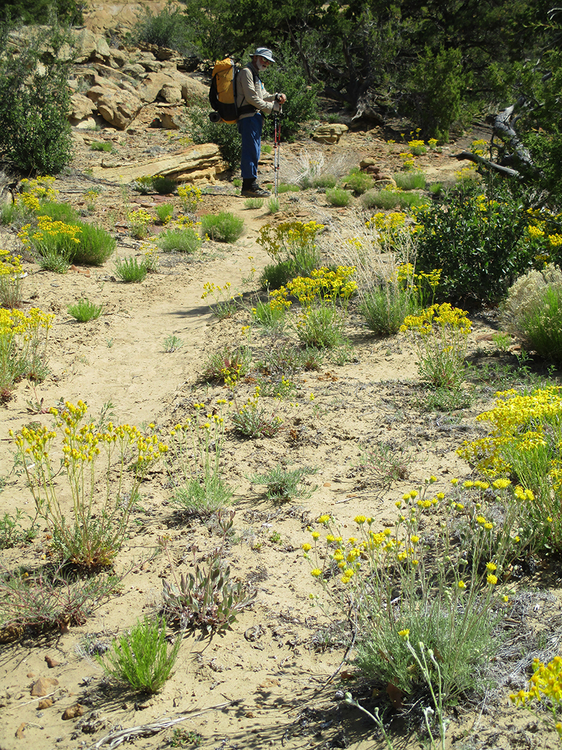
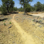
It was a bright, sunny morning–after all those clouds and thunder yesterday, we were really glad to have the sunshine.  Besides the rock fields, the trail was mostly in forest, but finally we reached a huge green meadow area, where the trail route was marked by posts and cairns.  We hiked happily along, till finally in one very long uphill meadow, the posts and cairns disappeared, and so did all signs of trail.  Our Guthook was gone because the battery was used up, so it was just us and our eyes and our maps.  We spent quite awhile checking every possibility of where the trail might have gone, and finally, way up at the top of the meadow, I spotted a fence with a gate and a CDT emblem!  Talk about a moment of joy and relief!

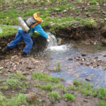
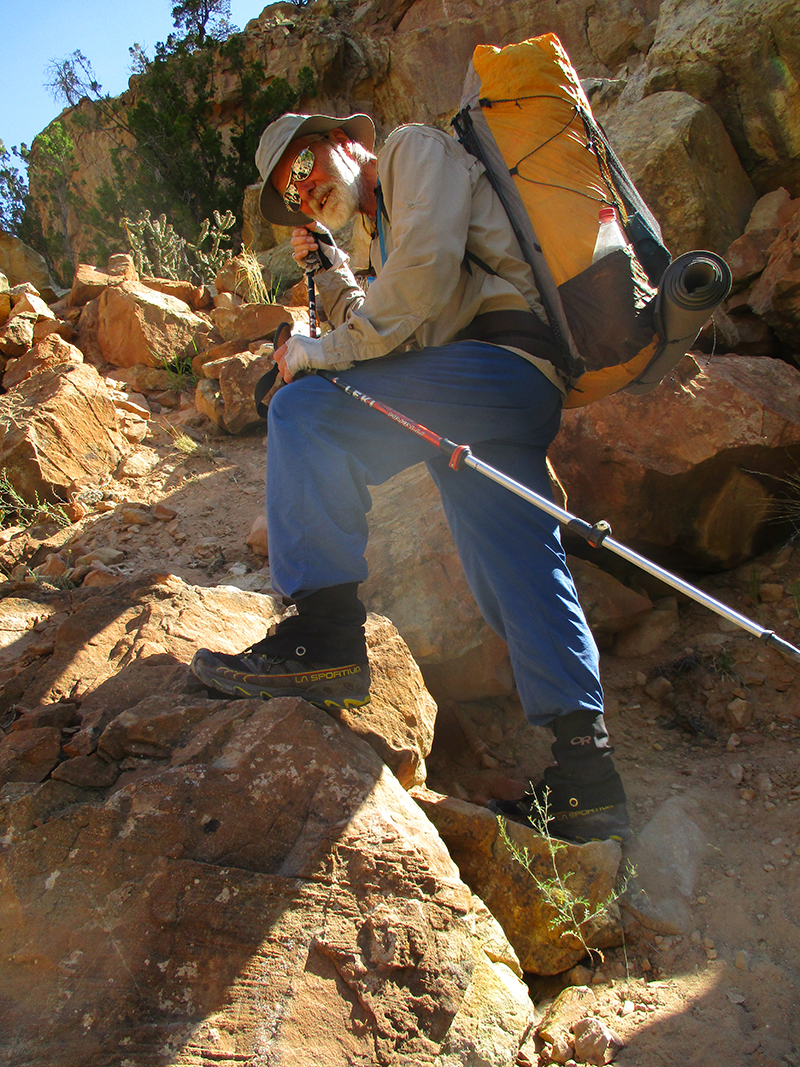
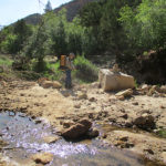
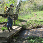
From the gate, the trail headed down into a canyon, way, way down.  This involved multiple creek crossings.  Unfortunately once again, we lost the trail, and ended up bushwhacking down a steep, muddy, rocky hillside till we reached the bottom, where we had to also crawl under a fence.  We tried to joke about this a bit, “It’s still New Mexico–gotta stay in practice at going under fences!”  But we found the CDT again (another moment of joy, spotting an emblem!)   Now the trail headed up high and followed the edge of  a dramatic and awesome cliff.  Ack!  I was so scared!  I had to use my favorite coping technique–just focus totally on the TRAIL and ignore what’s going on around it (like huge dropoffs!).  To add to the fun, we were walking straight toward a thunderstorm.  We made it past the cliff stuff and stopped for lunch, keeping a wary eye on the weather.  There was still enough sun that we dared get our sleeping bags out to air, as we always try to do at lunchtime.

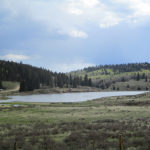
After lunch, the trail dropped down again into a very pretty lake ‘n creek zone.  We stopped to get water, and shortly after that, sigh…we lost the trail AGAIN.  And it started to rain.  But hooray!  Another moment of joy!  A CDT sticker!  Back on trail, up we went to another scary cliff traverse–whew, was I glad to get through that.  Again, gorgeous scenery, but with so little food and nasty weather, it kind of took the fun out of it.  I was so glad to be back in easy terrain with no cliffs, when a fierce wind began to blow and it started to hail.  We scrambled for cover.  I was thinking, “This is ridiculous.  Today is like crazy.”   But the hail stopped, the clouds began to break up, and a little while later, the sun came out for awhile!  We were thinking, “This is the kind of weather we were expecting in Colorado…is this an early ‘welcome to Colorado’?

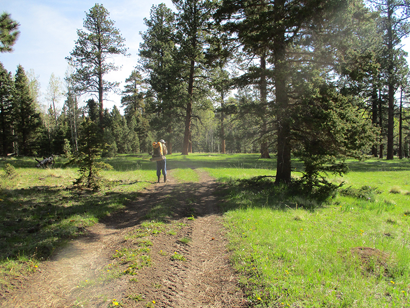
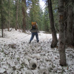
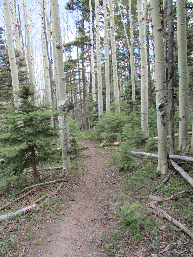
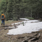
Then the trail headed into a snowcovered forest.  Basically what happens is that out in the meadows, the snow is gone and it’s mud and muck, but in the forests, the snow remains.  We were very happy to see a lot of footprints in the snow, all travelling along together.  But after awhile, the footprints began to split up and wander all over the place.  It was late in the afternoon and we were very tired.  I stood there looking at the dark forest and all the snow for a minute and sighed and got out the maps. After some thinking and studying, I concluded that if we just bushwhacked off to the right, we HAD to hit one of the forest roads, and from there we could figure something out.  So that’s what we did.  I cheered when I spotted the road, and then cheered even louder when I saw a post with a CDT emblem!  Another moment of joy!  At that point we sat down and ate some cold dinner.  While we were eating, along came another CDT hiker–Cerveza.  She was hiking along the road, and told us “I am so DONE with losing the trail–from here on out, I’m hiking the ROAD.”  We said a fervent “Amen” to that, because that’s exactly what we had decided to do!

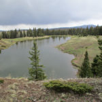
So for the rest of the day, we happily followed a road (the CDT trail had disappeared into the forest again–NO WAY are we going back there!).  The road runs right along the top of the Divide, at around 10,800 feet or so.  It felt as if we were on top of the world, in classic alpine country.  Up ahead of us were the massive, snowy mountains of Colorado, and way down below, we could see green valleys.  Wow!  Awesome!  At one point, we caught up with Cerveza–she had stopped to watch a little mini-drama with a porcupine and a coyote.  I was also  able to spot them both.  Apparently the coyote had decided it wanted porky for dinner, but when it got pretty close, the porky acted threatening and the coyote changed its mind and left.  Wise coyote!  He probably saved himself a facefull of quills.  Finally we stopped for the day behind some trees.  The wind was blowing pretty hard, and the weather looked iffy, so we did set up the tent.  The only food we have left is breakfast and a few odds ‘n ends.  Hope we make Chama tomorrow!

Wednesday, June 1 Thunder Rumblings

Wednesday, June 1st, 2016

june-1-2SUMMARY:  The sky had only a few clouds in the early morning, but that did not last long.  Big, dark gray ones came rolling in, and basically for the rest of the day, our hiking was accompanied by thunder, occasional sprinkles of rain, one downpour of hail, and some lightning that got kind of close.  But in spite of it all, at 9:30 am we came to a river ford and at last we knew exactly where we were.  But it means we did very few actual trail miles yesterday, so we will run out of food a day before we reach Cumbres Pass, if we don’t ration.  But the scenery today was gorgeous, the sun came out as we were setting up camp, and we will see what tomorrow brings!

DETAILS:  Last night I was in my sleeping bag, studying the maps, and concluded “I still don’t really know where we are.  All I know is I think we are on the CDT, maybe….?”

In the morning, Fixit made the decision to use up the last of our cell phone battery to consult Guthook in hopes of locating where we were.  No luck.  On our phone (which is rather old), what we do is look at the shape and pattern of the “trail” as shown on the phone, then try to find that same shape/pattern on the map.  But no luck.  We could not make any sense out of any of it.

Fixit’s response was “Let’s sit down and really study the maps and try to figure this out.”  My response was, “We have only two days of food left.  That’s not enough to spend a lot of time hunting for the trail.  At this point, all we can do is find a road that will take us to a town–then we can get more food AND we will know where we are.”   To further complicate the situation, Fixit was also convinced that we had been going the wrong way, and needed to go back.  It took a lot of persuading for me to show him that if we went back, we would actually be going back to Ghost Ranch, which is not what we wanted to do!  Finally, after some debate, we decided to keep on walking along the road we were on.

And then, HOORAY!  We spotted a CDT emblem!  And then another…and another.  And then, oh joy!  We reached a river crossing with some distinct features, and I FOUND US on the map!  There was a log bridge over the river, but it was way too tilted to one side to be of any use.  Fixit went off into the forest to look for a lever he could use to straighten the log, while I scouted for a ford.  According to the map, there was a place where the river was only thigh deep, and yes, that was true!  So I started across, very carefully.  The current was strong but not scary strong.  The problem was that the bottom of the river was full of smooth, rounded rocks covered with algae.  Very slippery!  And BRRR the water was cold–it was fresh snowmelt.  But I made it, and sat down on the other side rejoicing to know where we were.  I studied the maps and figured out that yesterday we only did a few real CDT miles.  Ouch.  That puts us way behind.  We will come into Chama “running on fumes” foodwise.

Eventually Fixit came back–no luck finding a sufficient lever.  He really did want to fix that log, so he was a bit disappointed.  He does not like it when he can’t FIX something!  He made it across the river, too, and since it was 9:30 am “Snickers break” time, we sat in the sun and relaxed for a few minutes.  I felt like a huge weight was lifted off us, now that we knew where we were.

When we shouldered our packs and headed out, dark gray clouds were rolling in, and by lunchtime,  thunder was rumbling.   But we marched happily along, so glad to be on trail again, till we reached Hopewell Lake, with its campground and picnic area.  It was raining at that point (with thunder) and we lost the trail again.  It took about an hour of beating around before we finally were able to find it.  Sadly, there were some posters up about a missing antler hunter.  Apparently he went out with some friends recently to hunt for elk antlers, and at the end of the day, he never came back.  Doesn’t sound good.

But now we were back on trail, and after that, things went well.  We were just beginning a roadwalk section when we met a ranger who told us how to locate the trail up ahead where it made a right turn.  As we hiked along the road, off to the left we could see two guys busy working with a Bobcat on building TRAIL so that future CDT hikers don’t have to walk the road.  They saw us and waved and cheered!

We found out later that several of our fellow CDT hikers, when they reached this road, simply hitch hiked to Chama, because like us, they had been “lost” so much that they didn’t have much food left.  But we decided to go for it anyway.  Once we got to the trail turnoff,  we were back to dealing with mud and marsh and snowmelt, with the additional difficulty of having a thunderstorm right over us, spitting lightning.  Our policy on this kind of situation is to keep going and pray, “Lord, You know where we are….send the lightning someplace else, and keep it from making trouble.”  At one point, it began to hail, and we ducked under a tree to wait it out.   The temperature was dropping, and the rest of the afternoon it was very cold, with lightning and thunder continuing.

At 7:00 pm, we stopped to camp at a spot where obviously someone else must have recently camped, because the grasses were flattened.  And as we set up our tent, the sun came out!   The storm went away and of course that meant a glorious sunset.  I studied our maps and told Fixit, “Well, we have 48 miles to go, and one day of food.  This will be interesting!  But at least we’re on the trail!  And the scenery today was gorgeous!”   Fixit agreed, and we burrowed into our sleeping bags for a cold night.

Tuesday, May 31 Um…where are we?

Tuesday, May 31st, 2016

may-31-2
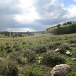
SUMMARY: Well, we spent about 8 hours today either very lost or else not knowing where we were.  Everything was beautiful and we were enjoying the spring greenery, till we ended up losing the trail, and after that–argh!–we were dealing with trying to find a route through snowy forest and marshy meadows.  Finally we found a road that occasionally had CDT “stickers” on posts, and just started following it, not knowing where we were till 6:30 pm.  We are sore from the obstacle course we’ve been doing, but grateful that at last we do sort of know where we are.  Did lots of praying today!

DETAILS:  I’d heard that “for the first couple of days north of Ghost Ranch, it can sometimes be hard to follow the trail.”  Yeah, no kidding!  Yesterday was a bit tricky, but today we spent most of the day pretty much lost and wondering where the trail went, complicated by snow and snowmelt marshes.

At first we were having a great time, enjoying the bright spring greenery, but just before 10:00 am,  we came to a junction where my Bear map said “Turn right here” but the Ley map said, “Or, you can go on a bit farther before you turn right, and it’s an easier way to go.”  We hemmed & hawed a bit over what to do and decided to consult Guthook, which said to go the Ley way, so that’s what  we did. (Not a good idea, in retrospect!)

We found the Ley right turn, and it was “Oh look, nice trail!  This is great!” until suddenly the trail completely disappeared, with no sign at all of where to go.  So we beat about a bit in the woods (Fixit went one way, I went the other, but we stayed within shouting distance) and finally we located a sort of trail.  From what we could decipher on the Ley map, we were now on a proposed route for the CDT, that wasn’t built yet.  OK, we figured on just doing the best we could, but it was frustrating!  And to add to the fun, the weather was being totally bipolar.  If you looked in one direction, it was bright blue sky with white puffy clouds.  If you looked the other way, it was menacing black clouds, rumbling with thunder.

Well, we persevered on the “future route of the CDT” as best we could, despite the fact that it turned into an obstacle course of fallen trees, including a whole hillside where ALL the trees had been CUT down and were lying all over the “trail.”  We climbed and scrambled through the mess, and suddenly, to our amazement, we arrived at a paved road by a lake, with a picnic area and a post with a CDT sticker on it!!!  All the trees in the picnic area had been cut down, and were lying around.  It was very weird.  None of our maps showed a lake or road or any of what we were looking at, so we had no idea where we were.  But hey, a CDT post and sticker–that must be the way??  So we followed the “CDT” and it led us a merry chase over hill and dale, through a snowy forest, and finally into a long meadow.  A faint trace of trail was still available, so we followed it (dealing with mud & swamp & mess along the way) until all indication of “trail” of any kind completely disappeared.

Time to check Guthook again…it pointed us into the forest, and we did find a sort of trail, but the only footprints on it were cows.  We had not seen any other human footprints all day.  At this point, we were pretty much in despair, and only hoping to find something that could at least get us to some sort of civilization.  We were doing a lot of praying!  But finally we got to the edge of the snowy forest and found a meadow with hooray!  A road!  We had no idea where we were or where the road went, but we prayed and gave it our best guess and started to follow the road.  A little way along, yahoo!  A CDT sticker!!  We kept going, and yay!  Another sticker!  We looked at our maps but still could not figure out at all where we were.  Then in the distance we heard a welcome sound–the roar of 4-wheelers!  Pretty soon there they were–six of them.  We flagged them down and got out our maps and asked them if they could tell us where we were.  No luck.  Turned out they never use maps–they know all the roads–and could not give us any advice at all.

Oh well….we kept going and finally, at 6:30 pm, we reached a place that was unique enough for me to find it on the map!  At last we knew (or hoped we knew!) where we were.  A half hour later we found a nice campsite and collapsed.  Man are we tired and scratched up and sore!  But the sunset was unbelievably beautiful, and 3 military jets flew over really low (very exciting!).  We hope and pray that tomorrow will be better!

Monday, May 30 Views!

Monday, May 30th, 2016

SUMMARY:  A lot of our CDT hike so far has been miles and miles of endless forest with no views.  Not today!  First we climbed out of Ghost Ranch, through dramatic “badlands”, where the trail became a rock scramble.   Later on, we climbed to over 9,000 feet elevation and it was epic, sweeping views that stretched for miles and included green grass, aspen trees and wildflowers.  Following the “trail” there was not easy–it was just a faint track through the grass.  We could also see the snowy mountains of Colorado ahead of us–oh boy!  We are camped tonight in a meadow on the mountainside at about 9,500′ elevation.

may-30-5
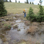
DETAILS:  We had our packs sitting by the door, ready to roll before breakfast–our last chance to eat lots of good food and talk to people.  We had fun talking to Yeti and her husband (don’t remember his trail name, unfortunately).  All the hikers are talking about one topic:  SNOW.  Many are planning to simply go home for a couple of weeks once they reach Chama.  Others say they will flip up to Wyoming and come back to Colorado later.  Yeti offered to help us do the “flip” if we want to, but we told her, “No, we’ll just keep walking north and do the best we can.”

So we took our trek poles in hand, and headed out, following the “Box Canyon Trail” from Ghost Ranch. We passed the Art Center with its very dramatic cliff backdrop (wow) and then headed into “The Badlands”–a rugged world of colorful rocky canyons, cliffs and rock formations.  At first the trail wound its way up a pretty canyon, repeatedly crossing a cute creek, but then it began a very serious climb where in several places it was a rock scramble so steep that I had to set down my trek poles and use my hands to help pull me up.   The views of Ghost Ranch down below were quite spectacular.

Finally we reached the top of the mesa, and it was back to “regular” trail through the sagebrush, with anklebiter cacti everywhere. We saw more and more cows and even (ack!) a couple of bulls, which gave us a very unfriendly eye.  We walked past them trying to look very humble and unthreatening.

Once again, we were also having problems figuring out where the trail went, and having to stop and look at maps, landmarks, etc. to try and figure it out. Then we met a guy who had flipped up to Chama from Ghost Ranch, and was now hiking back, waiting for the snow to melt.  He said he decided to put this “leisure” time to good use by doing some trail caretaking–picking up trash, building rock cairns, etc.  Good for him!  A short time after we met him, one of my trek poles suddenly collapsed, and Fixit had to repair it with a couple of bobby pins I had brought along.  My poor trek poles are seriously looking bad.  I probably should have gotten new ones before we started the CDT.

Finally we were out of the sagebrush and back into green forest (VERY green–the aspens have leafed out!) with lots of wildflowers, especially dandelions.  But this was a very open forest, with lots of EPIC views, including the snowy mountains to the north.  Some of them have a lot of snow, others less, but we eyed them with some concern….that’s where we will be in a few days.  Oh boy.  The trail crossed miles of grassland (where it was just a faint track in the grass and hard to follow) among rolling hills.  Everything is turning green and looking beautiful.  We are camped tonight in an open meadow at about 9,500 feet.h them

Sunday, May 29 Sabbath Rest – Ahhh!

Sunday, May 29th, 2016

SUMMARY:  A beautiful, cool morning with a breeze rustling in the cottonwood trees felt so good!  There was a church service with Psalm 46 included, which was very encouraging–“The Lord is our refuge and strength, a very present help in trouble; therefore we will not fear…”  This has been such a tough trail, and many times I have been at the end of my own strength.  But God truly is “very present”.  I spent time doing “chores” but very relaxed, with lots of eating the great food.  Fixit mostly just lay down and “turned into jello.”  We so needed this!  Sabbath rest is wonderful.  Tomorrow back to the trail!

may-29-8
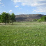
DETAILS:  This morning we stepped out into a cool, fresh morning and stood there taking in the sweeping views across the Abique valley.  The breeze was rustling in the cottonwood trees and birds were singing their morning songs.  No hiking today–time for a Sabbath rest.

After a great breakfast, we headed over to the chapel for church.  Turns out that the husband of Ghost Ranch’s administrator is a retired Presbyterian minister, and today he was preaching.  There was a small but colorful congregation of about 10 people attending.

Behind the communion table up front, there was a large clear window, with a panoramic view of the valley–what a view of God’s awesome creation!  It’s Memorial Day weekend, so the service focused on Psalm 46  “The Lord is our refuge and strength, a very present help in trouble; therefore we will not fear.”  I sat there thinking about how awesome it is that God is BOTH refuge (where we can go for comfort and safety) AND He is also our strength (so we can go out again and face whatever is happening and take it on).  I remember when I was basically an arrogant atheist/agnostic, and my reaction to people who were Christians was to pity them–“Poor little wussy babies!  They need to believe in God for a crutch because they’re too weak to stand on their own.”  That was before I discovered the powerful, awesome, loving beyond anything I ever could have imagined Person that God is.  Sure, I could stand on my own two feet and be strong, for myself, but to do that, I had to harden myself inside and concern myself more with “me” than with “others.”  Not good.  All that has changed since I stopped blowing God off and pushing Him away.  I “laid down my weapons” and surrendered to Him. Now I get to hike with Him, have adventures with Him, and make a difference in this very messed up world with Him.

Anyway, this HAS been a tough trail, this CDT.  I’m tired and uneasy from so often having to stop and say, “Where’d the trail go?”  Being able to sit and rest in church and listen to the Bible and just soak it in, was wonderful.   I’m 68 years old, and  many times in the last few weeks, I have been at the end of my own strength. But God truly has been “very present”, over and over again.  The minister also read some excerpts from the book “Grace Under Fire”, which is a collection of letters written by U.S. soldiers all the way from the Revolutionary War to Iraq/Afghanistan, about how they personally experienced God’s presence, strengthening them, when they were under fire or a prisoner.  I thought about the Wounded Warriors, who are hiking the CDT this year.  They are ahead of us by a couple of weeks.  Hope they all make it to Canada!

After church, I did our “town chores”–sorting food came first.  Once I knew what we still needed to get, I raided the awesome, well-organized hiker boxes at the Ranch, and found everything I needed to finish loading up our food bags for the “run to the border” (the Colorado border!).  Then I took the laundry, and while it was going through its wash cycles, I sat outside in the sun under an old apple tree, took my shoes off and gave my feet a good sunning.  They needed it!   For the “dry” cycles, I went to the library (just across the lawn) and indulged in a soft comfortable couch to sit on and read a book.  Like everything else here at Ghost Ranch, the library is very clean, well-organized and comfortable.  There’s no librarian–they operate on the honor system.

At lunch, while we were enjoying more great food, in walked HoB!  He was exhausted, fresh off the trail, and so hungry.  He plans to zero here tomorrow.  Other hikers also started coming in off the trail.  Everybody has tales to tell of their adventures up in the Pedro Peaks, with the snow, the icy swamp meadows, and the disappearing trail.

I spent a chunk of the afternoon lying down and studying maps for the upcoming section of the trail, trying to get an idea of what to expect.  We have both Ley maps and Bear maps, and I looked carefully at both.  After that, I just rested.  Fixit and I both feel like we are just turning into jello.  Wow, we are tired!  After dinner, Fixit went to the library so he could get wifi and do some internet stuff, while I wandered off to look at the plants and gardens and old buildings.

Tonight we’ll get a good rest, and tomorrow, we’ll be headed back UP to 10,000 feet again, in the northern New Mexico mountains!  Ghost Ranch has been wonderful.

Saturday, May 28 Creek and River Walk GHOST RANCH

Saturday, May 28th, 2016

may-28-15
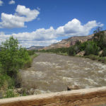
SUMMARY:  The day began with a long switchbacking downhill through spring-green forest to Ojitos Creek.  At that point, for some way, it was a creek walk with multiple crossings, just like the Gila River, but very cute and no wet feet!  Then out through a spectacular mesa-rimmed valley to a long walk by the rushing, roaring Chama River.  Groups of kayakers were riding it, though!  We finally reached Ghost Ranch and immediately felt the peace of this place.  Lots of hikers are here, and we are all being made very welcome.

DETAILS:  The CDT decided to play hide ‘n seek first thing this morning.  Only 20 minutes after we started hiking, down a dirt road, we lost the trail and could not figure out where it went.  We knew it turned off the road, but had seen no sign of the turnoff.  We fired up Guthook,  and it led us to what was obviously a totally abandoned trail that no one had been using.  Frustration!  I had an idea of a place back towards where we started that might, maybe be trail, so I ran back to take a closer look.  Fixit sat down and kept wrassling with Guthook, trying to figure something out.  By the time I got back, he had finally found the trail turnoff, not far from where we’d stopped and gotten frustrated.  We are finding that when the trail disappears, Fixit and I continue to have a totally different approach to the situation.  Fixit sits down and studies.  I like to run around and look.

But hooray, we were back on the CDT after the delay, and the trail took us down, down many switchbacks to Ojitos Creek. There were lots of oak trees just starting to leaf out, and we were walking on a soft carpet of last year’s brown leaves that covered the ground and the trail.  Ojitos Creek canyon turned out to be sort of a mini-Gila River canyon, with multiple crossings, but everything so small and shallow that we never had to get our feet wet  The only problem crossing we encountered was a place where the creek was in a narrow but somewhat deep chute, too wide to jump across, but a hassle to climb down into and up out of.   But the whole canyon was so pretty that we really enjoyed ourselves!  It sort of felt like back home in California, with a springtime oak forest.

Finally the creek left the canyon and we found ourselves in a much wider, sagebrushy valley surrounded by spectacular views of brilliantly colored sandstone mountains.  I kept just having to stop for a second and take it all in, it was so spectacular.  But then I’d hurry on, because now we were headed for the Chama River!  Hopefully we would easily make it to Ghost Ranch by tonight!

When we reached the River, wow!  It was a roaring, raging, muddy brown torrent, just tearing along.  Good thing there was a bridge–it would have been totally unfordable.  On the other side of the river, we began a 12 mile roadwalk  to Ghost Ranch.  What immediately amazed us what the amount of traffic on the road, in both directions.  The problem was the road at this point was a narrow dirt road– so narrow that it was very hard for cars to pass each other, and they had to sort of take turns.  On multiple occasions, we had to stop and stand well off the road, patiently waiting while a bunch of cars squiggled by each other.  Looking at the people in the cars, our best guess was that most of them were tourists.  The spectacular scenery might be a tourist draw, but we soon discovered there was more to it:  kayaking!

Groups of very colorful kayaks were bobbing down the rushing Chama.  As the road went up and down near the river, at times we got a pretty good view of them, and for lunch, we stopped and ate overlooking a kayak pull-out called “Big Eddy.”  The parking lot was full of cars & trailers and kayakers were everywhere.  We had a lot of fun watching them.  After that, the road moved away from the river and we couldn’t do any more kayak-watching, but a few miles later, along came a guy with a kayak on his car roof.  He stopped alongside us and said, “I just came from Big Eddy, and I’m done for the day–wish I had a beer to give you guys, but here, take these!” and gave us two granola bars!  We scarfed them up as we walked along, headed for Hwy. 84.  Trail magic!

The plan was that we’d take Hwy 84, then turn off onto a nature trail that made a nice shortcut to Ghost Ranch.  But when we got to the visitor center where the trail was supposed to start, we discovered to our dismay that the center had obviously been closed for a long time.  Big weeds were growing everywhere; the parking lot was chained shut, and there were very emphatic “No Trespassing” signs.  Bummer.  Now we would have to take the longer route of walking all the way along the highway till reached the side road to Ghost Ranch–two legs of the triangle instead of just one.  And we were so tired.  Sigh.  (We found out later that other hikers had ignored the No Trespassing signs, found the nature trail and reached Ghost Ranch that way, anyhow).

But we kept putting one foot in front of the other, and finally made it to the Ranch.  So beautiful!  And so hiker-friendly!  There were several large hiker boxes full of stuff, and there are lots of different options for CDT hikers who want to stay there.  We opted to rent a room and eat at the cafeteria, but started out with an ice cream from the store!  Then a shower, a short rest, and DINNER!   It’s all you can eat and the food was wonderful, and we were with the other hikers, including The Beast, but we found to our amazement that we couldn’t eat anywhere near as much as we thought we could.  Have our stomachs shrunk?  We’ve been so hungry so much of the time that we thought we could eat lots!  But we didn’t waste any food, fortunately, because we’d started with ordinary amounts, thinking we’d go back for more. The hikers said they heard that Newt Gingrich was staying at the Ranch tonight, but we saw no sign of him.  There did seem to be some groups on retreats (this is a Presbyterian retreat center).

After dinner, we did a little bit of wandering to find out where things were, and decided we were so tired that we might as well stay all day tomorrow.  That way we could go to church, and then do “town chores” without feeling rushed.  Back to our room we went, and bed felt so good!  Plus this whole place is so beautiful and so peaceful and welcoming.  It is good to be here.

Friday, May 27 Moosh, Goosh, Crunch Up & Down

Friday, May 27th, 2016

may-27-7
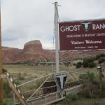
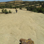
SUMMARY:  It snowed last night–just a dusting, but it was really pretty along the trail this morning–even the old snowdrifts looked pristine and white.  But every meadow we crossed had turned into a swamp of freezing cold snowmelt water.  Moosh, goosh.  Not fun.  Then in the forest, it was crunch, crunch, whooompf as we walked on snow and sometimes postholed.  A very long (most of the day) downhill through changing forest suddenly ended with a killer climb up a colorful sandstone mountain.  Huff & puff!  But we made the top, ate some food and now we are cowboy camped despite some clouds that look a bit iffy.  We are tired.  But what a varied day!

DETAILS:  It sprinkled and splattered rain on us for a little while last night, and then the rain turned to snow. Fixit is an old guy, which means he has to get up a lot at night, and he said when the snow hit the ground, it mostly just melted, but the snow on our tent didn’t, so every time he got up, he also knocked the snow off the tent.

It was 30 degrees this morning when we were packing up, and there was a very pretty dusting of snow along the trail—even the old snowdrifts looked pristine and white. But a bitter cold wind was blowing, and the trail was mostly either downhill or level, so it was a bit hard to stay warm.  The trail tread itself grew muddier and muddier.  In some places, we had to make fairly extensive detours to avoid the mud.

Finally we came to a wide green meadow.  “Look, how pretty!” I said.  We could see where to go–there was a post–but when we started across, we made the discovery that the pretty meadow with its green grass was in reality a snowmelt swamp.  We had no choice but to slog across in the ice-cold water and mud and grass.  Moosh, goosh!  By the time we reached the other side, our feet were freezing.  Then the trail headed into the forest, where there was a lot of old snow, so it was crunch, crunch,  then whoompf, we’d posthole.  Fun!  But on the bright side, it was pretty obvious where to go, because there were plenty of footprints in the snow.

The same thing happened at every meadow we came to.  Meadow = freezing swamp.

Eventually the snow was less, and that’s when the CDT did one of its tricks where the trail LOOKS like you should go straight, but in reality, you are supposed to make a sharp turnoff.  We kept on going straight, but fortunately, only a short time later, I became uneasy.  I had been trying really hard to keep track of where we were on the map, and I asked Fixit to stop so I could check.  Sure enough, we weren’t going the right way. “We’re going south and following a creek,” I said.  “Not good.  We should be going east, and NO creek.”  So we turned around and went back very carefully, till we found the turnoff.

For much of the rest of the day, the trail mostly headed downhill, and through a lot of forest (some of it beetlekilled, sadly)  and aspen groves.  In the late afternoon, we found ourselves at the foot of a colorful sandstone mountain, and the CDT headed right up it!  Great, a killer climb at the end of the day!  Oh well, we tackled it anyway and made it to the top (though we felt pretty fried).  Across the top and down the other side we went, into a green valley with a corral.  And that’s where we stopped and camped.  There were some nasty-looking clouds overhead, but we were so tired that we just cowboy camped and hoped for the best.   This has been one varied day!

Thursday, May 26 No More Desert!

Thursday, May 26th, 2016

SUMMARY:  I was finally able to reach our daughter on our phone–not easy–the cell phone signal was very weak, even here in town.  She said she did not want a bunch of company, and that there were no plans for a funeral, because her husband was the kind of guy who hated being the “center of attention” and he would have been very unhappy about a funeral focused on him.  She just wanted to be with her kids.  “You guys keep on with your hike”, she said.  “I will be OK.”  So today after breakfast, Fixit lived up to his name by fixing the toilet in our room while I went and did the laundry in another country–well, that’s what it felt like.  Nobody at the laundromat was speaking English–it was all local tribal folks.  Then we headed back to the CDT, and it was UP into the mountains!  No more desert!  It was clear, crisp air, huge trees, wildflowers, creeks and snow!  Tonight we are camped at just over 10,000 feet, and it is COLD!

may-26-1
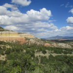
DETAILS:  The first thing that hit us this morning was “We’re HUNGRY!”  The Del Prado restaurant doesn’t open till 8:00, so we went across the street to McD’s and got something to start with.  Then I took the cell phone and tried to call our daughter Joy–at first I could not get a signal, but finally found that if I went outside I could get service.  Joy is doing as OK as can be expected under such grievous circumstances.  She was able to be with her husband when he died–it was very sudden and very fast–less than 5 minutes.  Apparently the cancer broke into a major blood vessel and before anything could be done, he was gone.  Joy says no funeral & fuss are planned–that Craig, her husband, hated to be the center of attention, ever, and the last thing he would want would be a funeral.  “So Mom, don’t drop your hike and come all the way out here,” she said.  “I’d rather just be with the kids and have things quiet.  I’ll be OK, don’t worry about us.”  I shed some tears after hanging up the phone.  This is really hard.

Fixit had eaten a big breakfast at McD’s, while I only had oatmeal, so at 8:00 I went and had some pancakes with the other hikers while Fixit lay down to rest.  We are both really tired, but I was worried about calorie deficit, so I figured those pancakes were important.  Then I collected all our very dirty laundry and walked off down the street….into another country.  Well, that’s what it felt like.  Everybody else at the laundromat was Native American, and were talking to each other in their own language.  When I tried to talk to them, it turned out few of them knew English!  Basically it was a lot of grandmas doing the laundry and minding the grandchildren.

Meanwhile Fixit was busy living up to his trail name.  He decided to fix the toilet in our motel room, but to do that he needed to walk a ways down the street to a hardware store.  Since his “do the laundry” clothes are pretty skimpy, he went to the hiker box at the motel and score!   A pair of pants that fit!  Off he went, and by the time I got back, everything was fixed, to the great delight of Mrs. Yang, who owns the motel.  Fixit said she had about the biggest smile he’d ever seen when he showed her what he’d done!   By the time I got back from doing laundry, we technically had only 15 minutes before we had to check out, but Mrs. Yang said not to worry.   By 11:30, we had shouldered our packs and headed out. Dark clouds were gathered overhead, and it was a little bit chilly.

As we headed out of town, we first stopped at the grocery store, which had a nice big sign saying “Welcome, CDT Hikers!”   Since we hadn’t sent a resupply box to Cuba, I bought enough food for 3 1/2 days, enough to get us to Ghost Ranch.  As I was standing in the checkout, it started to RAIN.  Oh great!  The checkout lady commented, “Oh yeah…around here it’ll rain for 10 minutes and then the sun comes out.  Don’t worry.”  I carried all the food outside and we loaded our packs while scrunched up under the overhang.  On went the raingear, and we headed to McD’s for lunch.  Sure enough, while we were in McD’s, the rain stopped, and it was just cloudy.

A walk along the highway took us to Los Pinos Road, which headed up into the mountains.  From this point on, we will be seriously headed UP into the mountains of Colorado.  But then we came to a very confusing intersection, a sort of Y in the road, and we could not figure out which way to go.  We were just getting out Guthook, when along came Flying Squirrel and Early Bird, so all together, we puzzled over maps and Guthook, till we decided where to go, and whew, it turned out to be correct!

For some time after that, as the road climbed higher and higher, we had the fun of walking with the two girls.  Fixit and Early Bird charged on ahead (Fixit is feeling good now; no more slow and tired) while I did my best to keep up, walking with Squirrel.  She told me about her adventures (mostly in New England) in trail crewing, wilderness adventure programs, etc.  What a great life she has had, and really trying to make the world a better place!

The road climbed steadily, and left the desert behind!  We were back into tall green forests, with creeks and grass and wildflowers and crisp, clean mountain air.  We felt like we were home again, in the Sierras!  Finally we reached the end of the road–Fixit and I stopped for a Snickers break, while the 2 girls headed on up the mountain and were soon out of sight.  We followed them shortly after, and found that the trail basically follows a creek, up a mountain canyon.  No more worries about water!  When we finally stopped to eat some supper, The Beast caught up with us.  (Note: he’s actually very nice, not beastly at all!).  We all agreed that we plan to camp up at the top, where there is some flat ground.

Soon we were encountering some snow, but it was not a problem other than the snowmelt running down the trail.  The only problem really was fallen trees–quite a few to climb over.

At the top, wow!   We were at over 10,000 elevation, and it looked like a golf course!  Seriously!  There were large green meadows, with groupings of trees and patches of snow.  It was still cloudy, bitter cold and windy, so we hunted about for not just a flat spot to camp, but a protected spot.  The Beast was camped nearby–we could not see him, but he later told us that he could hear us calling to each other as we split up to hunt for a campsite.  We set up our tent and bundled up for what we expect will be a very cold night–but it is SO GOOD to be back in the mountains and out of the desert!

Wednesday, May 25 Mesa Climbing to CUBA

Wednesday, May 25th, 2016

SUMMARY:  This was a sad day, but a beautiful one.  I was grateful for the beauty, because I felt very heavy-hearted and could not help but cry a bit while I was walking.  We feel so bad for our daughter who has lost her husband.  may-25-6
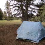
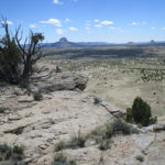
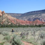
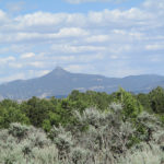
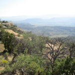
We tried to call her, but there is no cell phone service out here, not even on the high points. We did get lots of practice today in climbing mesas—those huge flat-topped mountains that are everywhere here in northern New Mexico. Whoever figured out and built the trail was amazing!  For me, there still were some scary parts–like skinny steps chiselled into the rock right next to a big drop-off.  But once you are “up top”, it’s quite a scene–acres of hard sandstone, spectacular views and wildflowers.  We reached Cuba late in the day, with just enough time to eat a bit of dinner and then collapse.

DETAILS:  The wind finally died down last night and it was a beautiful morning.  At first we were hiking in a flat prairie, but the rest of the day we were either climbing up a mesa, walking along the top of a mesa or going down a mesa, or walking along in between mesas.  Up on top, the mesas are flat, HARD rock, and the trail was a route following cairns.  And we had to stay very alert, because often the route veered off suddenly, and if we were not careful, we’d miss the turn.  The views from up top were spectacular.  The only downside was that sometimes (from my point of view) the trail was too near the edge of big dropoffs.  Wildflowers were everywhere–I saw several new kinds today that I’d never seen before.

The water source on this part of the CDT was lovely–you take a short side trail down a canyon off the main CDT, and it leads you to where a spring literally flows out of a large “cave” and is piped into a trough.  Swallows were flying about (they have nests in the cave) and there were lots of green trees and bushes–beautiful!

After the spring came a scramble up onto another mesa.  Looking at it from a distance, you’d never think a trail goes up it, but it does.  What a feat of trail engineering!  Somebody really worked hard on it.  There were stone steps, steps literally chiselled into stone, etc.  But it was very steep and scary for me, and the steps were really skinny.  Fixit went ahead and I watched how he went so I could see what to expect.  When we finally got to the top, we headed on the long walk along the rim, cheering because this was our last mesa before the road to Cuba.  Since we were up high, we also tried to phone our daughter Joy, whose husband had died, but no luck–no service out here.

Finally came a long roadwalk, headed for Cuba.  It was interesting to see the various homes and businesses along the way.  When we finally got to Cuba, it was late, and I wasn’t sure the restaurant was still open–but it was, and inside, I spotted HoB and some other hikers!  We went to the Del Prado motel and had to phone the proprietor to come out and talk to us about getting a room!  But she did have one left, and made a bit of a fuss about “so sorry, the toilet seat is broken”.  We assured her that was no problem, changed into our “town” shirts, and hurried to the restaurant, which was still open, and had a great dinner, hanging out with HoB, Early Bird, Flying Squirrel and The Beast.

Back in the motel room, we collapsed into bed.  We are SO tired!  Tomorrow I’ll try again to phone our daughter Joy.

Tuesday May 24 Rock Walking and Climbing

Tuesday, May 24th, 2016

SUMMARY:  Today was like a rock-walking and climbing tour…all kinds of rocks, colors, formations, and mind-blowing scenery.  It did involve a couple of scary places (for me) where all that kept me going was the thought, “If I can handle the scary stuff on Mt. Whitney, I can handle this.”  In the afternoon, an extraordinary chain of events happened. A guy named Slapshot passed us and 1) learned our trail names andmay-24-16 
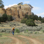
2)  That we were headed for the water cache 5 miles away.  We got to the roadcrossing where the cache was supposed to be, and could find no sign of it, so we flagged down a passing car and got water.  But Slapshot had found the cache AND a note inside for US to “Call your daughter Mercy ASAP.”  So as we went cruising by the cache, not planning to stop because we’d gotten water already, he flagged us down–“Hey, Fixit and 3rd Monty–there’s a note for you!”  Without him, we would never have seen the note.  It was bad news.  Our other daughter’s husband has suddenly died.  Oh no!  The rest of the day I was hiking all choked up.

DETAILS: Scenery-wise, today was a mindblowingly amazing day.  I would not have missed it for anything!  But it was also a very tough day, hikingwise–“embrace the brutality” definitely applied.

The day began with packing up at 5:20, then heading for a spring not too far ahead.  When we got there, we discovered HoB camped on a little hill nearby.  He came down and joined us, and together we looked at how to get at the water. HoB said when he arrived at the spring last night, it was too dark to see anything, so now we were all studying what to do.  Turned out that it works like this: the water is down in the ground, in a sort of tank, with large flat pieces of stone laid over the top to keep critters from falling in.  First you move a stone out of the way, then you lie down on your stomach and reach down to get at the water.  We had a look at the first bottlefull–it appeared to be OK, but we decided to AquaMira it, just in case.

We walked on with HoB until we stopped at 7:00 for breakfast.  Fixit is not feeling well, and he was not hiking at his usual speed.  He said that the problem is that for the last 2 nights, when he lies down, he starts to have trouble breathing.  He sort of solved the problem by propping himself up with his pack, but still didn’t sleep well and now he is feeling very tired.  Every hill leaves him out of breath, and he was hiking at a snail’s pace, often stopping to lie down.   I was very worried about him.

But the scenery offered lots of chances to stop and rest and LOOK at the amazing rock formations.  First we made our way down to the bottom of the wide valley, and crossed the totally dry riverbed, which was covered with some sort of fine white substance that looked like salt.  I didn’t taste it to find out, though.  Probably it’s actually some sort of alkali.  Then came the climb out of the valley, where there was one amazing rock formation after another, all different shapes and colors.  Finally we reached a fence by some big rocks, where there was a “hiker gate” for us to get through.   Waiting for us there were 3 horses, who obviously figured “We know the drill on how to yogi stuff from hikers.”  One of them, the brown one, was obviously the boss and was trying to get the other two to cooperate.  No luck, though!   We just don’t have enough food on us to be sharing any of it with the horses.  Poor things–they looked disappointed when we just elbowed past them and kept going.

Fixit was having such a hard time with uphills that I realized we would never make it to Cuba right after lunch tomorrow as planned.  I hope we make it there at least before dark, anyway!  To add to the difficulty, it turned into a very hot day.  We started hiking under umbrellas.

Little did we know, though, we were walking right into a God-engineered chain of events.  It went like this:

  1.  Because Fixit was so slow, in the afternoon another CDT hiker named Slapshot caught up with us.  We stopped to talk, and he learned our trail names–“Fixit” and “3rd Monty.”  We told him we were headed for the water cache 5 miles away, so he said, “See you at the cache” and took off.
  2. When we reached the paved road where the water cache was supposed to be, we hunted everywhere and could not find it.  We were desperately low on water.
  3. So I resorted to trying to flag down passing cars to ask for water, and hooray, a guy named Smokey stopped.  He was thrilled to be able to help CDT hikers, and gave us all the water we needed.  He even gave us some bananas and trail snax, which we ate immediately!   We are hungry!
  4. We hiked on, and only a couple of minutes later, there was the cache, hidden in some bushes.  Slapshot was there, too, and looking serious.  “There’s a note here for you guys,” he said, and held out a little yellow piece of paper.  It said “Fixit and 3rd Monty–call your daughter Mercy ASAP.  Urgent.”  This did not sound good.  But could we get cell phone service out in the middle of nowhere?  Slapshot offered to help if needed, but we did get our cell phone to work, were able to call our daughter, and she told us that our other daughter’s husband had just died.  Oh no! With our cell phone battery very low, we decided we’d better wait till Cuba (tomorrow) to call our other daughter.

If Fixit had not been slow, we would never have met Slapshot, and we would have walked right by the water cache without even looking in.  We would never have seen the note.  But Slapshot knew our trail names and he flagged us down.  So even though we were horribly bummed about what had happened (it was not a total shock; our daughter’s husband had been battling cancer for some time) we were still heartened by the way God took care of the situation for us.

The rest of the afternoon we hiked as quickly as we could, trying to chew into the 33 more miles to Cuba.  But we were slowed down by some (for me) scary steep, rocky uphills climbing up the mesa, and then once we were on top of that mesa, the trail went right by the edge of a huge dropoff.  I don’t like heights, and walking on a somewhat slippery, rocky trail right by a big edge was rough.  I had to force myself to keep going, when what I felt like was “Aaaaaaa!  I can’t do this!”   Near the end of the day, we had a very skimpy dinner.  We’re rationing our food now, hoping to have enough to make Cuba tomorrow.  But we did find a nice place to cowboy camp out of the wind among the rocks, and spent time praying for our daughter and her 3 children.