Wednesday, June 1 Thunder Rumblings
Wednesday, June 1st, 2016
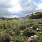
 SUMMARY: The sky had only a few clouds in the early morning, but that did not last long. Big, dark gray ones came rolling in, and basically for the rest of the day, our hiking was accompanied by thunder, occasional sprinkles of rain, one downpour of hail, and some lightning that got kind of close. But in spite of it all, at 9:30 am we came to a river ford and at last we knew exactly where we were. But it means we did very few actual trail miles yesterday, so we will run out of food a day before we reach Cumbres Pass, if we don’t ration. But the scenery today was gorgeous, the sun came out as we were setting up camp, and we will see what tomorrow brings!
DETAILS: Last night I was in my sleeping bag, studying the maps, and concluded “I still don’t really know where we are. All I know is I think we are on the CDT, maybe….?”
In the morning, Fixit made the decision to use up the last of our cell phone battery to consult Guthook in hopes of locating where we were. No luck. On our phone (which is rather old), what we do is look at the shape and pattern of the “trail” as shown on the phone, then try to find that same shape/pattern on the map. But no luck. We could not make any sense out of any of it.
Fixit’s response was “Let’s sit down and really study the maps and try to figure this out.” My response was, “We have only two days of food left. That’s not enough to spend a lot of time hunting for the trail. At this point, all we can do is find a road that will take us to a town–then we can get more food AND we will know where we are.” To further complicate the situation, Fixit was also convinced that we had been going the wrong way, and needed to go back. It took a lot of persuading for me to show him that if we went back, we would actually be going back to Ghost Ranch, which is not what we wanted to do! Finally, after some debate, we decided to keep on walking along the road we were on.
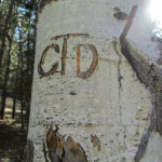
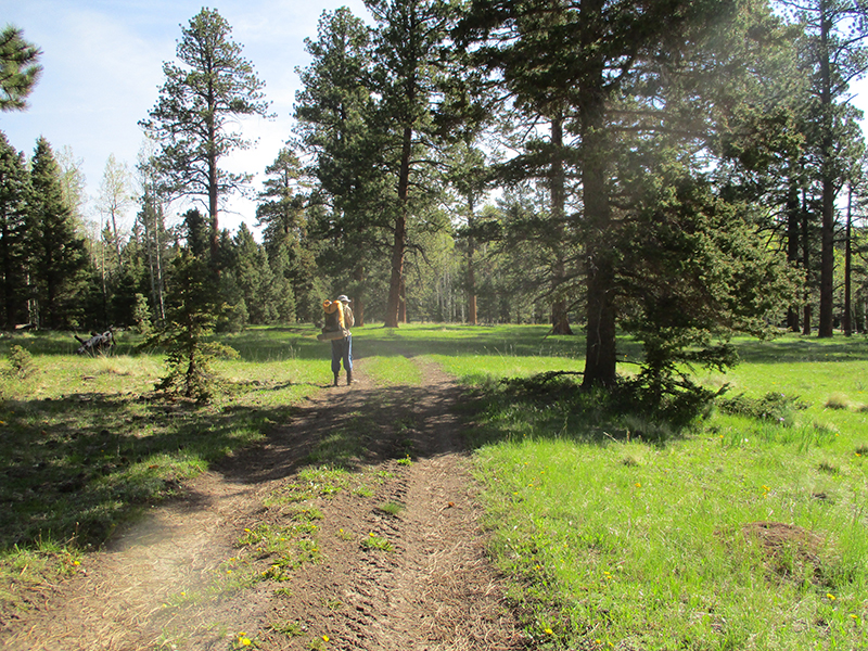
And then, HOORAY! We spotted a CDT emblem! And then another…and another. And then, oh joy! We reached a river crossing with some distinct features, and I FOUND US on the map! There was a log bridge over the river, but it was way too tilted to one side to be of any use. Fixit went off into the forest to look for a lever he could use to straighten the log, while I scouted for a ford. According to the map, there was a place where the river was only thigh deep, and yes, that was true! So I started across, very carefully. The current was strong but not scary strong. The problem was that the bottom of the river was full of smooth, rounded rocks covered with algae. Very slippery! And BRRR the water was cold–it was fresh snowmelt. But I made it, and sat down on the other side rejoicing to know where we were. I studied the maps and figured out that yesterday we only did a few real CDT miles. Ouch. That puts us way behind. We will come into Chama “running on fumes” foodwise.
Eventually Fixit came back–no luck finding a sufficient lever. He really did want to fix that log, so he was a bit disappointed. He does not like it when he can’t FIX something! He made it across the river, too, and since it was 9:30 am “Snickers break” time, we sat in the sun and relaxed for a few minutes. I felt like a huge weight was lifted off us, now that we knew where we were.
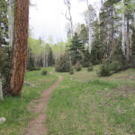
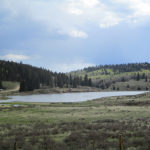
When we shouldered our packs and headed out, dark gray clouds were rolling in, and by lunchtime, thunder was rumbling. But we marched happily along, so glad to be on trail again, till we reached Hopewell Lake, with its campground and picnic area. It was raining at that point (with thunder) and we lost the trail again. It took about an hour of beating around before we finally were able to find it. Sadly, there were some posters up about a missing antler hunter. Apparently he went out with some friends recently to hunt for elk antlers, and at the end of the day, he never came back. Doesn’t sound good.
But now we were back on trail, and after that, things went well. We were just beginning a roadwalk section when we met a ranger who told us how to locate the trail up ahead where it made a right turn. As we hiked along the road, off to the left we could see two guys busy working with a Bobcat on building TRAIL so that future CDT hikers don’t have to walk the road. They saw us and waved and cheered!
We found out later that several of our fellow CDT hikers, when they reached this road, simply hitch hiked to Chama, because like us, they had been “lost” so much that they didn’t have much food left. But we decided to go for it anyway. Once we got to the trail turnoff, we were back to dealing with mud and marsh and snowmelt, with the additional difficulty of having a thunderstorm right over us, spitting lightning. Our policy on this kind of situation is to keep going and pray, “Lord, You know where we are….send the lightning someplace else, and keep it from making trouble.” At one point, it began to hail, and we ducked under a tree to wait it out. The temperature was dropping, and the rest of the afternoon it was very cold, with lightning and thunder continuing.
At 7:00 pm, we stopped to camp at a spot where obviously someone else must have recently camped, because the grasses were flattened. And as we set up our tent, the sun came out! The storm went away and of course that meant a glorious sunset. I studied our maps and told Fixit, “Well, we have 48 miles to go, and one day of food. This will be interesting! But at least we’re on the trail! And the scenery today was gorgeous!” Fixit agreed, and we burrowed into our sleeping bags for a cold night.