Archive for June, 2016

Friday, June 10 Lots of Mountain Climbing

Friday, June 10th, 2016

SUMMARY: Well, we did a lot of mountain climbing today—some by trail and some by mistake. We misread our maps this morning and thought a nearby mountain was Mt. Hope. The trail goes right up and over Mt. Hope, but we were down in forest and snow and didn’t realize we were looking at the wrong mountain.

So we bushwhacked and climbed up to the top and looked everywhere for the trail. Finally I caught sight of a couple of lakes below, found us on the map and said, “Oh no—this isn’t Mt. Hope!”  By then we had been at it for almost 5 hours because the mountains here are basically like big rockpiles with large snowfields. Very slow going.

During those 5 hours, Bill & I lost track of each other for about an hour. That was seriously scary! But finally we found the right Mt. Hope, climbed it, walked the Divide, and discovered that the side trail that was supposed to take us down to Creede, our next resupply, was impassable due to snow.

So, we went back to bushwhacking, a long, long way. We are camped by a creek tonight—probably won’t reach Creede until late tomorrow.

DETAILS:  Well, we sure got in a lot of climbing today–some by mistake and some by trail!  We woke up to a very cold morning, but whew, our shoes were not frozen.  We thought we knew where we were, and we thought that a mountain nearby was Mt. Hope, where the trail was.  But we were SO wrong!  In reality, Mt. Hope was still quite a ways away, on the other side of a big ridge and several lakes.  Yesterday the trail wandered around so much and was so often under snow, that we’d actually lost track of it and now instead of being just below it (we thought), we were far away from it.

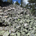
Thinking that “the trail is right up there”, we started bushwhacking up the mountain.  The problem is that the mountains here seem to be basically big rock piles and the rocks are big enough to make the going very slow. I am slow on rocks, anyway, and Fixit was having a hard time because last night he did not sleep much.  He said he was having trouble breathing while lying down and had to prop himself up with his pack.

Finally we got to the top and there was no trail.  We looked and looked (for a total of FIVE HOURS) trying to find it.  During that time we made a serious mistake.  We decided to split up, but stay within shouting distance of each other as we searched for trail.  Not smart!  Not only did we not find the trail, but we even lost each other.  For over an hour, I did not know where Fixit was and he could not find me.  We were in very rough country with snow and forests and rocky mountainsides.  Turns out we were both shouting for each other, but did not hear each other at all.  I climbed up to the top of a ridge and looked around for some sign of Fixit, and that’s when I spotted a couple of lakes down below.  I found them on my map, and now I knew where I was, and I also knew we were WAY off track.  I stood there shouting and yelling for Fixit, with no response.  I did a lot of praying, too, and finally  I decided to come down off the ridge slowly, yelling a lot.  It seemed like forever till finally, down below, I spotted Fixit climbing up towards me.  To say we were glad to see each other would be an understatement!  We vowed never ever again would we split up to look for trail unless we could SEE each other!  I told Fixit that we were NOT on Mt. Hope, but I now knew where it was.

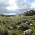
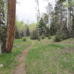
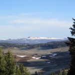
So we ended up doing some scary snow traverses and a bunch of rockwalking to get back on track with where we were supposed to be and FINALLY came the last big climb up to about 12,800 feet and back to the trail.  Whew, were we tired!  But hooray, there actually wasn’t much snow on the trail, and the views were totally magnificent.  We both wore  our down jackets AND rain jackets, trying to stay warm in the bitter cold wind sweeping across the ridges.  But it was so glorious just seeing where we were and the epic-style scenery.  We are right up on top of the Divide, and it’s mountain peaks, snow, rocks, and brown grass as far as the eye can see.  The snow is melting fast, and almost all the bare ground is very wet.  Best of all, we have trail to follow, and we can even see the side trails when they come in.

But a thunderstorm was moving in, and we were way up high and very exposed.  Ack, not good!  Our policy in these situations is to say, “OK, Lord, You know where we are…please send the lightning off somewhere else, like onto some rock where there is nobody around.”  At one point, because Fixit was having a hard time (he was so tired from lack of sleep), I ended up getting ahead of him on the trail.  When I realized this, I stopped to wait, and as soon as I spotted him, I held up one of my trek poles and waved.  And then a seriously scary thing happened–I felt a strong buzzing sensation in the trek pole I was holding up and I figured it was turning into an antenna that might attract the next lightning strike.  Yikes!   I  quickly dropped the pole to the ground and ran away from it.  No lightning came, and Fixit caught up, so I went back, picked up the pole, and proceeded on.  But I was scared.

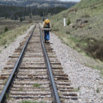
The trail took us around a big sweeping bend, and finally we spotted the Sawtooth Trail up ahead, which is where the shortcut to Creede begins.  It was totally under snow, and on a very steep mountainside.  We looked at it and said, “Forget the trail–we’ll just walk down from over here, where we are.”  That was the beginning of a long bushwhack down, first on steep snow (but not as steep as the official trail), and then through woods, with lots of climbing over logs and obstacles.  It was hard. There was no sign of anyone having come this way, but looking at the maps we figured we were still OK and reasonably near the trail.

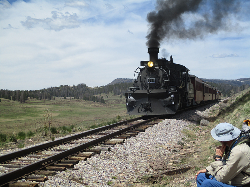
At 7 pm we came to a flat spot that was actually DRY ground, near a creek, and we just plain crashed.  We were so tired.  I was concerned about our food situation–would we have enough to make it to Creede, at this rate?  And it looks like we will maybe spend the night in Creede, because of it being Sunday and the post office not open.  Our original plan was to just do a pit stop.  But we are very grateful to the Lord for helping us during the 5 hour “where is the trail” and the even worse, “Where is Fixit?  Where is 3rd Monty?” episode.  That was scarier even than the potential lightning strike up on the Divide.  All I could do was thank Him and then go to sleep.  Tiiiiiiiiired!


Thursday, June 9 Lots More Snow

Thursday, June 9th, 2016

SUMMARY: The top priority for me this morning was get new trek poles (the old ones were really rickety) and find a new fanny pack, because the zippers were giving out on the old one. Then I had a quick look at the kayakers getting ready to launch into the rushing, muddy-brown San Juan River before Bill and I headed out to hitch a ride to Wolf Creek Pass.

We ended up squished into a little car with Titan, another thruhiker, and soon we were back up on the CDT, and soon after that, into lots of snow—almost 100% covering the trail. We mostly followed footprints, with frequent looks at maps.

Part of the time we were climbing over rocks on a mountainside above the trail. Scary! Had a hard time finding a campsite—finally got set up on a grassy “island” in a sea of snow and snowmelt.

DETAILS:  It sure was nice to “sleep in” till 6:30 this morning; we got up and headed straight for the First Inn’s coffee and cinnamon roll breakfast.  Yum!  But that was only the first round.  We put on our jackets and walked out into a very cold and cloudy morning, down the street to the Junction restaurant, where we made like hobbits and had a second breakfast.  We are trying very hard to stay ahead of the calorie deficit problem.  Suffer!

But then I had to get serious.  My trek poles were dead.  They had travelled with me for the whole PCT, twice, and I should have replaced them before tackling the CDT.  Fixit had been keeping them going, all patched together with wire bits and bobby pins, but it was obvious that they would not last much longer.  I also needed a new fannypack–again, the old one had done two PCT trips, and the zipper was in bad shape and threatening to fail altogether.  Not good.  So after the second breakfast, we headed for a nearby sporting goods store, where I was able to get new trek poles.  But no luck on the fannypack.  None of them were suitable.  The other sporting goods store was not due to open for awhile, so we went back to First Inn to load up our packs and get ready to go.  I also had some more time to read the Bible, which was a good thing, because I was thinking some more about what we were headed into and was very uneasy.  I read Psalm 46 again and also Psalm 89.  Conclusion: God is faithful, He is mighty and most of all He loves me.  I closed the Bible and told God, “OK, I do trust You.  Here we go!”

Fixit and I put on our packs and walked over to the second sporting goods store.  Technically, it was supposed to be open at that point, but there was no sign of life.  We decided to wait a bit.  Fixit said he just wanted to sit and rest, so I left my pack with him and walked a little way down the street to watch the kayakers getting ready to put in at the San Juan River.  They were busy blowing up their inflatable kayaks, right next to the rushing, deep, muddy brown water.  I also met Titan, a CDT hiker on his way to hitch back up to the trail at Wolf Creek Pass.  When I got back, the store was open and YES!  They had a fannypack that was perfect–small and lightweight and just big enough to hold everything it needed to hold.  And then I had a thought–how about replacing the umbrella I lost while I was postholing in the snow?  But no luck with that, even though the very kind clerk phoned around to see if any other store had any umbrellas at all.  Not only that, but she told us that the owner of the store is also a CDT trail angel who often gives hikers rides back up to Wolf Creek Pass, and she phoned the owner to see if the owner could give US a ride.  The response was, “Can’t do it right now, but tell them to go to the highway intersection and try to hitch, and I will come along when I can–if they are still there I’ll give them a ride.”  So the clerk told us exactly where to go near the intersection to have the best chance of getting a ride up to the Pass.

So we followed her instructions,  went to the Hwy. 160/Hwy. 84 junction and crossed over to the 160 side.  Two CDT hikers ( Titan and his friend Squirrel) were already there, and said “Nobody is stopping for us.”  Well, they were two big thruhiker guys (especially Titan, who very much deserves his name) so I volunteered to be the one to stick my thumb out and try to get us a ride, since I am a girl and look a bit less fearsome.  Car after car sped by, some waving apologetically, until along came a girl who is a friend of Titan’s.  She pulled over, and to our total amazement, Titan and Squirrel insisted that Fixit and I should be the first to ride up to the Pass.  “But you were here first,” we said.  “That wouldn’t be fair!”  Titan said, “But you guys are old and we wouldn’t feel right about hogging a ride and leaving you here.”  He and Squirrel insisted, so Fixit and I took our packs and started squeezing into the girl’s little car.  Just then, another car came along and stopped.  He had room to take one person.  So in the end, Titan, Fixit and I made like sardines and squeezed into Titan’s friend’s car.  It turned out that she works up at the Wolf Creek Pass ski area, and has hiked the whole PCT and part of the CDT, so she was very happy to help us all out.

The ride up to the Pass was beautiful–at first it was forest and meadows, then the road began a dramatic, twisting climb up to the top, where once again, there was plenty of snow, and happy kids and families having fun by the parking lot, with snowmen, snowball fights, etc. All the thruhikers “saddled up” and headed for the CDT.  There were 6 young guys plus Fixit and I.   The six zipped right up the trail and were soon out of sight, while Fixit and I did our best, and actually caught up with one of the young guys, Uberdude.  He was having a hard time with a bad cough (due to the altitude–all of us are having cough problems to one degree or another).

At first the trail was actually a TRAIL and a lot of fun to walk on, but soon it was back into 100% snow.  Knowing that there were now 5 people recently ahead of us, we simply followed footprints, but kept a weather eye on the maps.  Occasionally there would be a brief break in the snow, and we’d actually spot a bit of trail tread.  (I cheered loudly each time!  I hate being lost!)  The other good thing was that the snow was fine for walking on even without snowshoes, and we were making good progress, though of course not as fast as walking on trail tread.

But then oh no–the fast young guys must have had a disagreement about which way to go, because their footprints split up and headed out in several different directions.  We stopped and looked hard at the maps, then chose which footprints to follow.  Turned out we made the RIGHT choice, whew!  The route was basically circling around the head of a large river valley, and again, we did have occasional glimpses of trail tread.  Overhead, the clouds were gathering, getting darker and darker till they were almost a blue-black, rumbling with thunder and occasionally spitting a bit of rain.  At noon we stopped to eat dinner, sitting on a little “island” in the middle of the snow, wearing full raingear because it was so cold and windy and wet.

After dinner, Fixit decided, “I’ve had it with walking on the snow.  Let’s go up a bit to where it’s more bare mountainside, and walk on the rocks instead.”  Well, I totally suck at walking on rocks.  But Fixit hates walking on afternoon snow where postholing becomes a pain.  So all I could do was pray and ask God for help, and do my best to creep along on the rocks.  When 7 pm arrived (time to camp), the only place we could see that might be camp-able was down in the valley below, which meant a long downhill through the snow.  But we made it, and found a small sort-of-flat island of only slightly damp grass in the midst of a sea of marsh, mud and snowmelt.  We know that the actual trail is somewhere nearby, buried in the snow.   As best I can figure, despite a very late start and difficult conditions, we still made 10 miles, and we have a very snug camp here on the “island.”

Wednesday, June 8 Determination Has Lots of Different Looks: PAGOSA SPRINGS

Wednesday, June 8th, 2016

SUMMARY:  Yesterday took a lot of determination and patience, as we forded rivers, followed elk trails, and bushwacked through forest. Today, we put that same determination to work by pulling off a 20 mile roadwalk in 8 hours.  It was beautiful Colorado scenery, which actually has rather an “Oregon Look” to it.

But 20 miles is a long way, and it took lots of being in the moment and really looking at what we were walking by. A storm was brewing, and just before Pagosa Springs, the wind blew fiercely and it started to rain. But we made it to our motel and immediately went to work on town chores.  With the rain and wind, we were glad the motel has its own laundry, so we don’t have to face the weather in order to wash our clothes.  We are really tired.

DETAILS:  Last night I was trying to go to sleep, and for some reason started thinking about the musical “Little Mary Sunshine”, which is set in the mountains of Colorado.  All the songs began to run through my head, and it took awhile before I finally zonked out.  That’s a really fun musical, but it is NOT at all “PC”, so is rarely performed anymore.

Knowing that we had 20 miles or so to go before Pagosa Springs, we packed up quickly and headed out.  The road rolled uphill and downhill. At the bottom of every “down” it was so cold that you could see your breath, but at the top of every “up” it was warm.  Fixit and I were enjoying the scenery, and we commented to each other, “This looks like Oregon, except the trees are wrong–they should be Douglas Fir.”  We also noticed a fair amount of litter along the road, and the top two items were #1:  Bud Light bottles & cans and #2: Dead deer (most of them were already eaten up by vultures etc.  But phew, they still SMELLED!)  But to make up for that, the wildflowers were gorgeous, and all the grass was intensely green.  We stopped for a  break in a valley where there were a lot of cute houses, and each one had at least one horse in the yard.

A bit after 10 am, we reached an RV park with a store, so we went in to get some food!   Classic thruhiker stuff–ice cream (which we ate immediately, and it was so good; it was locally made), and a pizza (which we did not eat immediately, but had them fold it in half and wrap it in foil so we could carry it until lunchtime).   We lashed the pizza to the top of Fixit’s pack, on top of his snowshoes.  While we were sitting on the porch of the store eating ice cream, we had a chance to talk to some of the RV park folks–they were very interested in what we were doing.  The young guy who was manning the store particularly asked about the high lakes.  “Are they still frozen over?” he inquired.  “Totally frozen” we told him.  Turned out that he’s into fishing and he said the BEST time to fish is just when the lakes begin to thaw and there’s a little bit of open water in the ice.  At that point the fish are really hungry!

But we still had lots of miles to go before Pagosa Springs, so we couldn’t linger long.  So on we went, ticking off the miles by watching the mile marker signs by the road.  I said to Fixit, “Roadwalking takes a different kind of determination than bushwhacking.  Yesterday we had to deal with ‘Oh great, another mess of logs to climb over…fun, another gully to get down into and up out of’ and today we have to deal with not being bored, and instead finding things to look at and think about.”  A lot of the thruhikers deal with boredom by listening to music, but I prefer the challenge of being IN the moment and LOOKING at what’s around me and LISTENING to the sounds that are there.

The scenery at this point was “classic Colorado”–houses and barns with snowy mountains in the background.  We looked at all the snow and thought, “Well, we are supposed to be up THERE, but not with hardly any food.  We would never have made it.”  Dark clouds were building up over the mountains, clouds that were steadily getting bigger and bigger.  I wondered if they would affect us, down in the valley.  Finally we reached the outer fringes of Pagosa Springs, which included a big English-style place with a sign that said, “Winslow In The Shire”, and another place with a very cute, gangly-looking herd of alpacas.  At this point, the wind began to blow so hard that walking was difficult, and the dark clouds began to spread out from the mountains and gather overhead.  But we reached the county fairgrounds, (home of the Red Ryder Rodeo!)  and just before we got into town, the first drops of rain began to fall.  We didn’t bother stopping to put on raingear, and walked/ran as fast as we could to our destination, The First Inn.  Just after we got into the lobby there, the rain began in earnest.  Whew!  That was close!

But now it was chore time.  Bill took our laundry to wash (wow, was I glad we didn’t have to go to a laundromat down the street and deal with pouring rain!)  and I tackled the job of sorting out our packs, doing mending, and figuring out what to buy to resupply for the next leg of the trail.  We didn’t send a box here because it’s only a short run to the next town of Creede, but I have learned my lesson–carry a LOT of extra food!  We also were able to phone a “friend of a friend” who lives here in Colorado, to figure out a way we might be able to see them while we’re in the state.  Looks like maybe we could meet them at Monarch Pass in a few days.

We had a great dinner, and then I went and bought a bunch of stuff at a gas station convenience store.  Expensive. Ouch.  But we are out on the edge of town, and the nearest regular grocery store is far enough away, and I am so tired that we decided not to make the long walk in order to get cheaper food.  I really am tired.  Colorado is seriously tough.   Back at First Inn, I was thinking about “Tomorrow we head back into the mountains and the snow,” and I was worried, to the point of wondering if I could handle it.  I thought about how God had promised He’d see us through–yes, so far He definitely has!–but I really was tired and discouraged, almost to the point of despair.  So I pulled the Gideon Bible out of the drawer in the motel room and reread Psalm 46: “God is our refuge and strength, a very present help in trouble.  Therefore we will not fear, even though the earth be removed and though the mountains be carried into the midst of the sea…the Lord of hosts is with us; the God of Jacob is our refuge.”   And I told God, “OK, I believe You.  I know You love me.  Please give me the strength I need.”  And I had to sort of laugh at myself, because when I was a “selfsufficient” (hah! nobody is–we delude ourselves if we think we are!) atheist/agnostic, I used to look down on the Christians for being “weak”.  Now I realize that to run around depending on myself is certainly do-able, but the end product is a hardness of heart that spills over into other things.  Not good.  That’s one of the reasons the world is in such a mess.  It’s a lot better to live life in a close relationship with God and be part of what He is doing to help the mess in the world, rather than blowing God off.

And just for fun, before we collapsed for the night, I took a look at the yellow pages listings for churches in Pagosa Springs.  Whoa!  This is not a big town, but it has a zillion churches–all kinds!  And a nationally known Christian youth camp, too.  Wish we had more time here!  But tomorrow it’s time to head back up the hill!


(more to come–I am still working on this)

Tuesday, June 7 A Tough Day, but a Totally God Day

Tuesday, June 7th, 2016

SUMMARY:

We are beyond grateful to God for the wonders he did for us today.

  1. We safely crossed the East Fork of the Navajo River at 6:00am. Scary! Feet and legs like ice afterward.
  2. We needed to cross rugged terrain to connect with a road downriver. By “chance” (ha!) we found an elk trail that took us there (scary in places, but great).
  3. We ended up on private property—the manager came to “escort us off” and he was the same guy who gave me a ride earlier. Only God could organize that!

DETAILS:

It was a bit dark at 5:20 am, down in the canyon near the Navajo River, and I was NOT looking forward to walking right into it.  As we were getting into our cold wet socks and cold wet pants, I was listening to the roar of the river and thinking, “Oh Lord, HELP!”  Fixit said, “You’d better not try to cross by yourself.  Your trek poles are just about dead.  With the force of that water, they might just collapse and you’d be in big trouble.  We’d better do the SERIOUS river crossing technique.”  What he meant was, I must stow my trek poles (tie them to the top of my pack) and then get behind him, holding on to his pack, and then we sidestep across together.  That way the fiercest force of the water hits HIM and I’m slightly more protected.  We’d done this several times before when we were on the PCT.

When we got to the riverbank, I was glad to see that the water level was indeed down, but the force of the current was still enormous.  We prayed and stepped in to the icy water.  Wow.  It was seriously scary, but we just kept sidestepping and finally reached the other side and climbed out, VERY thankful!  My legs from the knee down felt like blocks of ice.

Down the canyon we went, knowing that it was quite a way to go before we reached the road.  And that is where the miracles really got going.  We were bushwhacking along, with lots of climbing over logs and slogging through wet stuff, when Fixit decided “Let’s try going UP a bit, higher on the canyon wall.  Maybe it will be a bit easier up there.”  And that’s where we found an ELK TRAIL that was beyond awesome.  We were able to follow that trail all the way down to the road!  It unerringly took us through what would otherwise have been some seemingly impassable terrain, including one area that was all steep cliffs, where the canyon became a narrow gorge with the river roaring and foaming at the bottom.  I admit to being very scared during parts of this “cliffy stuff” because I do not like heights and big dropoffs with whitewater at the bottom of them.  Fixit was very patient–he does not mind scary stuff at all.  But the elk had made it through, and so did we.  And even during the worst of the scary part, I kept thanking God that at least we had the elk path, and I was grateful for it.

The elk trail literally dropped us off at the road (we learned later that this road was built so that elk hunters could access the back country) and we happily started walking along, marvelling at how God had guided us.  Without that elk trail, we would have been faced with a SERIOUSLY difficult situation.

The road wound its way down the mountain, and finally came back to the Navajo River.  Alas, when it reached the river (at this point, a roaring whitewater torrent) there was NO bridge, only a ford–obviously for use in summer or fall, when the water level was much lower.  There was no way we could ever get across.  So once again, I looked at the edges of our map, and right by the trimmed edge a bit farther up the map, I found a place where it looked like the road crossed the river AGAIN.  That meant if we stayed on our side of that torrent, and bushwhacked down, we could reconnect with the road!

So the bushwhack began.  We had no elk trail to help us this time, and we had a LOT of climbing over logs, scrambling down into steep rocky gullies, and even a small canyon to negotiate.  Some parts were (for me) rather scary.  But we kept going, and finally Fixit (who was up ahead searching for the best route) yelled, “THE ROAD!”   Sure enough, there it was, switchbacking UP from the river!   To say we were relieved would be an understatement!   We decided to stop and eat lunch (it was late, but whatever) and do a “garage sale” to dry our gear.  So we sat by the road with our stuff spread all over the place and very happily had a cheerful meal, fervently thanking God for His help!

The road climbed up and up, then finally began a long descent.  By now we were way off our maps, and all we could hope for was that somehow we could connect to another road and find our way to Pagosa Springs, our next resupply town.  The road flattened out and went into a large green valley, when up ahead we saw CABINS!   CARS!   PEOPLE!   Now we could find out where we were and where to go!

On the porch of the first cabin were some guys talking, and a couple of dogs, who ruffed at us a bit.   To our dismay, the guys looked at us with a very UNfriendly glare, and when we greeted them, one said.  “Do you know that you’re TRESPASSING?  This is PRIVATE property.  And don’t say ‘We didn’t see a No Trespassing sign.’  We are not required to post those.  It’s YOUR job to know where the boundaries are.”

All we could do was to humbly apologize and explain that we had to bail out off the CDT, down the Navajo River.  “That’s impossible,” one of the men said.  “No way can you get down here from up there.”   We told him that yes, we did, and I got out the map and showed him our route.  The guys were amazed, and softened up a bit, so we told them again how we were very sorry we were for trespassing, and if they would just tell us the route to follow, we would get off their land ASAP.  The guys told us which way to go, and we hurried away as fast as we could.

We had walked some distance down the ranch road that led out to the highway, when Fixit decided he wanted to get some water from a creek that looked pretty iffy to me.  So he stopped there, while I kept walking.  No problem–I knew he would catch up with me, and I was anxious to get off the ranch property and reach the highway ASAP.  Awhile later, I spotted a pickup truck coming toward me along the road.  Odd–the truck looked somehow familiar.  And it didn’t just pass me by–it stopped, and out stepped the SAME guy–the ranch manager– who had given me a ride back to the hotel in Chama!  “Remember me?” he said.  Oh yes, I certainly did!  And in my own head, I was saying to God, “I am totally amazed!  Only You could engineer this.  Only You could work it out so this guy already knows me!”

Well, it turned out that the guys back up at the cabins had called him about “two trespassing hikers headed down the road” and when they described us to him over the phone, he immediately wondered if it was me, the hiker lady he had picked up in Chama.  Well sure enough, it was!  So he’d come to pick up Fixit and I in order to “escort” us OFF the ranch.  I quickly tossed my pack in the back of the truck and rode with him till we spotted Fixit, and then he turned around and headed for Highway 84.

As it turned out, it was a very long way out to the highway.  If Fixit and I had tried to walk it, I think it would have been an all-day adventure.  The ranch manager was very cheerful and kind, but very firm about “You guys can’t walk this road; it’s private property.”  Apparently the ranch is a huge private nature preserve, not a cattle ranch.  It’s called “Banded Peak Ranch”, and they are using it to do various studies with wildlife, forest management, etc.  The manager told us about their work in improving the forest by thinning and controlled burns, plus encouraging the elk and deer (they are very proud of their large elk/deer population) and they are doing everything they can to protect and encourage the native cutthroat trout.  They do have one income source, though–in elk hunting season, they charge huge sums of money to wealthy guys who want to go hunting but still have lots of “city comforts”.

The manager also told us what it’s like to live at the Ranch year-round, and spoke with justifiable pride about his own kids, who are growing up to be strong not just in body but in mind and spirit as well.  We told him how much trouble we’d had, trying to find the trail in the snow, and he said, “Snow’s melting fast–another couple of weeks and you should be fine.”  He dropped us off at Highway 84, and at the intersection there was an old gas station/convenience store, which was closed, but there were people working on renovating it.  I was able to get all the water we needed from an outdoor faucet on the side of one of the buildings, and we drank our fill of Emergen-C plus electrolytes.  Man, did it taste good!

A sign along the highway said it was 24 miles to Pagosa Springs, so we started walking.  Now that we were down off the mountaintops, we were spared the usual afternoon thunderstorm, but it was very warm.  We were in cattle ranch country, and I guess the cows weren’t used to seeing hikers–they came over to the fences to stare at us, and then the whole herd would run alongside following us.  There were so many of them that it really did make a “thundering” noise.  Some places had horses instead of cows, and several of the horses had little colts with them.  The horses also followed us along their fencelines, as far as they could.  It was all very entertaining.  We stopped in a wide turnout to eat some dinner.  And even though that was pretty much the last of our food, we had no worries, because the ranch manager said that up ahead along the highway, there were places where we could get something to eat.

At 7 pm, we found a place down below the road and somewhat out of sight, to set up a cowboy camp.  We didn’t want to put up the tent, because we didn’t want to attract attention, and I was a bit concerned about mosquitoes, but there were only a few, and we were soon very comfortable.  What a day!   Starting with a terrifying river crossing, and ending up camped by the road to Pagosa Springs!  But it was a totally “God” day.  Only God could help us find that elk trail.  Only God could help us find the ranch road.  And for sure, only God could have engineered that the very same guy I’d ALREADY MET in Chama, was the manager of the ranch.  Wow.


Monday, June 6 Going to Plan B

Monday, June 6th, 2016

SUMMARY:  We were very determined to get in lots of miles today, and at first all went pretty well. We were in snowshoes right from the get-go, and were doing well at spotting cairns. But the snow here is so soft that even with snowshoes, we were sinking in and postholing, which made for some slow going. Then around 11:00am, we found ourselves at the edge of a big dropoff looking at a lake far below, and realized, “Oh no, we missed a turn. We are supposed to be on top of that mountain behind the lake!”

So we backtracked a bit, climbed straight up the snowy slope, and got back on the trail. But our whole hard morning’s work—5 miles. Pathetic. Only have 1 1/4 days of food left. We will never make it.

So we decided to bail out by going down the Navajo River canyon. It took us 5 hours to get to the bottom, due to avoiding cliffs and dealing with snow. We hope to cross the river in the morning when it is less roary.

DETAILS:  We were very hopeful this morning that we’d be able to make good miles today to make up for our pathetic mileage so far–only around 20 miles done, and 40-plus left to go.  It was pretty cold, though not outrageously brrrrrr, considering that we were completely surrounded by snow.  Right from the start, we were wearing our snowshoes, and were doing quite well at spotting cairns.   The vast snowy expanse, and the high peaks were spectacular, and we were awed at so much amazing scenery.  The only bummer was endless postholing, even with our snowshoes on.  Sometimes we’d come to snowmelt marshes, and had to just walk right through them.   Brrrr, cold wet feet!

I was trying very hard to watch the maps and keep track of the trail, but it was hard with so many relatively similar mountains and ridges all around us.  Late in the morning, despite my best efforts at navigation, we missed a very important turn, and  found ourselves at the edge of a big dropoff, looking down at a lake far below.  Oh no!  We’re not supposed to be here!  The one good thing was that now we knew exactly where we were, and that the trail was way up high on a mountain on the OTHER SIDE of the lake.  To get there meant a big backtrack (there was no way down the dropoff) and then a walk straight up the side of a steep ridge. (I love my MSR snowshoes for this kind of thing–they really grip the snow and don’t slip and slide.)  At the top of the ridge, we finally managed to locate the trail again, and it was back to following cairns–slow going because the cairns are so far apart, and it’s hard to spot them.

We stopped for lunch on a rocky ridgetop surrounded by snowy mountains.  Besides eating, I was consulting maps and Fixit was consulting Guthook.  I was able to figure out from the maps pretty much exactly where we were, but we were very worried, because we couldn’t figure out how to make Guthook match our maps.  As best I could tell, for our whole morning’s hike, we’d only made 5 miles.  That is beyond pathetic, and it leaves 37 miles to go, and only 1 1/4 days of food in our packs.  At this rate, we will never make it to Wolf Creek Pass.  If we were on good, clear trail, 37 miles would be no problema, but a look ahead showed us a whole lot more of what we’d already been struggling through.  Obviously we had no choice:  we had to bail out.  But NO WAY did we want to go back to Chama.  What could we do?

One of the maps I was using (Trails Illustrated) was originally very large, but I had trimmed it down drastically to save weight and bulk.  Looking closely at it, just next to the trimmed edge, I spotted a dirt ROAD, way down at the bottom of a fork of the Navajo River canyon that was just up ahead of us. If we could bushwhack down the canyon to the road, we could eventually work our way out to the highway and roadwalk to Pagosa Springs.

So that’s what we did.  It took us from 1 pm until 6 pm to get off the ridge and down to the Navajo River.   At first it wasn’t too bad–somewhat steep snowy hillsides that we could negotiate in our snowshoes–but eventually we reached steep cliffs and had to figure out how to get past them.  Finally we got to treeline and were back in the forest.  At that point, we stowed our snowshoes, because it was so steep and so rough, that even though there was still a lot of snow, and yes, we did still posthole a bit (I had to dig myself out of baaaad postholes twice!) we found that just going in our hiking shoes worked better.  Finally we were out of the snow and following a cute little creek down a side canyon, heading for the main Navajo River.  Everything was wet and sloshing with snowmelt.

Down we went, and the farther down we got, the bigger the cute little creek became.  We decided we’d better cross it before it got any worse, and if even this little side creek was raging and roaring, the main river would probably be pretty bad.  We knew we had to cross the river to get to the road.   At last we reached the floor of the main canyon and headed to the Navajo River.  My heart sank when I looked at it.  “There’s no way we can get across this,” I thought.  Even Fixit, who is very fearless about river crossings, was dubious.  We decided to try walking upstream a ways, hoping to find a wider, flatter place where hopefully the current would slow down and it would not be too deep.  A half hour or so of walking, and we spotted a crossing place that looked barely do-able, maybe.  Fixit actually got into the river and tested it to see how strong the current was.  He climbed out and said, “It’s pretty bad, but let’s camp now and try crossing early in the morning.”  (In case you’re not familiar with snowmelt river crossings in the mountains, early morning is when the water level is at its lowest, and late afternoon, it’s at its highest)

Finding a campsite was not easy.  Every bit of ground was literally running with snowmelt (which explained why the river was so roaring!).  Plants were sprouting everywhere, and things were very green.  But I finally found a small, level, DRY patch of pineneedly ground under a tree up on a hill above the river.  Now we’re in our tent listening to the roar of the river and praying like crazy that we can make it across tomorrow.


Sunday, June 5 Trail Hunting

Sunday, June 5th, 2016

SUMMARY:  It took us all day to accomplish relatively few miles, because there was so much snow and it was hard to find the trail.  We followed footprints quite a bit, and they were a big help.  We are up high–12,000 + feet.  Mountains are everywhere, and deep valleys.  The snow is melting very fast–water is running off the hillsides, and it is hard to find a dry spot even to sit.  Postholing is also a problem–even our snowshoes posthole!  We’d heard about the “mashed potato show” here–no kidding!  Tonight we are camped on a little island in a sea of snow, and a thunderstorm is going on.  But we are (we hope) near the trail, and (sort of) know where we are.

DETAILS:  Last night was surprisingly mild–none of our wet stuff froze, even though the sky was clear (clear sky usually = COLD night)  It didn’t take us long to get going, because we were excited and at the same time apprehensive about facing our first full day of Colorado and snow.  The trail was very hard to follow–often it disappeared under snowdrifts and snowfields.  Posts and rock cairns were few.  In fact, just before we were planning to stop for breakfast, we were hiking along, following a trail of footprints, when I stopped to look at the map and discovered that the REAL trail was actually up on top of a ridge to our left.  We climbed up to have a look, and sure enough–TRAIL!  So we stopped, took off our packs, and ate breakfast with a glorious view of the mountains.  While we were eating, two other CDT hikers came along, following the footprints down below, and we were able to yell to them, “Up here!  The trail’s up here!”  They were very happy to see us, and it was fun to meet them.

After breakfast, at first we had a decent amount of “walk the brown, grassy ridge, with a visible trail tread and rock cairns” but that didn’t last, and pretty soon everything was covered in snow, so we went back to following footprints.  We dare not “fire up” our Guthook app, because we are trying to save it for times when we are really truly “lost.”  But for awhile, every now and then there would be a nice rock cairn sticking out of the snow, to let us know we were on the right track.  Finding those cairns was slow…there are other rocks sticking out of the snow, too.  Fixit and I both would be standing and looking till one of us spotted something.  We’d hike over to it (postholing even in snowshoes, sigh!) and sometimes it was a cairn, sometimes just a rock.  Also, there were enough “bare ground sections” where we had to stop and take off our snowshoes, that the day began to feel like “snowshoes on, snowshoes off, snowshoes on, snowshoes off….”

Not long before lunch, we came to a very large snowmelt mush swamp mess–a mix of snow, ice, freezing water and grass.  We had no choice but to march right through it.  By the time we reached the other side, my feet felt like ice cubes.  We stopped there in the sun to eat lunch, and when I studied the maps, I just groaned.  For a whole morning of hiking, we’d only done a few miles, when normally we’d have done at least 12 or more.  But Fixit and I were determined to just keep going and do the best we could.  Most of our slowness was from having to stop so much to figure out where the trail went, or to take snowshoes off/on, or scramble out of postholes.  Finally the “trail”  (footprints) headed down to Dipping Lakes and then up away from them.  Thunder was rumbling, and when we stopped to eat supper, it began to rain.  That’s when I made a very sad discovery–my umbrella was gone.  I must have lost it while postholing, because several of those holes were pretty deep, and I was so preoccupied with trying to climb out that I did not notice the umbrella had come loose from its moorings.  I was really bummed.  I use the umbrella for rain and for sun, both, and it really keeps me comfortable.

So I had to sit in the rain, with no umbrella (just raingear) eating cold beef stroganoff and feeling very discouraged.  Oh well.  Deal with it.  After supper, we headed out again, still following the footprints.  There have been two sets of them, and we had started calling them “Snowshoe Guy” and “Footprint Guy”. I am not sure if it was the two hikers we saw this morning, or not.  From the tracks, it looked like they were hiking together.  But then, they separated.  Footprint Guy went one way and Snowshoe Guy another way.  Since Snowshoe Guy’s tracks were way easier to follow, we went with his.  But then I said, “Wait a minute!  I think we are going the wrong way.  I looked at the compass, and sure enough, instead of heading NW, Snowshoe Guy was now heading south.  “Looks like he’s bailing out,” said Fixit.  Well, we did NOT want to bail out, so we decided to look at Guthook and find the right trail again.  Whew!  Turned out we were not too far off, after all, and before 7 pm, we spotted a rock cairn, and the trail.  I remembered what the Lord had told me, His promise to always be with us and always help us to find our way, and I was very encouraged.

Now we are camped on a little grassy “island” in a “sea” of snow and snowmelt.  The thunderstorm has returned–it’s raining, and there is some lightning, too.  But we are snug in our tent, and hoping that tomorrow we can continue to find our way, plus praying for the lightning to not hurt anybody or anything.  We sort of know where we are, and we know for sure that we are up HIGH–over 12,000 feet!

Saturday, June 4 Here We Go—Into the Snow

Saturday, June 4th, 2016

SUMMARY:  It was quite a challenge loading our packs this morning—we had all the usual stuff PLUS snowshoes and ice axe.  But we figured it all out and headed to the train station for our ride back up to Cumbres Pass.  Wow, was that fun!  The engine huffed and chuffed its way along–according to the resident “docent”, it takes 2 1/2 TONS of hand-shoveled coal to make it to the top!  Then (with train passengers cheering for us) off we went on the CDT.  It was nice trail at first (only some fallen trees and creek crossings) but then there was more and more snow, much on steep sidehills and in forest, where it was hard to see where to go.  But we always found the trail again, and the views are spectacular–snowy mountains, deep valleys.  It rained for a couple of hours.  Tonight we are on a ridge at 11,6001.

DETAILS:  Before breakfast this morning, we loaded up our packs–quite a challenge, with all the usual stuff, plus extra food, plus snowshoes and ice axe.  I lashed my snowshoes to the top of the pack, where I could get at them easily.  But when I lifted it up to try it on, oh man!  Heeeeavy!

Down in Chama, there was no snow at all; the morning was sunny and warm.  We stuffed ourselves with a great breakfast, then went over to the train station to get our tickets for the ride back up to Cumbres Pass.  ($25 each)  Then Fixit went off to do last minute stuff, while I went to mail the journal and have one last “garden fix”.  When we are hiking all summer, the one thing I miss is my garden–I grow pretty much all our veges and some of our fruit.  So I really enjoyed seeing the vege garden preparations going on in people’s yards.  I think every yard had a lilac bush in full bloom–beautiful!

Lots of people were gathering at the train station, and I enjoyed talking to a “re-enactor” couple who come along to add a bit of late 1800’s “color” to the train ride.  The guy re-enactor was dressed as a Texas Ranger, and his wife was with him.  Finally came the call, “All Aboard!” and the train began chuffing its way up to Cumbres Pass.  It’s a 4% grade, with only one engine, so that locomotive was really working hard!  Docents came by periodically to tell us interesting tidbits.  For example, it takes 2 1/2 tons of HAND-SHOVELED coal to get the train up to the top of the pass.  That means the fireman is lifting about 35 lb. of coal per shovelfull.  Wow, he has muscles!  Also, the black smoke coming out of the smokestack also contains many hot cinders (despite the screen designed to minimize them).  So travelling along behind the train is a little “fire engine” that puts out all the fires that are started along the tracks by the fiery cinders.  Apparently in the 1800’s and early 1900’s, when the railroad was busy serving the gold and silver mines, the trains all ran at night when everything was soaking wet with dew.  That way the cinders died a dewy death and there were no fires.

A costumed young guy walked into our passenger car and announced, “I’m Ranger Steve and I’m here to SHOOT you!”  Then he brandished a camera.  He then arranged people in family groups and took pictures.  We declined, since we were getting off at Cumbres Pass.  All the kids & parents were having a great time–there was a snack car and an observation car, and the scenery was magnificent.  When the train finally reached the pass, we were amazed to find that all the passengers waved at us and cheered as we got off.  “Happy Trails!” they shouted (many were taking pictures of us) and we yelled back, “Canada, here we come!”  Away went the train, and we faced our first challenge–finding the start of the trail.  We’d been told it was down below the trestle, and yes!  There it was, complete with a trail register!  I decided to put on my SNOW gaiters, because it looked like soon we would be in the snow.

At first the CDT was just regular trail, with an occasional fallen tree to climb over.  Sometimes there were patches of snow.  We went through three creek crossings–the last one was the hardest.  I forded it, while Fixit crossed on a log.  Gradually the snow patches grew larger, and the trail was winding and twisting uphill through forest.  Finding the route was becoming harder.  I began to feel a bit uneasy–“Oh no, here we go again, losing trail in the forest.”  But God intervened.  It was like He was saying to me, “Don’t be afraid.  I’m with you–I will help you find your way, even here.”   So every time we spotted a bit of trail in the snow, I would mentally cheer, “THANK YOU!”  to Him.  Finally the snow was everywhere, and we put on our snowshoes for the first time.  The route included several long sidehill traverses where a slip in the snow would mean a long fall to the bottom.  Normally I find these very scary, but instead, I felt God’s peace and was able to just walk across OK.

In the afternoon, it began to drip ‘n drizzle, and that continued for some time.  At one point, instead of snow,  we were crossing a clinky lava field, all shiny wet, but then it was back into deep snow and postholing.  Sigh. This Colorado snow is so soft and mushy that snowshoes don’t really help much.  It just means that when you posthole, you make a bigger hole.  We lost the trail for awhile, then spotted it again and managed to get over to it.  Up and up it went, switchbacking, to the top of a ridge where the wind was fierce.  The trail immediately plunged down into the snow on the other side, but looking ahead, we saw that if we stayed on the ridge, we could reconnect with the trail up ahead and stay out of the snow.  Fortunately, the rain had stopped and we were only dealing with wind.  Wow, the views were spectacular! Snowy mountains!  Deep valleys!   We were WAY up high!

At 7:15, we found a little hollow just below the top of the ridge, and (thank you, Lord!) the wind stopped while we were setting up our tent.  Once we were inside the tent and in our sleeping bags, the wind returned, but we didn’t care.  Here we were, at 11,600 feet, and so far we have managed OK, with God’s help.  We will see what tomorrow brings.

Friday, June 3 Into Colorado! CHAMA

Friday, June 3rd, 2016

june-3-11
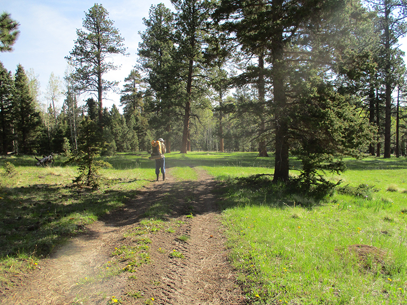
SUMMARY:  We started today at 10,800′,where winter is only reluctantly loosening is grip.  The meadows are still brown, and were covered with frost–the many snowmelt puddles were iced over, and hooray–the muddy road was frozen!  But before long, we were descending into spring–brilliant green grass, and creeks roaring with snowmelt.  There was no “Welcome to Colorado” sign, but we made it to Cumbres Pass, hitched a ride to Chama, and now we are at Foster’s Hotel, built in 1881, and it is great!

DETAILS:  We were expecting a freezing cold night last night and had protected our gear, but turned out it was not too bad after all!  But up here, winter is only reluctantly losing its grip. The meadows are still brown, and only the tiniest bit of green is occasionally showing through the ice and snowmelt mud.  We started hiking just before 6 am, and the sun was already well up (it’s June all right) and we had a clear view of the grand, snowy mountains up ahead.  But Cerveza had told us that every day, hikers are leaving Chama and heading into the snow and making it through, so we intend to join them and give it our best shot.

The further we walked, the colder it got.  We could see our breath, and all of the brown meadows were covered with frost, while the snowmelt puddles were covered with ice.  But hooray–that meant what would have been a muddy, slippery road was frozen solid and much easier to walk on. No more dealing with our shoes turning into mudballs!  It was a rather barren world of brown, with only a few trees, but the views were amazing–not just the snow mountains up ahead, but the gorgeous green valleys down below.

Finally the road took us down, down, down–into spring!  Creeks were roaring with spring snowmelt, the wildflowers were carpets of color, and there were great, sweeping, intensely green meadows.  There were no signs or any indication of where the New Mexico/Colorado border was, but we figured we had crossed it and cheered a bit!   One state done, and four to go!  Actually, the area reminded us of the California/Oregon border on the PCT–green meadows and trees.   We were glad to be on a road with bridges, though, because the further down we got, the bigger the creeks and rivers were, to the point of unfordable.  Finally we reached our first goal–the railroad tracks.

The info we had from reading hiker blogs plus the notes on our maps was “Follow the tracks to the train station at Cumbres Pass.”  So we started to do that, and a little while later, along came the train!  Wow, it was great– a real oldtime, coal-burning engine chuffing clouds of black smoke!  We moved over onto the embankment to watch it go by, and had fun waving at the engineer and passengers.  But it was still a long way to Cumbres Pass, so we finally sat down and ate the last scraps from our food bags and did a “garage sale” to air and dry our gear.  ( We figured that it might be hard to do that in town, and we were right).   It was the first time in 2 days that we weren’t dealing with rain at lunchtime, and everything dried very quickly in the sun.  Nice!

But walking along the tracks was a bit of a pain, so we decided to scramble up and walk along the highway instead.  Much easier going!  When we reached the train station, we found Freebird sitting there having something to eat before he headed out, and he also confirmed that a number of hikers have made it through the snow to Pagosa Springs.  He himself was geared up with snowshoes and ice axe.  Ours are waiting for us in Chama!  Poor Freebird, though–he said he got really sick and had to hitch into Chama from Hopewell Lake, then spend almost a week collapsed in bed.  He’s feeling OK now, and is determined to carry on.

We had no trouble at all hitching a ride into Chama, with a “gangbanger” guy and his girlfriend.  He dropped us off at Fosters–Freebird said that was a good place to stay, very hiker-friendly.  Yes, indeed!  It’s an old hotel/saloon, built in 1881, and still looks and feels like time has not changed it.  We got a room upstairs, ate a big meal (we were ravenous) and then tackled “town chores.”   Fixit went one way with our dirty clothes, headed for the laundromat, while I headed the other way to do the grocery shopping.  It was a 1 1/2 mile walk to the grocery store, but worth it–a great selection of food.  What I have found about New Mexico stores is that they have LOTS of meat, at very reasonable prices, but not much by way of produce or fruit.  Sort of the opposite of California!  I was worried about slow going in the snow, so I got extra food just in case, and as I headed out, I was thinking, “I so do not want to WALK all the way back, carrying this stuff.”  So I looked around the parking lot to see if I could hitch a ride with someone.

I spotted a young guy putting bags of groceries into his pickup truck, so I walked up to him, explained who I was, and asked for a ride back to town.  He very kindly said, “Sure, no problem” and made room for me.  As we drove back, he said he was the manager of a large ranch nearby, and that THIS week was elk calving season, so Fixit and I should soon be seeing a lot of baby elk!

Back at Fosters, I spread all the food out on the bed, sorted it, and loaded our packs.  Downstairs, things were getting pretty lively!  The saloon has a pool table, and there is always a game going on, plus the porch was full of jolly folks.  We had another big meal (very good!) and then tried to do some phoning.  No luck.  The only place we could get a signal was out in a parking lot, and even there, it was pretty weak.  So we gave up, and wandered off to look at the Cumbres-Toltec railroad stuff.  Very impressive!  Many of the old buildings and the equipment were in full working order, and well-cared for.  There was a sign that said basically, “If you don’t want coal dust and cinders on your car, DON’T park anywhere near the railroad!”

I love railroads, and I am so excited about riding the train back up to the pass tomorrow!  We walked around a little bit more before going back to Fosters, and I really enjoyed the FLOWERS  in the gardens.  The lilacs and the poppies were in full bloom, so the air itself was scented with sweetness, and of course poppies always make things colorful!  We climbed up the stairs to our room and collapsed. Being on a bed again is so welcome, and it’s been a great day!

Thursday, June 2 Moments of Joy

Thursday, June 2nd, 2016

june-2-8
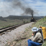
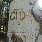
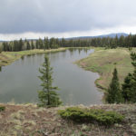
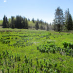
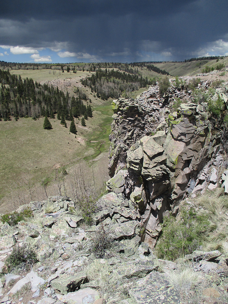
SUMMARY:  Several times every day (and today was no exception) we lose the trail and don’t know where to go.  Some of those “lost” moments last 5 minutes, others last an hour or more.  But there is always the moment of joy when we sot a CDT emblem on a tree or post!  What a massive relief!  Today we were “lost” and hunting for the trail at least 4 times, one of them at 5 pm in a dark snowy forest.  But we always found the trail in the end and had the joyful moment of “Look!  A CDT sticker!”  Today there were magnificent meadows, green forests, scary cliff walks, lakes and quite a lot of snow.  We are camped way up on the Divide tonight, at 10,800′ elevation.  We feel like we are on top of the world, plus there is awesome alpine scenery!

DETAILS: Well, if we hadn’t got so “lost” on Tuesday, we might have been heading into Chama today.  Oh well.  Today we managed to get lost again FIVE times, the worst situation being at 5:00 pm when we were in a forest full of snow and the trail disappeared.

This morning, we headed out along Trail 41, which had a lot of snowbanks next to the trail that were melting fast and turning the trail tread into a muddy mess.  We tried to go around the messes as best we could.  But aside from that, it was a very spectacular area, scenery-wise.  There were huge, dramatic rocky outcroppings and cliffs and areas where the trail edged around rock fields.  Some of the rocks in those rock fields were HUGE.  We stopped and looked at them and marveled, “How did that huge rock ever get over here?”  I can see why the trailbuilders opted to go around and not through the rock fields!

It was a bright, sunny morning–after all those clouds and thunder yesterday, we were really glad to have the sunshine.  Besides the rock fields, the trail was mostly in forest, but finally we reached a huge green meadow area, where the trail route was marked by posts and cairns.  We hiked happily along, till finally in one very long uphill meadow, the posts and cairns disappeared, and so did all signs of trail.  Our Guthook was gone because the battery was used up, so it was just us and our eyes and our maps.  We spent quite awhile checking every possibility of where the trail might have gone, and finally, way up at the top of the meadow, I spotted a fence with a gate and a CDT emblem!  Talk about a moment of joy and relief!

From the gate, the trail headed down into a canyon, way, way down.  This involved multiple creek crossings.  Unfortunately once again, we lost the trail, and ended up bushwhacking down a steep, muddy, rocky hillside till we reached the bottom, where we had to also crawl under a fence.  We tried to joke about this a bit, “It’s still New Mexico–gotta stay in practice at going under fences!”  But we found the CDT again (another moment of joy, spotting an emblem!)   Now the trail headed up high and followed the edge of  a dramatic and awesome cliff.  Ack!  I was so scared!  I had to use my favorite coping technique–just focus totally on the TRAIL and ignore what’s going on around it (like huge dropoffs!).  To add to the fun, we were walking straight toward a thunderstorm.  We made it past the cliff stuff and stopped for lunch, keeping a wary eye on the weather.  There was still enough sun that we dared get our sleeping bags out to air, as we always try to do at lunchtime.

After lunch, the trail dropped down again into a very pretty lake ‘n creek zone.  We stopped to get water, and shortly after that, sigh…we lost the trail AGAIN.  And it started to rain.  But hooray!  Another moment of joy!  A CDT sticker!  Back on trail, up we went to another scary cliff traverse–whew, was I glad to get through that.  Again, gorgeous scenery, but with so little food and nasty weather, it kind of took the fun out of it.  I was so glad to be back in easy terrain with no cliffs, when a fierce wind began to blow and it started to hail.  We scrambled for cover.  I was thinking, “This is ridiculous.  Today is like crazy.”   But the hail stopped, the clouds began to break up, and a little while later, the sun came out for awhile!  We were thinking, “This is the kind of weather we were expecting in Colorado…is this an early ‘welcome to Colorado’?

Then the trail headed into a snowcovered forest.  Basically what happens is that out in the meadows, the snow is gone and it’s mud and muck, but in the forests, the snow remains.  We were very happy to see a lot of footprints in the snow, all travelling along together.  But after awhile, the footprints began to split up and wander all over the place.  It was late in the afternoon and we were very tired.  I stood there looking at the dark forest and all the snow for a minute and sighed and got out the maps. After some thinking and studying, I concluded that if we just bushwhacked off to the right, we HAD to hit one of the forest roads, and from there we could figure something out.  So that’s what we did.  I cheered when I spotted the road, and then cheered even louder when I saw a post with a CDT emblem!  Another moment of joy!  At that point we sat down and ate some cold dinner.  While we were eating, along came another CDT hiker–Cerveza.  She was hiking along the road, and told us “I am so DONE with losing the trail–from here on out, I’m hiking the ROAD.”  We said a fervent “Amen” to that, because that’s exactly what we had decided to do!

So for the rest of the day, we happily followed a road (the CDT trail had disappeared into the forest again–NO WAY are we going back there!).  The road runs right along the top of the Divide, at around 10,800 feet or so.  It felt as if we were on top of the world, in classic alpine country.  Up ahead of us were the massive, snowy mountains of Colorado, and way down below, we could see green valleys.  Wow!  Awesome!  At one point, we caught up with Cerveza–she had stopped to watch a little mini-drama with a porcupine and a coyote.  I was also  able to spot them both.  Apparently the coyote had decided it wanted porky for dinner, but when it got pretty close, the porky acted threatening and the coyote changed its mind and left.  Wise coyote!  He probably saved himself a facefull of quills.  Finally we stopped for the day behind some trees.  The wind was blowing pretty hard, and the weather looked iffy, so we did set up the tent.  The only food we have left is breakfast and a few odds ‘n ends.  Hope we make Chama tomorrow!

Wednesday, June 1 Thunder Rumblings

Wednesday, June 1st, 2016

june-1-2
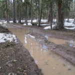
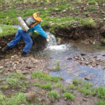
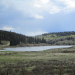
SUMMARY:  The sky had only a few clouds in the early morning, but that did not last long.  Big, dark gray ones came rolling in, and basically for the rest of the day, our hiking was accompanied by thunder, occasional sprinkles of rain, one downpour of hail, and some lightning that got kind of close.  But in spite of it all, at 9:30 am we came to a river ford and at last we knew exactly where we were.  But it means we did very few actual trail miles yesterday, so we will run out of food a day before we reach Cumbres Pass, if we don’t ration.  But the scenery today was gorgeous, the sun came out as we were setting up camp, and we will see what tomorrow brings!

DETAILS:  Last night I was in my sleeping bag, studying the maps, and concluded “I still don’t really know where we are.  All I know is I think we are on the CDT, maybe….?”

In the morning, Fixit made the decision to use up the last of our cell phone battery to consult Guthook in hopes of locating where we were.  No luck.  On our phone (which is rather old), what we do is look at the shape and pattern of the “trail” as shown on the phone, then try to find that same shape/pattern on the map.  But no luck.  We could not make any sense out of any of it.

Fixit’s response was “Let’s sit down and really study the maps and try to figure this out.”  My response was, “We have only two days of food left.  That’s not enough to spend a lot of time hunting for the trail.  At this point, all we can do is find a road that will take us to a town–then we can get more food AND we will know where we are.”   To further complicate the situation, Fixit was also convinced that we had been going the wrong way, and needed to go back.  It took a lot of persuading for me to show him that if we went back, we would actually be going back to Ghost Ranch, which is not what we wanted to do!  Finally, after some debate, we decided to keep on walking along the road we were on.

And then, HOORAY!  We spotted a CDT emblem!  And then another…and another.  And then, oh joy!  We reached a river crossing with some distinct features, and I FOUND US on the map!  There was a log bridge over the river, but it was way too tilted to one side to be of any use.  Fixit went off into the forest to look for a lever he could use to straighten the log, while I scouted for a ford.  According to the map, there was a place where the river was only thigh deep, and yes, that was true!  So I started across, very carefully.  The current was strong but not scary strong.  The problem was that the bottom of the river was full of smooth, rounded rocks covered with algae.  Very slippery!  And BRRR the water was cold–it was fresh snowmelt.  But I made it, and sat down on the other side rejoicing to know where we were.  I studied the maps and figured out that yesterday we only did a few real CDT miles.  Ouch.  That puts us way behind.  We will come into Chama “running on fumes” foodwise.

Eventually Fixit came back–no luck finding a sufficient lever.  He really did want to fix that log, so he was a bit disappointed.  He does not like it when he can’t FIX something!  He made it across the river, too, and since it was 9:30 am “Snickers break” time, we sat in the sun and relaxed for a few minutes.  I felt like a huge weight was lifted off us, now that we knew where we were.

When we shouldered our packs and headed out, dark gray clouds were rolling in, and by lunchtime,  thunder was rumbling.   But we marched happily along, so glad to be on trail again, till we reached Hopewell Lake, with its campground and picnic area.  It was raining at that point (with thunder) and we lost the trail again.  It took about an hour of beating around before we finally were able to find it.  Sadly, there were some posters up about a missing antler hunter.  Apparently he went out with some friends recently to hunt for elk antlers, and at the end of the day, he never came back.  Doesn’t sound good.

But now we were back on trail, and after that, things went well.  We were just beginning a roadwalk section when we met a ranger who told us how to locate the trail up ahead where it made a right turn.  As we hiked along the road, off to the left we could see two guys busy working with a Bobcat on building TRAIL so that future CDT hikers don’t have to walk the road.  They saw us and waved and cheered!

We found out later that several of our fellow CDT hikers, when they reached this road, simply hitch hiked to Chama, because like us, they had been “lost” so much that they didn’t have much food left.  But we decided to go for it anyway.  Once we got to the trail turnoff,  we were back to dealing with mud and marsh and snowmelt, with the additional difficulty of having a thunderstorm right over us, spitting lightning.  Our policy on this kind of situation is to keep going and pray, “Lord, You know where we are….send the lightning someplace else, and keep it from making trouble.”  At one point, it began to hail, and we ducked under a tree to wait it out.   The temperature was dropping, and the rest of the afternoon it was very cold, with lightning and thunder continuing.

At 7:00 pm, we stopped to camp at a spot where obviously someone else must have recently camped, because the grasses were flattened.  And as we set up our tent, the sun came out!   The storm went away and of course that meant a glorious sunset.  I studied our maps and told Fixit, “Well, we have 48 miles to go, and one day of food.  This will be interesting!  But at least we’re on the trail!  And the scenery today was gorgeous!”   Fixit agreed, and we burrowed into our sleeping bags for a cold night.