Archive for May, 2016

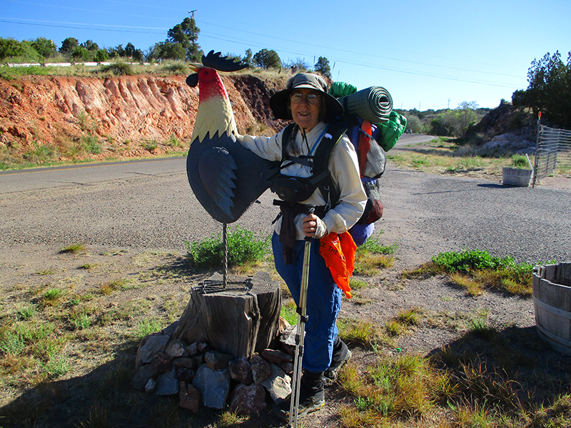
Wednesday, May 11 Tough Beginning—Great Day
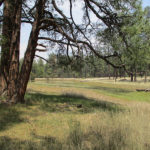
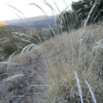
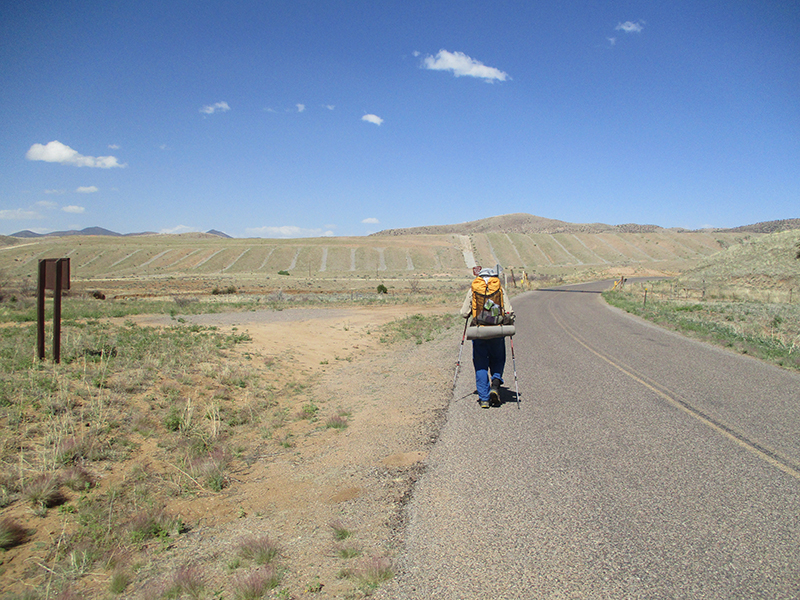
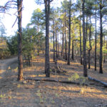
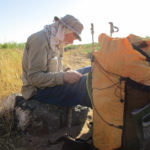
Wednesday, May 11th, 2016

may-11-5SUMMARY:  We slept very well in our cowboy camp last night, but woke up to temperatures below freezing, our shoes frozen solid, and frost all over our sleeping bags.  So we wrapped the frozen shoes in plastic and took them into our sleeping bags till they thawed out enough to put on.  Then it was bushwhacking and river crossings till we found the trail, and for the whole rest of the day it was like God sent one person after another, out in the middle of nowhere, to assure us (well, more accurately, to assure ME–Fixit says he enjoys the challenge of not knowing where we are!!) about which way to go on our alternate route.  Tonight we are camped in a horse camp with a bunch of packers & wranglers.

DETAILS:  Last night it was so warm and clear that we just cowboy camped, and slept very well.  Our new down sleeping bags are great!  And that’s a good thing, because at 5:20 when we tried to get up, we discovered  temperatures below freezing, our shoes frozen solid, all our wet things we’d hung up to dry were frozen stiff, and there was frost all over our sleeping bags. So we wrapped our frozen shoes in plastic and took them into our sleeping bags until they thawed enough to put on.  Then came the fun of putting on frozen pants, cold socks, etc.  It was so cold that we could see our breath.

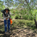
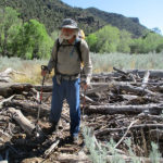
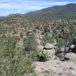
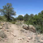
Then it was bushwhacking and river crossing, trying to find our trail up at the top of the valley. Fixit enjoys this sort of thing, but I don’t, so I was silently praying, “Lord, you are the Good Shepherd–we two sheep need you to show us where to go.”  I could see on the map that when we reached some cliffs, the trail should be right after that, and sure enough, it was–a very nice, well-built, broad trail, obviously well-used.  Whew!

After that, we were able to just follow Becky Campbell’s instructions, and they were perfect.  On the leg between Bear Creek Summit and the turnoff to the Prior Cabin, though, I started getting discouraged because it seemed like it was taking forever, and I was worried that we might have missed the turnoff.  We stopped for lunch, and instead of cooking as we would usually do, I simply put water into a freezedried dinner pouch to rehydrate while we hike this afternoon.  We resumed hiking, but I was more and more worried about whether we were on the right trail, when along came some Forest Service packers (the horses were branded “US”!) and they assured me that we were on the right trail and it was only 3 1/2 miles to the Prior Cabin.

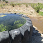
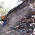
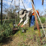
By afternoon snack break, we had reached the Cabin with its trickling spring, and we hung out there for awhile, collecting water, studying maps, and talking to a group of 4 guys who were camped there.  The guys were from Alaska and Colorado, and once a year they get together for a backpack adventure.  They had very good maps, and confirmed everything Becky Campbell had told us, plus they said, “You guys should go for the horse camp by Clear Creek.  There are tents and everything, and nobody is there.”

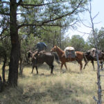
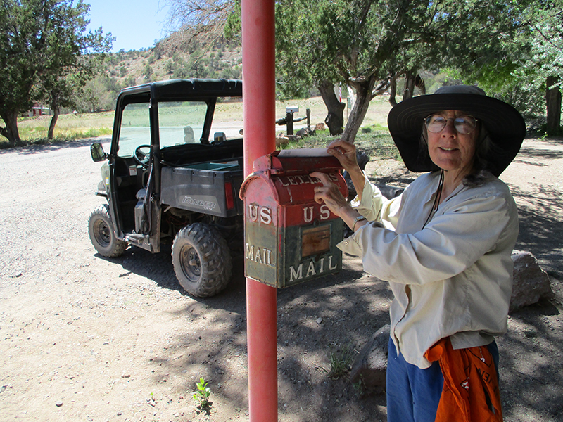
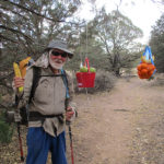
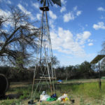
So we hustled along as fast as we could and reached the horse camp at 6:30, just as a large group of packers arrived!  So much for being able to stay in one of their tents!  But we hung out with them, eating our cold rehydrated dinner while they had BBQ, corn on the cob, etc.  Turned out that they were actually running sort of a “school” for learning how to be a packer/wrangler, and there were a number of guys who were learning how to manage all the details of a string of pack horses.  We mentioned we’d seen a string of Forest Service horses early this afternoon, and the “packer school” guys immediately looked very serious.  They wanted to know exactly when and where we’d seen the “US” horses and which way they were going.  (We found out later that the packer school had probably overstayed its permit and didn’t want to meet any Forest Service folks!)

While the packers went off to do a practice in packing up, we found a spot nearby on nice soft duff and UNpacked our stuff, set up our tent and turned in.  There were still horses snorting, mules braying and dogs barking, but we were so tired that it didn’t matter.  I am very grateful to God for sending people today at just the right time when I needed some assurance that we were on the right trail.  It’s like it was one person after another, out in the middle of nowwhere.  That’s more than coincidence, and I am very grateful.

Tuesday, May 10 Becky the Horse Lady at DOC CAMPBELL’S

Tuesday, May 10th, 2016

may-10-9
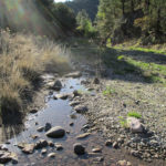
SUMMARY:  We spent the morning still following the Gila River as it winds and twists its way along through impressive rock walls.  Sometimes we were on nice trail, and sometimes we had to bushwhack, but we reached Doc Campbell’s Trading Post just in time for lunch, including their famous ice cream.  Then it was “sort the food” and even more important, try to figure out another hiking route.  We do NOT want to deal with the Gila anymore!!!!!  It was absolutely agonizing trying to figure things out from our maps (which are not set up for an alternate route) and I was almost in despair until “Becky the Horse Lady” drove in with a trailerfull of horses.  She showed me exactly what to do, and I was able to mark it on our maps.  By 4:00 pm we were on our way–sure hope Becky’s ideas will work!!

DETAILS:  What a nice campsite we had last night!  There were so many soft leaves that we were very comfortable.  But 5:20 am in a narrow canyon with a lot of trees is actually pretty dark.  We had to use our headlamps to pack up, then we hiked until the sun peeked over the edge of the impressive  cliffs, and stopped in a sun patch on a bench by the river for breakfast.

The rest of the morning, the trail was a mix of very nice pathway, clearly marked with rock cairns, that alternated with  bushwhacking through willows, tall grass, dead plants and flood debris from 2013.  At this point we were starting to mutter to ourselves, “I am so DONE with the Gila!”  At every bend and twist of the river, we hoped for a glimpse of the bridge on the road that goes to Doc Campbell’s.  Finally there it was, and we cheered!  It didn’t take long to walk the two miles to Doc Campbell’s store, and we arrived just in time for lunch.

The guy who runs the Doc Campbell’s Trading Post is apparently the son of the original owner, and he is…shall we say, “a character.”  He’s a mix of very helpful but very impatient.  The first thing he said was, “Hikers–you go around to the side of the building and don’t loiter out front.”  Well, around the side of the building was a very nice setup for us hikers–a lawn, picnic table, faucet for filling water bottles, a place to plug in electronics, etc.  I left my pack there and went inside to ask for our resupply box.  “Go find it yourself” was his reply.  So I ended up wandering all over the store, finding hiker boxes piled randomly here and there.  Ours, it turned out, was actually halfway up the stairs to the second level, and I was starting to get seriously worried about finding it.  What a relief to spot the big brown box with a green stripe on the side!

Then we had lunch–a whole pint EACH of Doc Campbell’s famous homemade ice cream (it was GOOD!) plus sandwiches and juice.  Our lunchtime also included discussing what to do about the trail.  Neither of us wanted any more Gila River, but our maps did not adequately cover an alternate.  We were too far away at this point from the official trail on the Bear maps to even consider switching and going over there.

Fixit’s idea was, “No worries–we’ll just head out as best we can and figure it out as we go.”  My view was, “This is very rough, rugged country with hardly any water sources.  It would be crazy to just start hiking and hope we find our way.”  Mr. Campbell, the store owner, tried to describe a possible route for us, but it did not make sense, and he did not want to waste time explaining it any further.  (Like I said, he’s very helpful but also very impatient!)

So I found myself in a seriously agonizing situation, caught between my own determination to not go anywhere till I knew fairly certainly where we could find water, and what the trails were, with Fixit very annoyed at the delay, because he wanted to go see the Gila Cliff Dwellings before they closed for the day.  “Stop fussing over the maps and let’s GO!” he said.  Finally I suggested, “Why don’t you just go on ahead and see the cliff dwellings, then wait for me there and I will catch up with you once I get a route figured out?”  Fixit was getting ready to head out when a lady arrived with a trailer full of horses.  Turned out she was Becky the Horse Lady, sister of the guy who owned the Trading Post, and she knew every trail for miles around.

I told Becky what we wanted to do–get to Snow Lake, but without following the Gila River.  “No problem!” she said.  “I’ll show you what to do.”  And she did.  Very clearly and easily, she described a good route, with water sources, and we found it on my maps and marked it.  Whew!  Talk about an answer to my frantic “Help, Lord!  What can I do??” prayers.

By now it was after 3:00 and the Trading Post was about to close for the day.  Just as we headed out, Stummy and Masshole arrived, completely exhausted and saying, “No more Gila!  We are DONE!”  Mr. Campbell very kindly (though saying, “Hurry up, we’re actually closed now!”) let them go in to find their box and buy some food.  We wished them well and hurried off down the road, hoping to make it to at least be able to SEE the Cliff Dwellings, even if we couldn’t get IN.  All along the road we saw signs saying, “Wildlife Management Area.”  There was no sign of any wildlife–just an obviously flood-ravaged and forest fire damaged area where even the plants (never mind wildlife) were desperately trying to survive.

Turned out that you can’t see the Dwellings from the parking lot, and the trail to them is gated and locked.  Oh well.  Our alternate route that Becky the Horse Lady described to us began from that parking lot.  It was suppertime and we sat down at a picnic table by the visitor center to eat.  A very bold bird flew down and sat on the table with us, to beg for crumbs.  Where the trail began we found the usual “gauntlet” of warning signs about rattlesnakes, etc.  But one sign made us say, “Grrrr!”  It said that the government had recently started to release Mexican wolves in the area, and that they were larger than the local wolves, but not to worry, “they will not harm humans.”  Yeah, sure.  We’d been hearing from ranchers how the wolves kill just for sport and not for food, and are decimating the cattle.  The sign included dire warnings about the consequences to humans who kill the wolves.  Great.

We began hiking along Becky’s alternate, but came to a point where even the alternate trail was all messed up by the 2013 flood, and we were back to bushwhacking along the West Fork of the Gila.  Fortunately, we were in a nice wide valley, not a canyon, so the bushwhacking was easier.  Added to the “fun” was the fact that a forest fire had started up, and we could see the smoke clouds from where we were.  It appeared to be a long distance away from us, so we figured we’d be OK.  At 7:00 we stopped to camp, figuring we should be back on proper trail tomorrow morning.  This has been a really hard day, not hiking-wise but heart-wise.

Monday, May 9 Sapillo Creek Adventure

Monday, May 9th, 2016

may-9-14
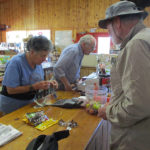
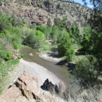
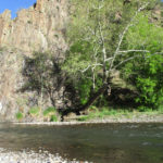
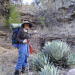
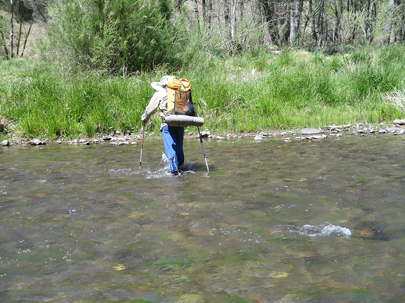
SUMMARY: We thought we’d be having a Gila River Trail adventure today, but we made a huge mistake and ended up going up the Sapillo Creek canyon instead.  It’s way prettier than the Gila River canyon, but it led us deeper and deeper into the wilderness–the canyon got so narrow we had to wade it in (for me) shoulder-deep water.  We finally got to the point where there was NO way to go on, realized what we had done (groan!) and retraced our steps all the way back till we reached actual Gila River.  The “trail” turned out to be very hard to find–we did lots of bushwhacking and river crossings–some were a wee bit scary.  We are camped in the canyon tonight.  Glad to be safe!

DETAILS:  We were really excited at the thought we’d be having a Gila River Trail adventure today, as we headed down into the river canyon.  The views of the canyon and the anticipation of  such a famous part of the CDT  kept me going even though the last bit down  was rough, rocky and slow.

At the bottom, we charged straight ahead to what we THOUGHT was the Gila River (it looked just like all the pictures of the Gila we’d seen on hiker blogs) and stopped for breakfast plus a good washing up of our rather dirty hands, feet and faces.  We AquaMira’ed water as well.  What we didn’t realize was this was NOT the Gila.  It was Sapillo Creek.  Had we checked our compass and maps we would have seen that the Gila runs north, but the creek runs east.  Our map showed that we should turn RIGHT at the Gila, so blissfully ignorant, we turned right (to the east, if we’d looked at our compass) thinking, “OK!  We should maybe make it to Doc Campbell’s today!” and started walking along a very nice trail through a lovely canyon into what turned out to be an unbelievable adventure, but also the loss of over half a day of CDT route hiking.

The Sapillo Creek canyon really is beautiful. The cliffs are impressive, and there were huge sycamore trees, pine trees and oaks, draped with wild grapevines loaded with baby grape clusters.  After awhile we came to a large cave in the canyon wall, where people had obviously had a lot of fun camping–there were fireplaces in the walls, shelves and even cooking equipment.  Shortly after that, we crossed the “Gila” on a log, and the trail continued very clearly and nicely on the other side.

But not for long.  Suddenly the trail just disappeared.  No problem, we expected that–we’d heard so many stories about how the Gila River trail had been trashed by a big flood a couple of years ago, and the hikers were all complaining about having to do a lot of bushwhacking.  So with only a bit of grumping, we kept on going and going and going.  But the canyon walls were getting closer and closer together, and finally we reached a point where the only way through was to wade.  Beyond that narrow point, the canyon widened again.  “Hmmm,” I thought.  “I don’t remember any hiker blogs talking about this.  Weird.”  Just after that, again the canyon narrowed, and again we began to wade.  But this time the water was getting deeper and deeper.  I took off my fanny pack that was around my waist and hung it around my neck to keep it dry.  Soon the water was at the bottom of my backpack and obviously getting deeper.  I stopped.  Fixit went ahead, and it was chest deep on him, but he made it.  He took off his pack, laid it on the shore, and came back to help me.  He took my pack, and I followed along, clinging as best I could to the vertical wall of the canyon, in water that was shoulder deep on me.  Fortunately, there was no current to deal with!

By now both of us were saying, “This is CRAZY!  How can they expect hikers to cope with this??”  We were both completely soaking wet, cold and shivering, and some of our gear was wet, too.  So we headed for a patch of sun (ahh did it feel good!), took off our wet clothes and spread out all the wet gear to dry while we talked about what to do.  We looked up at the canyon walls for some way to climb out, but there was nothing.  So our conclusion was “Keep going and see what we can find.”  So on we went, but after a bit, the canyon narrowed again, the creek became very deep, and looking ahead we could see that it narrowed to just a slender crack.  Fixit said, “I’ll take off my pack and have a look.”  So while he bravely waded on into that deep, cold water, I sat on the bank and prayed like crazy.  “Help, Lord!  Please keep him safe…please show us what to do.”

Suddenly I had a thought:  “Yes, this IS crazy.  This CAN’T be the CDT.”  So I got out the map and looked at it again.  That’s when (duh!) I noticed that we should be going NORTH.  One look at the sun and the shadows, and I knew we were going EAST.  Just then Fixit came back, shivering and dripping, to tell me the narrow crack was impassable.  I told him what I’d just realized, and that we’d have to go all the way back to find the CDT again.  We both groaned.  The thought of redoing what we’d just been through was seriously awful.  So again we looked up at the cliffs–were they climbable?  Maybe….so we put our packs back on and made an attempt.  Nope.  The ascent would be too technical (well, for me, anyway–I’m sure Fixit could have made it!) So we turned around and started back.

When we reached the deep water passage, Fixit went first–he took off his pack and carried it resting on his head and shoulders so it would not get wet.  Then he came back and did the same with my pack.  Meanwhile, I crept along in the shoulder deep cold water, clinging desperately to the canyon wall.  I guess I could have said, “Oh whatever, I’ll just swim” but I didn’t.  I was trying to keep my wristwatch dry.  (Fixit’s watch had gotten wet and was already starting to have problems that continued all the way to Canada)

It was a very sad journey back down the canyon.  I kept thinking, “How could I be so stupid?  I should have checked at least the compass!”  and blamed myself for being so careless.  At the same time, I was also thinking, “God, I am so grateful to You for your patience with us and for keeping us safe.”  Finally, after lunch,  we got back to where we had started, and found the REAL Gila River!  Hooray!  It was heading north!   But we couldn’t find the TRAIL.  Grrrrr.  After some bushwhacking and hunting about, we finally located it.  Turned out that we still had plenty of bushwhacking to do–yes, the trail still was messed over by the big flood–but at least there were some rock cairns occasionally to let us know we were on track.  And of course, there were LOTS of crossings of the river as it wove back and forth across the canyon.   Some of the crossings were borderline scary, with enough strong current to make my trek poles vibrate.The pattern went something like this: Search for trail, bushwhack a bit, find trail, cross river, lose trail, repeat,  over and over again.

The Gila River canyon is pretty, and wider than the Sapillo Creek canyon, but I would say Sapillo Creek is the prettiest by far.  I tried very hard to enjoy the beauty, but I was mega frustrated by so much lost time, and very unhappy about constantly losing the trail.  “Embrace the Brutality” says the CDT motto.  I’m not embracing any of this, no way!  But we found a very nice campsite for tonight, on soft, comfortable duff, and hung all our wet clothes up to dry.  Doc Campbell’s famous ice cream tomorrow!

Sunday, May 8 Tough & Beautiful

Sunday, May 8th, 2016

may-8-11

SUMMARY: This was an unbelievably tough (took us all day to make 18 1/2 miles) but it was beautiful.  On the “beauty” side, we reached our first creek, walked around a natural amphitheater, saw amazing rock formations, and hiked creek canyons full of greenery–ferns and wildflowers.  On the “tough” side–there were climbs so steep I wondered if I’d make it, many miles of horribly rocky trail, and downhills so steep, slippery and rocky that I had a really hard time.  But that’s OK.  I like the contrasts much better than hiking all day in the “same ol’ same ol’ stuff”.

DETAILS: It was a really cold morning to start with as we walked along a fire road admiring the many desert-looking but pretty plants along the way.  It wasn’t long before we reached our first CREEK !  That was seriously a big deal after so many days of water caches and wells and occasional cow “tanks” (muddy gross ponds).

After the creek, we entered a natural amphitheater, surrounded by high dramatic cliffs.  We were down below in a green meadow, walking along and periodically turning to look up and around at the amazing rocks.  There were also extensive ruins of an old mine.  For us it’s tempting to stop and look and try to figure out how the mine operated, but we said, “Nope, gotta make miles,” and pushed on.

Unfortunately, we pushed onto a wrong trail and it took us about 20 minutes to figure out we’d messed up, and head back to the right trail.  Bummer.  But that did connect us with Czech Mix again!  For the rest of the day we were leapfrogging with him regularly.  He is a great guy to hike with–cheerful, kind and encouraging.  By midmorning the three of us had reached what the map called “The Devil’s Rock Garden”.  It is truly amazing–there are scores of rock towers everywhere.  I said it should be called “Rock Giant City” because it looked like a whole cityfull of rock giants standing around.  We all took a lot of pictures–Czech Mix was glad to have us there, because we took pictures of him in the Rock Garden.  That was a lot better than selfies!

The beauty continued, with many, many flowers.  Among the rocks, there were cactus blooming, and near the creeks there were ferns, greenery and lots of “regular” wildflowers.  Beyond the Devil’s Rock Garden, the trail crosses large sheets of volcanic rock, but hooray, somebody had made plenty of rock cairns to show which way to go.  At one point, they even used sticks to spell out a large “CDT” sign!

But on the tough side of things, the trail today was seriously hard.  It included some of the steepest uphills and downhills I have ever seen, on very rough & rocky & slippery trail.  I actually had to stop and rest in the middle of some of the uphills.  Even Czech Mix got winded; we’d all sort of stagger over the top of a climb and stop to huff ‘n puff a bit.  None of us were able to walk very fast.

Towards the end of the day, it became more and more difficult to locate the trail.  But Czech Mix would whip out his iphone and instantly be able to point out “It’s that way.”  We are thinking we should have gotten a new iphone like his instead of our slow old one.   The hiking got a bit easier, and Czech Mix zipped on ahead of us, but we caught up with him for one last time at a large water tank where he’d stopped to filter some water.  We got water, too, and Aqua Mira’ed it.

But Czech Mix was looking really sad and we asked him if he was OK.  No, he was not.  He was agonizing over a very tough decision that would determine whether he’d continue hiking the CDT.  He told us that back in Silver City he’d called his girlfriend in Czechoslovakia to see how things were going, and got some very bad news.  She went to the doctor for some sort of very routine medical procedure and they discovered she has a serious and life threatening condition (Czech Mix didn’t say what it was–cancer, maybe?)  So poor Czech Mix was agonizing over “Should I go home to be with her, or keep on hiking?”  I asked him, “What kind of girl is she?  Is she the kind who would say, ‘I’m so proud of you, heading for your Triple Crown on the CDT!  Come be with me after you are done’ or is she the kind of girl who would say, ‘I need you; I’m so scared–please come home’?”  Czech Mix sighed and said, “She would want me to come home now.”

So we talked a bit about his options.  The water tank was right by a dirt road that could take him back to a highway and from there to Silver City and transportation back to Europe.  After this dirt road, there were no more “turn back options” for a long way.  Czech Mix very sadly said, “I think I must go back.  I will go to Silver City again and phone to find out how bad it is and make a final decision there.”  We promised him that we would be praying for him and for his girlfriend.  I had to choke back tears; I felt so bad for him.  When they say hikers are sort of one big family, it is true–we do really care about each other.

We never saw Czech Mix again on the trail, nor did we hear any word of him, so we are guessing he did go home. But we did pray for him a lot and I hope his girlfriend will be OK.

The day finished up with a long haul down along a creek–very rocky going, plus a final “Oh no–where is the trail?”  We did locate it again, and tonight we are camped about a mile from the Gila River, and are already getting glimpses of its famous mountains and canyons.  Clouds have been threatening all day, and they are even nastier looking now; the wind is howling and fierce, so it was pretty tough setting up the tent, but we managed it in the end.  My feet are so sore from all the rocks, even with the protection of the La Sportiva shoes.  But we are excited about reaching the Gila tomorrow, and I thought about our CDT Bible verse, Micah 4:5: “For all people walk each in the name of his god, but we will walk in the name of the Lord our God, forever and ever.”

Saturday, May 7 Pit Stop in SILVER CITY

Saturday, May 7th, 2016

may-7-2
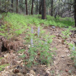
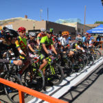
SUMMARY:  Our day began with a 3 1/2 hour walk to breakfast in Silver City, and we arrived just in time to watch the start of the 4th dayof the Tour de Gila bike races.  Today the riders were doing 20 laps of a 1-mile loop through downtown Silver City.  We got a window seat at the Silver City Cafe and watched the Masters bikers go flashing by. (The “elites” race in the afternoon).  Then it was grocery shopping (food for 3 days), then off to the RV park for showers and laundry, a visit to Pizza Hut, and we were back on the trail through a beautiful forest.  It’s now a quiet night–no wind, just a few coyote songs in the distance.

DETAILS: Last night I tried an experiment–using my fleece headband as an eyeshade at night to block any light so I can sleep better.  We had cars and trucks going by all night with their headlights shining, so I figured I needed to do something.  And it worked great!

We were up and getting dressed by headlamp at 5:15, ready to begin the 11 or so mile roadwalk into Silver City.  We kept hoping for some restaurant or coffee place on the way in, but no luck.  We decided to ignore how hungry we were and just push on for breakfast in town.

Along the way, though, we were entertained by a variety of interesting things.  The first one was when we stopped to take off our “warm layers” at a set of mailboxes/newspaper boxes by the road.  Turned out that one of the newspaper boxes had a bird’s nest in it.  A bold bird!   It didn’t seem to mind the fact that people would come every day to get their mail.  The other standout on the roadwalk was a huge metal sculpture of a chicken!  It reminded us of home in Petaluma, CA, which in earlier days was known as “The Chicken Capital of the World” because of the huge number of chicken raising farms.  (Actually, there still are a lot of chicken farms even now!)

Scenery-wise, the road led us up and down (felt like mostly up!)  through miles of pasture lands with pinyon pines and a variety of dryland plants.

By 9:30 am, we had reached the hilly outskirts of Silver City and were surprised to find ourselves meeting a LOT of bike riders, many wearing bike team uniforms.  They would come chugging uphill, then a short time later, they’d come flying past us again, going downhill.   Then we’d see them again, chugging uphill.  “There must be some kind of bike race on,” we said to each other.  “Looks like the guys are practicing.”  And yes, they were–it was Day 4 of the Tour de Gila professional bike races.  Just before we got to town, there was a very long hill (downhill for us, at last!) and a guy came driving by in a car, rolled down his window as he passed us, and yelled, “Canada!”  We waved and yelled back, “Canada, eh!”

When we finally reached the foot of the hill, we stopped and pulled out our maps to make a plan on what we would do in town, beginning with BREAKFAST, and the same guy drove up, stopped and came over to talk.  Turns out he’s a trail angel/volunteer, and he was happy to answer our questions.  1) Where is the best place in town for breakfast?  Answer: The Silver City Cafe, downtown.   2) Why does the official CDT take hikers way far away from Silver City and then just drop them off in the middle of nowhere?  Answer: Private property owners refuse to allow the trail to be any closer, so they had to keep it way up in the mountains, and yes, it isn’t finished yet.  Someday it will be.  We said, “Then please, SOMEBODY put up a sign on the trail to let the hikers know this!”

Now, very tired and very hungry, we headed for downtown and walked right into…the bike race.  Many of the downtown streets were blocked off in order to form a 1-mile-long loop through town, so that Day 4 of the Tour de Gila was to do lots of laps on that twisting, one mile course.  We found ourselves very close to the Start/Finish line, and just then a round of the race began–CHARGE!  Lots of bicycles went tearing right past us down the street in a huge pack and rounded the first turn.  How they avoid crashing into each other, I have no idea.

We found the Silver City Cafe and got a window seat so we could eat AND watch the bikers go by.  Turned out that what we were seeing were the Masters bikers–older guys.  They do 20 laps.  And it didn’t take too long before some of them were obviously having a hard time keeping up.  The cafe people said that next would be local bikers (all ages, including kids) and finally this afternoon, the professionals.

From the Cafe, we headed to Silver City Hike & Bike to get me a new headlamp–the super lightweight one I brought  from home had turned out to be annoyingly hard to operate.  Then we went to the grocery store to buy 3 days worth of food, and on to the Silver City RV Park for showers and laundry.

The RV park people were super-nice–we recommend the place to all CDT hikers!  While I was sitting around waiting for the laundry to be done, a very friendly, precocious little girl whose family were staying in a big RV right across the driveway, came over to talk to me.  She had a zillion questions about what we were doing and why.  It was really fun talking to her!   She wanted to know all about our gear and who we were.

Now that we were clean again, we went to Pizza Hut and stuffed ourselves with salad and pasta before heading onto the Ley Red Route road that would take us back to the trail.  I wish we could have stayed longer in Silver City–seems like a great little town!   On the way out, Fixit spotted some wire lying on the ground.  “Aha!” he said.  “Now I can fix your trek poles!”  My poor old trek poles were still unhappy about having to be taken apart to go on the Greyhound bus, and were threatening to come apart again at the handles, which were slipping and getting worse every day. Fixit worked on them with the wire and now I think I’ll be OK, but that was seriously dumb of me not to get NEW trek poles before starting this hike.

We’d walked a couple of miles when I realized, “Oh no, I forgot to mail the letter with my journal pages in it!”  So I stopped at a house along the road and asked if they could mail my letter for me.  They very kindly said, “Sure!”  Whew!

Our paved road route eventually became  a dirt road following a creek through a very pretty forest of pine trees and oak trees–with a few nasty little cactus plants here and there, just to remind us, “This is New Mexico, not California!”  Nearby, somebody was busy with target practice–bang, bang, bang.  Our maps warned of a key turn up ahead that was easy to miss, but we were very careful and did find it.  After being lost so much already, we are sort of paranoid about not getting lost again.

Another uphill climb till around 7:00, and here we are camped in a pleasant forest with coyotes “talking” in the distance.

Friday, May 6 The “real” wrong trail

Friday, May 6th, 2016

may-6-19
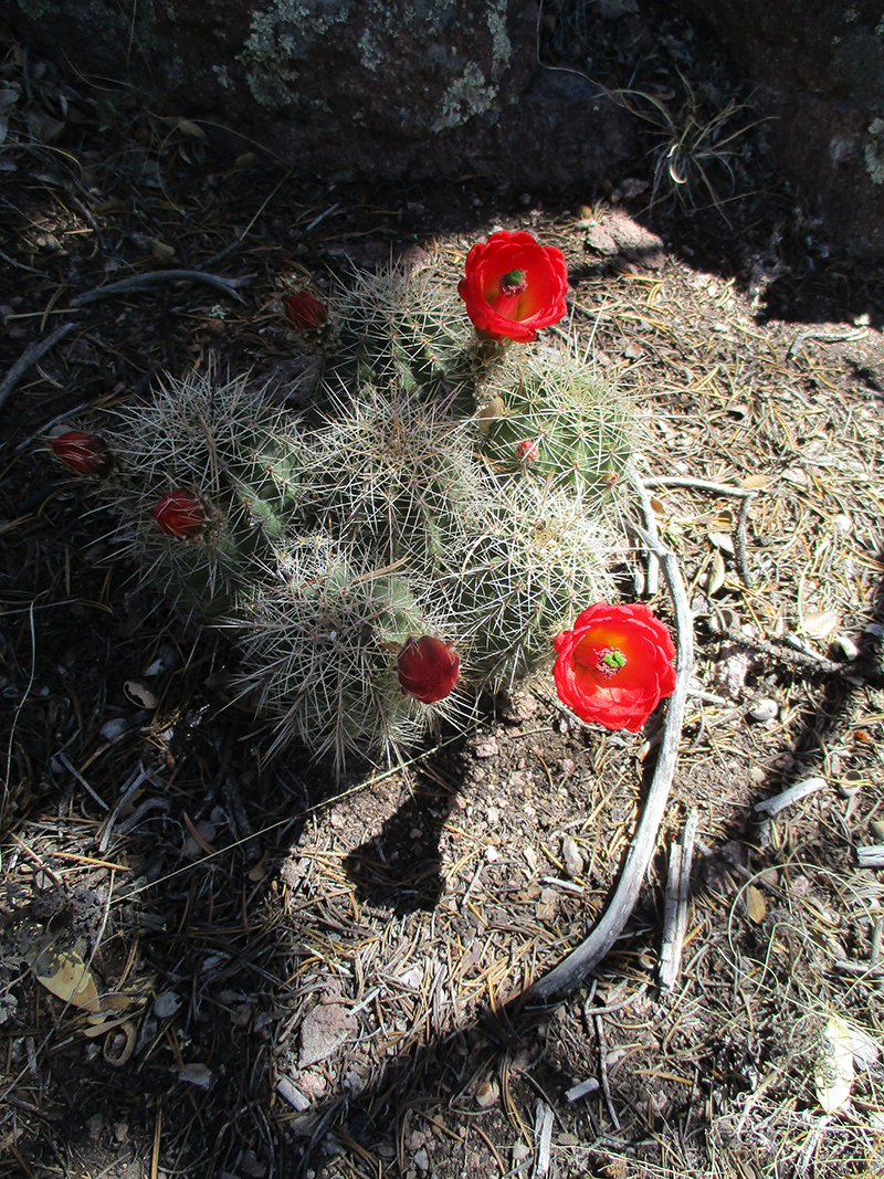
SUMMARY: Today began with beauty and ended with frustration.  We had a wonderful time doing “peak bagging” this morning in the clear, fresh mountain air.  Views, too!  Wow, we were up high!  But just before 10 am, things went wrong.  We reached Tyrone Road, where the map said we were supposed to turn right and walk into Silver City.  But there was a big CDT sign that said to keep going.  We were puzzled, but we did follow the sign.  Miles and miles later, we finally said “phooey” and took the next road we came to, down the hill, getting water and directions from various people, met another CDT hiker in the same predicament, and tonight we are camped by the highway.  Silver City tomorrow!

DETAILS: Today began with beauty, but ended with frustration.  Last night the rain sprinkles included a bit of lightning, but the early morning light showed a clearing sky and the air was clean, cold, mountain-y air, scented with pine, the kind where you want to take deep breaths and it’s almost like drinking pure, cold water.

We finished the climb up to the top of Jack’s Peak, and thoroughly enjoyed being in a forest again, with lots of trees.  At the top, we discovered the foundations of what I guess were once summer cabins.  One of them still had a magnificent fireplace more or less intact.  Cows were everywhere, and we went through countless gates of all sorts, each one with a bright yellow sign that said, “Please!  Close the gate!”  Of course we did.  (We found out later that the ranchers really appreciate us hikers, because we DO close gates, unlike ATV people who often forget!)

The trail then took us down, across a ridge, and over to Burro Peak.  Whenever there was a break in the forest, we could see WAY down below–wow, we were up high!

When we reached Mudhole Spring, we were really glad for the water cache yesterday.  The spring is well-named.  Yuck!  Glad we didn’t have to get water here.

Not too long after Mudhole Spring, at around 10:00 am,  we arrived at what we thought (and as it turned out later, we were correct!) was Tyrone Road.  According to our map, we should turn right onto the road, then follow it down to the highway and walk into Silver City sometime this afternoon.  But to our great puzzlement, there was a very large CDT sign indicating that we should cross the road and keep on following the trail.  Thinking that we’d miscalculated how far it was from the spring to the road, we followed the CDT sign and kept going, expecting that we’d soon find Tyrone Road.

But the trail kept going and going till it reached another road, where ANOTHER large CDT sign indicated that we should cross that road and continue on again.  By now we were very puzzled and seriously wondering what was going on.  Reluctantly, we kept on following the trail, but finally we just stopped, very disheartened.  “Something is really wrong here,” I said to Fixit.

At that point we began to discover that Fixit and I have very different viewpoints about what to do when the trail doesn’t make sense.  I tend to look at terrain, compare it to the map, make an educated guess as to where we are, and head out with no further ado.  Fixit is much more methodical.  He took off his pack, sat down with the maps and spent a long time trying to figure out where we were and what to do.  I had to finally just take off my pack, too and try to wait patiently. (Well…not very patiently, I’m afraid.  I didn’t do a very good job of it!)  In the end, our joint conclusion was to keep on till we reached the next road, then turn right and head into some sort of civilization, then figure out where to go from there.  When we were thruhiking the PCT in 2005 and 2010, the trail was mostly very well marked, and we didn’t have to wonder where to go, so we were never in this situation before.

What we didn’t know was that the CDT trail we were following was the official trail, all right, but it wasn’t FINISHED.  Other hikers who didn’t give up and turn off like we did, faithfully followed it only to discover that it dropped them off in the middle of nowhere, and they had to hike through miles of soft sand and other difficulties before finally reaching Silver City.  We heard that Zippy Morocco, who was ahead of us, and likes to hike fast, was very growly and upset by the experience.

We didn’t have to go much farther before we found a road and headed to the right.  At this point we were seriously low on water again, and hoping to find some way to get more.  Hooray, a guy in a pickup truck who was out collecting firewood with his two very serious-looking (make that SCARY looking) dogs came along, and kindly gave us some water.  The dogs were very quiet and polite as we talked to him, but they were the kind you would not want to mess with.  I did not even remotely attempt to pet them!

Later on, we were still walking down the road, when a lady came along with a horse trailer, and stopped to see if we needed anything.  She was very cheerful and friendly and told us she’d been able to help several CDT hikers.  We got more water from her, and that was great, because now we could drink as much as we wanted–no more worries about getting dehydrated.

So that afternoon, instead of walking into Silver City as we’d thought we’d be doing, we were hiking along various back roads, trying to reach the highway to Silver City.  We passed mining areas, and also looked in awe at places where flash floods apparently come roaring across the roads.  At each of these places, there were signs warning, “Do not cross if there is flooding.”  Judging by the debris fields, the signs are not kidding.  It was obvious that trying to cross during a flood would mean being swept away.  Very scary.  We were glad it was not raining!  Several kind drivers who came along offered us a ride; we had to explain to them what we were doing and politely decline.

Around 5:30, we finally reached the highway that would take us to Silver City.  The wind was blowing fiercely, as usual, but hooray, there was a large mailbox setup at the junction, and we were able to hunker down behind it out of the wind and eat some supper.   While we were eating, along the highway came what was obviously a CDT hiker–we hailed her and she came over to hang out with us.  Her trail name is Moxie, and she had faithfully followed the official CDT till it dropped her off in the middle of nowhere.  She finally found the highway and was headed for town.  We all growled about the CDTA not putting up some kind of sign to warn hikers about where to go, and then walked on together.   It was 12 more miles to Silver City.

At 7:00 pm, Fixit and I decided to stop and camp.   We managed to find a small flat place, squeezed between some trees and a barbed wire fence, and more or less out of sight of the highway.  There was no way to set up our tent, but we figured the weather looked OK for a cowboy camp.  Moxie kept on going.  She said, “I will walk all the way to Silver City and not TRY to hitch hike, but if somebody stops and offers me a ride, I will take it.”  Hope she made it OK–we did not see her again.   So we hunkered down and tried to sleep with trucks going by, while thinking, “Oh great!   We’re going to be a day late getting in to town.”

Thursday, May 5 Back to trees and trail

Thursday, May 5th, 2016

SUMMARY:  Shortly after breakfast this morning, we reconnected with the CDT.  First order of business was to head for the windmill  a few miles down the trail, to get WATER!  Then we spent the rest of the day on real trail, with trail signs.  Wonderful!  Near the day’s end, we arrived at a surprise cache of water and fruit.  The fruit was in bags hanging from tree branches right over the trail, and we got a good laugh from that, and ate some of it.  Tonight we are camped up high on a ridge, with rain sprinkles whispering on the tent.

DETAILS: We got up when there were still a couple of stars in the sky and the birds were just beginning to chirp–I was VERY much ready to locate the CDT and get back on track.  We were a bit sleepy because last night we cowboy camped, and during the night the wind began to blow so hard that it literally felt like somebody was grabbing my sleeping bag and trying to pull it away.

In the early morning we climbed up over the next ridge, hoping to see the Gold Canyon road down below to confirm where we were and hooray, there it was!  We scrambled down to it and began to follow it along, stopping for breakfast along the way.  We were awfully low on water by this point, but trusting that we’d soon find the windmill by the CDT, we used up most of what was left to mix with powdered milk for our granola.

By carefully studying the maps, looking at topography and consulting Guthook, we finally reconnected with the CDT, including a CDT marker post!  Wow, did we cheer!  (We found out later from other hikers who had been able to follow the official CDT all the way that they had a terrible time with the wind.  So maybe our bushwhack wasn’t so bad after all–we only had a tough time with the wind AFTER we’d stopped for the day).

It only took a couple more miles of walking to reach the windmill, just off the trail in a grove of trees.  It was still standing, but it turned out that now there is a solar pump, and the windmill is just for looks.  We drank lots of water there (adding electrolytes) and filled our platypuses and water bottles.  When I lifted my pack, I groaned.  Heeeavy!  Water weighs a ton.  Fixit of course was busy studying the windmill construction.  “They built this from a kit,” he said, and pointed out the features that proved his point.

We continued on, so glad to be on REAL trail (complete with “trail engineering”, rock ducks and signs), among big shady trees. Only once did we briefly have to hunt for the trail.  Scenery-wise: beautiful!  There were what I call pinyon pine rock gardens, groves of trees and distant mountain views.  Also, there were so many different kinds of rocks!  If we weren’t thruhiking, I would have collected a lot of samples to take home and try to identify.

At around noon, shortly before we stopped for lunch, the wind returned.  We always cook at lunchtime, and I was hardpressed to locate a spot that would be safe to set up our little Esbit stove in those conditions.  I had a terrible time getting the Esbit to light, and then to make it even worse, the pot fell off its stand and spilled all over the ground, so we ended up basically lunchless.  Bummer.

But as it turned out, we need not have worried.  Around 4:30 pm, we met a very friendly guy out dayhiking.  He said he’s been meeting CDT hikers almost every day, and kindly warned us about a tricky turn in the CDT just up ahead.  “A lot of hikers miss that turn,” he said.  “Keep a sharp eye out!”  (Good thing he warned us–when we got there we saw we would have missed it too, if it hadn’t been for him)   He also told us there was a water cache just ahead, and some trail magic.

When we got to the water cache, wow!  There were trees arching over the trail at that point, and hanging from their branches, right in the middle of the trail, were several bags of FRUIT!   We filled our water bottles and ate a big banana and tangerine each.

All cheered up and energized, we began the big climb up Jack’s Peak and Burro Mountain.  By around camping time, we were not quite at the top, but didn’t like the looks of the weather–dark nasty-looking clouds.  So we stopped at a flat spot on a ridge, among trees, and set up the tent.  Good thing we did–it started dripping and drizzling a bit shortly after that.  There are cows all around us; we can hear them mooing to each other.  It feels really good to be in a cozy tent and to be back FOR SURE on the CDT!

Wednesday, May 4 Unexpected Cross-country

Wednesday, May 4th, 2016

may-4-2
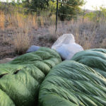
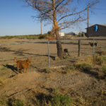
SUMMARY:  We spetn the morning in Lordsburg, first having breakfast with all the other hikers–hey, we “hikertrash” are a great bunch!  After checkout, we walked down to El Charro again–had lunch, and then the adventure began.  Somehow we missed the turnoff for the CDT–when we realized that, we said, “No problem–Plan B–we’ll just go the Ley alternate.”  Afer 6 1/2 miles, we reached it (a pipeline road) only to discover a large locked gate and very emphatic “no trespassing” signs.  So–plan C–we walked on, found a gate we could climb over and headed out on a cros-country bushwhack adventure, which included seeing some javelinas!  Tonight we are close to being reunited with the CDT!

DETAILS:  We slept in till 7:00–had to get up then, because we were so hungry and so thirsty.  I found myself craving orange juice especially.  We did drink a lot yesterday, but I guess it wasn’t enough.  In the breakfast room at the EconoLodge, we found a lot of other CDT “hiker trash” who had also finished the first stretch of trail from Crazy Cook.  Some of them have taken a zero or two to recover, but our plan is to head out later on today.

Fixit spent the rest of the morning wrassling with our cellphone (we have never had one before, and it’s sort of a foreign entity for us) trying to contact Gossamer Gear to order a polycryo groundcloth.  Somehow, when we were loading our packs back at home, the ground cloth was forgotten.  We’ve managed without it so far, but really need to get something.  No luck for Fixit, though–he could not figure out how to place an order on the cell phone.  He was very frustrated.

While Fixit wrassled with the phone, I took all our filthy dirty clothes downstairs and handed them over to the ladies at the EconoLodge desk.  For a small fee, they will wash your stuff for you, and I was so tired that I was quite glad to let them do that chore!  They did a fabulous job.  After a couple of hours, they gave me a call and handed over our clothes, beautifully clean and folded !

By the time the 11:00 checkout arrived,  Fixit and I both felt way better, and ready to start.  So off we went, stopping along the way at a Dollar store to buy a plastic tablecloth to use for a groundcloth.  Then we crossed the railroad tracks, went to El Charro again, had lunch, and then the real adventure began again.

The first leg of the trail out of Lordsburg was supposed to be a couple of miles along the road, then a right turn into a cow pasture. It was very windy and there were a lot of cars roaring by along the road.  We watched carefully, but could not see the turnoff anywhere.  Finally we said, “Oh well, we’ll just take the Ley map purple route alternate.”   After 6 1/2 more miles, we reached it (a pipeline road) only to discover a large locked gate and very emphatic “no unauthorized people allowed” sign.

While we were standing there thinking “Oh great–now what?”  a very kind Native American guy in a pickup truck stopped to see if we needed help.  We asked him if there was another route we could use along the base of the mountains up ahead.  He said, “Yes.”  What we didn’t know, though, was that he meant yes, there was a road all right, but it was on the OTHER side of the mountains.  So we walked on another 9 miles to the mountain base, only to discover NO road at all.

Now what?  The only alternative was to just go for it and bushwhack.  So we found a pole gate we could climb over (making sure there weren’t any “no trespassing” signs around) and headed off along the mountains, figuring to eventually reconnect with the CDT.  The countryside was laced with gullies and hills and had plenty of barbed wire fences for us to crawl under.  (Good thing we had lots of practice doing that while hiking from Crazy Cook to Lordsburg!)  Cows were everywhere–some stared at us and some ran away.  We never even stopped to eat supper, but only took a 15 minute snack break, during which a couple of javelinas (wild desert pigs) came by and stopped to look us over.   I had never seen one before, so that was pretty exciting!  And I have to admit that despite having to deal with gullies and barbed wire, the views everywhere we looked were just spectacular.

Fixit does not mind bushwhacking, and he does not mind it when we don’t exactly know where we are.  I much prefer being on a trail, and knowing where I am.  But we actually aren’t really lost–just not on the trail right now, and if we keep on this course, we WILL intersect the CDT.  And it sure is nice to be off the highway.  Roadwalking is not fun.

Tonight we are just short of Gold Canyon, as best we can figure it from our maps, and that means we are only about 2 miles from the CDT.  We are really low on water, but if we are where we think we are, it’s only 4 miles to a windmill with a well.  It will be our first time getting water from a source that’s not a cache.  Our prayer tonight is for eyes and wisdom to find the trail tomorrow!

Tuesday, May 3 Pyramid Peak Day; LORDSBURG

Tuesday, May 3rd, 2016

may-3-11
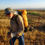
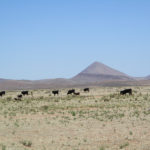
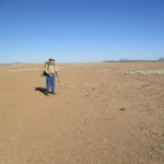
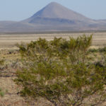
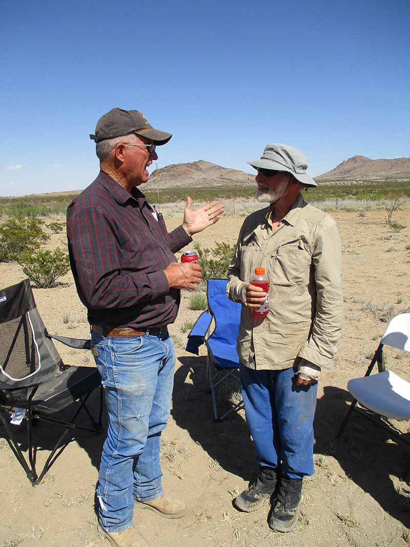
SUMMARY:  We started hiking at 6:20 am today and finished at 6:45 pm in Lordsburg.  Lots of miles!  Basically we spent the morning in very bare desert on the approach to Pyramid Peak, and the afternoon we spent circling around its base.  To our amazement, there was trail magic at the lst water cache, and we got to meet the rancher who owns all the cow critters around the Peak.  After that, it was one final walk, and we were back in Lordsburg.

DETAILS: What a day!  By 6:20 am, we’d eaten breakfast and packed up for the 1/2 mile walk to the next water cache, where we loaded up on water for 18 miles of desert hiking.

Today was pretty much dominated by Pyramid Peak, a dramatic cone-shaped mountain near Lordsburg.  In the early morning, it was on the horizon, and all day long we were getting closer, until in the afternoon we were circling around its base.

Today we also got lots of practice in crawling under barbed wire fences, and were very grateful whenever there was some sort of gate available.  The gates were quite varied–but mostly the good ‘ol loop of baling wire over a post .  Cows were everywhere, many of them a Hereford/Angus cross, with black bodies and white faces.  Lots of cute calves were scampering about–a lively bunch.  (We found out later that there was plenty of rain this winter and plenty of grass, so as one rancher put it, “The calves are just blooming this year.”)

There were some cow skeletons and remains, though, so I guess not all the cows have had a good year.

On the approach to Pyramid Peak, we were in very BARE desert, with hardly any plants of any kind.  But there were quite a few prairie dog towns, some quite impressive.  At one point in the morning’s hike, though, we were totally baffled as to where the trail went.  We finally “fired up” the Guthook app (it’s a big hassle to get to it, and our iphone battery won’t let us do this more than about 8 times before there’s no battery left, so we are very cautious about going to Guthook).  Yay for Guthook!  It pointed the way, we discovered that the trail went through a cow corral, and we needed to crawl under another barbed wire fence to continue.

We got to eat lunch in the shade of a lone tree–the only one for miles–it was wonderful to be in the shade, with  the temperatures  in the upper 80’s.  When we took our packs off, we discovered that the backs of our shirts are not just wet with sweat, they are also ringed with salt deposits.  Yikes!  We made sure to drink some electrolytes to make up for that.  After lunch, I indulged in a few minutes of admiring the brave wildflowers that were growing near the tree. ( I need my “flower fix”!)

As we got closer to Pyramid Peak, the trail got very rocky, and involved some scrambling.  We were very glad when we reached the dirt road that would take us around the Peak–much easier on the feet!  By 4:00, we’d reached the last water cache before Lordsburg, and to our amazement, there was trail magic!  Gatorade!   Apple pie!  All provided by a trail angel from Ohio appropriately known as “Apple Pie”.  Stummy and Masshole were there, and also the rancher who owns all the cows and solar cow water tanks around Pyramid Peak. We had a great time talking to him and Apple Pie.  “Do you just hang out here, waiting for hikers?” we asked.  And it turned out that no, Apple Pie has some kind of sensing device up the trail, and when a hiker goes by, it lets him know, and he goes out to the cache to meet that hiker.  The rancher sometimes comes too, just to hang out.  He said his family has been ranching here for generations.  “The 1920’s were pretty tough, though,”  he said.  “My grandpa had to go to work punching cows for somebody else, and my grandma took a job being a teacher for the kids in one of the big silver mines up by Pyramid Peak.”  Wow.  That’s determination!  We mentioned to him how frustrating the CDT “trail” had been, with so many marker posts fallen over and lying on the ground.  “Yeah, I figured that would happen,” he said.  “Those CDT people hired a bunch of college kids one summer to come out and put up posts.  The kids didn’t know what they were doing–should of asked the ranchers like me.  The wind blows so hard here that if you don’t dig a really seriously deep hole to put your post into, it’s gonna blow over next time there’s a big wind.  And it’s no joke trying to dig holes here–the ground is really hard and rocky.  Those CDT college kids dug little holes and stuck in the posts and that was it.  No wonder they blew over.”  Sounds like the CDT crew kids needed a bit more determination!

But there were still 6 more miles to walk in order to reach Lordsburg, so we had to exercise some determination and get going again.  So we shouldered our packs and headed into town, even though  we were tired from “pushing the miles” all day, and a little bit footsore  from the rocky trail.  Boy are we glad for our La Sportiva shoes!  The shoes we used to wear would never have coped with trail that rough.

We made it back to the EconoLodge  by 6:45, and met Zippy Morocco in the lobby!  He was actually just leaving, after taking a break to rest up a bit.  We headed for our room and SHOWERS!  Oh man, did it feel good to be clean again.  Between sweating and crawling in the dirt under fences, we were pretty gross.  Then I went in search of something for dinner, and the only thing I could find were the last 2 hot dogs from the Valero gas station next door to the motel, plus some ice cream.  No problem–we were happy to eat anything we could get.  Then we collapsed.  We’ll get back on the trail tomorrow!

Monday, May 2 This is one epic trail!

Monday, May 2nd, 2016

SUMMARY:  A 2013 thruhiker said, “Epic!  Everything about the CDT is epic!”  I would agree.  So far it has been WAY harder than the PCT, but walking through the desert today and looking at the epic scenery–vast and sort of alien but also beautiful–wow!  And it was  way easier today to find our way, so we made good miles.  Having cooler weather till late afternoon helped, too.  We made a cowboy camp again, and a pack of coyotes went by in the night.

DETAILS:  Brrrrr, it was COLD this morning, and we weren’t 100% sure where the trail was, so we decided to eat breakfast before we started hiking.

It didn’t take too long, though, before we were sure of our route again, and from that point on, it was mostly easy to find and follow the trail.  There were only four times when we were perplexed and wrassling with our maps trying to figure out “Which way now?”  In all four cases, we did figure it out and didn’t have to turn on the Guthook app.

It is amazing to be out here, walking through miles of total desert, yet safe and secure, with our packs full of water and food.  Most of the day there was no “trail”, and we were just following a line of posts, which turned out to be quite unpredictable–some were ridiculously easy to spot and some very difficult.  There were also a number of PUDs (Pointless Ups & Downs) over very rough rocky hills.  The one “plus” with that was looking at the geology–there are a lot of obviously volcanic features here in the desert.  Sometimes we were walking on pumice, and sometimes on sand.

A 2013 thruhiker said, “Epic! Everything about the CDT is epic!” I would agree. So far it has been way harder than the PCT, but walking through the desert today and looking at the epic scenery—vast and sort of alien, but also beautiful, was actually enjoyable.

We finally crossed the actual Continental Divide for the first time and nearby was a little oasis of green grass and shady trees with an old tire as a water trough—it looked like a fishpond with no fish.  We stopped for lunch at the bear box water cache, and I was glad to be able to set up our little Esbit stove out of the wind.  It’s been hard to do our usual hot lunch, because around 11:00 am, the wind begins to blow and by noon, it’s really blowing.  The Esbit setup does not work well in the wind.  While we were there, we met Juan (who keeps the caches stocked with water) and he told us that the guy who got lost on his first day hiking the CDT is not the only hiker who had to be rescued after the first day—a couple of years ago there was an older man who got confused and wandered off the trail.  When he didn’t show up in Lordsburg, a search began, and they found him, lost and dehydrated and hungry, but otherwise OK.  Fixit and I were amazed, because we had been able to follow the route just fine on that first day.

The afternoon was quite warm, and it included our first “squiggle” under a barbed wire fence (the first of many such squiggles!)  At the end of the day, we just cowboy camped again, and were still settling in, when along came Zippy Morocco, eating his dinner as he hiked.  Turns out he started only yesterday!!  But he is very fast, and he told us he skipped all the gullies and just walked along the road and took shortcuts wherever possible.  We thought, “Well, it took awhile, but we are glad we toughed it out.”  Zippy took off–we won’t see him again, I am sure.

Stummy and Masshole are now ahead of us, too.  They are determined to reach Lordsburg by tomorrow night.  I am not sure if we will make it that far.  If this were the PCT, and regular trail, no problem–but constantly hunting for posts and spending a lot of time trying to figure things out…that’s rough.  I still can’t “embrace the brutality.”  All I can do is take a deep breath and keep going.

But it is a beautiful, quiet evening in the desert.  Very quiet.  Here in the bootheel of New Mexico, there are no airplanes going over, no roads full of cars, no trains going by.  Just a vast sky with a zillion stars.  A pack of coyotes went by, talking to each other in their weird voices, but other than that it was just quiet.