Saturday, May 21 The Generous Gentlefolk of Grants
Saturday, May 21st, 2016SUMMARY: We started walking early this morning, all clean, rested and much more relaxed. Our goal was the CDT trailhead on Lobo Canyon Road. But before we reached it, four different Grants people stopped with offers of water, food, and even a ride to the trailhead. Very generous! One lady even told us that this Monday the city fathers of Grants will be having a meeting to discuss ways Grants could be even more hiker-friendly. They like hikers! Meanwhile, back on trail, a spring we’d counted on for water was dry, but we found another one. We are camped in the woods tonight.
 DETAILS: We decided to do the “run for your life dash” across the RR/freeway overpass first thing, early this morning, so by 6:00 am we were tucking our last bits of gear into the packs and getting ready to start. We felt much better than when we first got here–now we are well rested, clean and relaxed.
We made the dash across the overpass just fine, running as fast as we could, and began walking along what used to be Route 66, “The Mother Road” as it headed into downtown Grants. So sad, though. Many businesses are closed, and things really look run down. The locals had told us that there used to be over 50,000 people living here in the 1990’s, but now it’s way less. We ended up getting breakfast (burritos & coffee) at the only place we could find that was open–“Lotaburger”–a hamburger joint which was started in 1952.
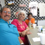
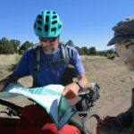
Then we followed Yogi’s map through the residential neighborhoods of Grants, till we reached Lobo Canyon Road. At the intersection, there was a grocery store, and I decided on one last trip to a “town” bathroom before we started the roadwalk to the CDT trailhead. After I came out, and we were walking through the parking lot, a sweet older lady pulled up alongside us and got out of her car to talk. She told us that the city of Grants has woken up to the fact that they are a very important “way station” on the CDT, and that this Monday night, the city fathers are having a meeting to discuss how they could make Grants more hiker-friendly. They are already known as a “Route 66 City”, and now they’d also like to be known as a “CDT Gateway” city as well. She told us some of the ideas they are considering, like free bus passes for hikers, so they don’t have to hitch hike. We told her it would be a big help if the city could appeal to the BLM to allow water caches north of town, for the hikers to use. But she looked very sad at that, and said, “The BLM thinks they own everything. They are closing roads up in the mountains here, that people have been using for years. They are even closing off whole areas and saying nobody is allow to go in at all, not even hikers. They are arrogant and rude and awful. I don’t think there is much we can do with them, but I guess we could at least TRY.” Then she asked if we needed water or food or anything! We told her we were just fine, and appreciated her kindness.
The walk up Lobo Canyon Road had several highlights. After we’d reached the edge of town, we got to a sort of informal shooting range right by the road. It was basically a bunch of concrete barricades (the kind you see in highway construction zones) at a turnout, with various targets on the hillside across the way. Then we came to a prison, where we could see the prisoners in their red & white clothes behind a LOT of razor wire. Sad. Fixit goes to a prison back home and a couple of times a month he goes in with the Gideons (the guys who put Bibles in hotel rooms) and they go cell to cell to see if any prisoners want a Bible, and to talk to them. Prisoners have lots of time to read, and the Bibles have a very good effect. We hoped the prisoners we were seeing had someone visiting them, like Fixit does at our local prison.
While we were walking along the road, three more folks from Grants stopped to offer us water and rides to the trailhead. So generous! We were grateful, but had to decline. “We’re WALKING from Mexico to Canada, and we want to leave a trail of footprints, not tire tracks!”
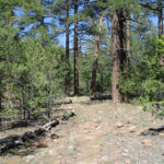
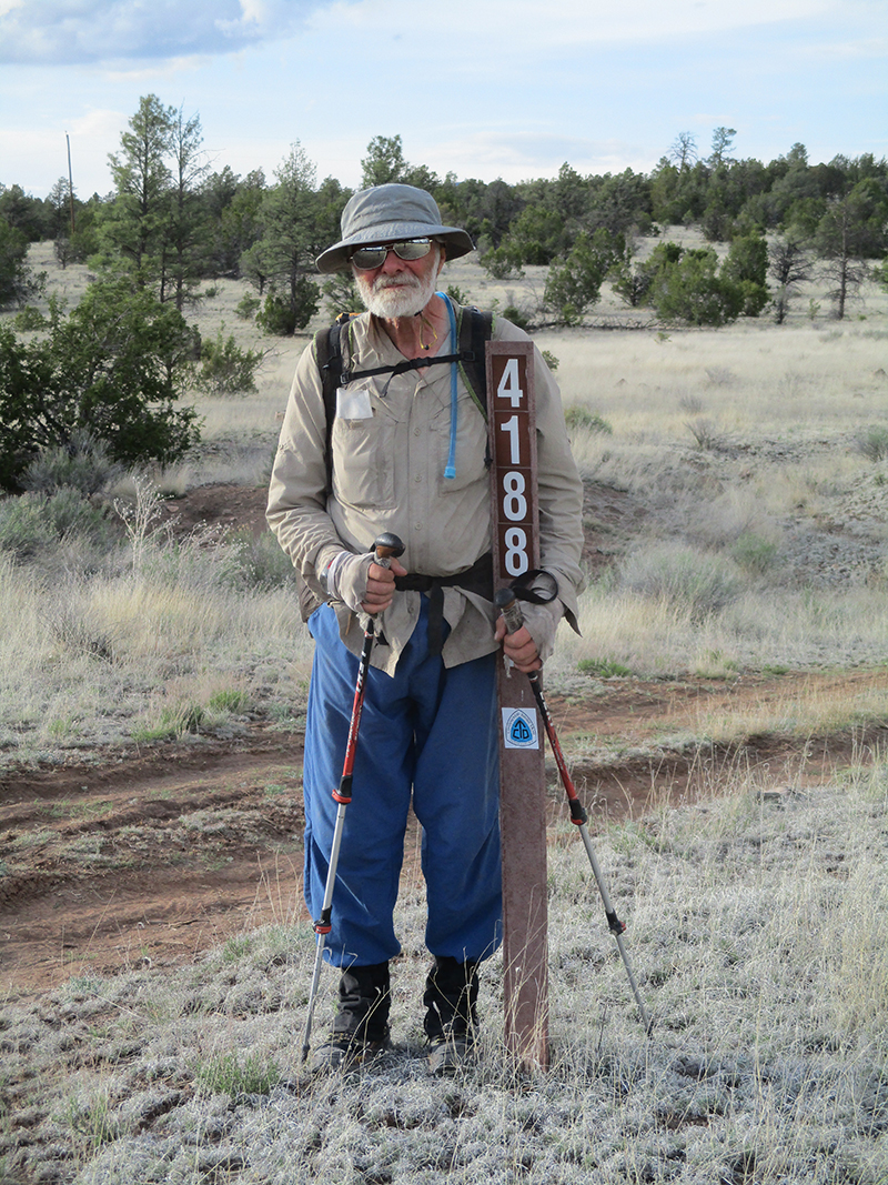
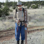
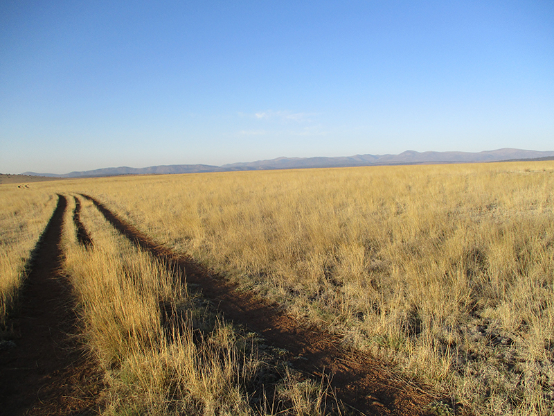
Finally we reached the CDT parking lot, where there was a whole collection of the usual signs about trail rules, critters, etc. We look at all that stuff and just shake our heads…use ordinary common sense, and you will be fine. And all those signs could easily put off newbie hikers who are not confident yet in what they’re doing. We have friends who never hike, because they see all those signs at trailheads and get scared. But wow, it felt so good to be back on TRAIL! We had so many miles of roadwalking INTO Grants and then OUT as well.
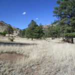
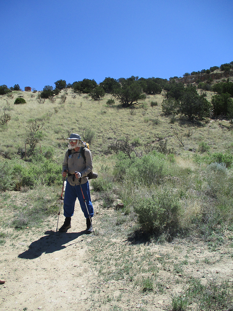
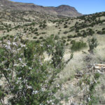
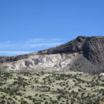
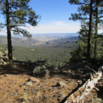
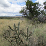
The trail began with a stiff climb up to the top of the mesa, where once you get there, it’s totally flat. We ate lunch in the shade of some small trees, right near the edge, with a great view. Continuing on, the only hazard along the way (other than the usual rocks) was what we call “anklebiters”–short little cacti lurking right by the trail, waiting to stab you in the ankle with their spines if you’re not careful. The anklebiters were hiding in the grass and plants on both sides of the trail. Sometimes it was like running a gauntlet to get past them.
On the mountainsides across the way from the mesa we were on, we could see mines that looked like they were actually in use. We wondered what they were mining? There used to be uranium mines around here…are they still working some of them?
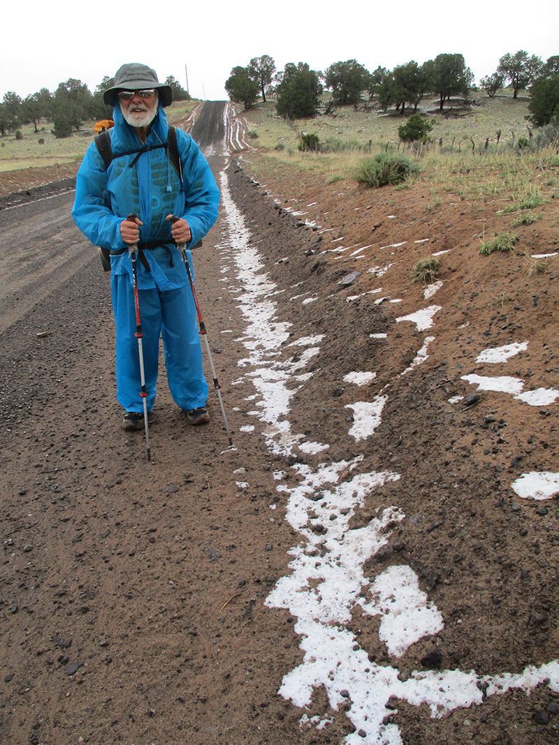
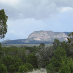
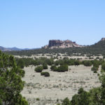
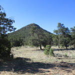
Our afternoon’s walk took us closer and closer to Mt. Taylor, till we reached the road that takes you to the top. We’d already decided, though, to stick with the official CDT, which goes AROUND Mt. Taylor instead of up it. So we stayed with the trail, looking forward to replenishing our water supply at a nice piped spring with a metal tank not too far away from the trail route. When we reached the spring, though, we met with a HUGE disappointment. There was the pipe all right, and the metal tank, but somebody had opened the valve at the bottom of the tank to let all the water drain out. So no water. None. We growled and snarled and said, “I bet the BLM did this!”
But there was nothing else to do except start rationing our water we had left, to make it last 11 miles, till the next water possibility. Fortunately, we had already started hydrating our dinner, so when we stopped late in the day to eat, we did have a good meal. And even better, it was one of the freezedried dinners our daughter had given to us as a Christmas present, so that made it even more special. I needed that encouragement–I was very concerned about our water situation.
We walked on, mostly in dry forest (but with one section where the trail went along the edge of a cliff, and there were awesome views!) and at 7:00 we started looking for a flat place to camp. The trail took us down into a small canyon, and aha! A flat place at the bottom! That’s when we saw the little sign. It said, “Spring”, with an arrow pointing down the canyon to the left. It didn’t say how far, but we decided, “Fixit will go see if he can find the spring, while I (3rd Monty) will look for a good campsite.” So Fixit headed off into the woods, while I started looking around for the best place to camp. In the process of looking, I walked just a bit farther up the trail and discovered that it crossed a dirt road, and near the road in a little hollow, nestled in a bedraggled plastic bag, I found a quart bottle of WATER! It had never been opened. I figured it might be all that was left of one of the Mumm’s water caches. I was really thirsty, so I carefully drank about 1/3rd of it, figuring that Fixit needed more than I did, with scrambling down and up the canyon. When I got back into the canyon, I didn’t have to wait too long before Fixit got back, very happy, because he had found the spring. No more water worries! He drank the 2/3 quart I’d found, then took all our water containers and headed back down, while I set up our camp in the best flat spot I could find. Whew!
Now we are very comfortably cowboy camped, watching a gorgeous sunset overhead, and enjoying the quiet of the woods with just a breath of wind. And we have plenty of water to last us awhile.
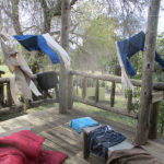
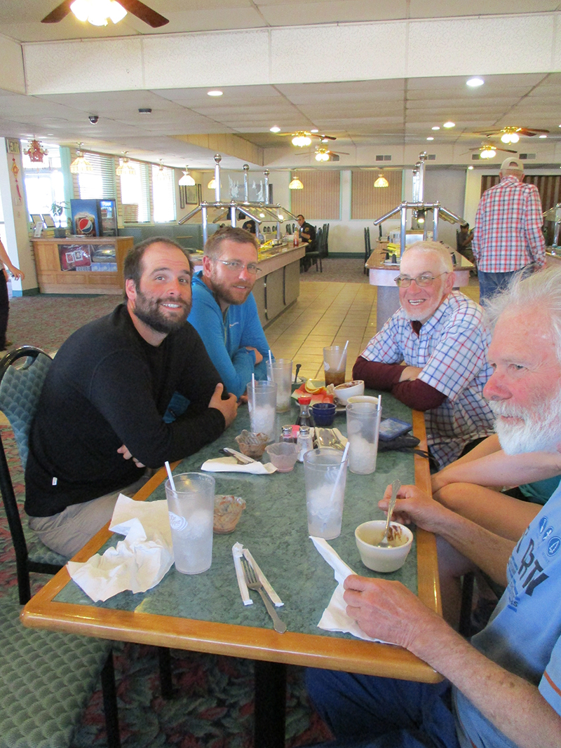 SUMMARY: We had a great zero day today, and when we went for lunch to the Chinese buffet we joined a tableful of other thruhikers. Of course they asked, “When did you start?” and when we told them “April 30”, they rolled their eyes and said, “What did you do–RUN here??” Well, we didn’t run, but we did keep walking a lot. So what did our zero look like? Sleep in, eat big breakfast, do laundry, pick up resupply box, lunch at the buffet, do the mending, load food bags, take a nap, finish the journal, eat dinner, go to bed.
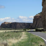
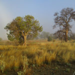
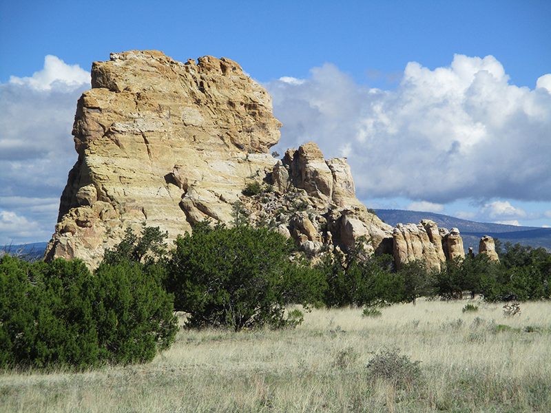 SUMMARY: We woke up to a thick ground fog that made everything (including us and our gear) soaking wet and fringed with ice. But oh, it was beautiful! We packed up and walked out into what looked like a misty watercolor painting. Gradually the fog cleared, and we went through “The Narrows” where menacing black lava reaches the foot of dramatic sandstone cliffs, including the famous “Ventana Arch.” Many hikers do a trail that goes across the lava, but we skipped that (lava – very sore feet) and roadwalked into Grants, continually amazed at the rock formations. We had some trail magic, too, from a tourist family and from a ranger, and reached the Grants Motel 6, ate dinner and collapsed. Zero tomorrow!
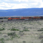
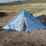
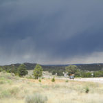
 SUMMARY: We sure are grateful for our nice pine-needly campsite last night. It rained and rained, so all the ground around us became a sea of mud…except where we were. We spent all morning slipping and sliding along a very muddy road, with rain so cold that it actually snowed on us for awhile. But by lunch time, the sun began peeking through, and we reached “El Malpais” lava fields, which meant walking a paved road. Goodbye, mud! But yikes! Ahead of us lay some of the blackest clouds I have ever seen, with thunder rumbling. But as we walked along, the blackness gradually disappeared and tonight our little blue tent is perched by Hwy 117 on a nice gravel area out of the mud (which is everywhere!)
 SUMMARY: The weather was brewing for nasty right from early morning–dark clouds were moving in. But we had a wonderful breakfast at the Pie-O-Neer Cafe and when we returned to the Toaster House, the wood stove was crackling and purring, hikers and bikers were organizing their stuff, and all was cozy and cheerful. Once we were ready, we headed back to the Pie-O-Neer for lunch, and there were so blessed to meet a wonderful Christian family and have a great time with them. Manuel, the dad, prayed for us, and as it turned out, we sure needed that–we ended up walking in steady rain most of the afternoon, with thunder and lightning nearby. Then we found ourselves in SNOW, on top of MUD. Tonight our tent is tucked under a tree, while the rain continues.
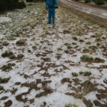
 DETAILS: We were up ‘n at’em early on a cold morning, thinking, “Get to Hwy 60, go to Pie Town!” We still had no idea where we actually were, but took every dirt road that went north or nor’east. Hours went by–no sign of the highway. Our water was running low. Then a gift from God–“Talus”, a bikerider, came pedalling along and told us, “Only 9 1/2 miles, and you’ll be in Pie Town, and by the way, there’s a water cache in 3 miles.” Wow! Tired, sore feet, too bad–we turned on the afterburners and made it in by 2 pm, dumped our packs at the “Toaster House” hostel, and got a good meal, showers, laundry and lots of hang-out time with other hikers, and locals, too, sharing trail tales.
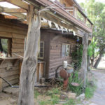
 SUMMARY: One thing about the CDT–to get from Point A to Point B, you often have several choices of which way to go, and those choices can overlap. Today we began on the “Ley Red Route” from Hwy 12 to Pie Town, but finished the day on a different route–the “Bear Survey”. This change was accidental–the two routes came together for awhile, and we went with “Bear” even though we didn’t mean to. This happened way up high on Mangas Mountain, with fantastic views for miles around, and lots of trees (aspens, too!) and wildflowers. Tonight we are cowboy camping down at the base of Chavez Canyon. Pie Town tomorrow!!
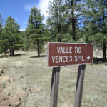
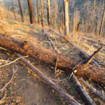
 SUMMARY: We had a glorious time this morning, hiking high up on the Divide, with awesome views in all directions. For a time it was a forest fire zone, which meant a lot of climbing over fallen trees; that’s normal. But around 11:00, with no warning, the really nice trail (well-marked with CDT signs) simply vanished. We were low on water and not sure exactly where we were, because the battery ran out on the cell phone. So we spent the whole rest of the day bushwhacking. It was very tough and we were severely rationing our water. Long story short, we finally popped out of the woods, spotted a big house, got water from their garden hose (nobody was home) and found our way back to the CDT by 6:30 pm. Now it’s raining, but we got into our tent in time to stay dry.
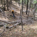
 SUMMARY: Our little blue tent stood bravely last night in the midst of miles of beautiful golden prairie with distant dark hills. Coyotes howled around us, but we slept well and warm. This morning while we were packing up our little “tent on the prairie”, an elk came and stood on a nearby ridge to watch us. Amazing! Elk are usually very shy. We spent the rest of the day doing miles of roadwalks through prairie and forest. Great views! Dramatic clouds today. Tonight we are back on trail, camped on a rocky ridge. So now I guess we’re the “Little Tent on Rocky Ridge.”
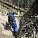
 SUMMARY: We tiptoed past the horse packer camp at 6:00 am, but the dogs spotted us and set up a ruckus! Our goal was to hike down to the Middle Fork of the Gila River, then take an alternate route to Snow Lake. But we decided to do one last dance with the Gila–it really is pretty there, and it was only 7 miles, so it was back to lots of river crossings, hunting for trail, crossing debris, and admiring the dramatic beauty of the canyon. We reached Snow Lake, hung out for awhile with “Hippy Longstocking”, and headed out on the next leg of our adventure–a crosscountry (no official trail) run up a canyon and into the hills beyond. But we missed a turn somehow and are camped tonight somewhere…not sure exactly. Hopefully we’ll relocate the trail tomorrow!