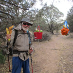
Friday, May 6 The “real” wrong trail
Friday, May 6th, 2016
 SUMMARY: Today began with beauty and ended with frustration. We had a wonderful time doing “peak bagging” this morning in the clear, fresh mountain air. Views, too! Wow, we were up high! But just before 10 am, things went wrong. We reached Tyrone Road, where the map said we were supposed to turn right and walk into Silver City. But there was a big CDT sign that said to keep going. We were puzzled, but we did follow the sign. Miles and miles later, we finally said “phooey” and took the next road we came to, down the hill, getting water and directions from various people, met another CDT hiker in the same predicament, and tonight we are camped by the highway. Silver City tomorrow!
DETAILS: Today began with beauty, but ended with frustration. Last night the rain sprinkles included a bit of lightning, but the early morning light showed a clearing sky and the air was clean, cold, mountain-y air, scented with pine, the kind where you want to take deep breaths and it’s almost like drinking pure, cold water.
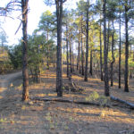
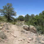
We finished the climb up to the top of Jack’s Peak, and thoroughly enjoyed being in a forest again, with lots of trees. At the top, we discovered the foundations of what I guess were once summer cabins. One of them still had a magnificent fireplace more or less intact. Cows were everywhere, and we went through countless gates of all sorts, each one with a bright yellow sign that said, “Please! Close the gate!” Of course we did. (We found out later that the ranchers really appreciate us hikers, because we DO close gates, unlike ATV people who often forget!)
The trail then took us down, across a ridge, and over to Burro Peak. Whenever there was a break in the forest, we could see WAY down below–wow, we were up high!
When we reached Mudhole Spring, we were really glad for the water cache yesterday. The spring is well-named. Yuck! Glad we didn’t have to get water here.
Not too long after Mudhole Spring, at around 10:00 am, we arrived at what we thought (and as it turned out later, we were correct!) was Tyrone Road. According to our map, we should turn right onto the road, then follow it down to the highway and walk into Silver City sometime this afternoon. But to our great puzzlement, there was a very large CDT sign indicating that we should cross the road and keep on following the trail. Thinking that we’d miscalculated how far it was from the spring to the road, we followed the CDT sign and kept going, expecting that we’d soon find Tyrone Road.
But the trail kept going and going till it reached another road, where ANOTHER large CDT sign indicated that we should cross that road and continue on again. By now we were very puzzled and seriously wondering what was going on. Reluctantly, we kept on following the trail, but finally we just stopped, very disheartened. “Something is really wrong here,” I said to Fixit.
At that point we began to discover that Fixit and I have very different viewpoints about what to do when the trail doesn’t make sense. I tend to look at terrain, compare it to the map, make an educated guess as to where we are, and head out with no further ado. Fixit is much more methodical. He took off his pack, sat down with the maps and spent a long time trying to figure out where we were and what to do. I had to finally just take off my pack, too and try to wait patiently. (Well…not very patiently, I’m afraid. I didn’t do a very good job of it!) In the end, our joint conclusion was to keep on till we reached the next road, then turn right and head into some sort of civilization, then figure out where to go from there. When we were thruhiking the PCT in 2005 and 2010, the trail was mostly very well marked, and we didn’t have to wonder where to go, so we were never in this situation before.
What we didn’t know was that the CDT trail we were following was the official trail, all right, but it wasn’t FINISHED. Other hikers who didn’t give up and turn off like we did, faithfully followed it only to discover that it dropped them off in the middle of nowhere, and they had to hike through miles of soft sand and other difficulties before finally reaching Silver City. We heard that Zippy Morocco, who was ahead of us, and likes to hike fast, was very growly and upset by the experience.
We didn’t have to go much farther before we found a road and headed to the right. At this point we were seriously low on water again, and hoping to find some way to get more. Hooray, a guy in a pickup truck who was out collecting firewood with his two very serious-looking (make that SCARY looking) dogs came along, and kindly gave us some water. The dogs were very quiet and polite as we talked to him, but they were the kind you would not want to mess with. I did not even remotely attempt to pet them!
Later on, we were still walking down the road, when a lady came along with a horse trailer, and stopped to see if we needed anything. She was very cheerful and friendly and told us she’d been able to help several CDT hikers. We got more water from her, and that was great, because now we could drink as much as we wanted–no more worries about getting dehydrated.
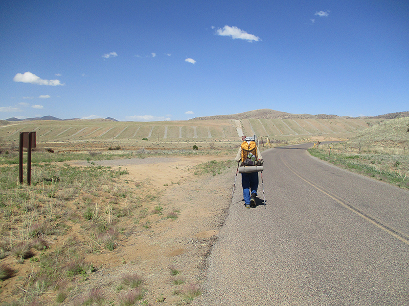
So that afternoon, instead of walking into Silver City as we’d thought we’d be doing, we were hiking along various back roads, trying to reach the highway to Silver City. We passed mining areas, and also looked in awe at places where flash floods apparently come roaring across the roads. At each of these places, there were signs warning, “Do not cross if there is flooding.” Judging by the debris fields, the signs are not kidding. It was obvious that trying to cross during a flood would mean being swept away. Very scary. We were glad it was not raining! Several kind drivers who came along offered us a ride; we had to explain to them what we were doing and politely decline.
Around 5:30, we finally reached the highway that would take us to Silver City. The wind was blowing fiercely, as usual, but hooray, there was a large mailbox setup at the junction, and we were able to hunker down behind it out of the wind and eat some supper. While we were eating, along the highway came what was obviously a CDT hiker–we hailed her and she came over to hang out with us. Her trail name is Moxie, and she had faithfully followed the official CDT till it dropped her off in the middle of nowhere. She finally found the highway and was headed for town. We all growled about the CDTA not putting up some kind of sign to warn hikers about where to go, and then walked on together. It was 12 more miles to Silver City.
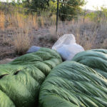
At 7:00 pm, Fixit and I decided to stop and camp. We managed to find a small flat place, squeezed between some trees and a barbed wire fence, and more or less out of sight of the highway. There was no way to set up our tent, but we figured the weather looked OK for a cowboy camp. Moxie kept on going. She said, “I will walk all the way to Silver City and not TRY to hitch hike, but if somebody stops and offers me a ride, I will take it.” Hope she made it OK–we did not see her again. So we hunkered down and tried to sleep with trucks going by, while thinking, “Oh great! We’re going to be a day late getting in to town.”