July 2, Sat.–23.9 miles Oregon F
Saturday, July 2nd, 2005
Sat. July 2 PCT miles today: 23.9 Total so far: 897.4 Oregon Section F
We woke up to a chilly morning and treetop level clouds. After less than half an hour of hiking, we realized we were NOT on the alternate route we’d thought we were on, but on the OTHER alternate route, which was longer. “Oh well, we’ll get back to the PCT eventually,” we said. And it turned out that this particular alternate has really great views, including some “Yosemite-looking” dramatic rock formations. Finally it dropped down into a very lush, green forest, with lots of wildflowers and even wild rhododendrons in bloom! (Now I KNOW I’m in Oregon, when I see those “rhodies”!)

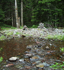
Niiiice--steppingstones across Hunt's Creek
We reached Hunt’s Creek, which had a well-marked crossing (large rock cairns) and choices of steppingstones. And down in the creek’s valley, there were some REALLY HUGE Douglas fir.
We finally made it to very pretty Pamelia Lake, where we took a short rest. I was worried, though, about Russell Creek, 4 1/2 miles away. The guidebook warned to cross it before 11 am, because in the afternoon, the snowmelt volume off the glaciers above becomes considerable. Several people have died trying to cross Russell–knocked down and swept away into the gorge just below the trail. We had a long, steep climb ahead of us to get there.
So we huffed and puffed up the hill and reached the crossing right at 11:05. It didn’t look too bad; only a little bit “roary.” Bill does not like to get his feet wet, so he went quite a ways upstream looking for a “dry” crossing, but I just wanted to get across, so I looked for a place that was slightly less “roary” and waded carefully across. Whew! (And thankyou, Lord!) By the time Bill got across and got back to where I was, I’d already wrung out my socks and was letting them dry on a rock.

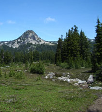
Creek near Jefferson Park
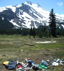
On we went, still climbing (and meeting many weekend backpackers) up to spectacularly beautiful “Jefferson Park.” It’s an open, lush, green, wildflowered, well-watered valley just below Mt. Jefferson. I heard one hiker saying, “Wow, I feel like I just stepped into “The Sound of Music!” And that says it perfectly. (Note: when Bill and I finished the PCT, and people asked us, “What was the best part?” we always said, “The most beautiful part of all was Jefferson Park.” And it is true! This place looks like paradise on earth.)

Our noontime gear and spectacular Mt. Jeff
Jefferson Park was the perfect place to stop and cook dinner and just soak up the beauty. So we did. We lingered as long as we dared before beginning the climb up to the shoulder of Mt. Jefferson.
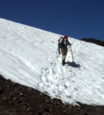
A backpacker we met along the way warned of megasnow beyond the Park, and he was right. But it wasn’t hard to see where the trail went, with so many footprints to follow, and we climbed steadily till we reached the top. Wow! To the south lay a still-frozen lake, and of course towering Mt. Jefferson with the green Park below. To the north, we got our first view of Mt. Hood on the horizon.

Bill climbs the shoulder of Mt. Jeff
The “trail” down from the ridge shoulder was not a trail at all. There is so much snow that hikers must simply head down, following a “line” of rockpiles, and thankfully, we also had plenty of footprints to follow, also. I took a picture looking back up, once we’d made it through the worst part.
Finally we were below the snow at last, on a trail that went up and down, and was often very rough and rocky. At sunset, we took a very short detour off the PCT to camp by pretty Ring Lake. If the SOBO’s are right, this means we shouldn’t have any more snow problems after this! And seeing Mt. Hood was really encouraging. We are within sight of the end of the PCT in Oregon!

