July 1, Fri.–25 miles–Oregon F
Friday, July 1st, 2005
Fri. July 1 Miles today: 25 Total so far: 873.5 Oregon Section F
A bright sunny morning meant lots of mosquitoes looking for their breakfast–so when we stopped for OUR breakfast, we had to eat it under headnets in the PCT trailhead parking on Highway 20. Granola-munching done, we headed up on the climb to our first goal–Three-fingered Jack mountain.
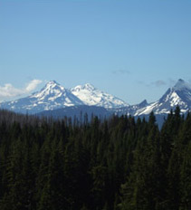
So THAT's what the Sisters look like!
After awhile we were high enough to look back and see the Three Sisters where we had so much grief a few days ago. Then we began to run into snow again, but it was melting fast–often turning the trail into a creek.
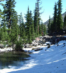
"Manageable" snow
The snow got deeper and more extensive, but we always managed to find our way. Meanwhile, we had endlessly fascinating views of Three-Fingered Jack, and when we “came around the corner” to the north side–surprise!
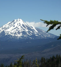
There it is--Mt. Jefferson!
There was Mt. Jefferson, our NEXT goal! However, most of our attention went to admiring the dramatic north side of Three-Fingered Jack. Wow!
The PCT took us down into “forest” again (or rather, what used to be a forest–it was devastated by a huge fire in 2003). We were pleased to see that there were a few signs of regrowth. Bill was looking at the enormous size of many of the burned trees and annoyed that no effort was being made to replant the trees. We saw no seedling trees at all–only wildflowers and the beginnings of a few bushes.
Shortly after we passed pretty Rockpile Lake, we met our first real, live, SOBO’s! (That’s trail lingo for “SOuthBOund thru-hikers”. ) They told us the snow was “pretty bad” at Mt. Jefferson, but after that it was OK. After a good time chatting, we wished each other “Happy Trails” and hiked on.
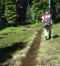
No sense walking the trail when it's a creek
We passed South Cinder Cone. It was a very warm day, so the trail frequently was just a “linear lake” of snowmelt. But as we drew closer to Mt. Jefferson, the snow got steadily worse. Pretty soon we were losing the trail and having to hunt for it. (Not again!)
But by suppertime, we managed to find the trail and ate with a great view of Mt. Jefferson for “ambiance”. Hiking on, we lost the trail AGAIN, found it, and most important, found a vital trail JUNCTION. But (grrr, snarl, growl!!) all there was to mark this crucial place was a large pile of rocks and four trails going off into the snow. There was not a single written sign to tell which was which. Not even the PCT was marked.
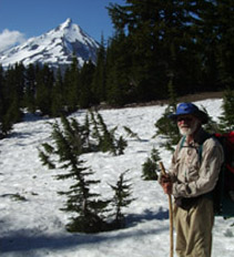
Hmm, where's the trail? Well, there's Jefferson!
After much map-consulting, we chose an alternate route (not PCT) which was lower in elevation, which hopefully meant less snow. It was getting late at this point, the sun was touching the horizon, and it was quite cold, so we didn’t walk too far before making camp by a small grove of trees way downhill from the trail (it was the only flat place we could see!). And hooray–there were no mosquitoes! We were pleased with our mileage, considering how much trail-hunting we’d had to do.

