June 26, Sun.–24.6 miles–Oregon E
Sunday, June 26th, 2005
Sun. June 26 Miles today: 24.6 Total so far: 800.3 miles!!!!! Oregon Section E
We did it–just barely, but we did it–crossed the 800 mile mark today! Thankyou, Lord! What an encouragement!
It was colder this morning, (only 42 degrees) when we got up, and crowds of mosquitoes were waiting for us. Gray clouds covered “Irish Rock”, which juts up high above Stormy Lake. Distracted by dealing with the worst mosquito situation we’ve had yet, we forgot to fill water bottles, so we were short on water when we stopped for breakfast an hour later. Normally we drink a cup of Emer-gen-C each, plus a cupful of granola with powdered milk. This morning we only had enough water to make the powdered milk, so we ate the granola and milk under headnets amid a buzzing, whining horde.
Later on, we reached pretty little Tadpole Lake, which had nice clean water, and stopped to fill our very empty water bottles, despite the mosquitoes. But in my haste to change out of my warm fleece jacket (because the morning had warmed up) into my raingear jacket (for mosquito protection), I really messed up. I forgot that I had put my watch OVER the sleeve of the fleece jacket, so when I yanked the jacket off in a tearing hurry to put on the other jacket, the watch went flying, and I did not even notice.
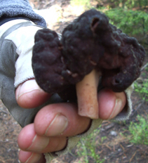
Dark red & black "Sith" mushroon
Now cooler, and protected from the mosquitoes, we went cheerfully off along a very green and pretty trail. A major “green component” here are the shining, ribbony clumps of beargrass. There were also a lot of mushrooms. Somebody (not us!!) had knocked loose one that I call a “sith mushroom.” There were many of these along the trail–black and twisted, with a touch of a dark, “evil” red.
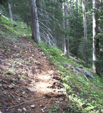
The PCT doing its usual "side of a mountain" thing
At that point, the trail did a lot of contouring along steep hillsides. Bill and I firmly believe that the PCT should really be called “The PSMT” for “Pacific Side of a Mountain Trail, because that’s what it mostly does!
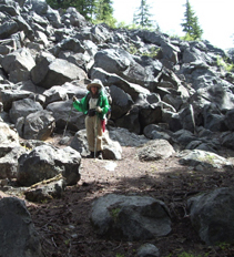
Monty by one of the "rockpiles"
At one point, Bill spotted a tiny gray frog–we never expected to see a frog out in the middle of a forest. The trail went around many rockpiles (thankyou to the trail gorillas who built the PCT through challenges like this!).
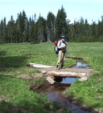
Bill in one of the violet-carpeted meadows
I was particularly thrilled by the fact that we were walking through big meadows carpeted with VIOLETS!! The sweet smell was amazing! And we passed lakes galore–too many to count–with names like Desane, “S”, Mae, Island, Dumbbell and Camelot.
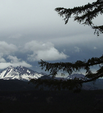
South Sister, with clouds closing in
We put in many miles just walking through forest. At lower elevations, this meant huge douglas firs, but as we climbed higher, it was lodgepole pine and mountain hemlock. Finally we began to catch glimpses of the “Sisters” mountains. At about 2:00 pm, we stepped out into a burned forest with a full view of South Sister, then began a 1,200 foot climb of Koosah Mountain. The clouds were growing thicker and darker, and we were very tired, especially our feet. But at the top there were amazing views, including one of South Sister in gathering clouds. Middle Sister was entirely hidden under clouds, and we never saw “her’ again.
On the downhill trail now, the temperature really began dropping, and there were large areas of snow across the trail. But we’re getting better at following trail through snow, and Bill figured out a way to NOT posthole–you RUN across instead of walking! He’s braver than I am. When we reached Sisters Mirror Lake, there were only patches of snow, and though the Sisters were all hidden in clouds, it was still a very pretty area. We were just starting on a crackers & peanut butter supper when along came two section hikers we’d seen earlier. We talked with them for a little while, and they filled us in on their adventures following the PCT right past Mt. Thielsen. They said it was really tough, and the only reason they made it through was because they had a GPS, and wore snowshoes. Hearing their tale made us glad we chose another route! And they told us that they’d been following our footprints in the snow for quite awhile, and that had made it easier for them, especially coming off Koosah Mountain.
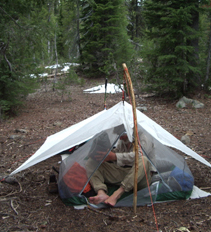
Setting up camp near Sisters Mirror Lake
They pushed on, and we finished our supper in a leisurely way, because it was so nice to be able to eat in peace with hardly any mosquitoes. There were a lot of frogs singing and swimming in the lake; could that explain the scarcity of buzzers and whiners? Just as we finished eating, a light rain began, so we hurried to find a campsite in the “Forest Service approved” area near the lake. After setting up tarp and net tent, we were glad to crawl into warm sleeping bags. Our feet were aching and tired, but my sore ankle is feeling much better–thankyou Lord, and praying friends! And we cheered when we did our mileage math and realized we’d crossed the 800 mile mark. Knowing that helped cheer me up a bit, because I was still very sad about carelessly losing my watch.
We went to sleep to the sound of rain on the tarp, singing frogs, and even a hammering woodpecker. Easy, Greenman & Co are probably back down at Elk Lake Resort eating hamburgers and staying dry. We met them earlier in the day at a trail junction where we all had our maps out and were scratching our heads over which way to go. The PCT in Oregon, as usual, was not well-marked, and the guidebook trail names don’t match the ones on the trail signs. Hope they are having a good time!

