June 1, Wed.–22.6 miles–So. CA Section D
Wednesday, June 1st, 2005
Wed., June 1 Miles today: 22.6 Total so far: 380 So. CA Section D
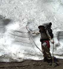
We woke up to a very pleasant early morning with a red sunrise that said, “hot day ahead.” Weirdly, to the west there was fog down below, and to the east lay a brown haze of smog. We were glad to be up at 6,500 feet, above it all! We started hiking, eager to reach Guffy Campground, about 3 1/2 miles away, since we were almost out of water. But the trail had other ideas! Soon we were running into snowbanks requiring an ice axe for safe traverse. I’m getting braver and faster about getting across these nasty icy things, but it did slow us down. We finally reached Guffy, and oh no–the trail down to the spring was totally covered with snow. There was a big old water tank, and Bill climbed up its very rickety ladder to look inside for water, just in case. Nope–it was filling up with empty bottles and cans. Sigh. So poor Bill took our water bottles in a bag, plus his ice axe, and negotiated the steep, snowy trail down to the spring and back. He said that if I tried it, we’d be there all day. (He was pretty fed up with me being slow on icy snow.) I knew his feet hurt, so I was very grateful. My only contribution was to be praying for him that he’d be OK on that steep snow.

This is why it was easier to walk the road!
Moving on, it wasn’t long before we lost the trail completely in the snowy woods. Oh no, not again–just like back at Mt. San Jacinto! But this time, no need to follow a compass heading–we just went over to the other side of the ridge and started walking on a dirt road that parallels the PCT. The road was plowed, and some of the snowdrifts were pretty big! The views from the road were awesome, and much better than the PCT side of the ridge, where forest blocks any views.

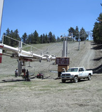
Taking down the ski lifts
Pretty soon we reached a “ski zone” where things got a little unreal. There were several weird-colored, fenced ponds which were for snow-making during winter. At the ski lift area where we ate lunch, two guys were busy removing seats from the lift. The ski runs were totally bare of snow. In the afternoon, our views of Mt. Baden-Powell (which we may climb tomorrow) grew better and better. When we reached another ski area, I had a look into he ski patrol hut and Bill had fun with the ski run map. Turns out we were at the top of 2 runs–one called “Conquest” and the other, “Inferno.” Hmmmm. Sounded like pretty macho stuff, but neither had any snow–just a few wildflowers. Our hike for the rest of the afternoon was often slowed down every 5 or 10 minutes, not by snow, but by large, fallen trees. One of them, fortunately, fell in a way that you could walk UNDER it instead of around it. And at one point, we found an official PCT mileage sign!

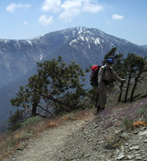
Should we tackle Mt. B-P....or not?
But more and more, we were concerned about whether or not to tackle the 12 mile Mt. Baden-Powell climb. Obviously the mountain was well-covered in snow. And the closer we got to the base of Mt. “B-P”, the more snow we could see, and the more worried we got. At about 5:00 pm, we came out of the woods into the “B-P” parking lot, and what should we find but an official, “B-P Base Camp” big tent, AND the whole gang of thruhikers we’ve been running into all along the trail–Josh & Anna, Panda, Bethany, etc. Turned out that Josh and the other GUYS had just come back from summiting B-P, while the GALS waited at Base Camp. Josh & Co. said it was very do-able, but very tough. We hemmed and hawed some more, factoring in that at Base Camp, it was very cold and the wind was blowing hard–up top at 9,300 feet, it would be worse, and the long trail down the other ridge was totally covered with snow, so we would have no trail there.
Anna and Bethany had already decided they did NOT want to tackle “B-P” and wanted to go by one of the alternate routes. There were two of these. Route #1 was the now-closed Sunset Highway (closed by avalanches covering the road). The other guys said they’d heard that it was a dangerous route due to collapsed road and unstable avalanche fields. Route #2 was a lower-elevation trail route, shown on a map in the B-P parking lot. We decided to go that way.
At first the trail was nice, but then we began coming to avalanche debris fields that were made from frozen snow mixed with trees, pieces of road, and in one of them, even a wrecked car! It was scary and slippery, trying to pick our way across this stuff! Ack! And then there were the creeks–so roaring and full that Bill could not cross by his favorite method of rockhopping. I, as usual, just waded in where it looked least nasty, and walked across. But at one creek, Bill, who is not used to fording, slipped and fell into the water and got totally soaked. Fortunately, our clothes are the type that dry very quickly, so he didn’t stay wet long.

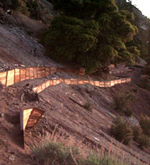
Wood panel trail engineering
We did enjoy one section of the trail there very much, however! It went through a wide, sandy area with rocks here and there, and somebody had moved the rocks to form “edges” for the trail, so that it looked like a garden path. I enjoyed that part! We also passed some weird rock formations and encountered a variety of “trail engineering” efforts designed to TRY to support a path across a steep, loose hillside. One method I had never seen before was sturdy wood “support panels”. The success of these was rather mixed. Some worked, but some had collapsed, making it definitely scary for me, and even Bill admitted that they were a challenge to get across.
But the highlight of the evening was when we saw a large, round, furry brown BEAR, right on the trail ahead of us. He didn’t even hear us coming, but when I said loudly and firmly, “Hey, Mr. Bear, we’re coming through! Move over!” he looked up, and then took off up the mountain like he was shot out of a gun. (By the way, I learned from a guy who lives in the Sierras how to handle California bears–you have to act like an “alpha” bear so that the REAL bear will respect you). We hiked on till after dark before we finally gave up any hope of finding a flat spot for a campsite, and slept right on a side trail that came into the PCT. We did hang our food first–didn’t want that bear to get it! It’s been a long day, but I was pleasantly surprised that even with all the obstacles we had to face, we still made close to 23 miles.

