May 28, Sat.–21.2 miles–So. CA C
Saturday, May 28th, 2005
Sat., May 28 Miles today: 21.2 Total so far: 326.8
I was sound asleep this morning when Bill started talking at me, “Monty, wake up! It’s first light already–look at the sky!” Well, it was first light all right–but MOONrise, not SUN rise. I checked my watch. “It’s 3 o’clock in the morning–not 5 o’clock!” Bill still wanted to get up and start hiking, but I was too sleepy and tired to handle it. “How about 4:30?” I mumbled, and went back to sleep. We did get up at 4:45, and were ontrail by 5:00 am, hoping to do as many miles as we could, with Bill still limping terribly. However, I did persuade him to try taking a couple of Motrin (known as “Vitamin I” in trail lingo).
In early morning light, we passed a flat area where a number of backpackers were camped, but nobody was up. Finally we reached what we guessed must be the trail to the famous Hot Springs, but weren’t absolutely sure. With Bill in such a bad way, we decided that our best plan was to keep moving forward towards where he could rest at our next resupply.
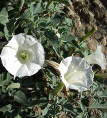
Moonflowers? They were huge!
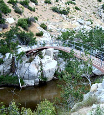
"Japanese garden" bridge over Deep Creek
We ate breakfast at the next pretty arched bridge over Deep Creek, and a short time after that, we had our first view of the end of the canyon and the SNOWY San Gabriel mountains beyond. Bill was still limping along so slowly that I told him to go on ahead while I looked at flowers–there were plenty of them, and some I had not seen very often.
The nearer we got to the end of the canyon, the more trash and worse–graffitti–we saw. Finally it got so bad that almost every decent-size rock had red, blue, or green graffitti. One, at least, had some redemptive value–sort of. I will say this about the PCT: when you are far enough out to be beyond the range of dayhikers, there’s NO trash, NO graffiti, NO shortcutting of switchbacks. Serious PCT hikers universally respect the trail!
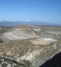
One useless dam
Near the end of the canyon, where the PCT comes out on enormous Mojave River Forks Dam, we met a very friendly couple, who pointed out the PCT route in the distance up ahead, and even described it for us. Very encouraged, we strolled across the top of the huge dam which has been rendered totally useless by environmentalists trying to protect an endangered frog. Never mind the fact that there are creeks and arroyos all over Southern CA where the frog lives. Bill and I were joking about “I’ll bet that if they DID let water accumulate behind the dam (as they did for a few years) the frogs would probably LOVE it and multiply exceedingly, just like the caribou in Alaska with that nice warm oil pipeline!”
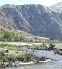
Deep Creek ford
Below the dam, the PCT has a ford of Deep Creek. I had been dreading this all day yesterday, as I watched the “Creek” get bigger and roarier. But it turned out to be a nice, sandybottomed, kneedeep splash-across. Whew!
The next challenge was the MANY miles of PCT going in and out of gullies on its way to Silverwood Lake. And it was hot–in the 90’s. What a joy it was to find a note tacked to a post that told of a PCT water cache up ahead, hidden behind a juniper tree!
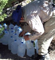
"Vaya Con Dios" water cache
We gladly filled our water bottles from jugs labelled, “Vaya Con Dios” (Go with God) and felt blessed indeed! I left a thankyou note.
It was getting so hot that we were now walking with umbrellas. Bill was a little perkier, too–the Motrin is definitely helping. At one point there was supposed to be a quarter mile side trail down to a store (Drinks! Ice cream!) but when we got there, we found a sad little sign saying, “Don’t waste your time–store has been closed fo a year.” Rats! Oh well, keep on! Bill also discovered that when the trail goes DOWNhill, he can trot just as “comfortably” as he can walk. So our mileage started taking a turn for the better.
Our lunchtime goal was Grass Valley Creek. I was ahead of Bill, looked the rushing creek over and said to myself, “Rockhop crossing–no problem!” Well, I failed to factor in that the creek approach was deep soft sand, and a lot of the sand was caught in the treads of my shoe soles. Halfway across, on a slanted but perfectly dry rock, my foot slipped, and I was in instant freefall towards/into the creek. It was amazing how many thoughts flashed through my mind in midair! First was “Lord, help!” Second was “Please don’t let me get hurt!” Third was “Yikes, the camera!” (it was in my fanny pack). I tried to at least twist myself so the “camera side” of my hips would not go under water, and it worked! There I was in the rushing water, with the camera BARELY above the surface, and after some struggling with the strong current, I managed to get back on my feet and wade ashore unhurt, thanking God over and over again. Then I sat down and cried, ’cause I’m a girl and that’s what we do. Bill came along while I was still sniffling, but I managed to pull myself together and cook dinner. We took a little rest and pushed on. I kept giving Bill Motrin, and he’s able to walk with less pain, but still pathetically slowly compared to what he usually does.
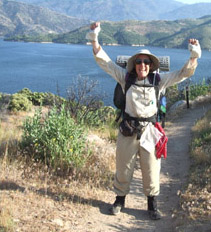
We made it! Silverwood Lake!
The scenery was very interesting, and though Bill stopped often to rest his sore feet, we made steady progress all afternoon toward Silverwood Lake. Finally we reached its dam, and a stiff climb up a ridge gave us our first view of the lake! Hooray! We were beginning to wonder if we’d even make it there today!
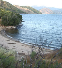
Great place for a swim!
The lake is huge and really pretty–lots of little sandy coves. I know lots of thruhikers swim there, but for us, it was 6:30 pm and really chilly and very windy, so we didn’t try swimming, but enjoyed our crackers-and-peanut butter supper with a magnificent lake view. Then we continued on till sunset, often pushing through grass taller than we were along the trail, and made a very comfortable camp for the night.

