May 20, Fri.–6.8 miles–So. CA B Idyllwild
Friday, May 20th, 2005
Fri. May 20 Miles today 6.8 (plus another 4.5 walking to town) Total so far: 178.6

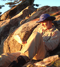
Bill checks maps by sunrise light
Our campsite last night was about the best yet, but thre were still several miles to Idyllwild, our next resupply, so at 4:00 am we were up ‘n at it, hoping to beat the heat. Even at 4:00 am, it seemed unusually warm for 7,200 feet of elevation. Litle did we know (found out in town later) that we were in the middle of a serious heat wave! Well, we set out happily along the trail in the blackness of early morning, using our headlamps to light the way. The next section of trail had been made with lots of dynamite, I think! I was sort of glad I COULDN’T see down the dropoffs! But the lights of the cities below were very pretty, and we stopped for a snack at 5:30 and watched a beautiful sunrise. “Breakfast at 6:30” was the plan. Little did we know we wouldn’t be eating that granola till past 10:30. Adventure lurked!

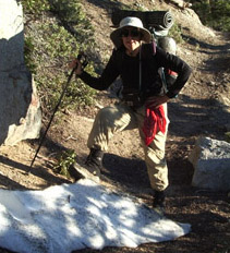
Monty poses at our First Snow patch on the PCT!
A short distance along the trail, we came to our first little snowdrift. Oh boy! It was picture time, after days of hiking in heat, rocks, sand and cactus! Shortly after that, though, the entire trail was covered with snow for about 25 yards, and on a steep hillside. Tracks led across. Out came our ice axes we’d carried since Campo, and we happily followed the tracks, thinking “no problema!”

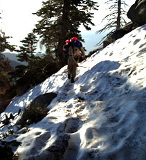
Things start to get a bit tricky
But soon we came to where the whole mountainside was covered with snow, and there was no longer any indication of a trail. In Lassen Park, where we often backpack, there are small colored triangles on the trees to indicate the trail, but in the San Jacintos, tough luck–you’re on your own. Obviously we weren’t the first to arrive at this spot–tracks led in every direction. We tried to follow what looked like the most “used” set of tracks, but whoever they were–well, they didn’t know where they were going, either. To add to the fun, since it was still early morning, the snow was hard and icy and very slippery.
For me personally, the next few hours were scary. We were trying to find our way across steep mountainsides in icy snow. Bill was having a blast, “bootskiing”, whizzing around and sliding around looking for the way to go, while I was creeping along with trek pole and ice axe, fairly terrified. Twice I slipped on the icy slope and both times (hooray!) was able to use the ice axe “self arrest” to keep me from sliding right off down the mountain. Bill was pretty disgusted with how slow and cowardly I was. I have walked on snow lots of times and never had a problem, but this hard icy stuff was too much for me.
We finally gave up all attempts at finding the trail, got to a place where the forest thinned out enough to see a landmark, determined a compass heading to hit the PCT up on a ridge, and just went for it, crossing creeks twice on “snow bridges”, and going over every obstacle till we finally reached the ridge and found the PCT! We did some cheering and dancing and marched along, now confident of reaching Idyllwild. And the snowdrifts-on-trail weren’t so big anymore, so we easily located the turnoff and headed downhill for TOWN!
By this time, we were pretty tired and hungry (we’d had only one snack for the last 6 tough hours), so we hiked partway down to where there was a spring by the trail and finally ate breakfast a bit after 10:30. Then came along, hot walk into town, where we stopped at the local mountaineering shop. They said very few PCT hikers were doing the next part of the PCT. Even in nice conditions, it’s such a difficult stretch of trail that no one does it unless they have plenty of daylight. He said the alternate routes were also snowbound, and the only other choice was to hitchhike or walk many miles up the highway to where we could take another trail back up to the PCT. Hmmmm. We decided to think about it.
On to the post office to get our box, and whom should we see but Josh and Anna! We told them we’d found Bugaboo’s data book lying on the trail the day before, and they said, “Great! He’s camping with us–he sure will be glad!” We took our box to the campground and made a frustrating discovery–every site was already taken, even the hike-in ones, and every other place in town was all booked up because of a huge big “Earth Days” festival this wekend. So even though we were really tired, we knew we’d have to move on. Talking to the ranger, we found out we were welcome to take showers, but that he’d “get us for sure” with a big fine if we tried to sneak in late at night to camp. So we left all our stuff with Josh and Anna and went to get some dinner and do some shopping. It was so hot that even the restaurant was uncomfortable.
Back at the campground, we loaded our packs with 5 days of food and at sunset, began to walk out towards the road, literally not knowing where we would sleep that night. We talked as we walked, and decided to go over to the local Christian campground and ask if we could sleep there, when just as we were almost to the state park entrance, walking by the parking lot, a young guy called to us and asked for help in finding out how to get to Tahquitz Peak. We got out our PCT maps and showed him what to do. Then he asked if we knew anywhere he could camp, since everything was full up. To make a long story short, he ended up giving us a ride to our trail back to the PCT and he and we are both camped at the trailhead tonight. He’s happy because it’s near Idlylwild and it’s free (he’s just a poor UCLA graduate student in linguistic anthropology, named Brian) and WE are happy because we were saved from about a 10 mile walk along a busy , narrow mountain highway. (Not to mention the risk of us being bothered or worse by some “bad dude” driving by.) So we are very grateful to the Lord for working it all out for us, and very sorry to miss the famous “Fuller Ridge.” But with all that snow, and no GPS, we dare not try it.
(Note: Later on, we found out that today they had to use a helicopter to rescue several hikers who tried to cross Fuller Ridge and got totally lost. So we are glad we didn’t attempt it. Josh, Anna & Co. did cross it a day later, by staying in a large group led by a guy who had GPS and knew the trail well.)

