Tuesday, June 29 Pinchot Pass Miles today: 11.4 Total: 812.2
Tuesday, June 29th, 2010
Had a solid night’s sleep, which really helped me today. I felt 100% better! Bill was also feeling perky and was talking about “maybe we can get over both Pinchot and Mather passes today!” (I thought, “I’ll settle for just Pinchot!”) The mosquitoes came to see us off as we packed up and headed for the “little Golden Gate Bridge” over Woods Creek. The creek was a roaring torrent of white water–I sure am glad for the bridge! It’s a suspension bridge that will take one person crossing at a time. I went first. The bridge sways every time you take a step, and for me, it’s a bit scary. But I made it almost all the way across (only about 20 feet left to go) when Bill thought I was done, and bounded on to the bridge. Yikes! The whole bridge started bucking and heaving up and down. I was terrified, but too scared to turn around and yell at Bill to stop. So I kept going, but man, was I glad to reach solid ground!
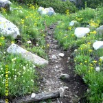
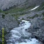
But the walk up toward Pinchot Pass along the creek was beautiful, and I soon felt very much consoled by the wildflowers along the trail, and the beauty of Woods Creek as it rushed and roared and cascaded and leaped in foaming whitewater torrents over the boulders in its path. We also met some JMT SOUTHbounders Hooray! That meant people are starting to make it through the snow and over the passes–there will be footprints to follow!
But suddenly, without warning, Bill just “bonked.” He stopped hiking, took off his pack, lay flat down on the ground, and said, “I feel awful.” From that point on, he would not eat (“I feel sick”) and for the entire rest of the day, he could only go a little way before stopping again. I was worried. Yesterday during the climb out of Vidette, I had to stop and rest a couple of times because I was so awfully tired, but I didn’t feel sick. It soon became obvious that we would only make it over Pinchot Pass today, not Mather.
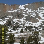
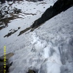
Soon the trail completely disappeared under the snow, and we spent at least two hours trying to head in more or less the right direction, based on Bill’s JMT experience. Pinchot is a tricky pass to locate, and many early season hikers get lost trying to get there. But Bill was watching for his favorite landmark, a rock formation he calls “Kilroy”, that’s located just to the left of the pass. He spotted it, and we were headed for it, doing snow traverses and rock scrambles along the way, when we spotted two other hikers headed in the wrong direction. We shouted and yelled and waved to them, trying to point out the right way to go, but they couldn’t hear us and eventually disappeared from sight. We never saw them again.
Note from Alexa: Ack that sounds fairly ominous!
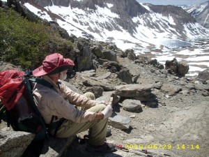
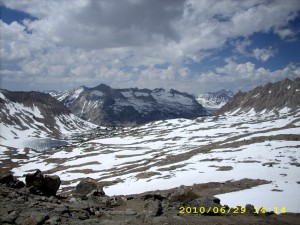
By lunchtime we were at the foot of the pass. Bill choked down a few bites, and drank Emer-gen-c with a liberal dose of GSE in it, while he studied the pass and strategized on a way up. Then it was time to put on the Microspikes, take ice axe in hand and climb straight up. This is still “terror time” for me, but I am getting better at it. Near the top of the pass, amazingly, several switchbacks were snowfree, and we were able to just plain hike instead of climb. But just short of the very top, it was steep snow again, and I went back to Microspikes and ice axe. What a relief to finally be standing on top! It was whoop ‘n holler time for me!
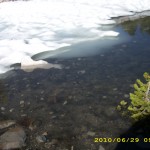
Bill rested again, and planned a strategy for getting down. There are several lakes below the north side of the pass (they were mostly frozen over and surrounded by snow) and that made it easier to see where to go. At first we were able to follow snowfree switchbacks down the pass, but then the snow took over again, and footprints headed along the snow, roughly following the path of the trail. We decided to only “sort of” follow them, and shortcut whenever possible. Our plan worked fine. The farther down we went, the less snow, and the trail was playing hide ‘n seek, but we always managed to find it again. We noticed that there was one set of footprints which seemed to be following the same basic strategy we were using, and that did save us a bit of time–at several points, when we were hesitating about which way to go, one of us would spot the footprints and cheer, “Look! They went thataway!” and off we would go again.
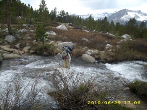
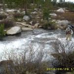
When the snow thins, the creek crossings begin, and of course the trail itself (when visible) was a creekbed itself. The outlet creek of Lake Marjorie was wide and a little deepish, but moving very slowly, so it was an easy crossing. Whew! After that came numerous smaller creeks that were rushing and roaring, but only knee deep. I was able to cross them OK, and I am a lot less scared than I was a couple of days ago. Practice helps!
Finally we were happily switchbacking down a snowfree !!! trail into the Kings River Valley, when we came to a sign the rangers had put up. “Please Read!” it said in large letters. It warned that the next creek crossing was extremely fastmoving water, and would be much safer to cross on a log 300 yards upstream. It also said that the next crossing (the Kings River) was very deep and fast and far too dangerous to attempt a crossing. The rangers recommended that all hikers stay on the near side of the river and follow it up till the trail itelf crosses back over near Mather Pass. Bill’s reaction was, “Humph! The rangers are sissies!”
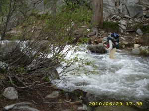
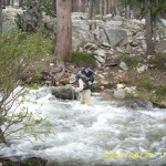
He then took off on a tear down the trail. I couldn’t keep up with him! So he arrived at “the next creek crossing” and was standing there looking at it when I arrived. It did look nasty–all white water, and yes, moving very fast. I said, “Wow, we’d better go upstream to the log!” Bill said, “No way. This is do-able,” and in he went. I thought about going up to the log all by myself, but in the end, I watched Bill very carefully to see where the worst spots were . I could see that the creek was never more than “just above the knee” deep, but oh man, was it roaring! Scary! Once Bill was safely across, I started in, praying like crazy with every step. Basically what I do is say, “Lord, please guide my foot/trek pole”. The rule of thumb in these crossings is to move one thing at a time–either one trek pole or one foot.
About 2/3 of the way across, it started getting really hard for me. Taller, heavier people have an advantage over us shorter, lighter people on these roaring crossings. I yelled to Bill for help, and he came back into the creek to help steady me against the current as I finished the crossing. Whew! Then he said he was completely exhausted and wanted to camp NOW, even though it was only 6 pm. I agreed, but asked if we could go just a bit farther on, to get away from the roar of the creek.
And so we walked for a little while till we found a really nice camping spot between two big logs. It was clouding over, so we rigged the tarp. Bill went straight into his sleeping bag, but I did persuade him to drink a cup of Emergen-C with GSE added, and to take an Advil PM to help him sleep, since he said he didn’t sleep well last night, and that was part of his problem. But he refused to eat anything else, saying “I’m too tired”, and went to sleep. I was feeling pretty good, so I sat up for awhile eating supper and just enjoying the beauty of the woods. What a relief to be out of the snow! And no mosquitoes, either! When I did go to bed, I took some time catching up on my journal notes. I’ve only written one sentence a day till now, because I was so tired!
I am concerned about the Kings River crossing tomorrow. All the hikers I know of always do as the ranger recommended and follow the river far upstream. But Bill is being very stubborn about river crossings, and he does not feel well. I decided that if the river looks too scary tomorrow morning, I will not attempt to cross it, but will meet Bill farther up the trail. I hate doing this, but I am also very worried.
Walk to Lórien: Within Moria and Gollum begins following
Tags: JMT, Mather Pass, Pinchot Pass

