Sat. Sept. 18 Miles today: 26.2 Actual total: 2,621.7 miles
Saturday, September 18th, 2010
We ate breakfast at 5:30 am, but it was still so dark when we finished that we waited a bit before packing up. It rained off and on all night, and was still raining as we loaded our packs under the protection of the tarp, and we set off hiking in the rain, too. But after less than an hour, the rain stopped, and did not return. Hooray! (Though we were “up in the clouds” all day, and did have to deal with a lot of “fog drip”).
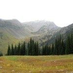
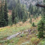
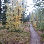
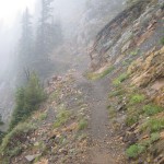
The first project of the day was to finish the climb up to Cutthroat Pass. The drippy clouds at that point were lifted up high enough that we could see more than just trailside plants. We could see some mountainsides, and the fall foliage was beautiful. An added plus was that the trail was wide enough that we were not having to push through soaking wet vegetation, but just walk happily along–the very wet plants could not touch us. As we climbed higher and closer to the top of the pass, the terrain became more stark and alpine. Soon we were actually IN the clouds. The top of the pass was completely barren (except for a PCT sign), and as we began the descent, the clouds were so thick that we could not see a thing. The trail switchbacks down, with big dropoffs on one side, which had me really nervous in 2005, but were not a problem this time. The wind was blowing, and the clouds were moving around, so occasionally we’d get a glimpse of the huge, deep valleys below or of the snow-capped peaks up above. The PCT heads down to Grant’s Pass, then follows a long, contouring climb up to Methow Pass.
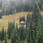
From the top of Methow Pass, we headed down again into the Methow River valley, and it was quite a “down”! Bill joked, “Are we going back to sea level, do you think?” The long walk down could have been more enjoyable, but we were in clouds and couldn’t see anything but the forest right by the trail. There were lots of little rockhop creeks to cross before we finally reached the valley floor. We stopped for lunch at Willis Camp, by Golden Creek. When I was rummaging in the food bags, I discovered that a mouse had gotten into the cookies in Bill’s food bag. We ate them anyway, along with hot (!!yum!!) coffee the Manns had given us, and a backpacker version of tuna casserole (Lipton Side of noodles & sauce, plus a packet of tuna, plus freezedried peas. Love this stuff!!) It was very cold down in the valley, but not raining, so while we ate, we hung our very wet tarp between two trees to dry off a bit, and managed to dry the ground cloth a little bit, too.
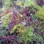
The long climb out of the valley up to Glacier Pass took most of the afternoon. Basically it involved a lot of contouring and switchbacking, in and out of avalanche paths and forest. The “avalanche sections” were very overgrown with floppy wet plants, and the PCT there was rocky and muddy–what a mess! It’s the sort of situation where you just have to grin and say, “Are we having fun yet? Wheeeee!” and keep on walking. Eventually, as the trail climbed higher, there were no more big floppy plants–just very steep grassy hillsides. We still couldn’t see anything except for one brief moment when the clouds parted and we could see some views. The wildflowers along the trail are pretty much just faded and dry, but the fall foliage was very colorful. The little six inch high huckleberry plants had lots of ripe berries–I ate a few, but it’s hard to bend over that low with a backpack on, while continuing to hike!
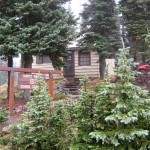
We reached Glacier Pass (which had a nice campsite) and mushed on for another hour to the final top of the climb. From there we watched the trail and map carefully, because there was supposed to be a campsite with water up ahead. In 2005, we couldn’t find the water, and that was hard, because from that point, there is no more water for 15-20 miles (depending on which guidebook you follow). Complicating our search was the fact that we were IN the clouds. It was like being in a dense tule fog back home. We did locate the campsite, and the serious water search began. First step is simply to stand still and LISTEN–that’s often the best way to locate a small, hidden water source. But this time, careful listening didn’t help. A number of different little paths led downhill from the campsite, so I headed off on one, and Bill on another. I had no luck, but Bill did. He found the water, a ways down the hill, coming from a small spring located in a little meadow. We collected water and sat down to eat some supper, enjoying the fact that we were down out of the wind behind some rocks. The best part of all was that a totally cute little pika came out of the rocks nearby and sat “meeping” at us. (I have decided that the best way to describe a pika’s voice is that it “meeps”).
Then it was back up to the trail, continuing on in a very cold wind and thick clouds. Brrrr! But we were very glad it was not raining–just cloud mist and no more. Less than a mile along, we met a SOBO hiker who asked if we’d seen “the campsite with water”. We assured him that we’d just come from there, and told him how to find the water; he was delighted. After wishing each other well, we went our separate ways, but now it was MY turn to be worried about finding a campsite. We could not see more than about 20-30 feet in the thick clouds, and the PCT was endlessly contouring along a very steep hillside in a bitter cold wind. The map showed a saddle up ahead–hopefully we’d find some flat ground there, and soon, because by 7 pm it starts to get dark.
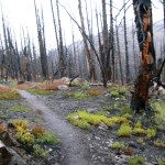
We reached the saddle and were terribly disappointed. Not only were there no flat places (it was too narrow), but everything was blackened by a relatively recent forest fire. All we could do was to keep going, and now I was seriously praying for God’s help in spotting something despite all the clouds. Finally, just before dark, the mountainside widened out a bit, and I saw a slightly sloping, but still reasonably flat little spot just down from the trail. It was all covered with some sort of dwarf heather stuff, but we put down our ground cloth anyway, and got our tarp up just before it became truly dark. The wind was rushing and roaring all around us, but the heather made a very soft “mattress”. At around 9 pm came the pitterpatter of rain on the tarp, but we were snug and warm. I thought about tomorrow–it will be our last “regular hiking day” of this journey. “Will the sun come out?” I wondered. Bill commented that the weather forecasts in Washington state shouldn’t ever say “Chance of rain”–they should just be realistic and say “It WILL rain.” What they should be saying is “Chance of SUN”, because that really IS chancy! Well, we will see what tomorrow brings!

