Wednesday, August 11 Seiad Valley 2010 Miles Today: 20 Total: 1,670.2
Wednesday, August 11th, 2010
Down in the Grider Creek canyon, it’s really the deep dark woods–so dark that we waited till 5:30 to get up. We took off along the trail as soon as it was light enough to see– and it is worth seeing. The canyon walls are high and steep. Often the creek is running along below cliffs, cascading over the rocks. The creek water looks so clear and pure–and it sort of sings to itself as it goes rushing along. Overhanging everything are the huge trees, and the ground is covered with greenery of all sorts.
Eventually we reached the campground and passed a couple of bicycle campers just getting up. We didn’t have to wonder for long where Croatian, Tangent, etc. were–tracks on the dirt road toward town showed that they were just ahead of us. Bill stopped to use the restroom at the campground, and I just kept going, figuring he would catch up with me. But the first person to come along from behind wasn’t Bill–it was Ann. We walked along and talked a bit. I told her that we’d managed 30 miles yesterday, and she commented, “I did 40 miles. That was easy trail.” Turned out that 30 mile days are commonplace for her. I can well believe it! She always walks very intensely, as if she were “on a mission.” Ann soon took off and disappeared around a bend.
It was shaping up to be a hot day, so I was walking at a leisurely pace, wondering where Bill was. When I reached the Klamath River, I stopped to take a picture of it, when Bill came along, and we decided to stop for a Snickers break. We discussed the puzzle of why there were so many “No Monument!” signs in front of houses along the way. What “monument”? When we reached Hwy 96, it was very busy, so we had to be careful as we walked the road shoulder toward town. When we reached the Klamath River bridge, I had a brief terrifying moment. Bill was out ahead of me and by the time I was halfway across the bridge, he was almost all the way across. Along came a great big truck. The driver saw Bill, swung out a bit to avoid him, then swung back in and was headed straight AT me! I flattened myself against the railing, and the truck missed me by a space that was way too small for comfort! Yikes!
It was great to reach the Seiad Cafe at last. Several packs were outside, leaning against the wall, and the place was full of hungry hikers. Nobody has won the pancake Challenge yet this year–4 out of the 5 pancakes is the record so far. Bill and I went for huge omelets and potato pancakes, accompanied by fruit shakes. I asked the folks at the Cafe what all the “No Monument” signs were about. Turns out that the Feds want to turn the whole valley into a wildlife national monument and get rid of the people. We were horrified. I’d like to get on a soapbox and say what I think about it!
I picked up our resupply box and went to the hiker tables next to the cafe to sort everything out and load our packs. The two bicycle guys were there hanging out with their pet KITTEN! All the hikers were having a great time petting it and playing with it. Ann was there, and she gave me her leftover Nutella. I also bought more food at the store. The distances between resupplies in Oregon are relatively short, so I am pushing up the food weight in an effort to get more calories.
Then we went next door to the RV park, where they have set up a wonderful “hiker zone” which includes a whole area in the shade, covered with soft hay. Ahh! Comfort! You just role out your Ridgerest and take a nap! There was also a refrigerator, table & chairs, and a DVD player. I just plain lay down and collapsed for awhile. Bill went back to the Cafe for lunch, but I just could not face eating any more–I was still stuffed from breakfast. All the other hikers were also lying around resting. They planned to push on at 5 pm, when it was cooler. But around 2:30, a breeze sprang up, and Bill & I decided to head out.
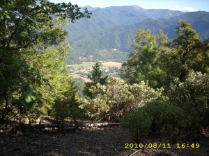
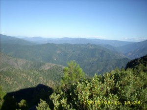
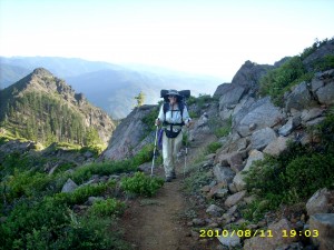
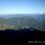
It’s an 11 mile climb out of Seiad Valley, and it was a hot afternoon, but the views were incredible, and the trail itself is quite varied, as it winds in and out of Lower, then Middle, then Upper Devil’s Peak. The Klamath River at first looks like a scenic blue river, then as you climb higher and higher, it becomes more like a silver ribbon far below, wandering toward the sea. We were carrying a ton of water, because in 2005 we hadn’t been able to find the spring that’s located partway up the climb. This time, the side trail to the spring was well marked, so we took a break there and enjoyed drinking plenty of cold “bug juice” (Crystallite mixed with Emergen-C).
The trail is constantly climbing and traversing on steep mountainsides, but we were not worried about finding a campsite, since we were up here in 2005, and knew that there was a reasonably flat zone up ahead, on a saddle, not too far from the top of the climb. Sure enough, by just after 7 pm, we made it, and managed to squeeze in between the bushes with a wonderful view out towards the south. It’s a clear night, with a nice (though chilly) breeze. Oregon tomorrow!
Walk with Aragorn to Isengard: In green valley with lots of streams. Huorns are sighted.
Tags: Grider Creek, monument, Pancake Challenge, Seiad Cafe, Seiad Valley

